Tolmie Peak Trail
View Photos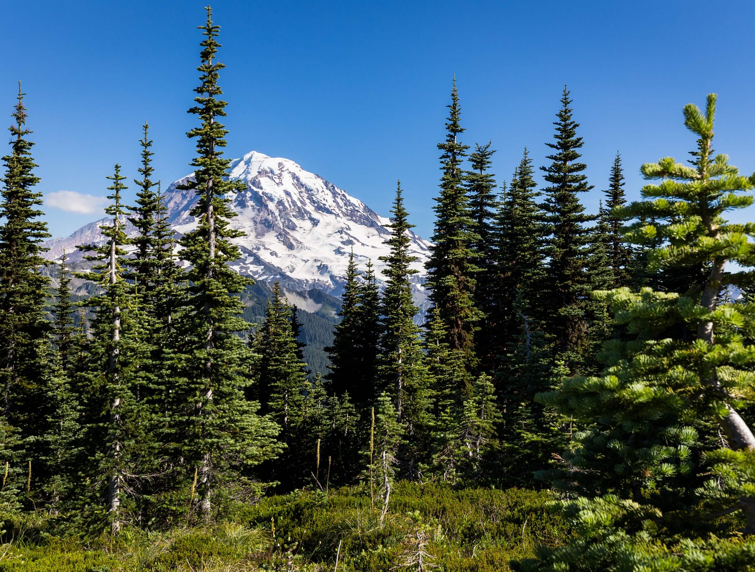
Tolmie Peak Trail
Difficulty Rating:
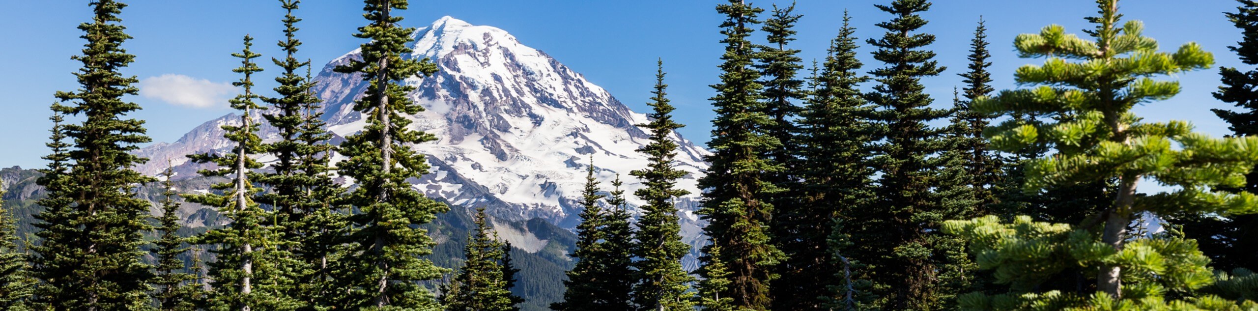
The Tolmie Peak Trail is a moderate hike in Mount Rainier National Park that takes you up to an old fire lookout, where you’ll enjoy incredible up-close views of Mount Rainier and Eunice Lake. Eunice Lake makes a beautiful alternative stopping point for those who don’t want to complete the entire hike. These two viewpoints are go-to spots for sunrise and sunset photographers.
The Tolmie Peak Trail crosses over part of the Wonderland Trail, one of Washington’s most impressive long-distance trails. With just enough of a physical challenge to make you feel like you’ve earned your views but no technical sections, this hike is a perfect way to maximize your time in Mount Rainier National Park.
Getting there
To get to the Tolmie Peak trailhead from Puyallup, drive east on Highway 410 for 13.0mi. You’ll enter Buckley and turn right on Highway 165 and drive through Carbonado. Just past the Carbon River Gorge bridge, turn right onto Mowich Lake Road. Continue for 17.0mi until the road dead-ends. At the end of the road, look for the trailhead on the left side.

About
| Backcountry Campground | Mowich Lake Campground |
| When to do | June-October |
| Pets allowed | No |
| Family friendly | Older Children only |
| Route Signage | Average |
| Crowd Levels | High |
| Route Type | Out and back |
Tolmie Peak Trail
Elevation Graph
Weather
Tolmie Peak Trail Description
The Tolmie Peak Trail is a truly impressive hiking route in Mount Rainier National Park that offers some of the best sunrise and sunset photography opportunities in the area. Any other time of day, the trail is still an impressive journey. The bugs on this trail are especially bad, even in comparison to other buggy trails in the area, so bring a potent spray.
The Tolmie Peak Trail begins from the parking area at the Mowich campground. Head around the west side of Mowich Lake on a trail that gains gradual elevation. The elevation soon picks up a bit as you approach Ipsut Pass, which is part of the Wonderland Trail. Keep left here. After 0.8mi, you’ll reach Eunice Lake. Some hikers choose to make this scenic spot their objective and turn around, but to continue, take the trail past the lake and begin a steeper section of the trail.
After a mile of uphill hiking, you’ll reach Tolmie Peak. Views of the Carbon River Valley and Mount Rainier dominate your sightline, and Eunice Lake down below makes the view extra impressive. You’ll return the way you came once you’re ready to depart.
A note for sunset and sunrise photographers: the nearest overnight camping in the area is at Mowich campground. There is no camping permitted on the trail. It is recommended that you use the campground as your overnight base to allow for early morning photos.
Hiking Route Highlights
Mount Rainier
Although Mount Rainier (14409ft) is a given highlight for most of the trails in the area, this hike offers an exceptional view of the peak and is one of the premier routes to take sunrise and sunset photographs on. Enjoy an up-close view of the largest active stratovolcano in the Cascade Range.
Frequently Asked Questions
What pass do I need for Tolmie Peak?
You’ll need to acquire a daily entry pass for Rainier National Park or possess a yearly national park pass to access Tolmie Peak. These can be purchased online ahead of time or at the park entry.
Can you swim in Mowich Lake?
While you’re technically allowed to swim in Mowich Lake, the water comes directly from snowmelt and thus presents a risk of hypothermia to swimmers. If you choose to swim, ensure you take proper precautions like limiting your time in the water and warming up promptly afterwards.
Is there camping near Tolmie Peak Trail?
Yes, Mowich Lake Campground is only a short distance from the trailhead. This is a frontcountry campsite!
Insider Hints
The last stretch of road to the trailhead is gravel and sometimes in poor condition, so bring a high-clearance vehicle if you can.
The bugs are particularly bad on this trail, and a high-strength bug repellent is a must.
Mowich Lake is a perfect place for a swim after your hike.
The meadows around Eunice Lake are gorgeous but fragile, so watch your step and stay on the path.
Similar hikes to the Tolmie Peak Trail hike

Paul Peak Trail
The Paul Peak Trail is a 6.3mi lightly trafficked out and back trail in Mount Rainier National Park…

Narada Falls to Mazama Ridge Loop
The Narada Falls to Mazama Ridge loop is an 7.4mi moderately trafficked route in Mount Rainier National Park…

Camp Summerland via Wonderland Trail
The hike to Camp Summerland on the Wonderland Trail is a 8.4mi moderately trafficked out and back trail…
Comments