
Ipsut Pass Hike
View Photos
Ipsut Pass Hike
Difficulty Rating:
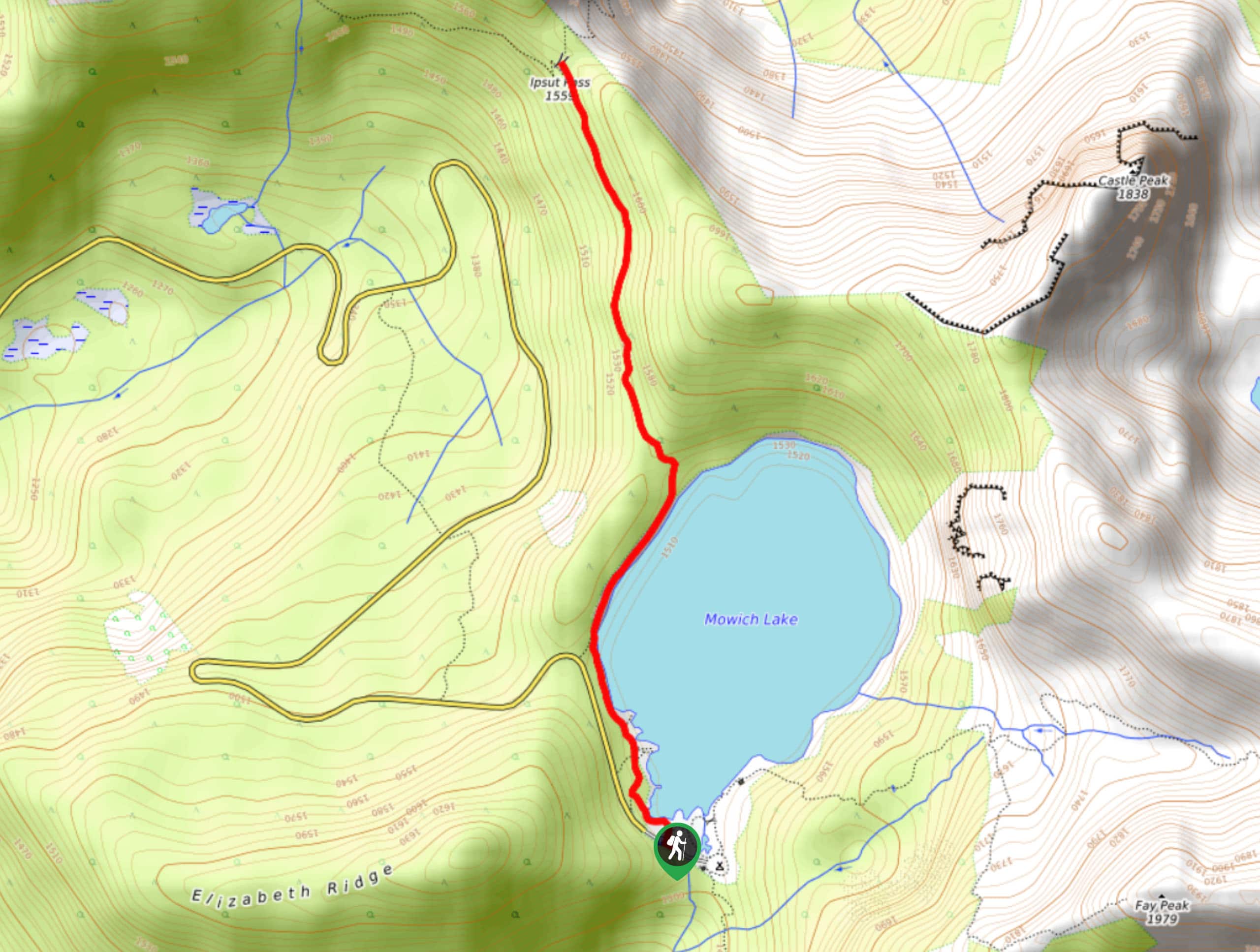
The Ipsut Pass hike on Wonderland and Lakeshore trails is a 2.7mi moderately trafficked out and back trail in Mount Rainier National Park that is rated as easy-moderate. This trail itself is short and sweet, but you can extend your hike to Eunice Lake or further on. With minimal elevation gain and great views, this is a great choice for most skill levels. We recommend bringing bug spray on this hike.
Getting there
The trailhead for the hike to Ipsut Pass is in Mowich Lake near the campground. Take Mowich Lake Road to its terminus and park at the first parking area you come to.

About
| Backcountry Campground | Mowich Lake Campground |
| When to do | May-October |
| Pets allowed | No |
| Family friendly | Yes |
| Route Signage | Average |
| Crowd Levels | Moderate |
| Route Type | Out and back |
Ipsut Pass Hike
Elevation Graph
Weather
Ipsut Pass Hike Description
The hike to Ipsut Pass is a quick, scenic trip in Mount Rainier National Park. While the walk alongside Mowich Lake and the views from the pass are enjoyable, many people choose to continue to Eunice Lake to extend their trip.
From the Mowich Lake trailhead, walk along the lefthand side of the lake on Wonderland Trail. The trail will eventually break away from the lake, gaining light elevation as it approaches the pass. At the pass, the trail branches to the left and right; if you wish to continue to Eunice Lake, take the trail on the left and prepare for more considerable elevation gain. If the pass is your objective, retrace your steps to the lakeshore.
Similar hikes to the Ipsut Pass Hike hike
Twin Firs Loop Trail
Twin Firs Loop is a 0.3mi hike in Mount Rainier National Park that is incredibly easy, making it…

Paul Peak Trail
The Paul Peak Trail is a 6.3mi lightly trafficked out and back trail in Mount Rainier National Park…

Narada Falls to Mazama Ridge Loop
The Narada Falls to Mazama Ridge loop is an 7.4mi moderately trafficked route in Mount Rainier National Park…
Comments