
Eastside Trail
View Photos
Eastside Trail
Difficulty Rating:
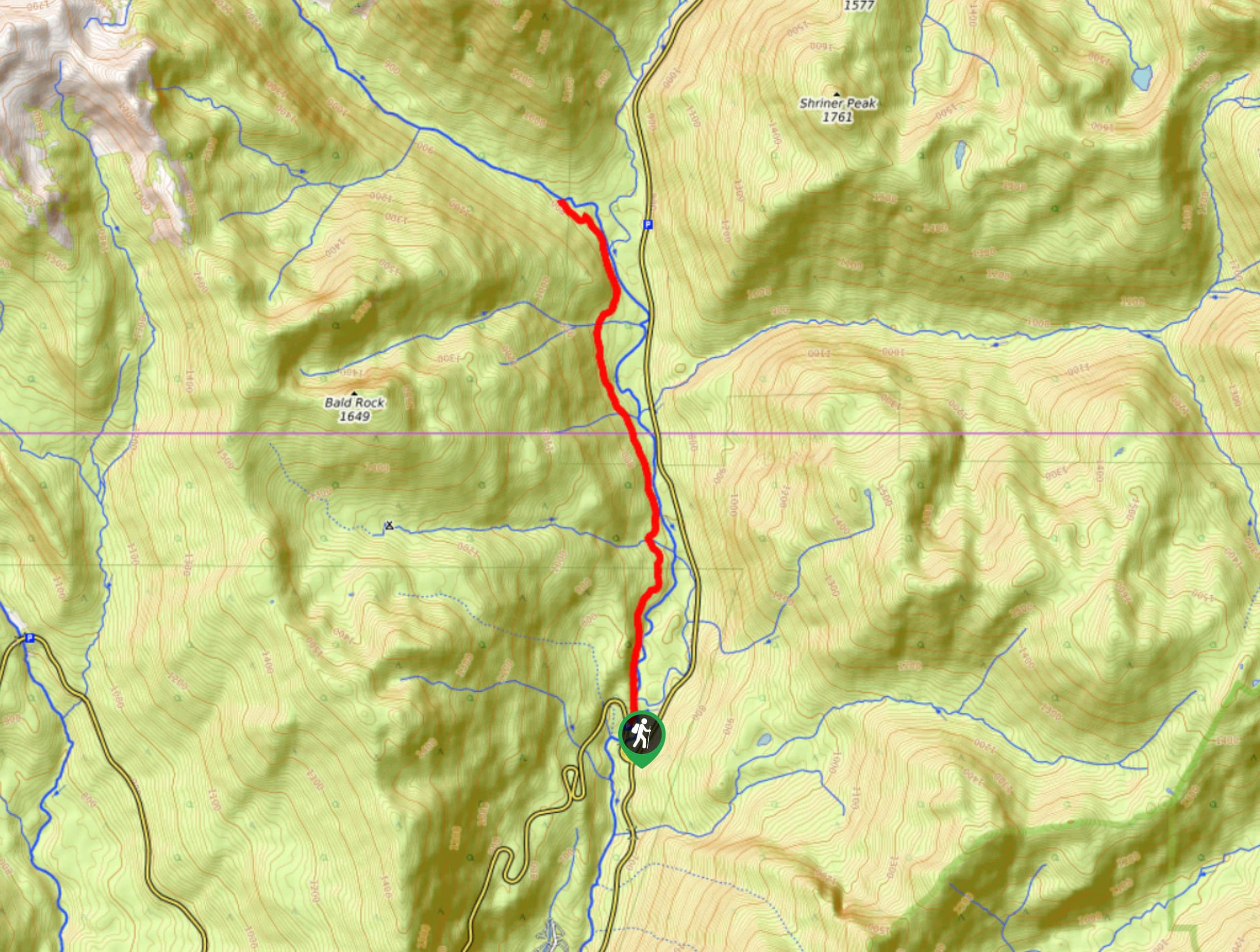
The Eastside Trail is an 7.2mi moderately trafficked easy trail in Mount Rainier National Park that offers the opportunity to appreciate the old-growth forests of the park without the crowds that other forest trails can draw. This trail also reaches a pleasant waterfall. While it doesn’t boast mountain views, the ancient trees that line the path are reason enough to go.
Getting there
The trailhead for the Eastside Trail is located on Stevens Canyon Road just northeast of the intersection with Highway 123. There is a small parking area on the east side of the road.

About
| Backcountry Campground | No |
| When to do | April-October |
| Pets allowed | No |
| Family friendly | Yes |
| Route Signage | Average |
| Crowd Levels | Moderate |
| Route Type | Out and back |
Eastside Trail
Elevation Graph
Weather
Eastside Trail Description
Want to appreciate the old-growth trees of Mount Rainier National Park? The Eastside Trail is a lovely way to walk among ancient trees without walking among the crowds that other nearby trails draw. While this hike is a touch longer than most other easy trails, the elevation gain is very gradual and modest, making this a non-challenging hike.
From the parking area, set out along Eastside Trail. You’ll hike alongside the Ohanapecosh River, far below the tops of mighty Douglas fir and western red cedars. The Grove of the Patriarchs Trail connects on your right-hand side, and makes a nice, short addition to your hike for even more old-growth experience.
The trail meanders along, crossing several steams. Our route ends at a crossing with the Ohanapecosh River, but you can certainly go further or turn around sooner if desired.
Similar hikes to the Eastside Trail hike
Twin Firs Loop Trail
Twin Firs Loop is a 0.3mi hike in Mount Rainier National Park that is incredibly easy, making it…

Paul Peak Trail
The Paul Peak Trail is a 6.3mi lightly trafficked out and back trail in Mount Rainier National Park…

Narada Falls to Mazama Ridge Loop
The Narada Falls to Mazama Ridge loop is an 7.4mi moderately trafficked route in Mount Rainier National Park…
Comments