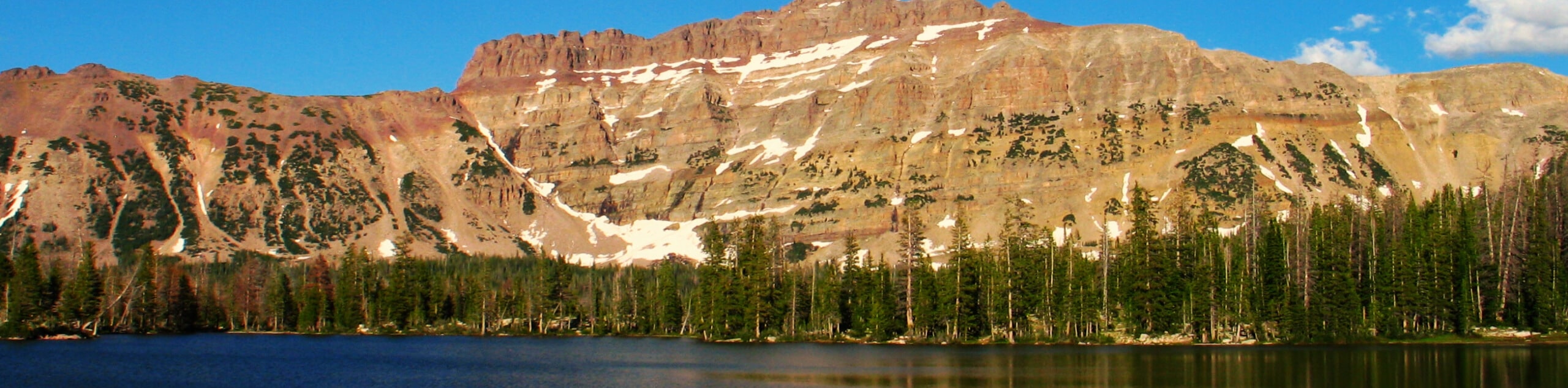
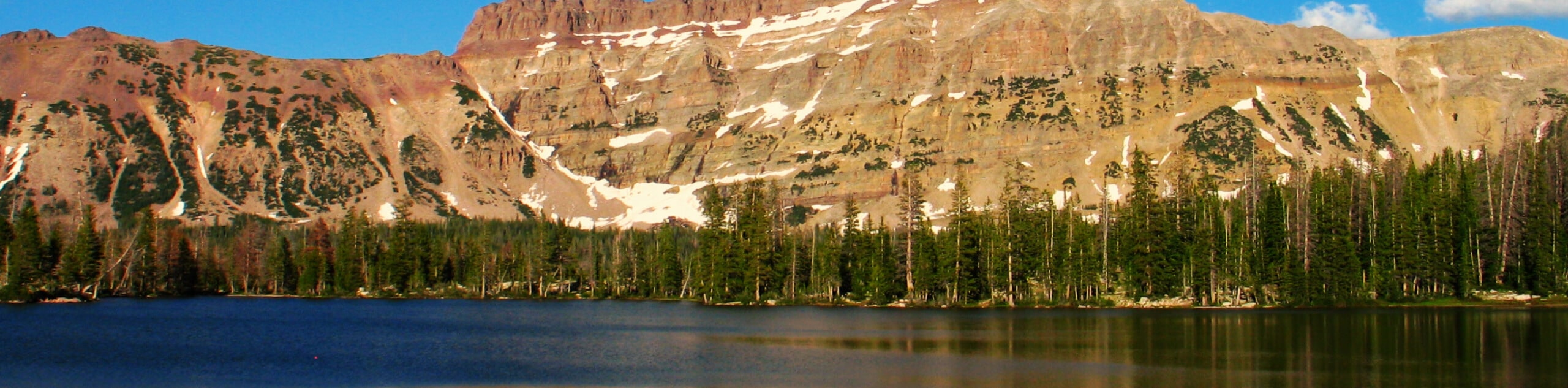
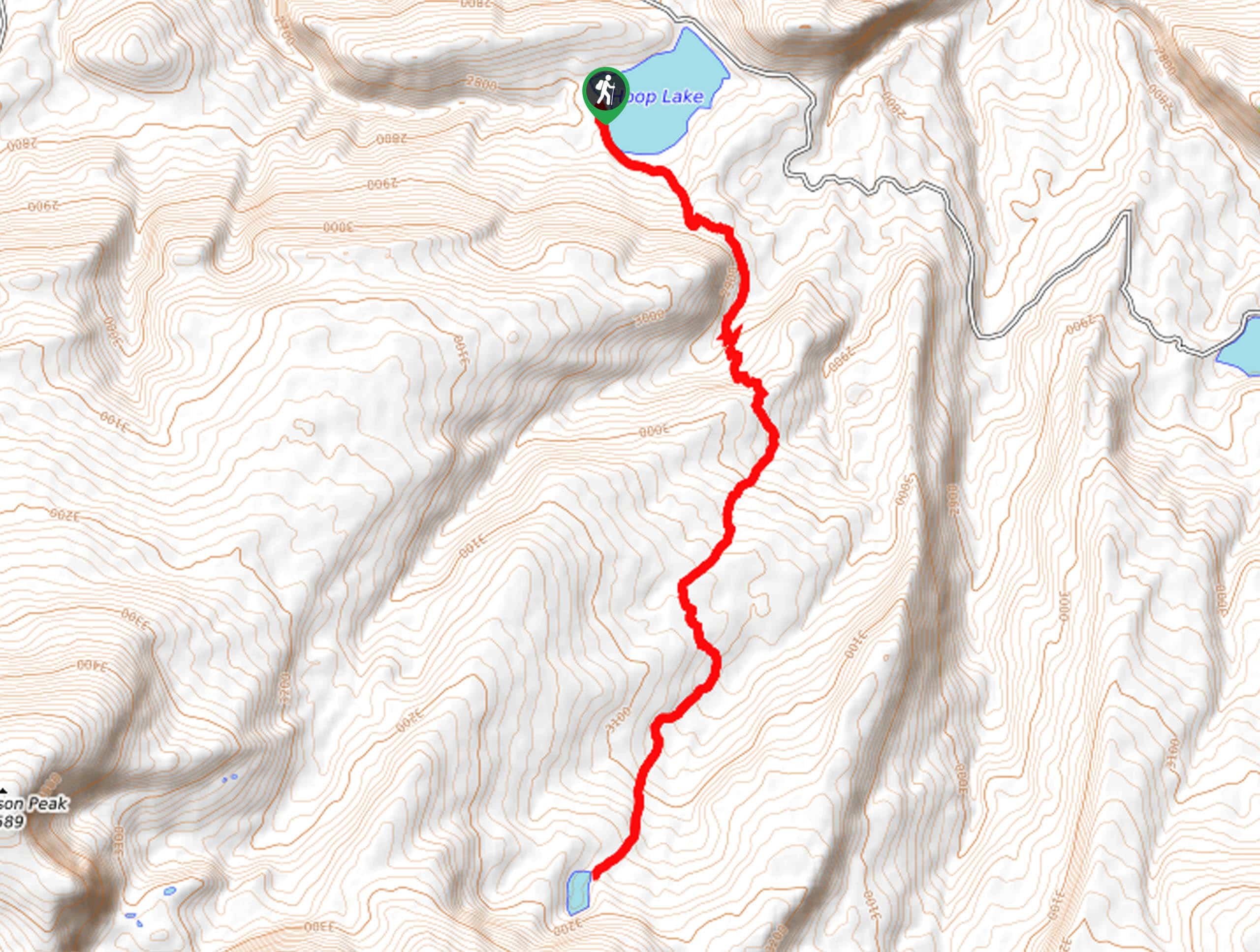
hikes in Uinta Mountains
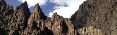
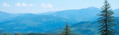
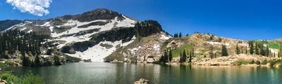
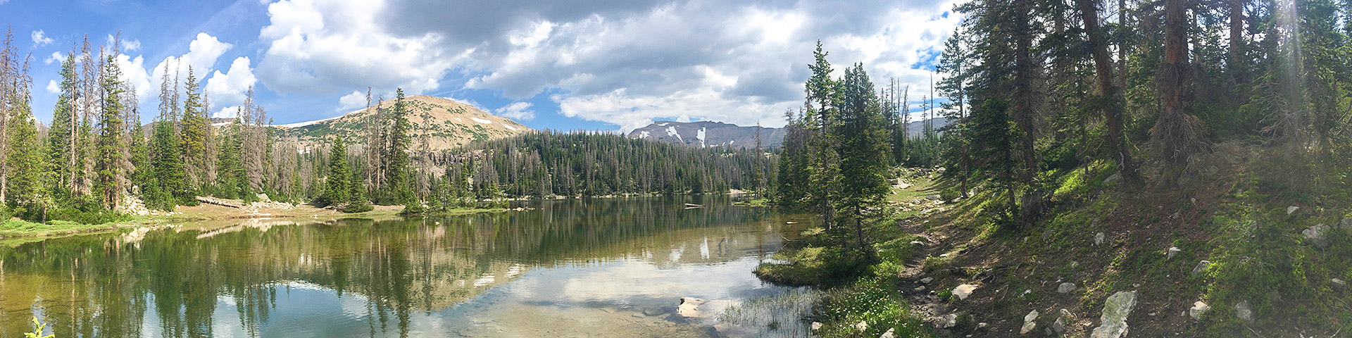
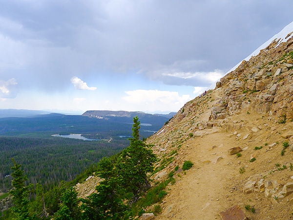
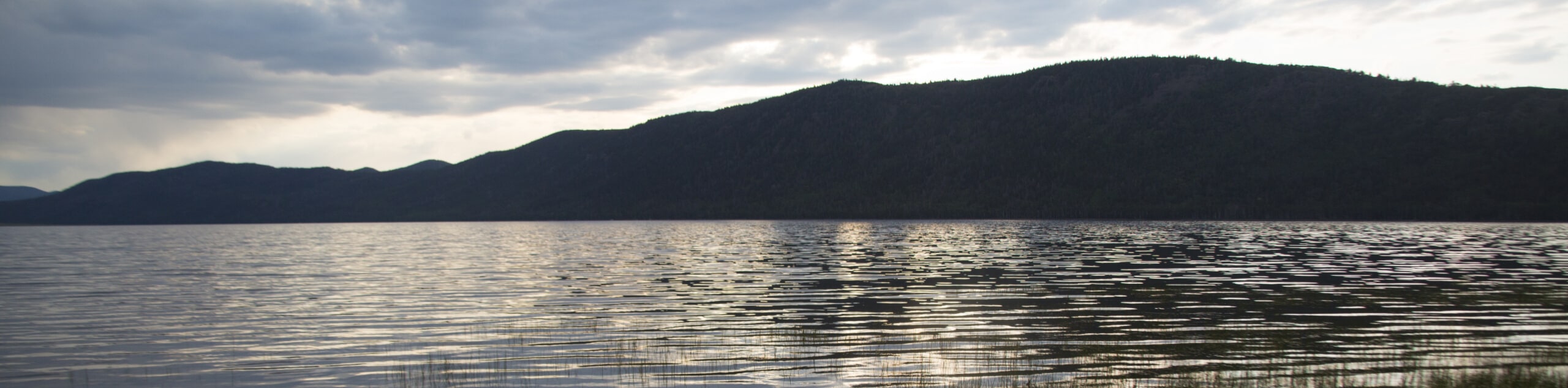
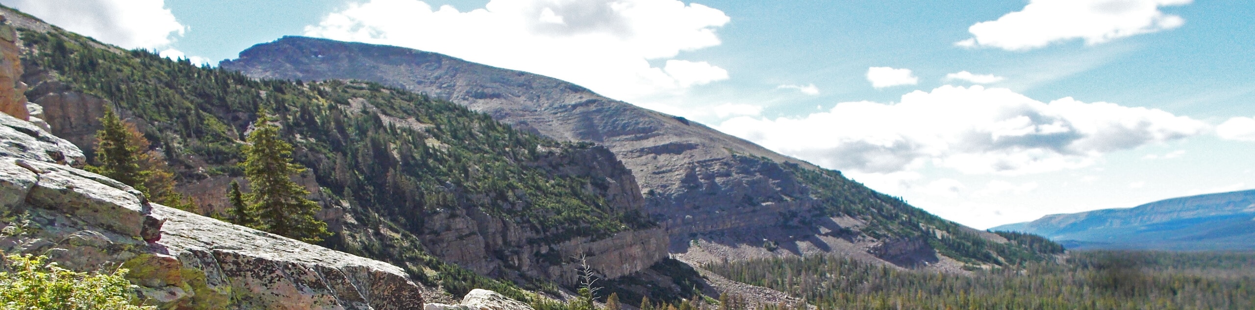
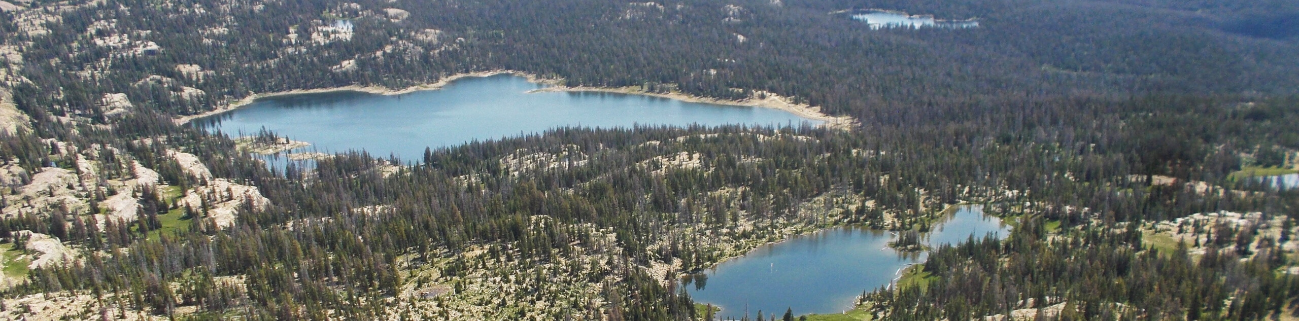
The Uinta Mountains are one of Utah’s best-kept secrets, a little known mountain paradise tucked away in the northeast corner of the state. This beautiful region is the perfect destination for a fun hiking adventure, with gorgeous mountain scenery, fast-flowing streams and pristine, serene lakes. Forget everything you think you know about Utah’s landscapes – hiking in the Uinta Mountains is a truly unique adventure.
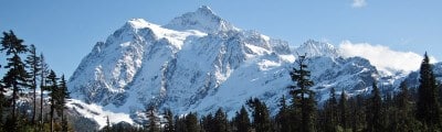
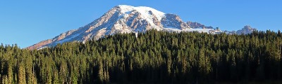
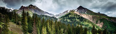
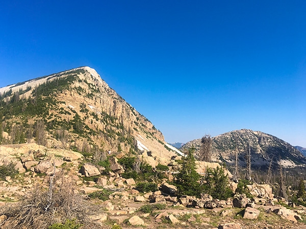
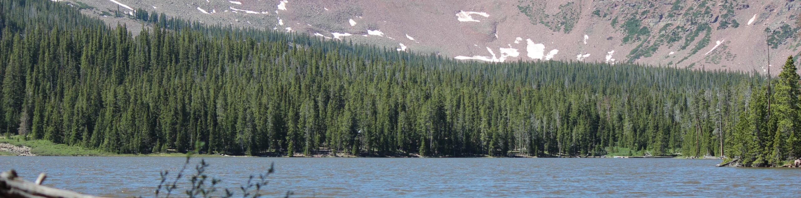
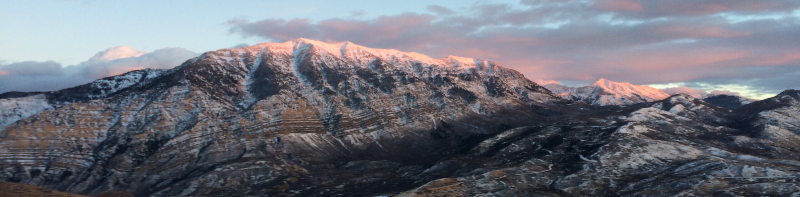
Hiking in the Uinta Mountains is a real treat for outdoor adventurers. This range contains the highest peak in Utah, Kings Peak, and summiting this 13533ft mountain is a satisfying challenge for keen hikers. The beautiful Naturalist Basin is the site for many pleasant hiking trails, and is the ideal spot for a backpacking or camping trip.
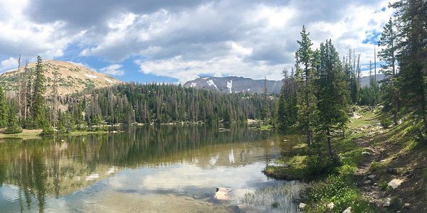
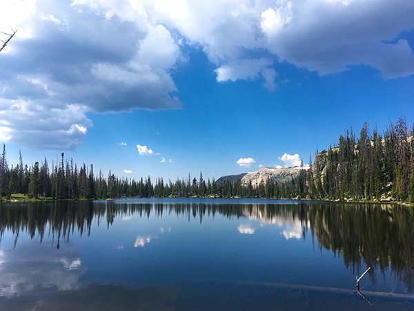
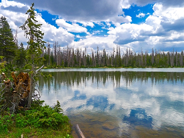
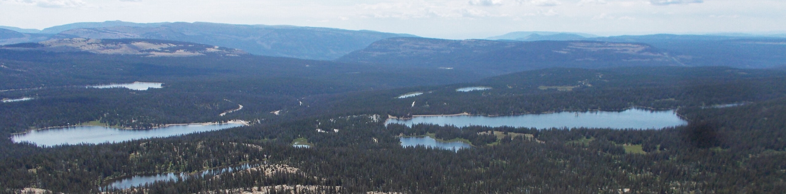
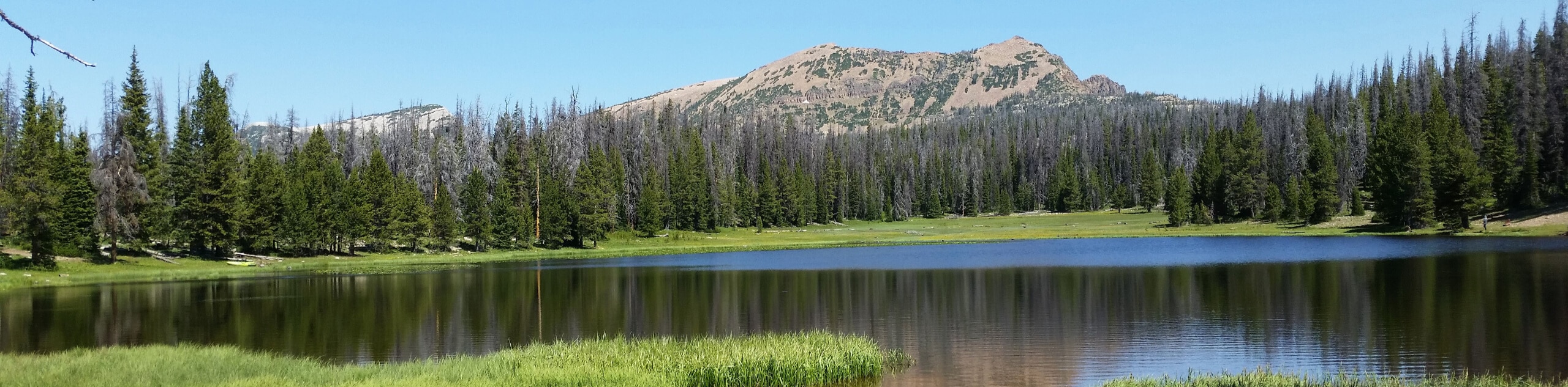
Utah is not known for an abundance of water, but the Uinta Mountains are littered with beautiful, pristine lakes – perfect for taking a dip, or simply as a spot where you can sit and admire the view. Whether you go, you’ll find sparse pine forest, beautiful wildflower meadows, and gorgeous natural sights, all punctuated by fantastic hiking trails.
The Uinta Mountains defy all expectations, and it’s somewhat surprising that they are not more widely known among travellers from outside Utah. We think this beautiful region is a fantastic hiking destination that deserves much more attention than its gets. Check out these epic hiking trails in the Uinta Mountains for more information and a little inspiration!
Top Hikes In The Uinta Mountains
The Uinta Mountains are a wonderful destination for a family hiking trip, with plenty of easy, family-friendly trails that are perfect, even for little legs! Younger visitors will love exploring the region’s many beautiful lakes, the ideal place to cool off on a hot day. You’ll enjoy spectacular views, even on short, easy hikes, making this an excellent spot for a relaxed hiking trip. However, if you’re looking for something a little more strenuous, the Uintas also offer some more challenging routes that will take you high up to some of the tallest peaks in the state. These longer, more strenuous hikes are a good option for hikers looking for challenge, and come with fabulous views as a reward for your exertions.
Easy Hikes In The Uinta Mountains
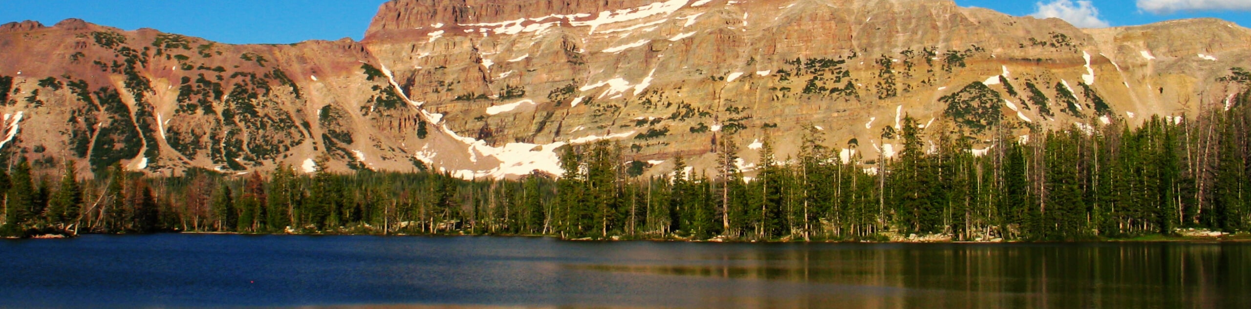
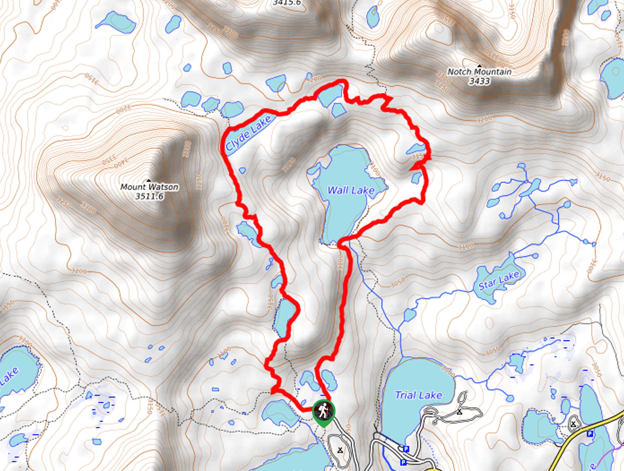
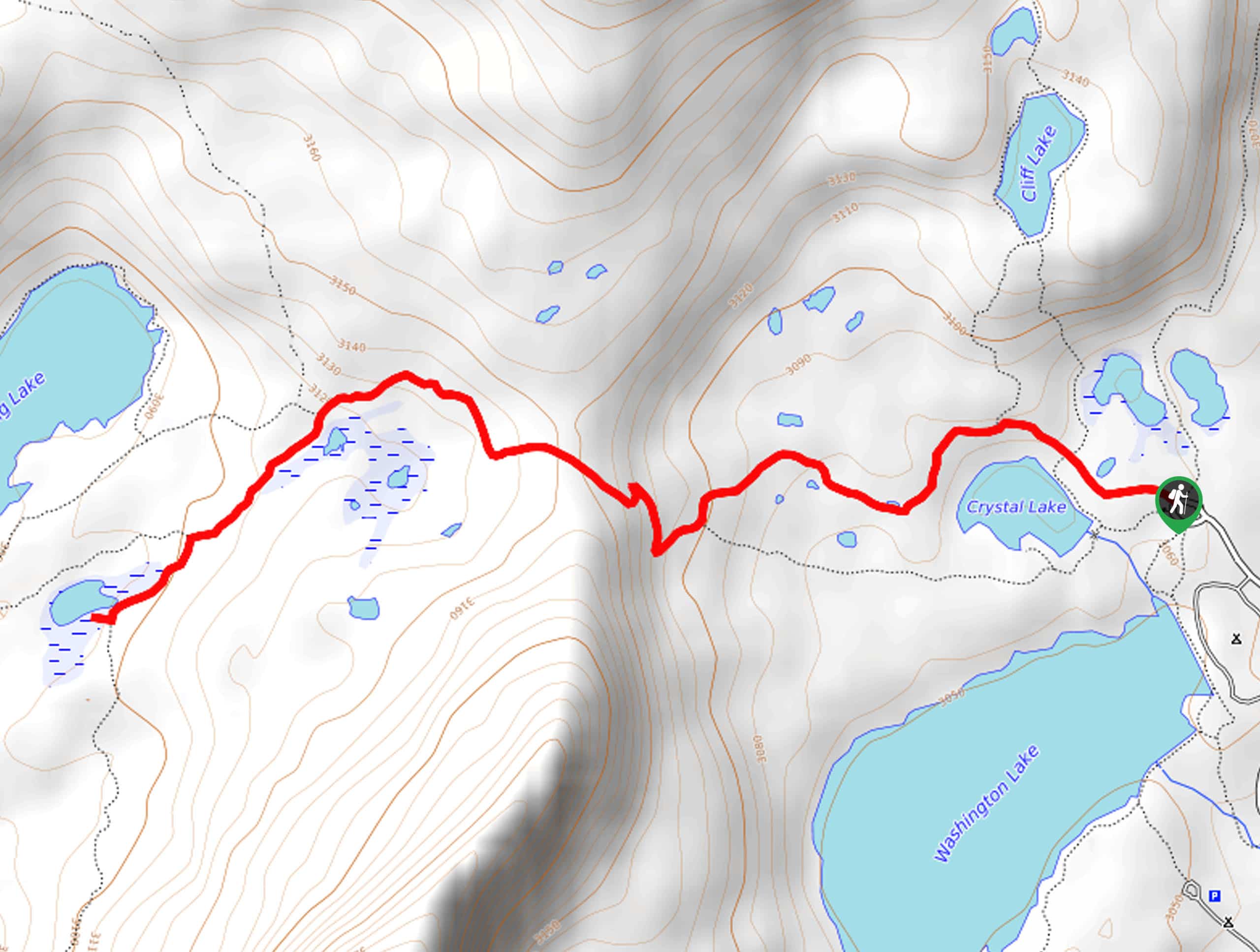
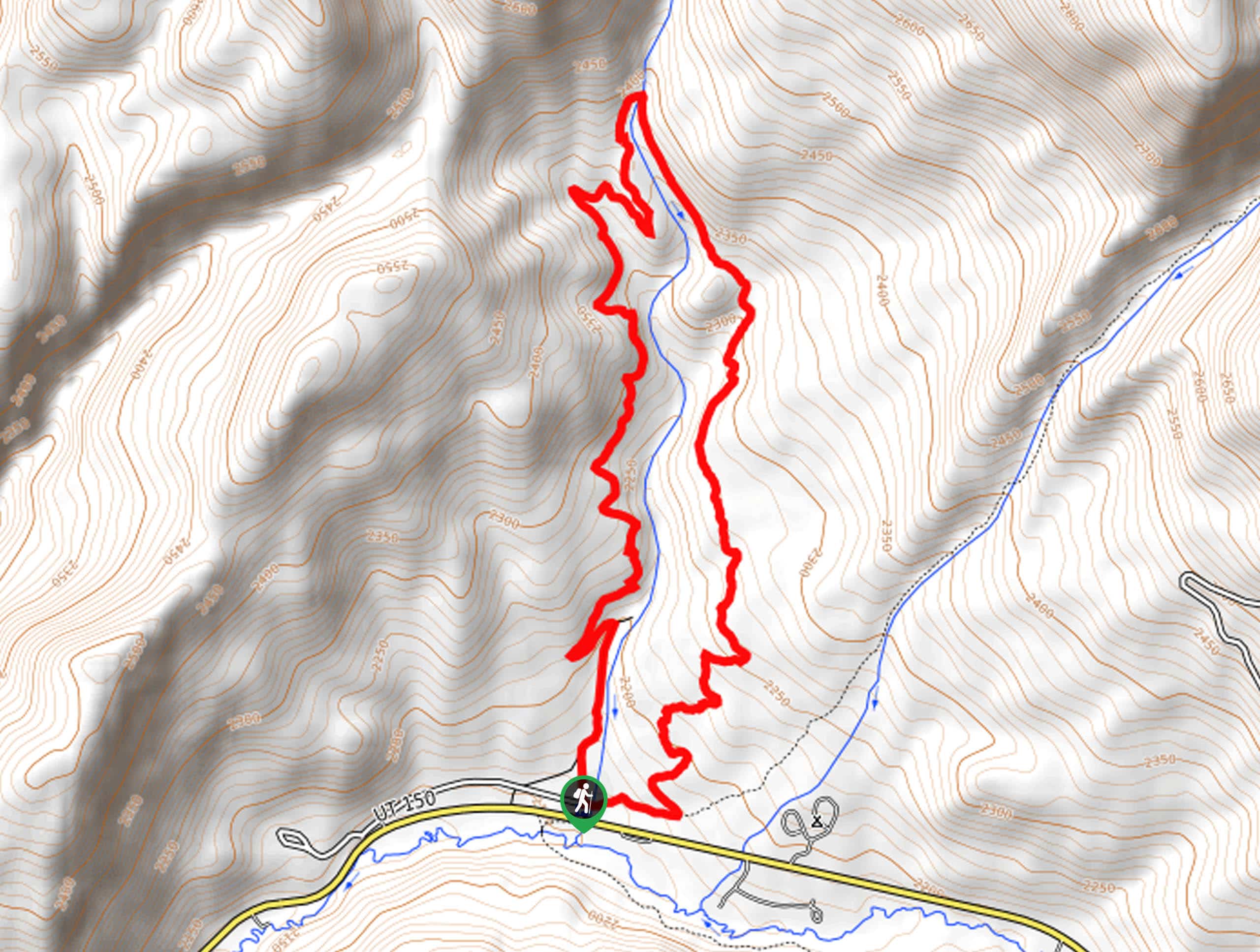
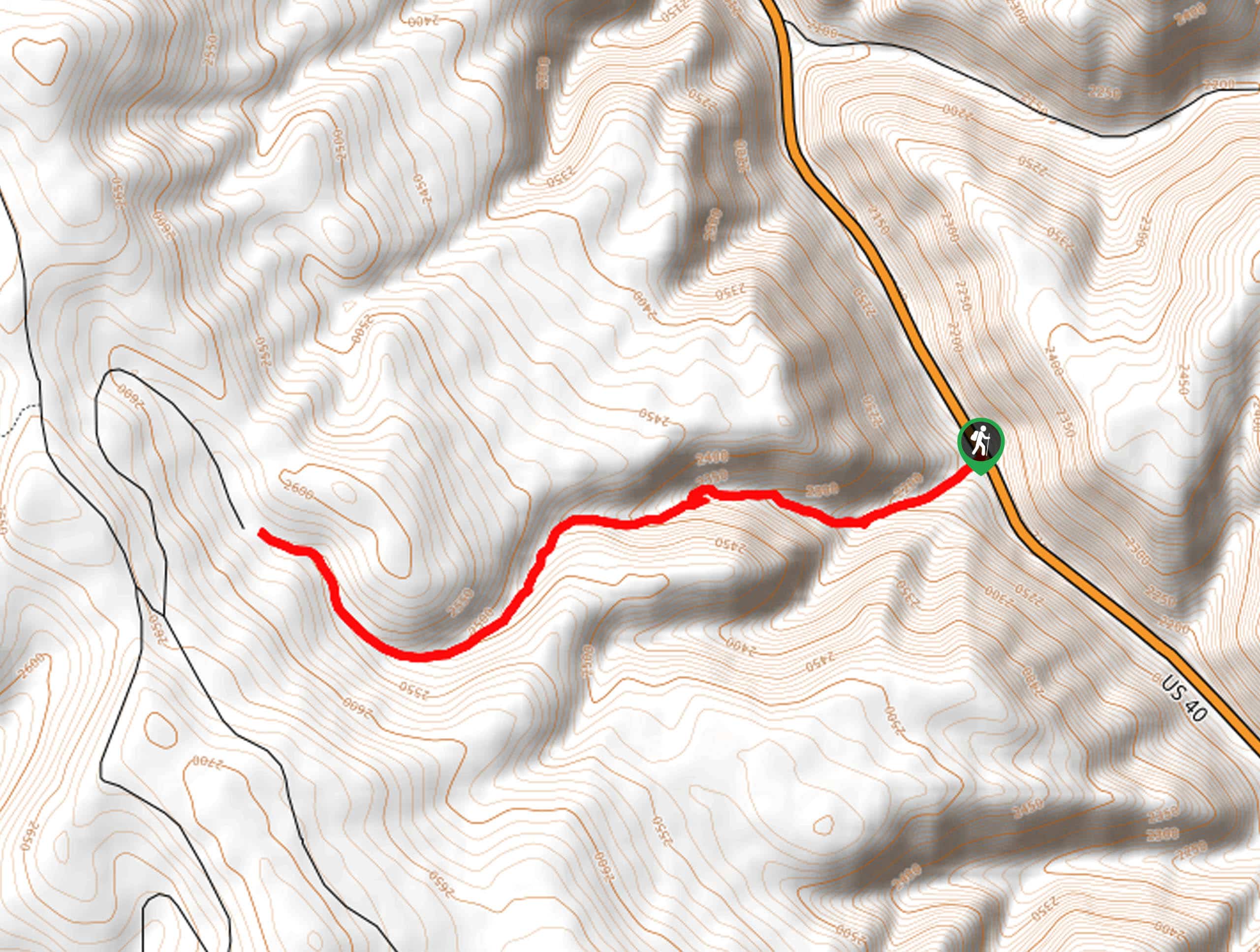
Clyde Lake Hike: This lovely, easy hike is perfect if you’re looking for a relaxed way to enjoy the wonderful landscapes of the Uinta Mountains. Clyde Lake is remarkably scenic, with views of Notch Mountain and Mount Watson. However, the finest delights of this hike are enjoyed along the way – you’ll ascend from Cliff Lake to Petite Lake and finally to Watson Lake, before reaching your destination. Each one of these wonderful lakes is worth every bit of effort, and the surrounding landscape makes an idea destination for a fun hike.
Family Hikes In The Uinta Mountains
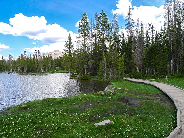
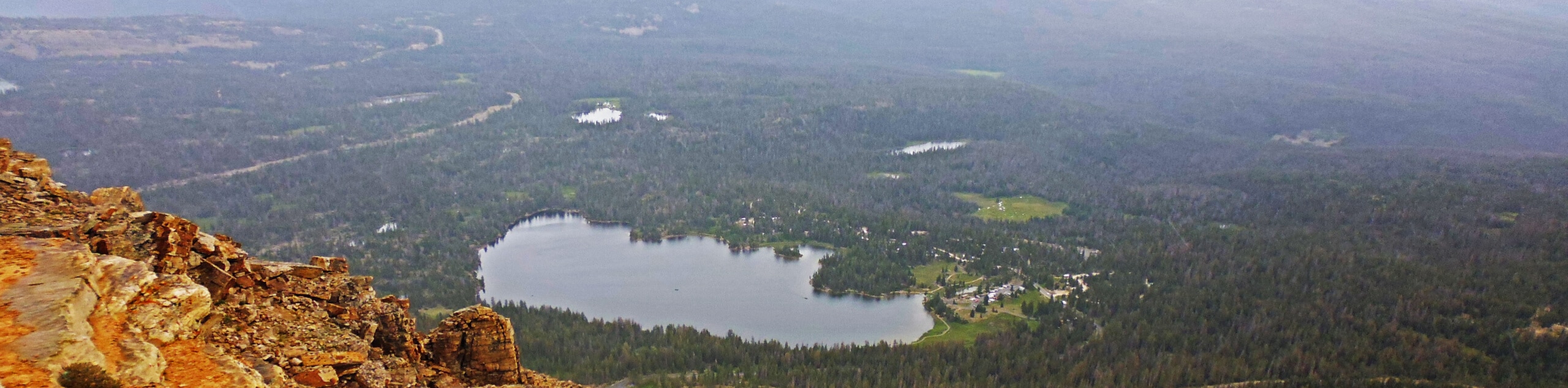
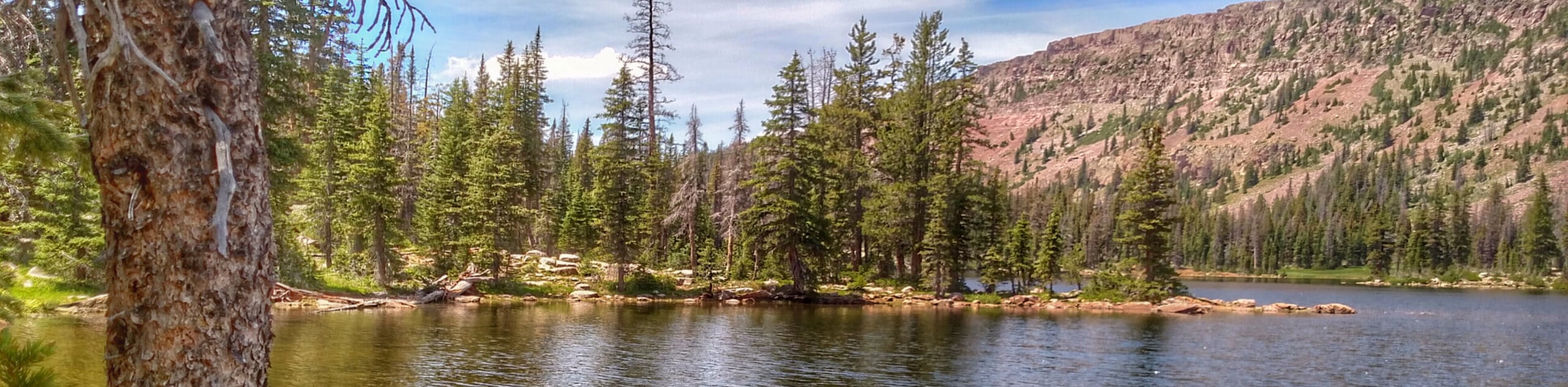
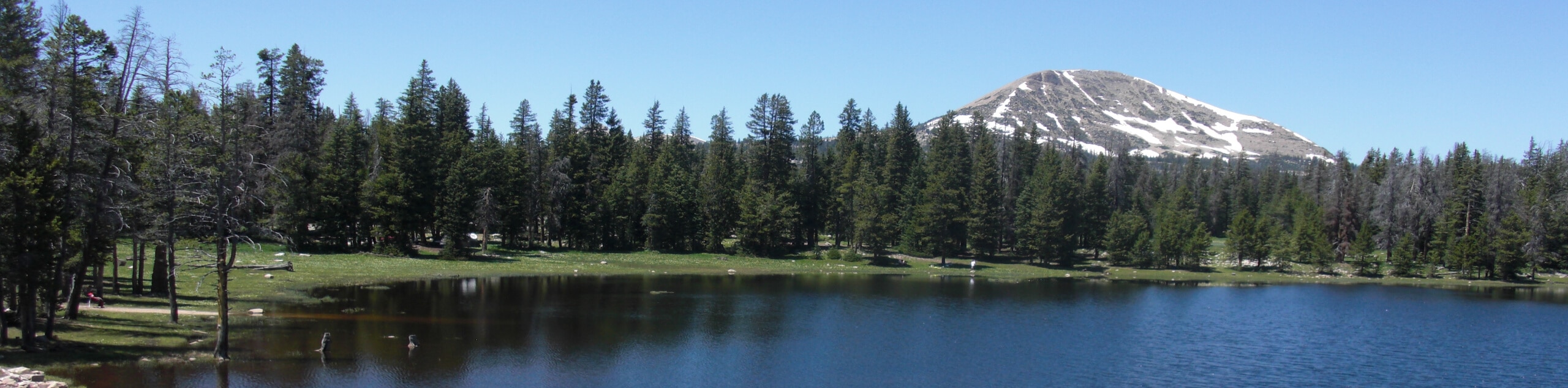
Shoreside Loop (Mirror Lake) Hike: This easy route that traces the shores of Mirror Lake is one of our favorite family hikes in the Uinta Mountains. The views at each point of the lake are stunning – as you walk you’ll see Reids Peak, Murdoch Mountain and eventually the Mount Agassiz Massif reflected in the peaceful waters. This is a fantastic place for a swim on a hot day.
Day Hikes In The Uinta Mountains
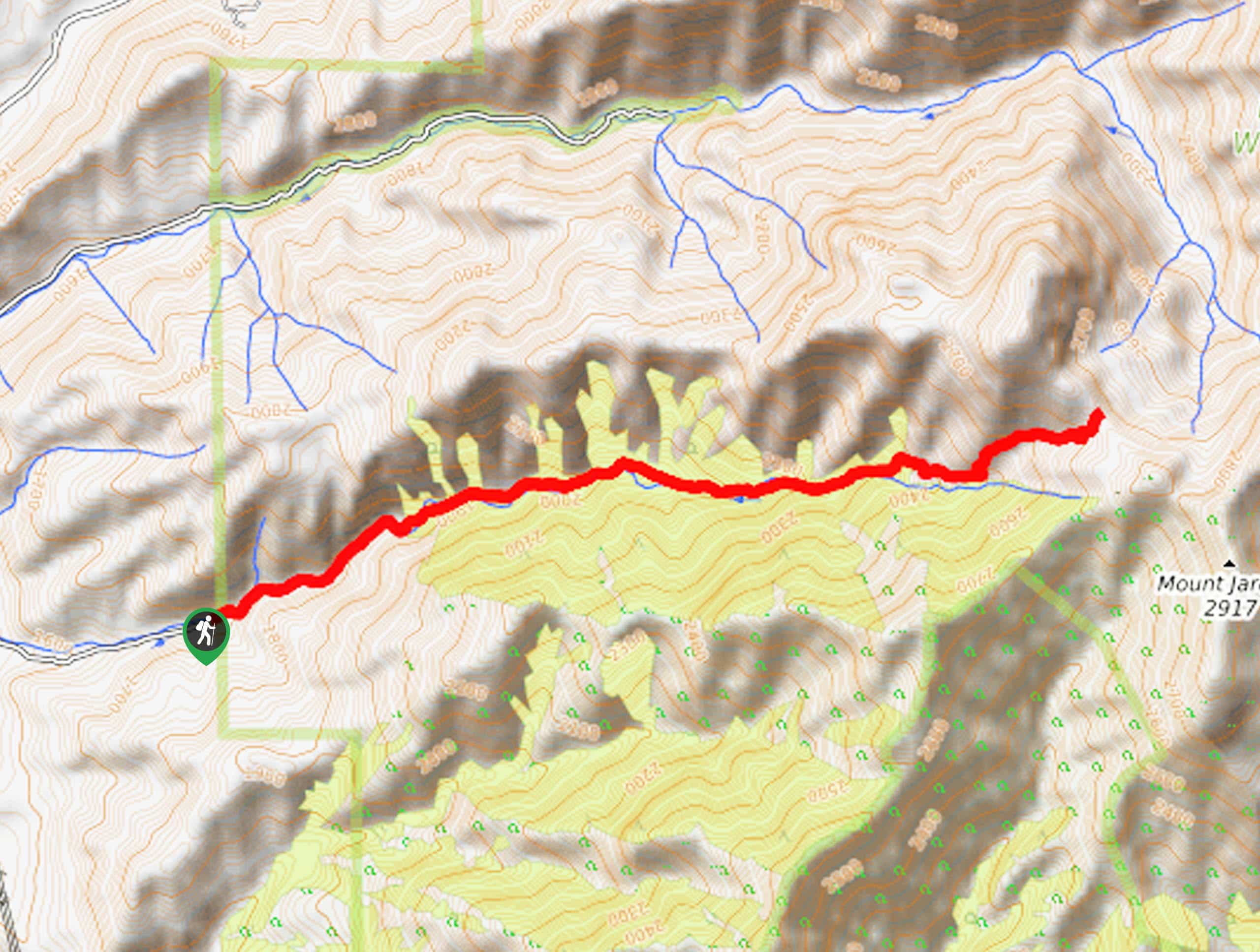
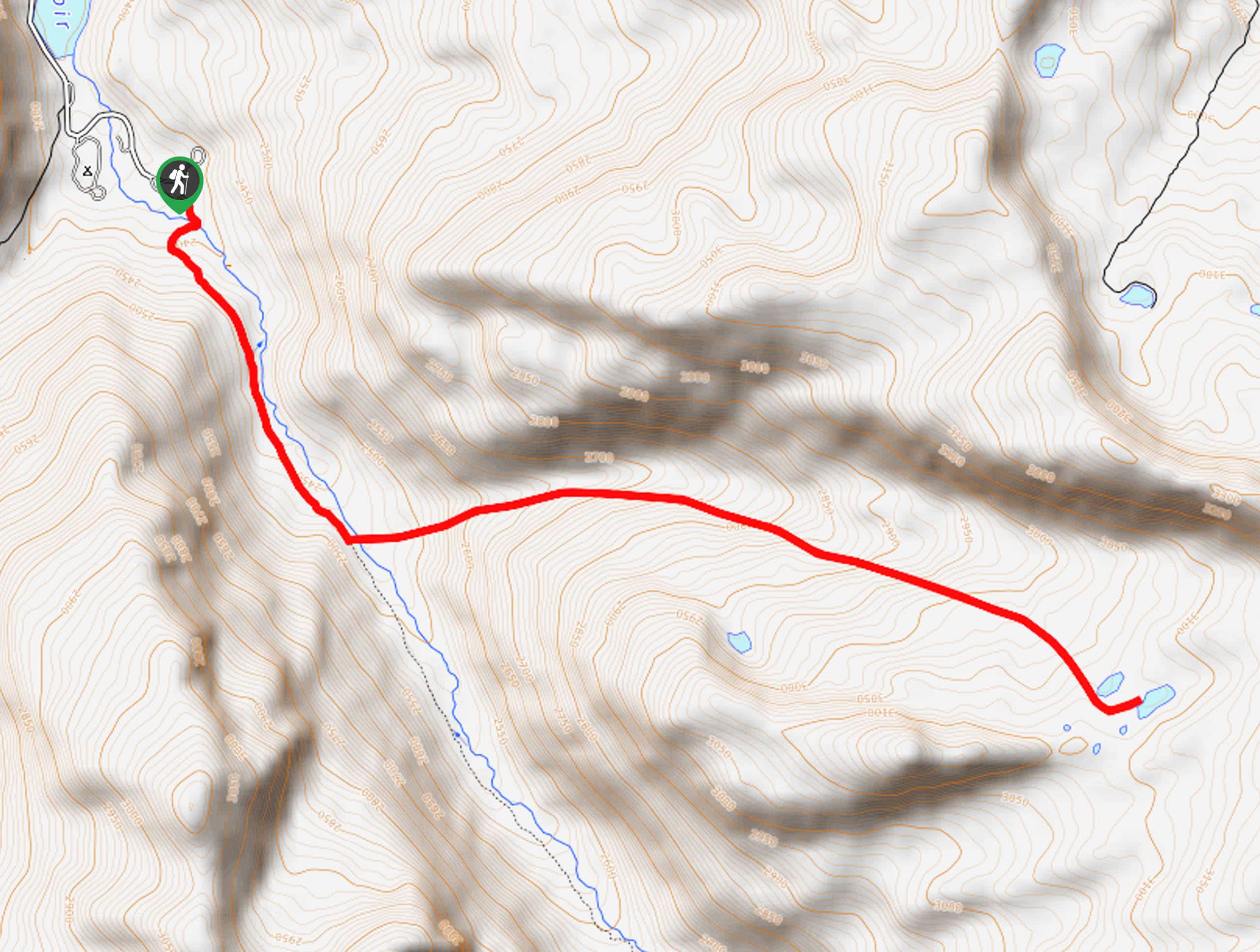
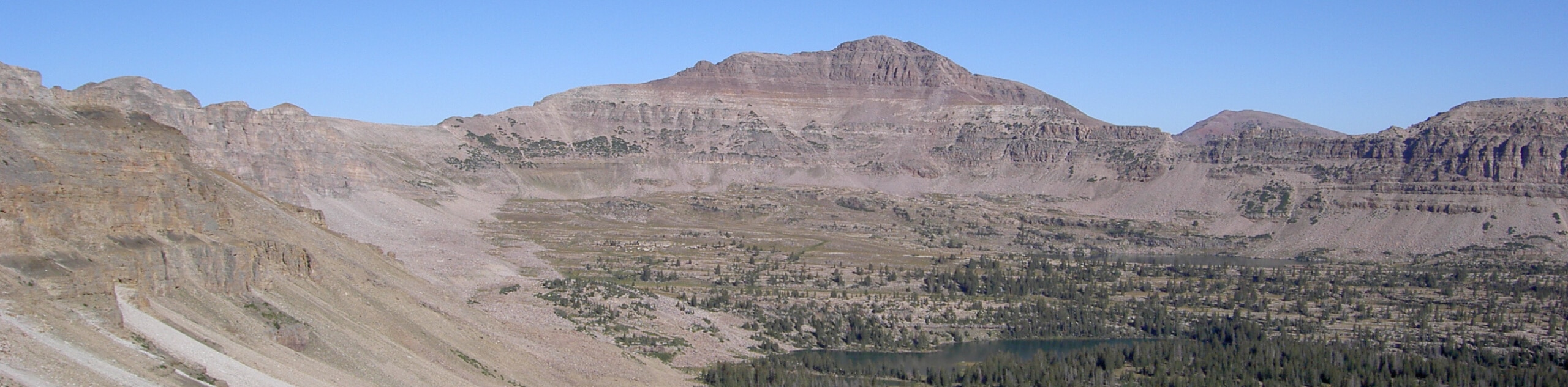
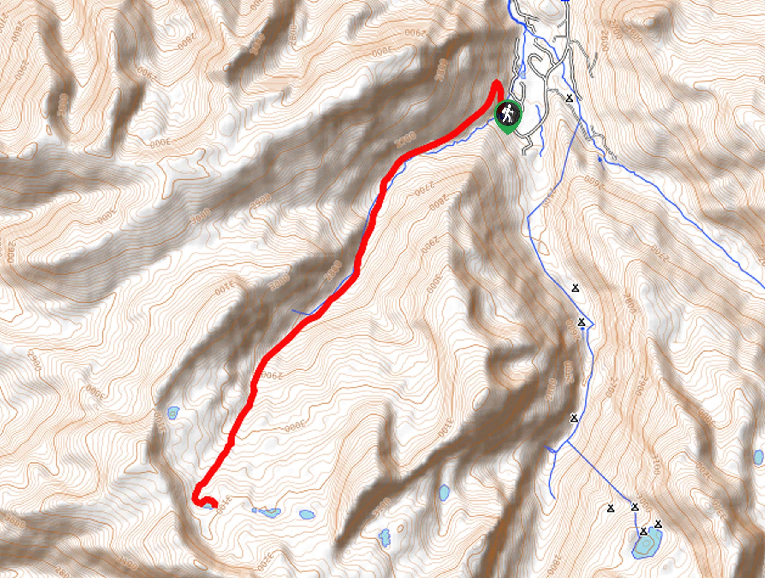
Naturalist Basin Hike: Tracing the route of the 167.4km Highline Trail, this trek to Naturalist Basin is certainly one of the most epic hikes in Uinta Mountains. This is a fabulous way to experience the High Uintas Wilderness, passing along an undulating trail that takes you through some impressive scenery. You’ll enjoy gorgeous alpine lakes and specular mountain views, and the final destination of Jordan Lake is a wonderful secluded haven. Linger a while before turning for home to enjoy the magical serenity of this wild, beautiful spot.
Challenging Hikes In The Uinta Mountains
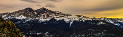
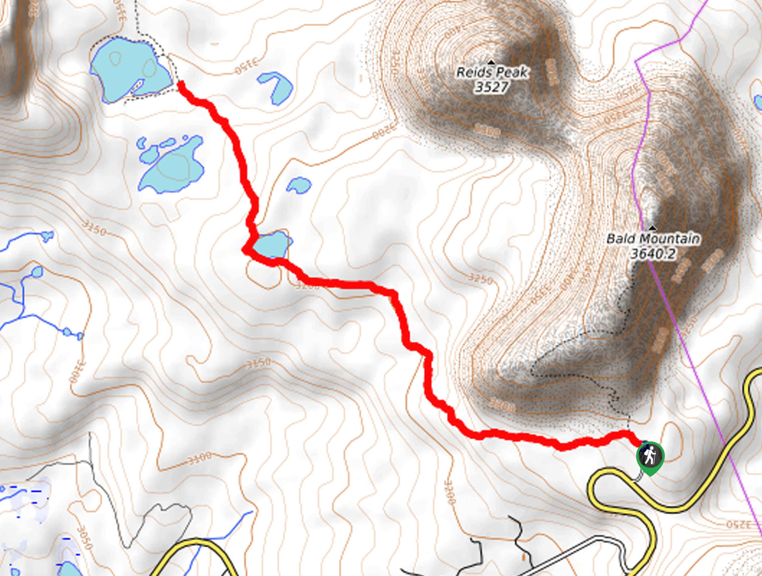
Bald Mountain Hike: Don’t let the length of this hike fool you – it may be short, but you’ll need to be prepared for a grueling, steep climb! The trail ascends the southwest flank of the mountain via a series of switchbacks up to a wood ridge. The climb may be steep, but the views are magnificent from the 3639m summit of Bald Mountain. Come early to avoid the crowds and enjoy this epic hike in the Uinta Mountains!
Other Great Hikes In The Uinta Mountains
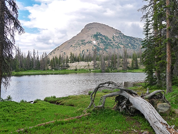
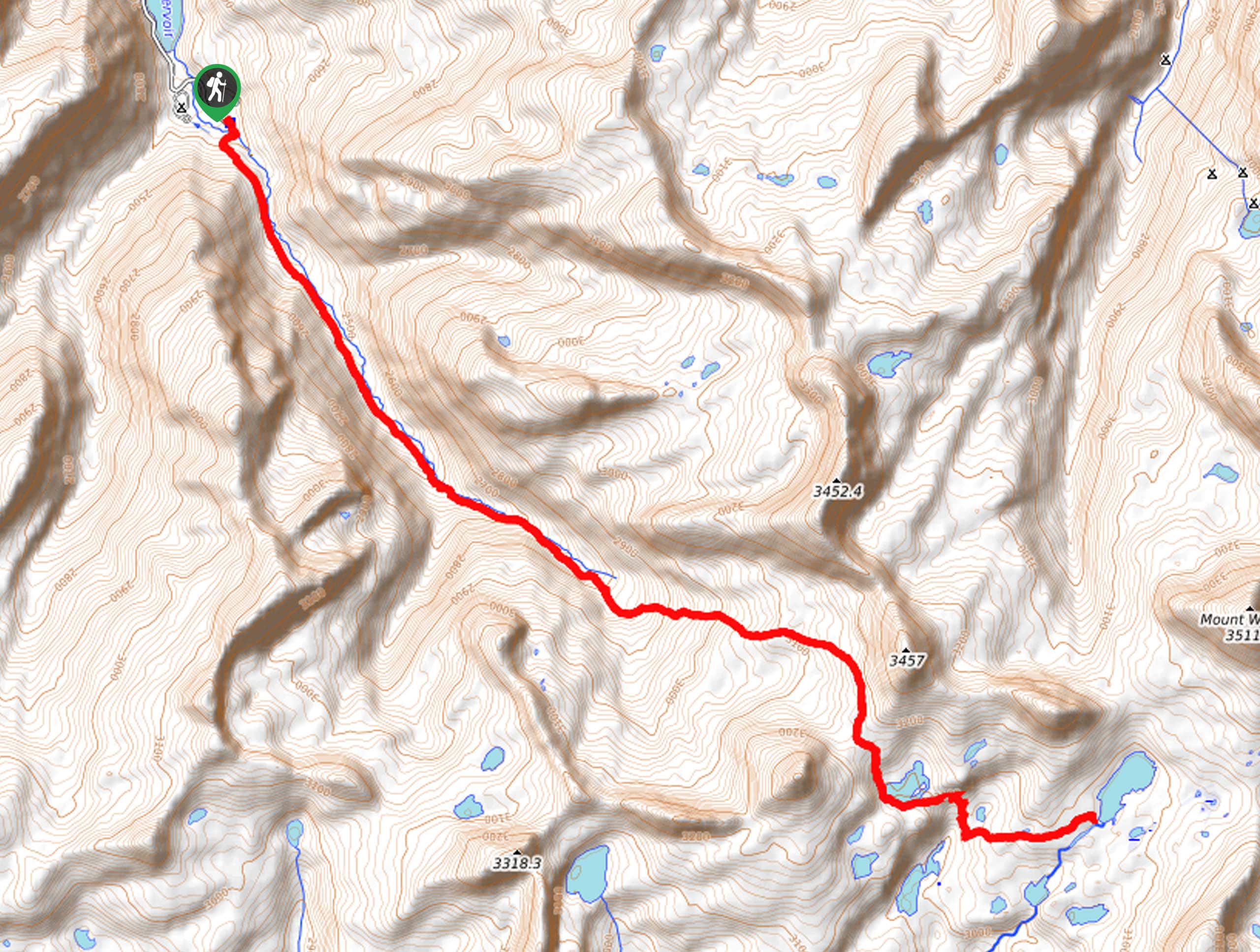
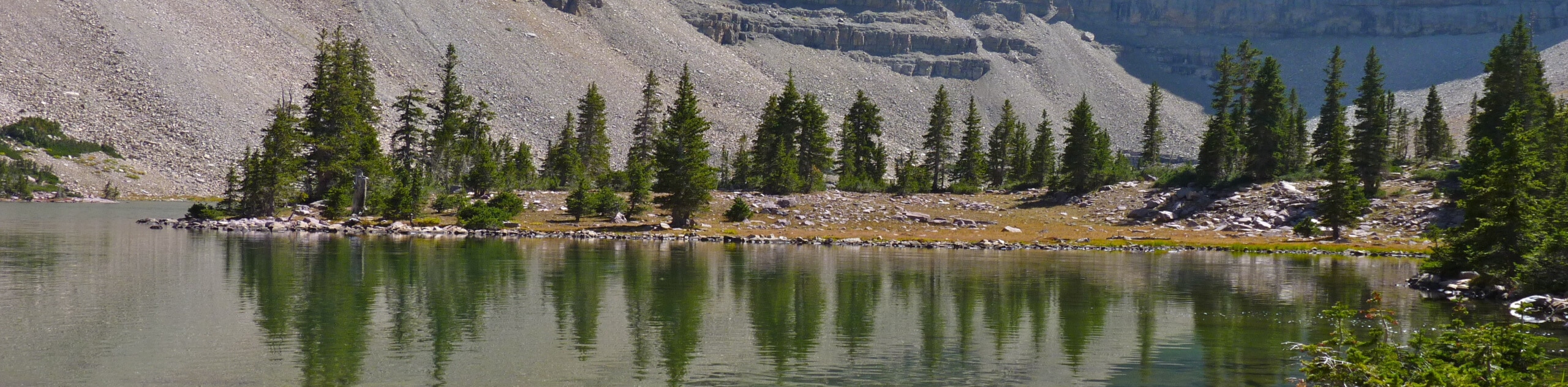
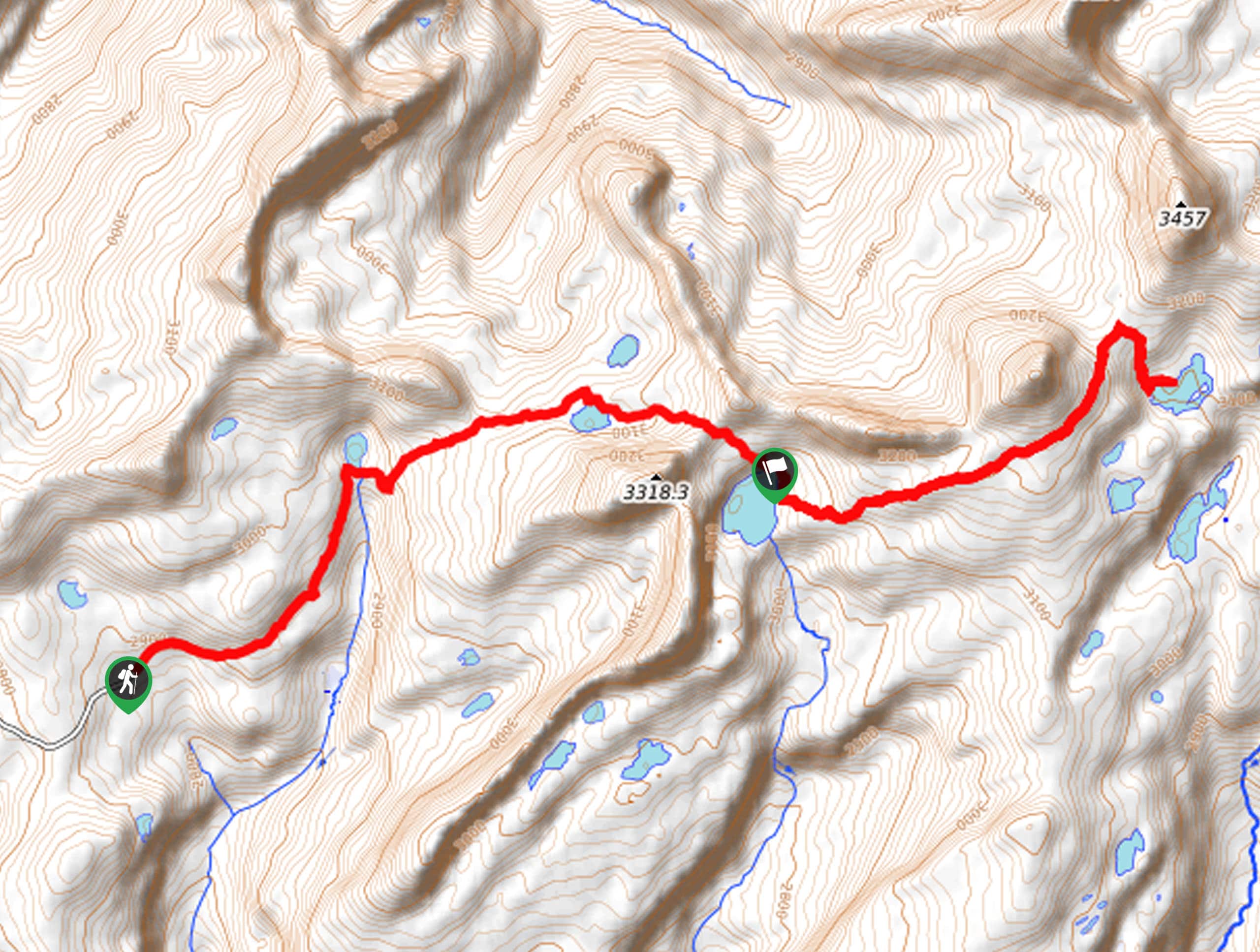
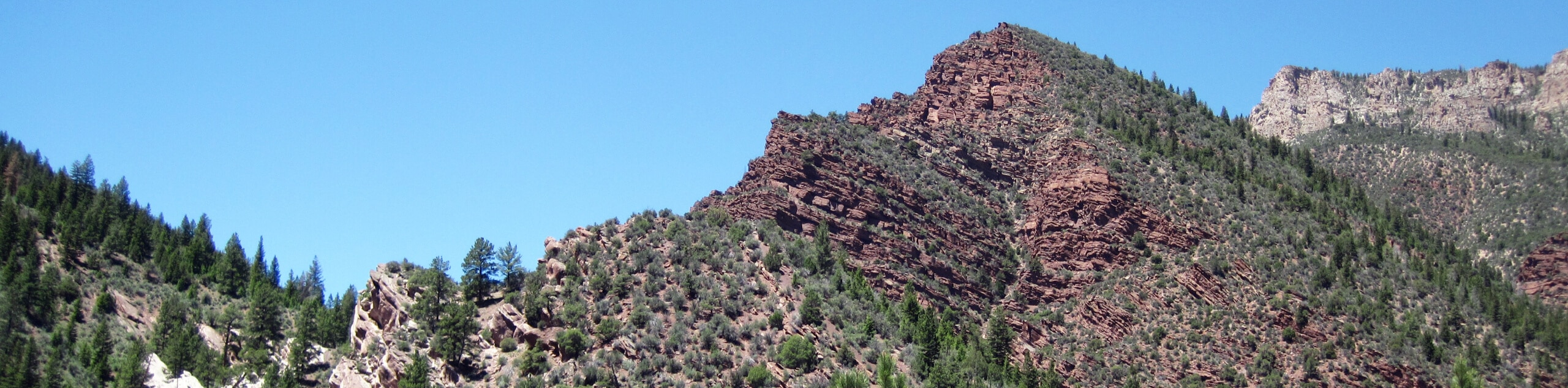
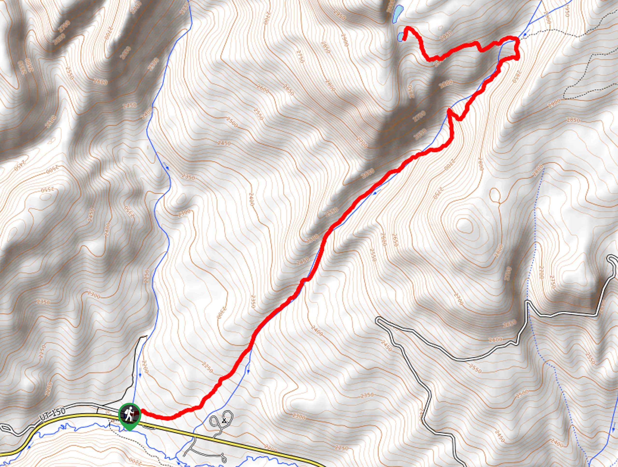
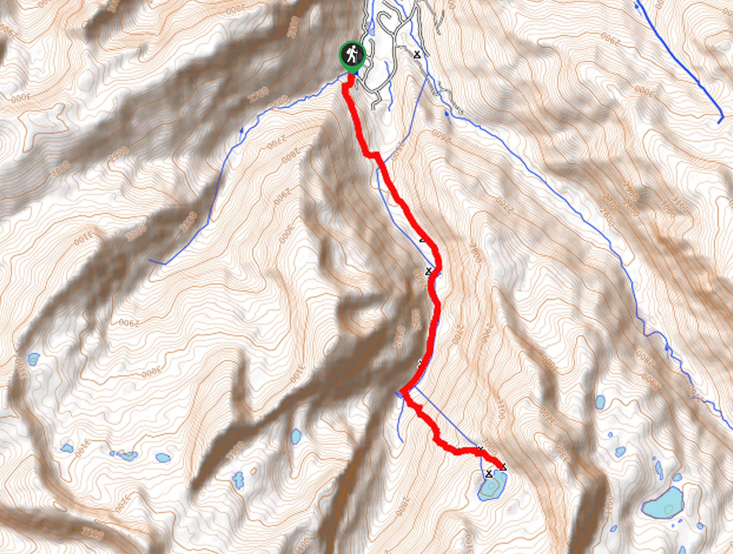
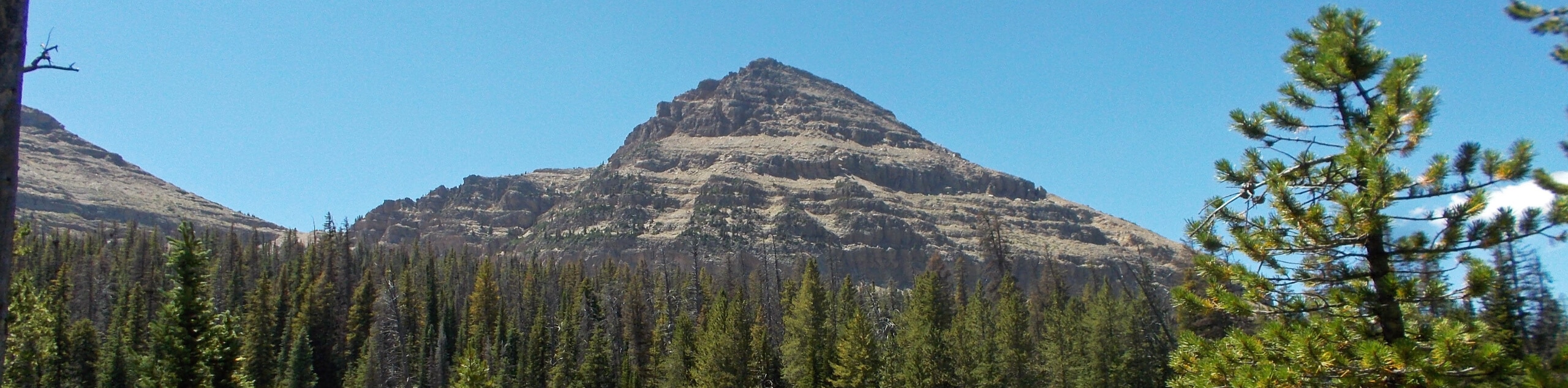
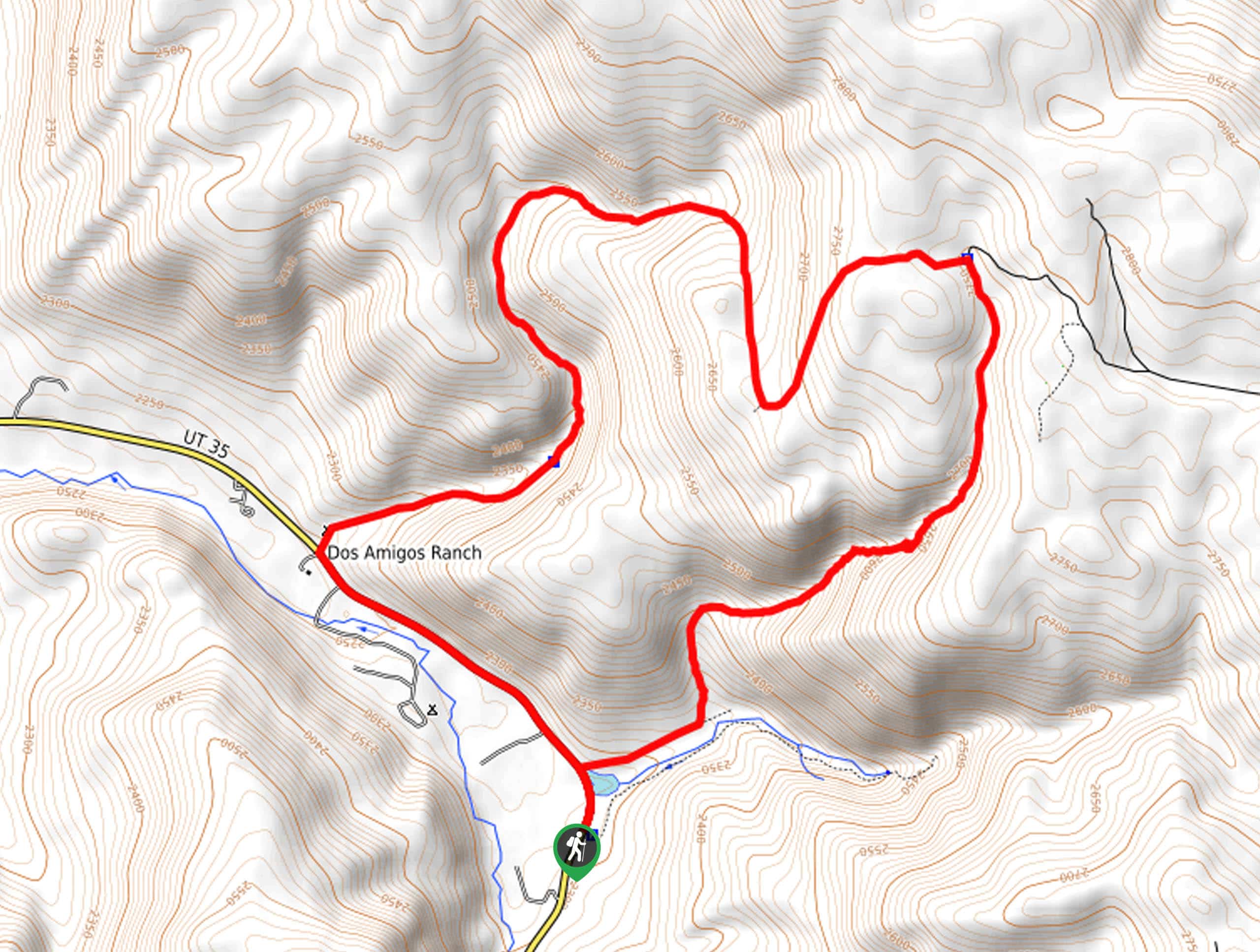
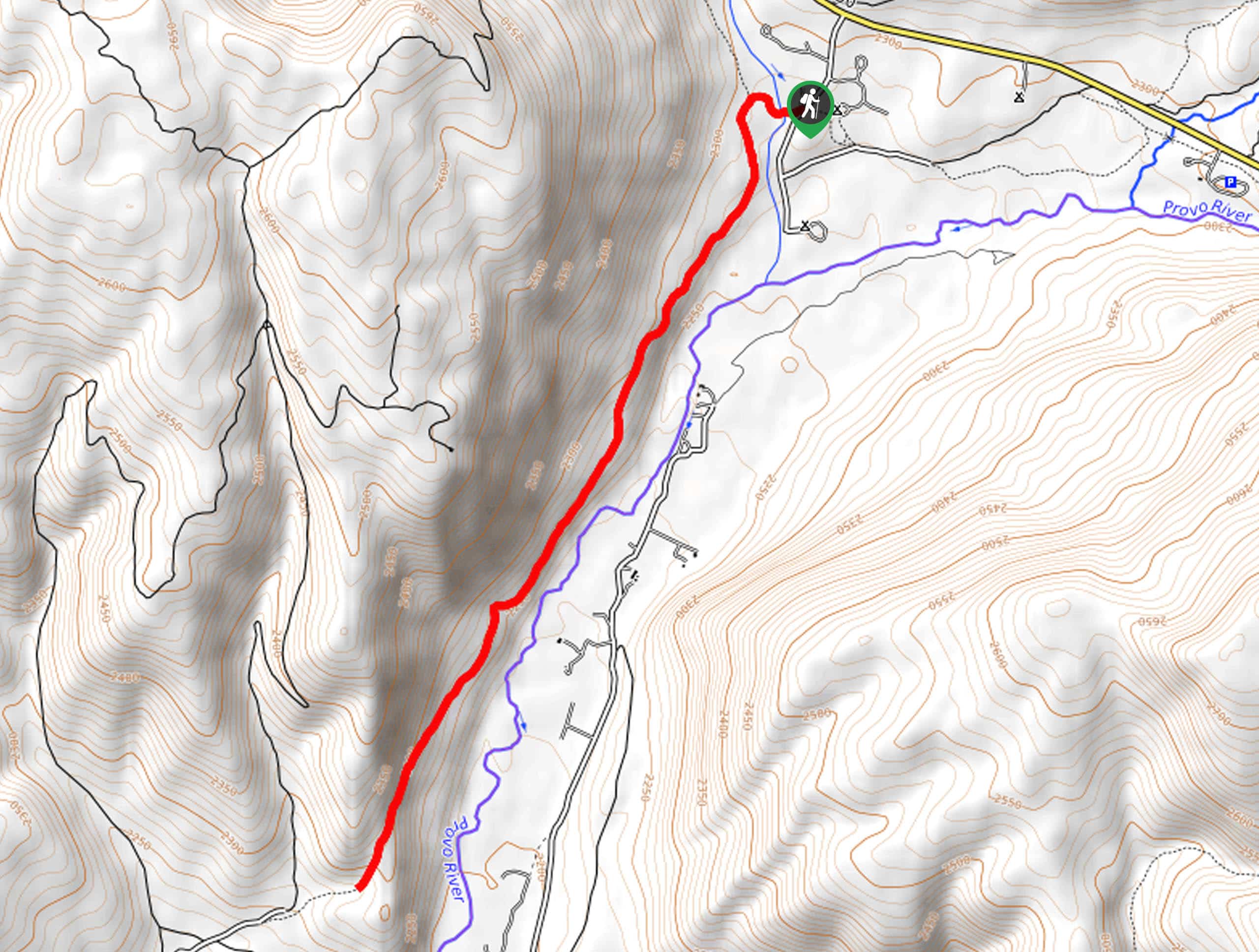
Ibantik Lake Hike: This beautiful hike will take you to one of the most beautiful spots in the High Uinta Mountains. Ibantik Lake sits at the opening of a canyon formed by the Notch Mountain Massif, and its pale blue water is a feast for the eyes. This undulating route takes you over the iconic ‘Notch’, a high pass in the middle of Notch Mountain, and offers a wonderful day out in this sublime region.
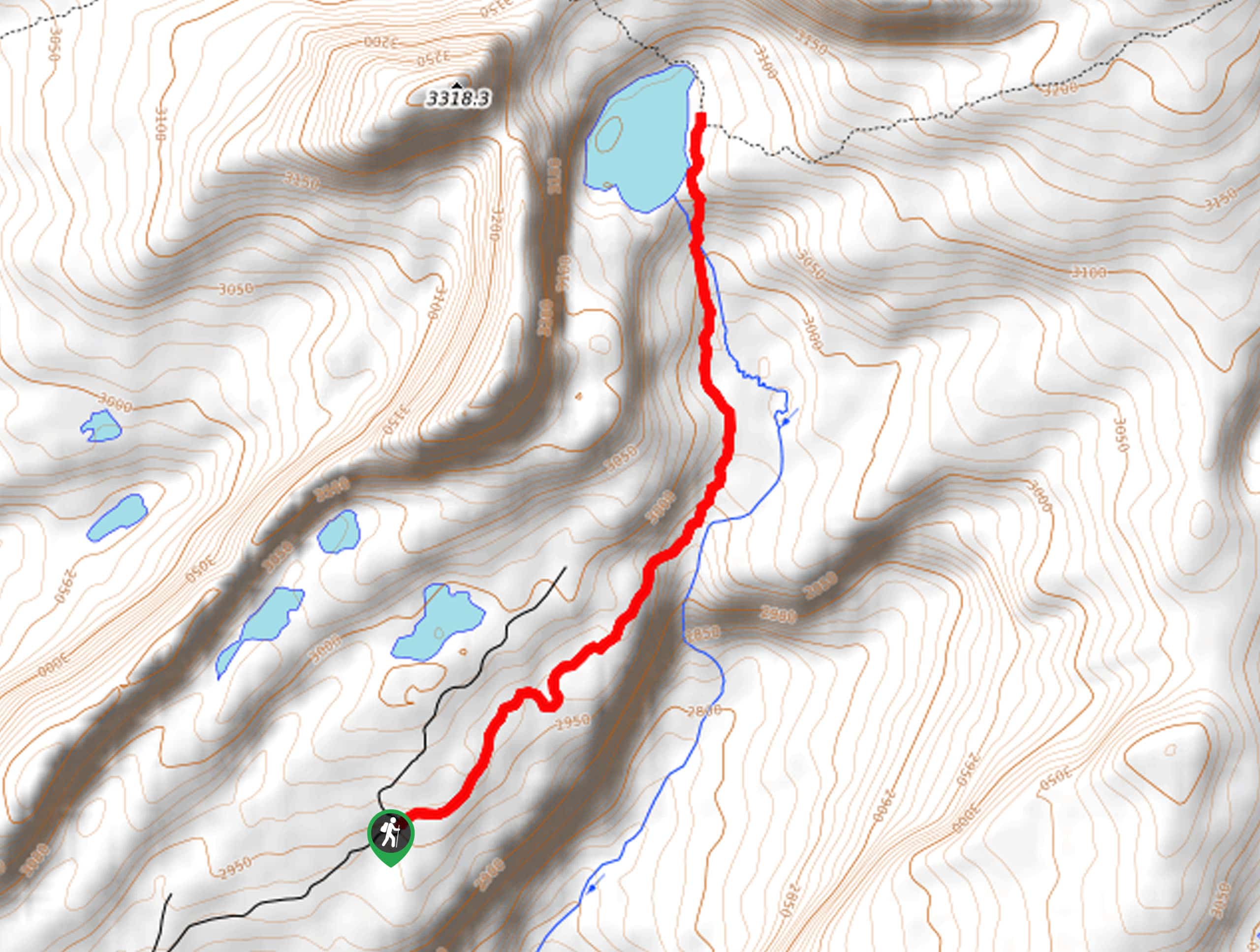
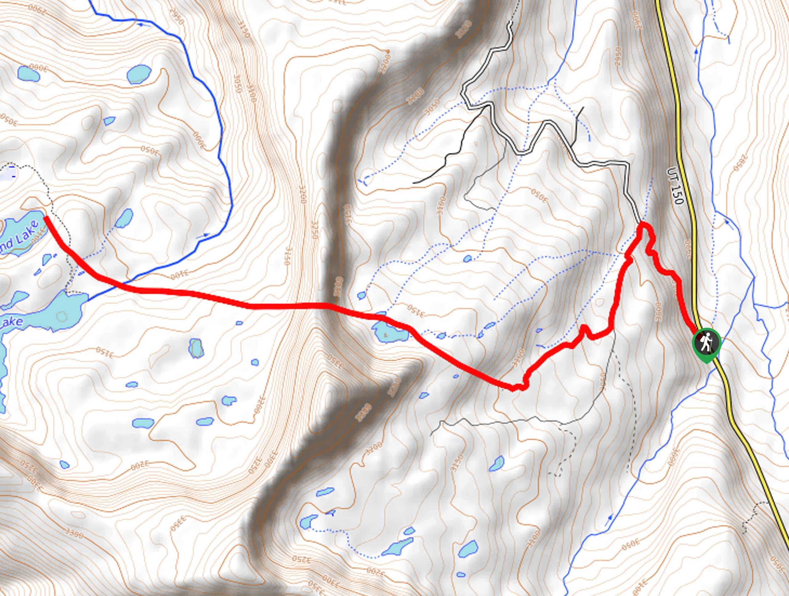
Wilder and Packard Lake Hike: This popular route begins on the Highline Trail, and offers truly incredible views of the High Uintas Wilderness. The trail is undulating and not too challenging, and descends to the tranquil Wilder Lake, where you can stop and admire the view. If you have the energy, continue onwards to Wyman and Lake and Packard Lake, or turn back for home, enjoying a spectacular vista as you hike.
Fehr Lake Hike: This short hike is one of the best-kept secrets in the Uinta Mountains! If you’re looking for an easy hike away from the crowds, this route is perfect, passing through a pretty forest until you reach a beautiful, calm lake. Make sure to bring a picnic, and enjoy a relaxed afternoon in this lovely spot!
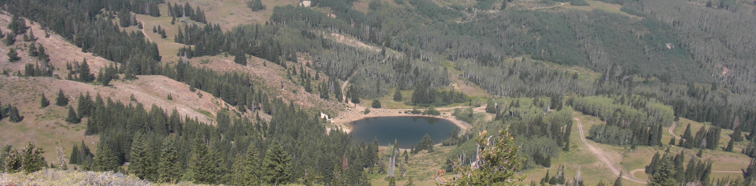
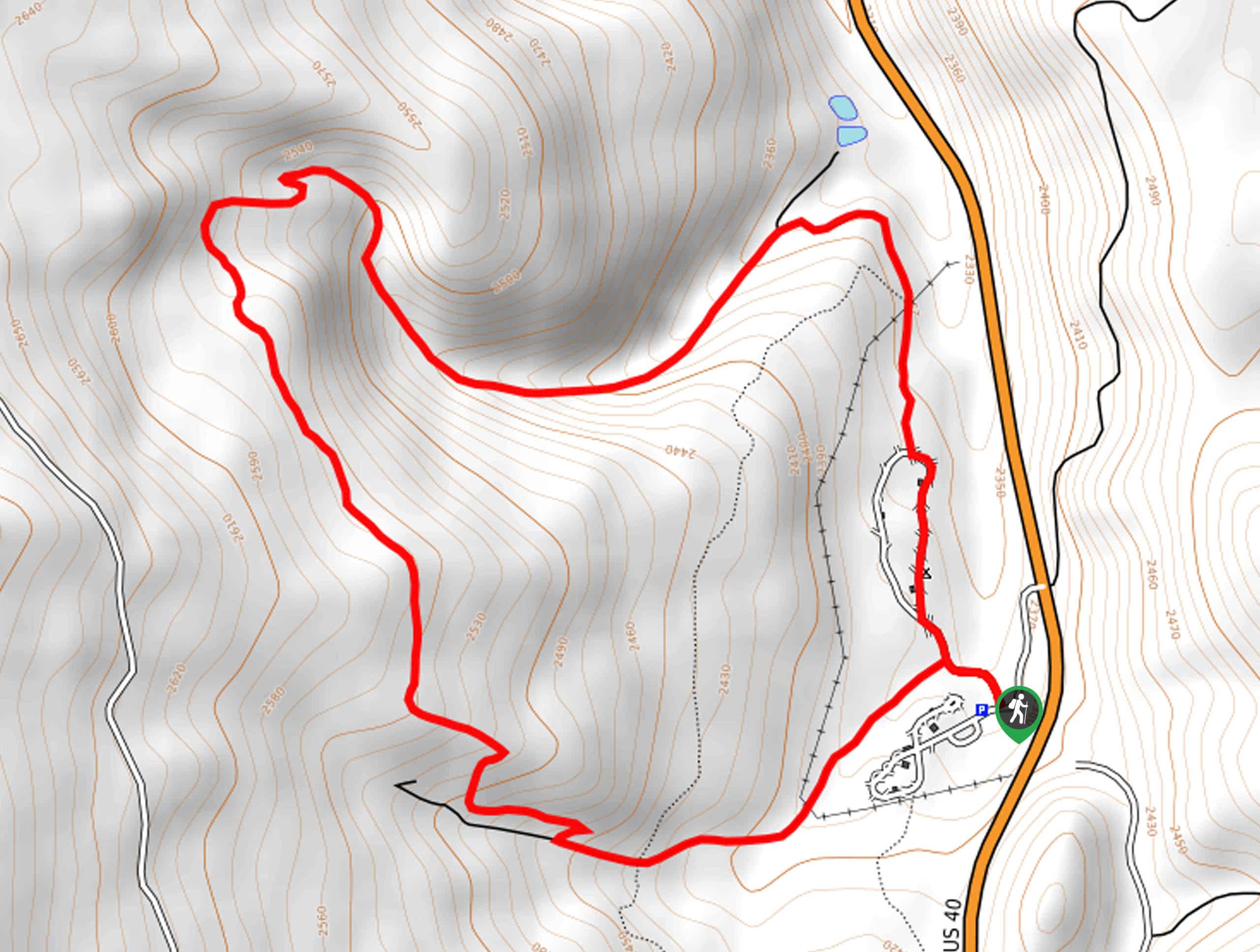
Lofty Lakes Loop Hike: This fantastic hike is a classic hike in the Uinta Mountains, offering stunning scenery along the way! The trail climbs steadily to Scout Lake, a popular fishing spot, before continuing up to a view of Lofty Lake from a beautiful mountain pass. This is the best vista of the lake, with the Spectacular Mount Marsell in the background. The Lofty Lakes Loop hike is ideal for a hot day, when you can cool off by taking a dip in one of the lakes along the way!
Haystack Lake Hike: Looking for a little peace and quiet in the Uinta Mountains? Follow this trail out to Haystack Lake, leaving the crowds behind at the Washington Lake Area. You’ll pass three pristine, beautiful lakes, enjoying a moment of peace and solitude before turning back the way you came. This is one of the best easy hikes in the Uinta Mountains.
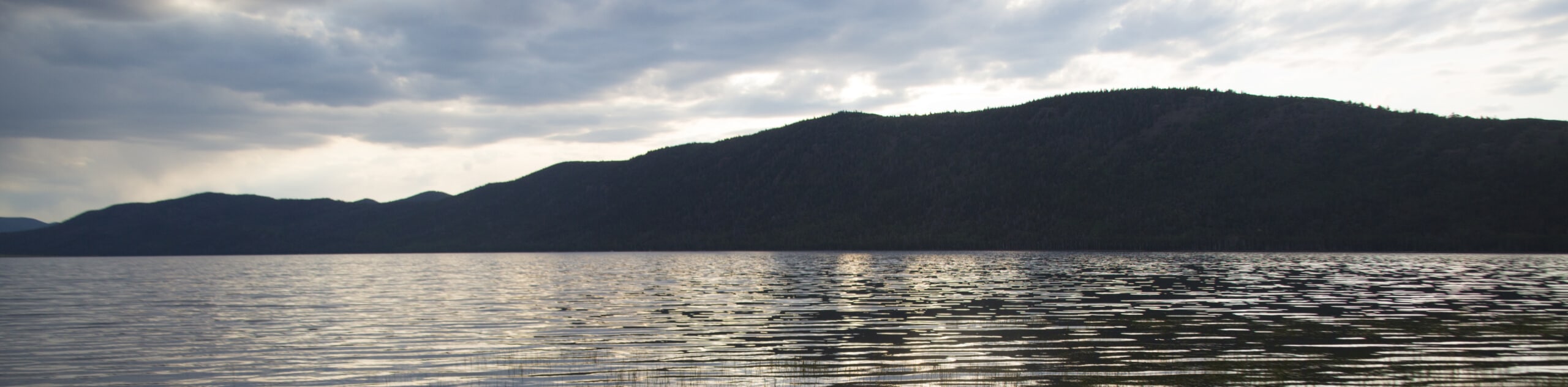
Notch Lake Hike: This wonderful hike is also a popular backpacking trip, deep in the heart of the High Uinta lake country. The trail descends gently through the valley along a rocky path, passing by Clegg Lake and Dean Lake. However, the best views are saved until the end, with a spectacular vista over the expansive Notch Lake. If you’re looking for a fun family backpacking trip, don’t miss this fantastic hiking trail in the Uinta Mountains.
When Is The Best Time To Hike In The Uinta Mountains?
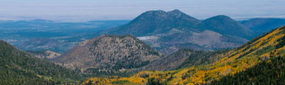
The best time to hike in the Uinta Mountains is between April and May and September and October, in the ‘shoulder season’ when the crowds are smaller and the weather is still fine. In particular, spring is an excellent time to go wildlife watching or to see the early blooming flowers. In autumn, the fall foliage bursts into life like a golden flame, setting the forests on fire in a blaze of color. June, July and August offer sunny weather, but the temperatures can be very warm, making long hikes uncomfortable. The winter months can be cold and snowy, but January and February offer wonderful possibilities for cross-country skiing.
Other Outdoor Activities In The Uinta Mountains
The Uintas, like many other parts of Utah, are perfect for outdoor enthusiasts. Once you’ve had your fill of the hiking trails, you’ll find plenty of other outdoor activities in the Uinta Mountains! Camp out under the stars and admire the remarkable Utah night sky, and extend some of these trails into a fun backpacking trip for the whole family. Alternatively, you might want to try your hand at rock climbing, take a dip in the hot springs, hunt for rocks and fossils along the trail, go fishing, or enjoy some wildlife watching. There’s no end to possible outdoor activities in the Uinta Mountains.
How To Plan A Trip To The Uinta Mountains
Want to plan an epic hiking trip in the Uintas, but not sure where to start? Don’t worry – here at 10Adventures we’ve put together all the information you’ll need to enjoy the perfect hiking adventure. Check out our guide to how to plan a trip to the Uinta Mountains for trail recommendations and lots of practical tips to make sure you enjoy every aspect of your trip. The Uinta Mountains are one of Utah’s finest underrated gems, so head here to avoid the crowds and enjoy this natural wilderness in complete peace and serenity!
Frequently-Asked-Questions About The Uinta Mountains
What does Uinta mean?
The name for the Uinta Mountains is derived from the Ute word ‘Yoov-we-teuh’, which means ‘pine tree’. The region was named for its dense and fragrant pine forests, which cover the sides of the mountains across the region.
How many lakes are in the Uinta Mountains?
When most people think of Utah, they imagine a dry, arid, desert landscape with very little water. However, the Uinta Mountains are particularly known for their beautiful lakes. There are over 1000 natural lakes in the Uintas, and 400 miles of streams.
What animals live in the Uinta Mountains?
The Uinta Mountains are an important habitat for many different species of animals and birds. Amongst others, you may catch a glimpse of elk, moose, mule deer, mountain goats, bighorn sheep, black bears, river otters and cougars whilst out on your hike.
The best hikes in Uinta Mountains
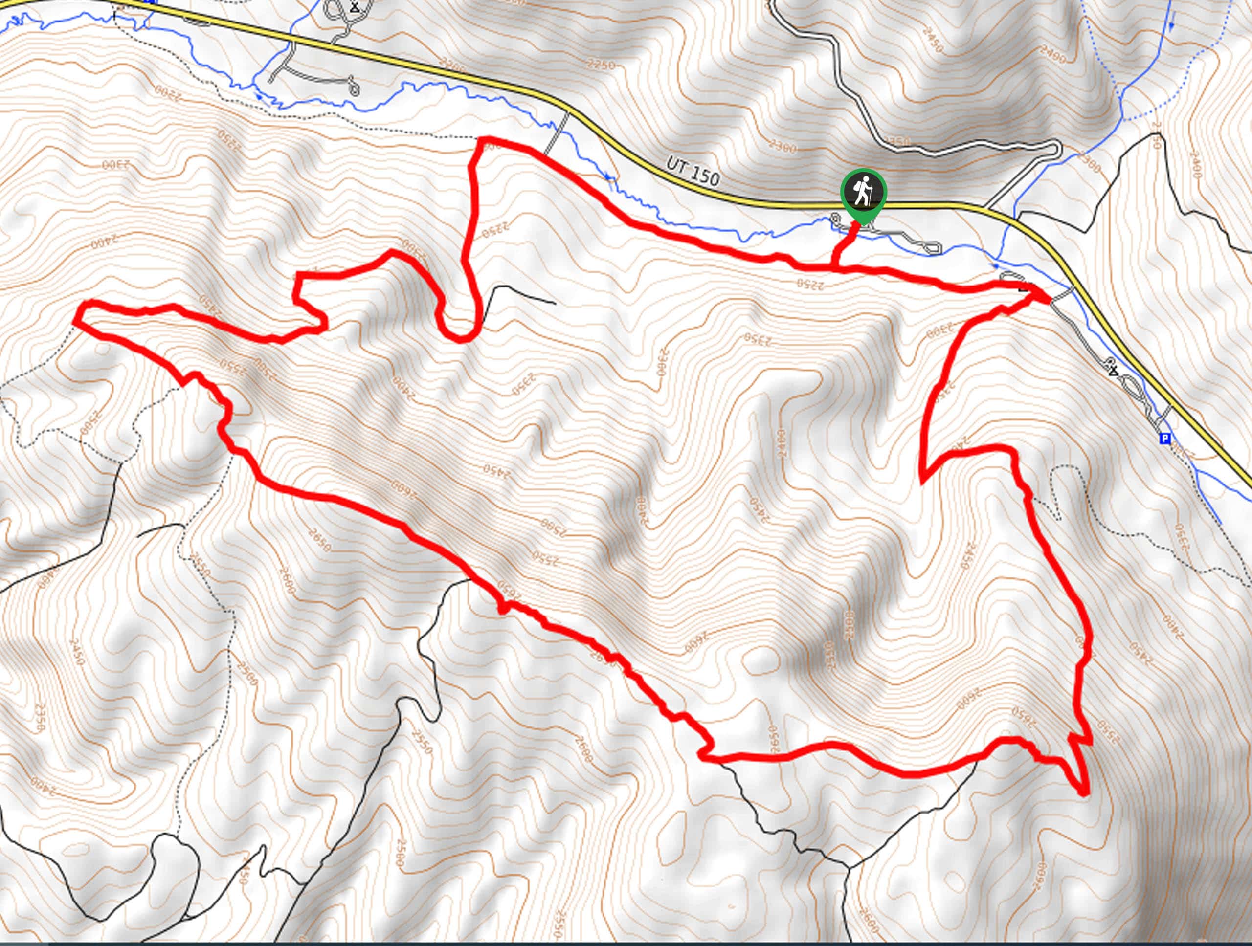
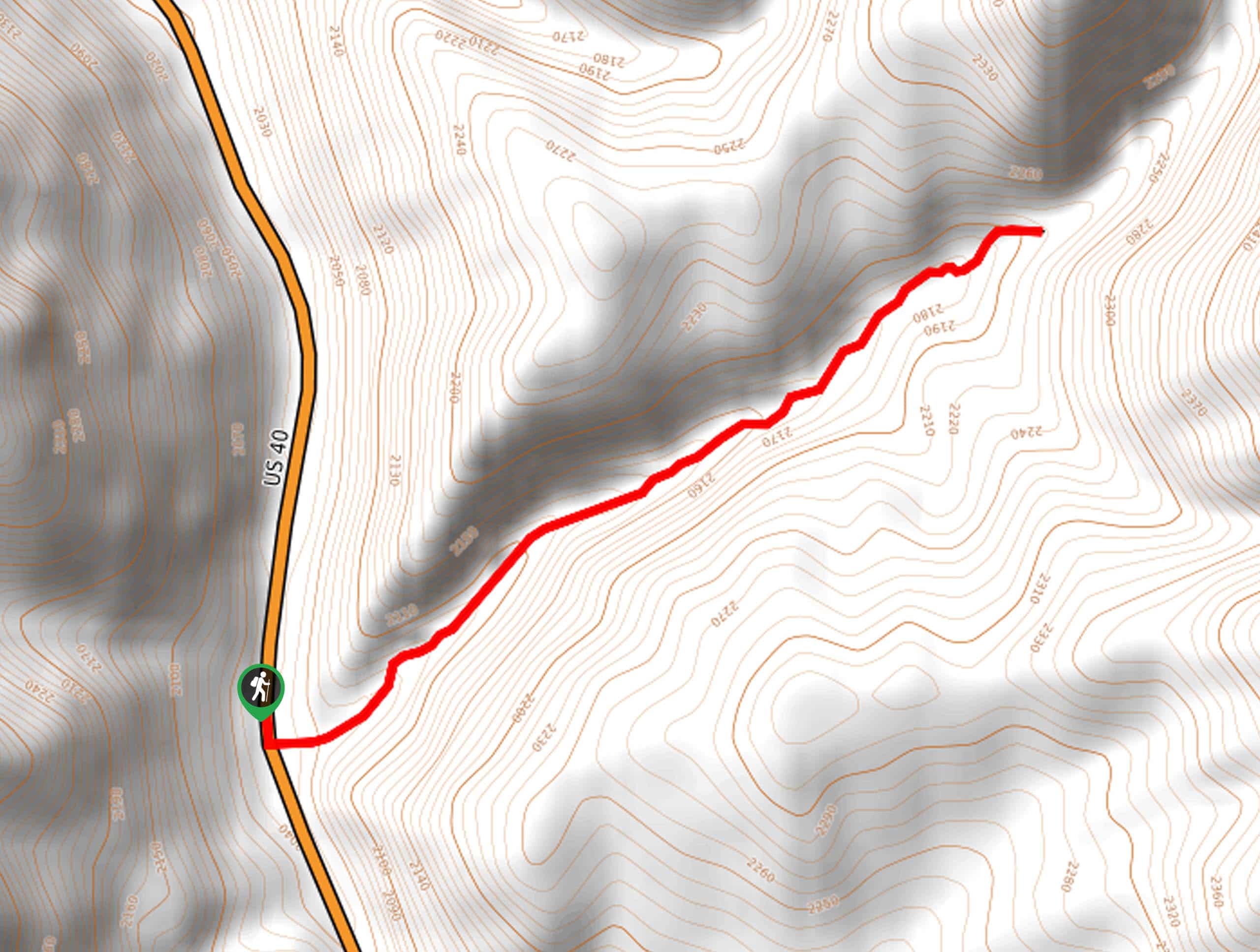
01. Ibantik Lake
Difficulty
This hike, in the heart of one of the most picturesque valleys of the High… Read More
02. Clyde Lake
Difficulty
This easier hike captures much of the incredible beauty of The Uintas’ Lakes. Following an… Read More
03. Lofty Lakes Loop
Difficulty
A classic loop hike in the High Uintas, the Lofty Lakes Loops passes by several… Read More
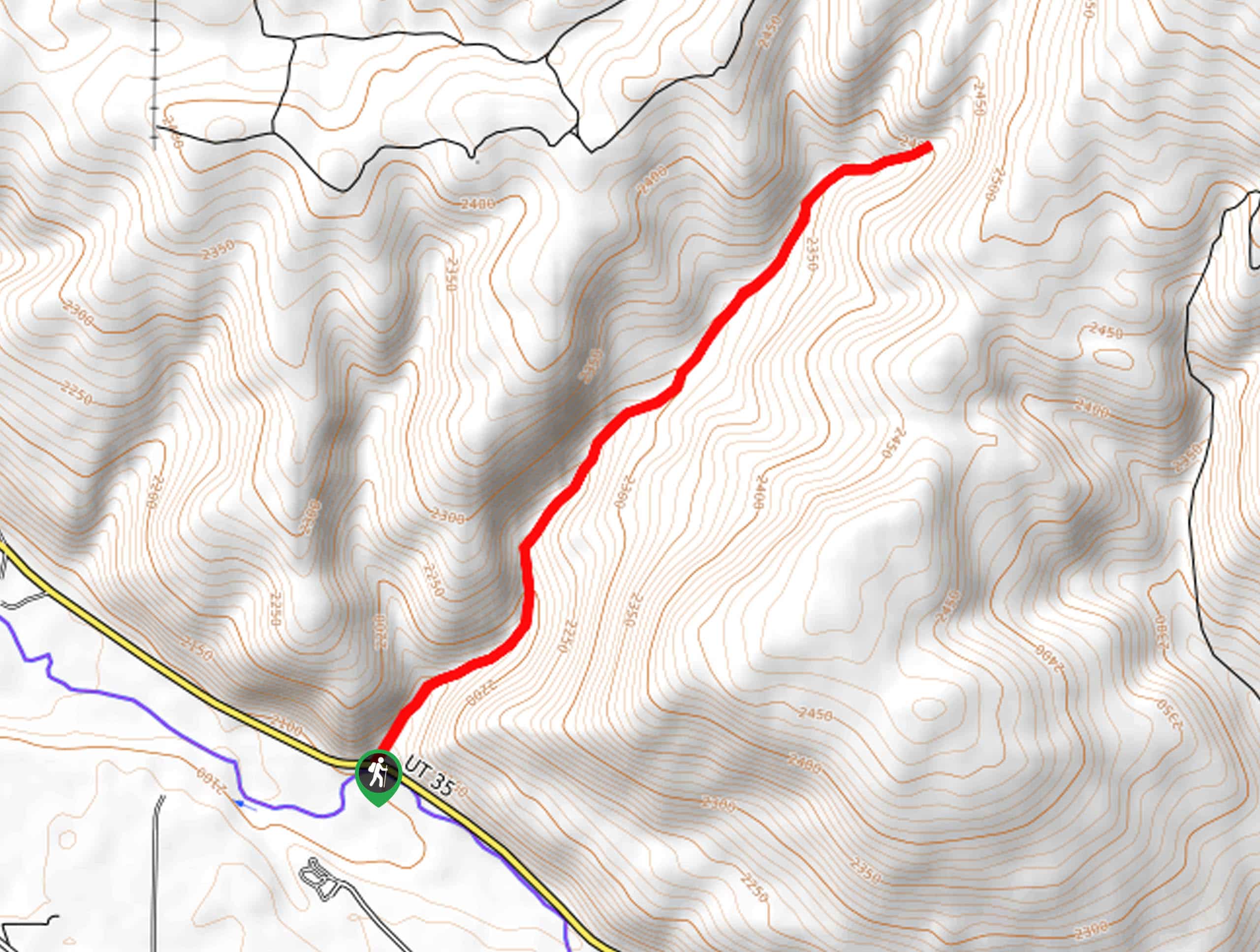
04. Bald Mountain Trail
Difficulty
Though short, this extremely steep hike is quite a grueling climb. One of the classic… Read More
05. Mirror Lake Hike
Difficulty
A great, easy hike to do if you are enjoying the beach or the water… Read More
06. Naturalist Basin
Difficulty
Following the famous 104.0mi Highline Trail, the hike out to Naturalist Basin is… Read More
07. Haystack Lake
Difficulty
The quiet yet beautiful hike out to Haystack Lake quickly leaves the crowds of the… Read More
08. Notch Lake
Difficulty
A popular backpacking trail, the hike out to Notch lake takes hikers into the heart… Read More
09. Fehr Lake
Difficulty
This little-known trail out to Fehr Lake is a good way to avoid the crowds… Read More
10. Wilder and Packard Lake
Difficulty
Beginning along the impressive 104.0mi Read More
Yes, there are more than 10
Uinta Mountains is so beautiful that we can not give you only 10 hikes. So here is a list of bonus hikes in Uinta Mountains that you should take a look at as well
11. Island Lake Trail
Difficulty
The Island Lake Trail is a gorgeous hike in the Western Uintas. This trail travels… Read More
12. Lily Lake Trail
Difficulty
The Lily Lake Trail is a gorgeous route in the Western Uintas. This trail is… Read More
13. Shingle Creek Trail
Difficulty
The Shingle Creek Trail is a gorgeous route in the Western Uintas. This trail is… Read More
14. Fairy Forest
Difficulty
The Fairy Forest Trail is a family-friendly hike in the Western Uintas. This trail loops… Read More
15. Wall Lake Trail
Difficulty
The Wall Lake Trail is a beautiful hike in the Western Uinta Mountains. This trail… Read More
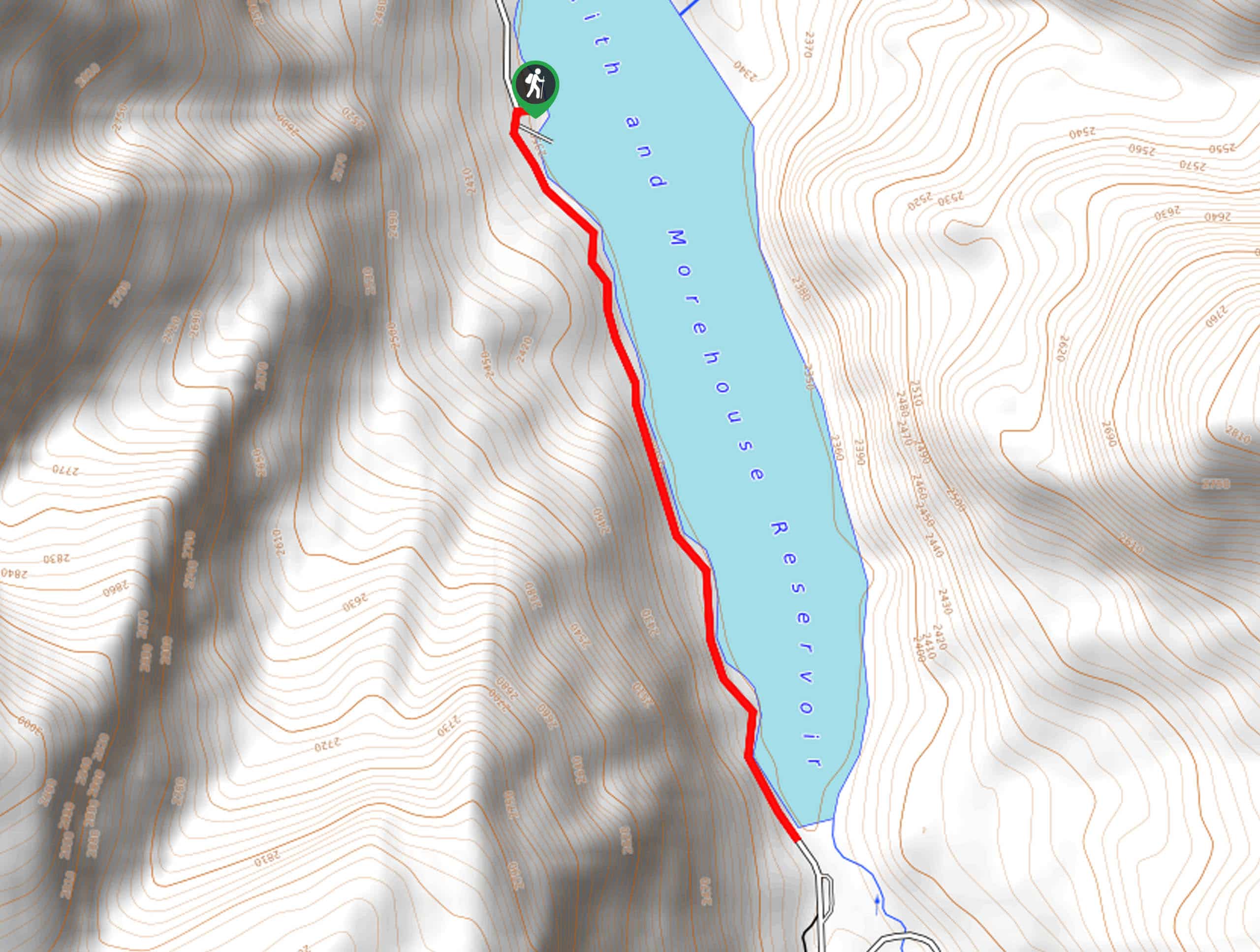
16. The Smith and Morehouse Reservoir Trail
Difficulty
The Smith and Morehouse Reservoir Trail is a short hike along a makeshift path on… Read More
17. Smith and Morehouse Trail
Difficulty
The Smith and Morehouse Trail is a gorgeous hike in the Western Uintas. This trail… Read More
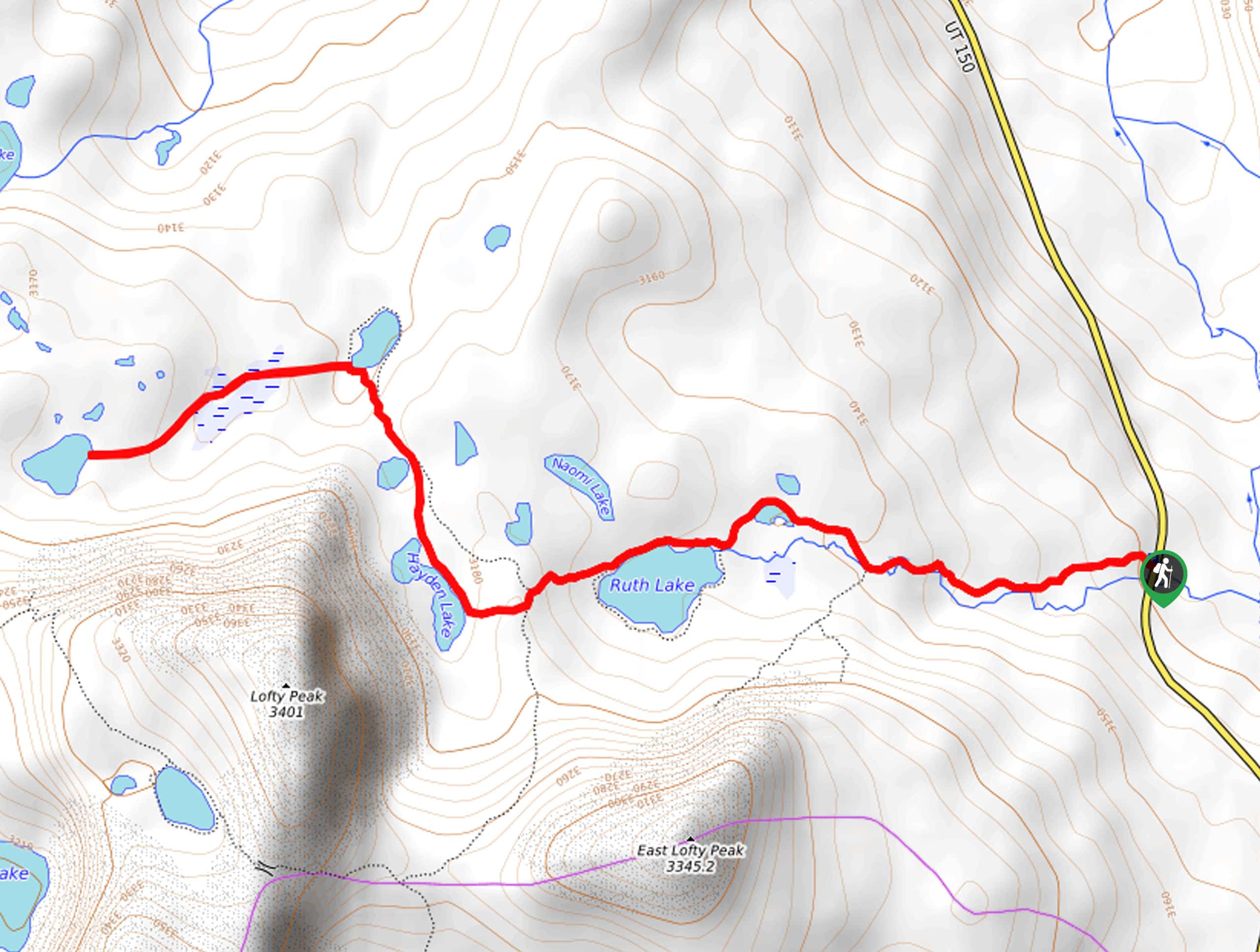
18. Ruth Lake Trail
Difficulty
The Ruth Lake Trail is a short hike in the Western Uinta Mountains, east of… Read More
19. Big Elk Lake Trail
Difficulty
The Big Elk Lake Trail is an adventurous hike in the Western Uintas. Access to… Read More
20. Jewel Lake via the Ruth Lake Trail
Difficulty
The hike to Jewel Lake via Ruth Lake is an incredibly beautiful hike in the… Read More
21. The Ruth Lake, Lofty Lake, and Scout Lake Trail
Difficulty
The Ruth Lake, Lofty Lake, and Scout Lake Trail is a fantastic hike east of… Read More
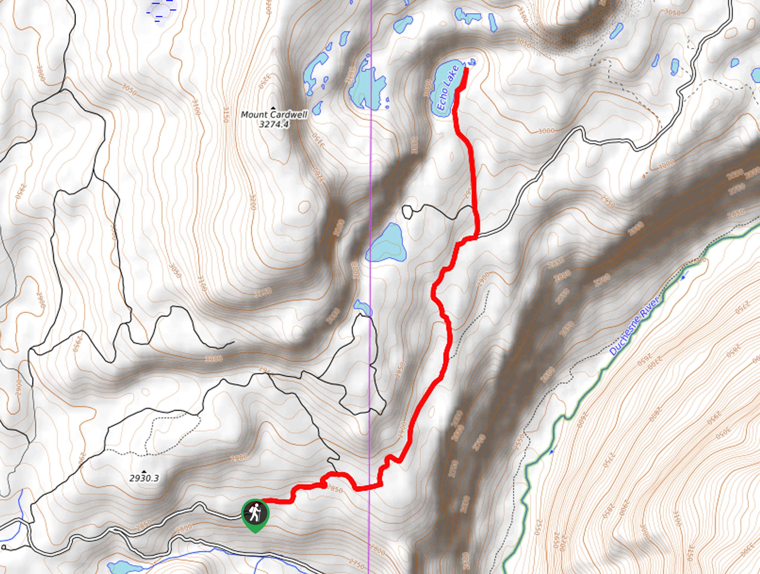
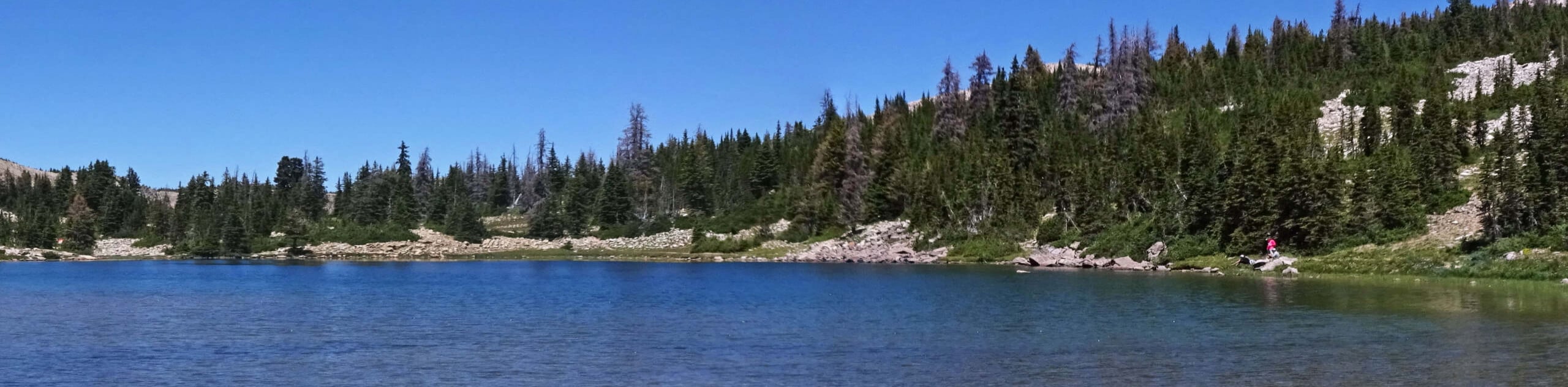
22. Joan Lake, Gem Lake, and Echo Lake Trail
Difficulty
The Joan Lake, Gem Lake, and Echo Lake Trail is a beautiful trail in the… Read More
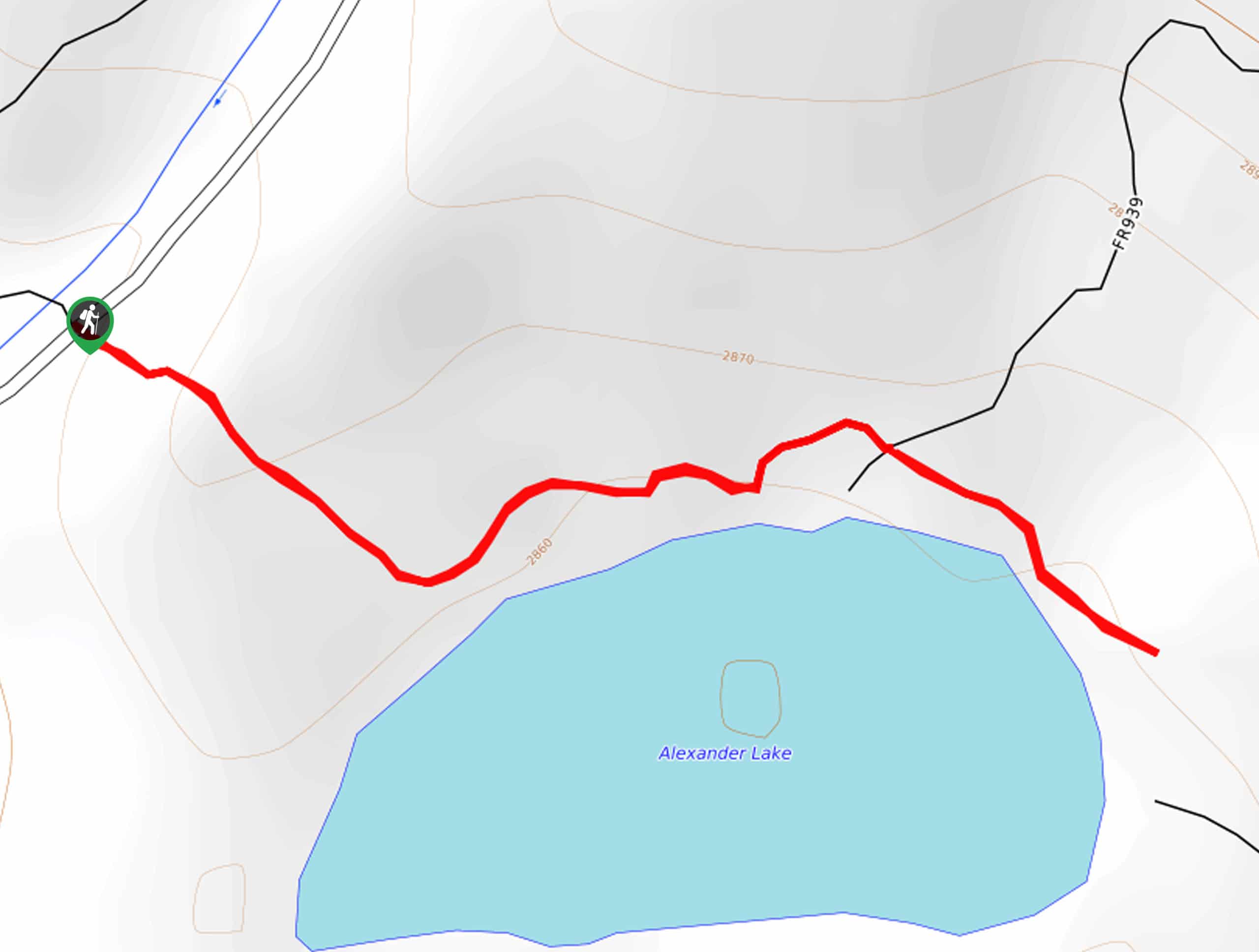
23. Alexander Lake Trail
Difficulty
The Alexander Lake Trail is a short and sweet hike to access Alexander Lake in… Read More
24. Fire Lake via the Crystal Lake Trailhead
Difficulty
The hike to Fire Lake via the Crystal Lake Trailhead is a fantastic hike east… Read More
25. Center Canyon Trail
Difficulty
The Center Canyon Trail is a gorgeous hike in the Western Uintas. This trail is… Read More
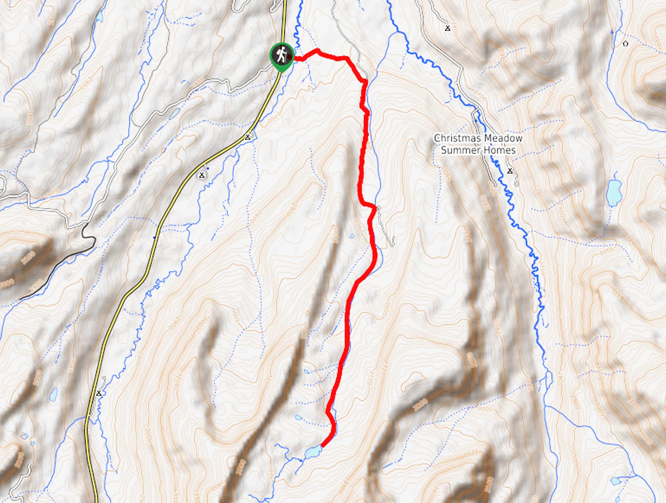
26. Christmas Meadows to Ostler Lake
Difficulty
The Christmas Meadows to Ostler Lake Trail is a gorgeous hike in the High Uintas.… Read More
27. Cliff Lake via Clyde Lake Trail
Difficulty
The hike to Cliff Lake via the Clyde Lake Trail is a gorgeous route in… Read More
28. Teal Lake via the Ruth Lake Trail
Difficulty
The Teal Lake via Ruth Lake Trail is a gorgeous hike in the Uinta-Wasatch-Cache National… Read More
29. Trial Lake Trail
Difficulty
The Trial Lake Trail is a gorgeous hiking route in the Western Uinta Mountains. This… Read More
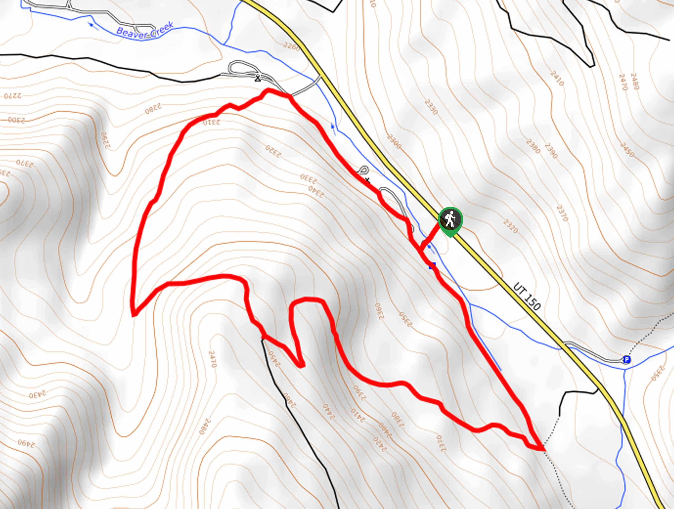
30. Beaver Creek Trail
Difficulty
The Beaver Creek Trail is a gorgeous route east of Park City, Utah. This trail… Read More
31. Amethyst Lake Trail
Difficulty
The Amethyst Lake Trail is a fantastic route in the high Uinta Mountains. This trail… Read More
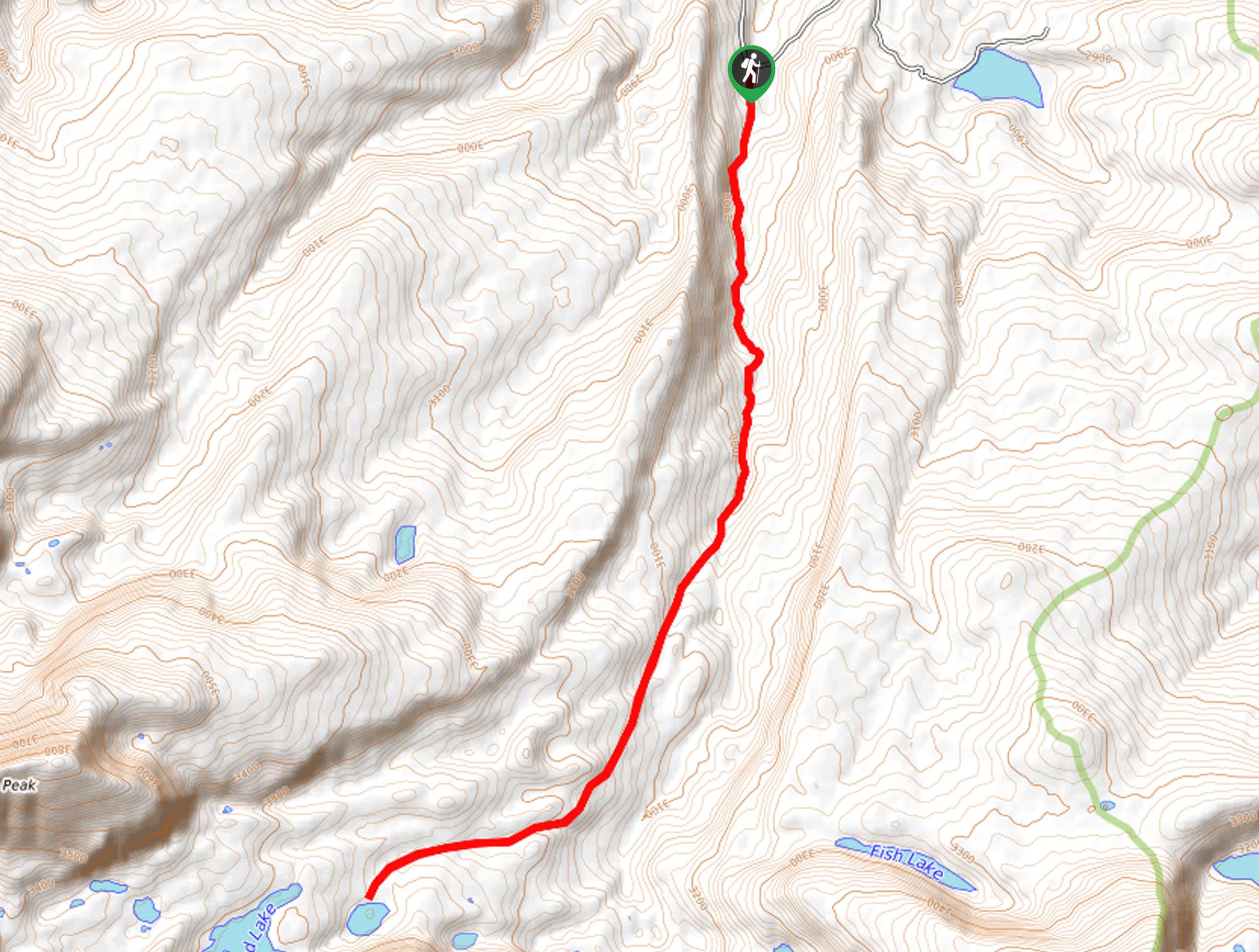
32. Fish Lake via Spirit Lake
Difficulty
The Fish Lake via Spirit Lake Trail is a fantastic hike in the eastern Uintas.… Read More
33. Daggett Lake via Spirit Lake
Difficulty
The Daggett Lake via Spirit Lake Trail is a beautiful trail in the eastern Uintas.… Read More
34. Kabell Lake Trail
Difficulty
The Kabell Lake Trail is an adventurous hike in the Eastern Uintas. This trail is… Read More
35. Notch Mountain via Trial Lake
Difficulty
The Notch Mountain Trail via Trial Lake is a gorgeous hike in the western Uintas.… Read More
36. Duck Lake Trail
Difficulty
The Duck Lake Trail is a gorgeous hike in the western Uinta Mountain Range. This… Read More
37. Ruth Lake, Jewel Lake, Cutthroat Lake, and Teal Lake Trail
Difficulty
The Ruth Lake, Jewel Lake, Cutthroat Lake, and Teal Lake Trail is a gorgeous hiking… Read More
38. Clegg Lake and Notch Lake Trail
Difficulty
The Clegg Lake and Notch Lake Trail is a beautiful hike in the western Uintas.… Read More
39. Kamas Lake via the Lofty Lake Trail
Difficulty
The hike to Kamas Lake via the Lofty Lake Trail is a gorgeous trail in… Read More
40. Mount Agassiz Loop
Difficulty
The Mount Agassiz Loop is a challenging hike in the western Uintas. This route is… Read More
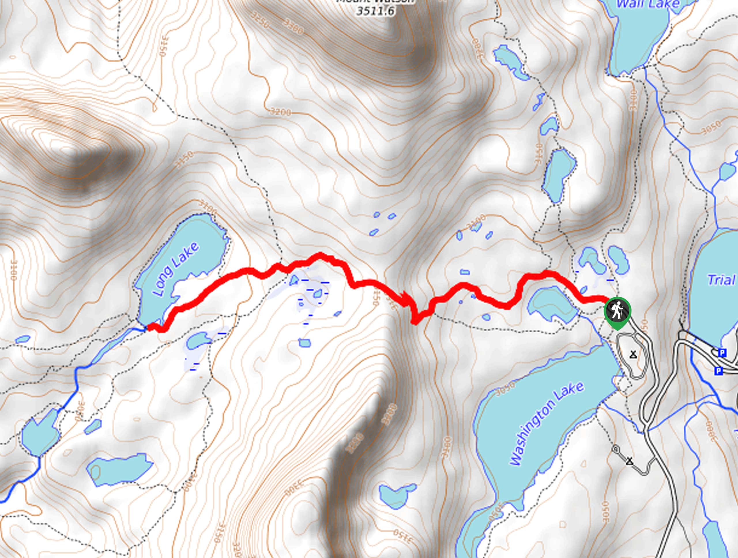
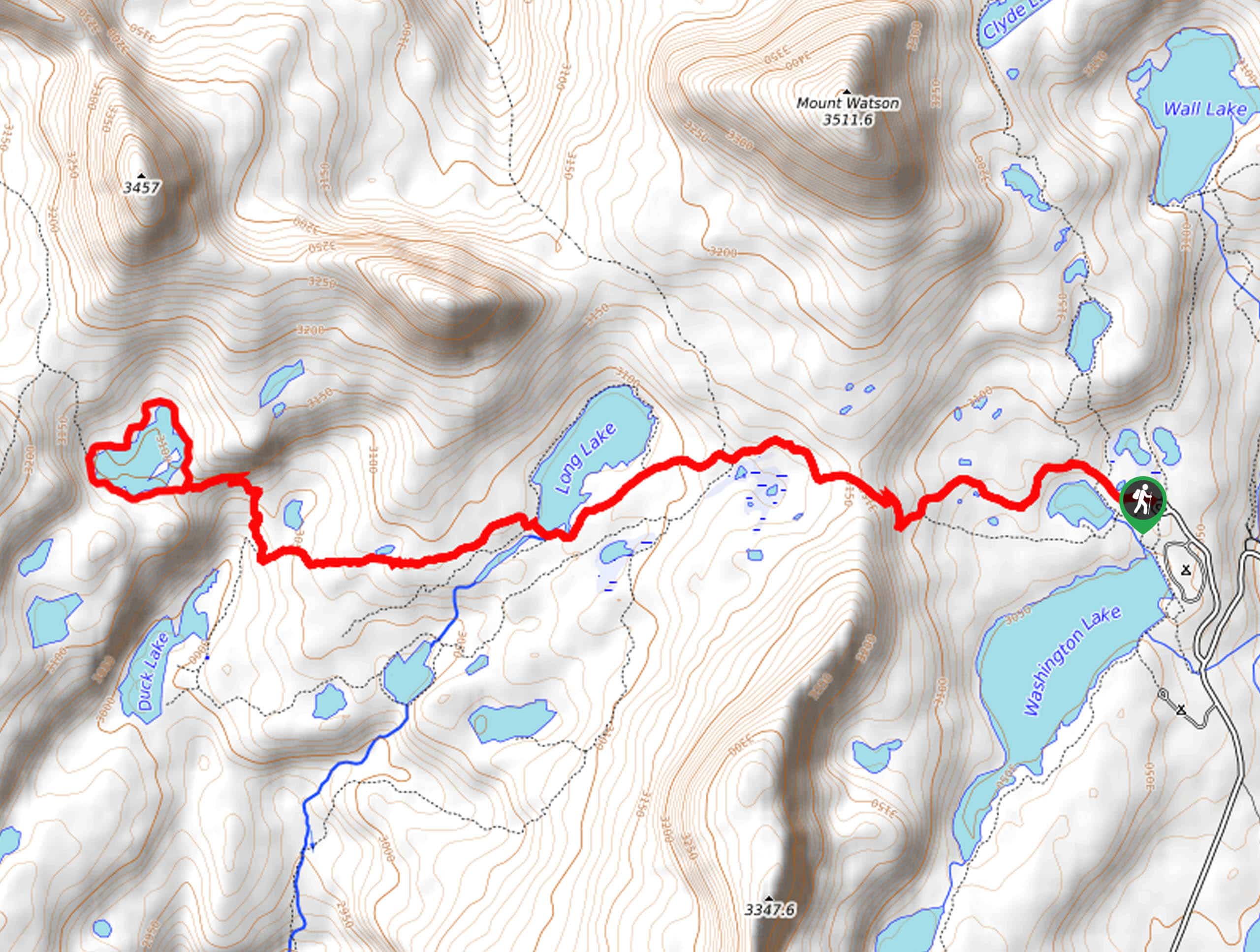
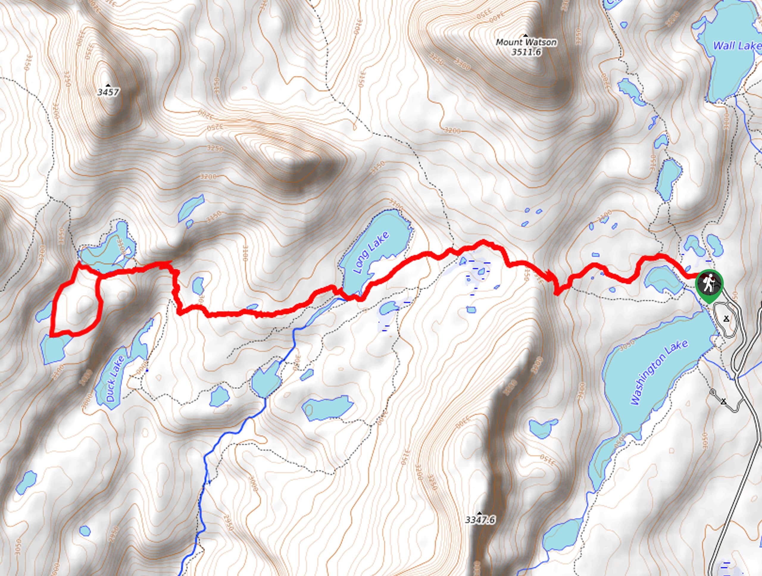
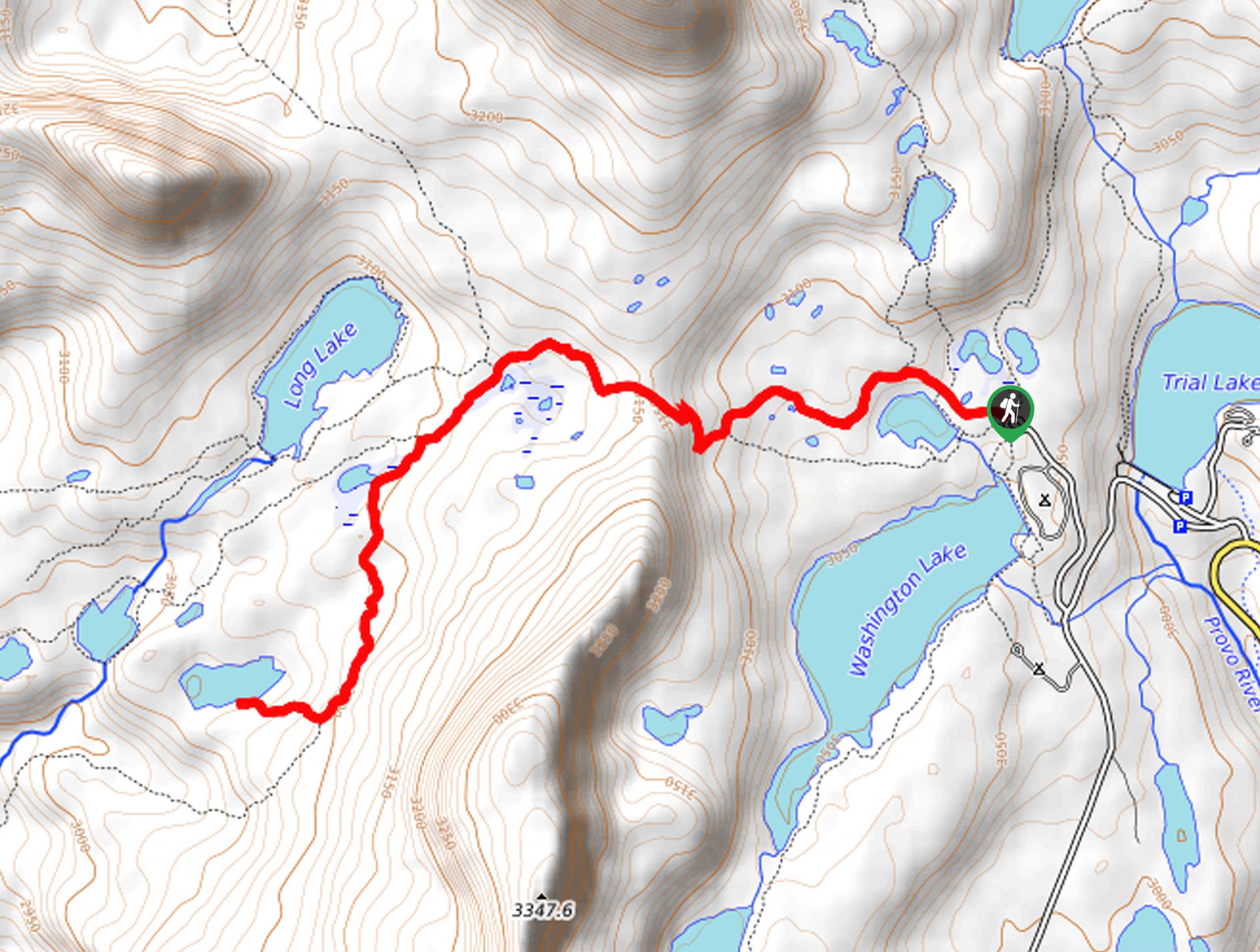
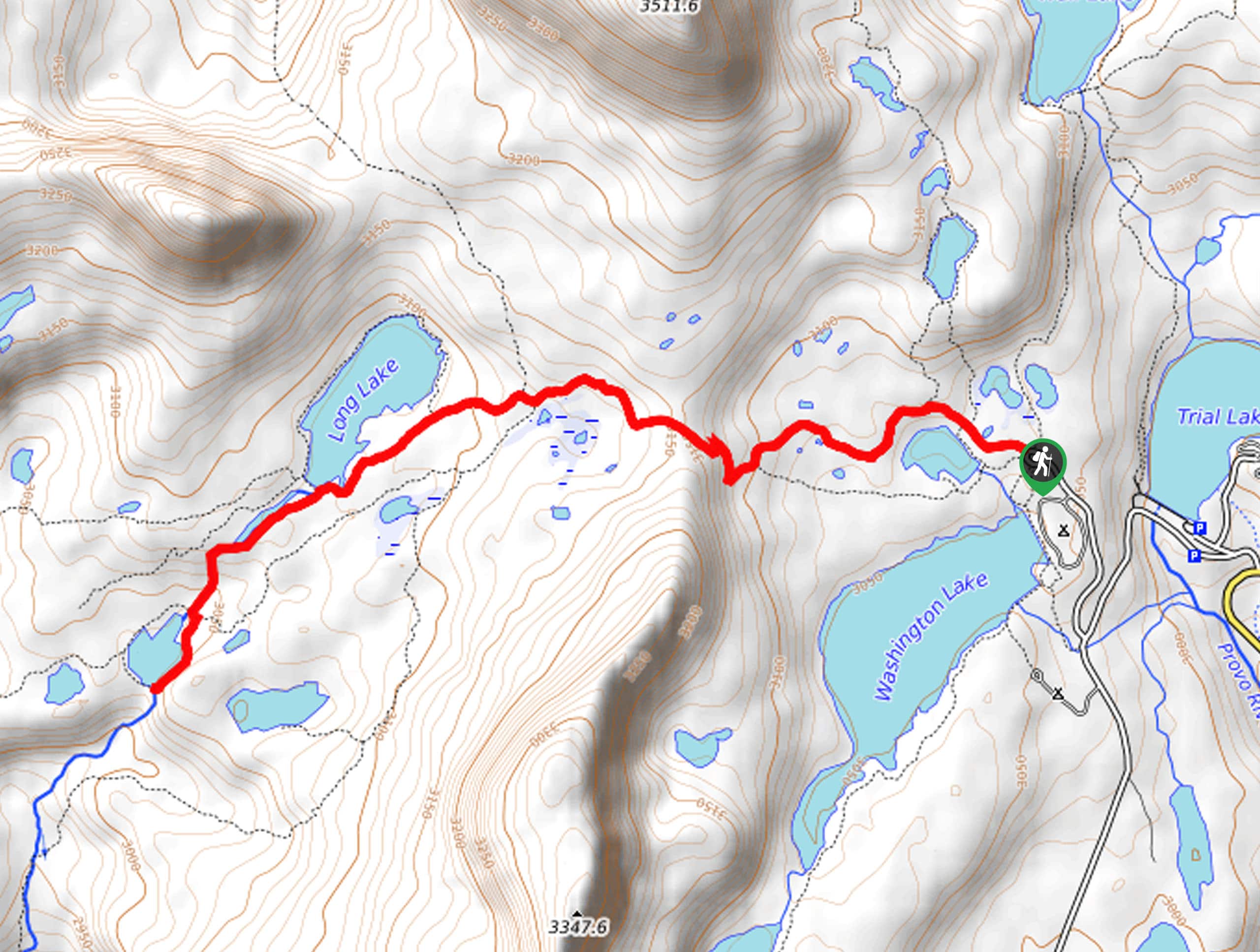
41. Long Lake Trail
Difficulty
The Long Lake Trail is a gorgeous hike in the western Uinta Mountains. This hike… Read More
42. Three Divide Lakes Loop
Difficulty
The Three Divide Lakes Loop is a fantastic trail in the Western Uintas. This hike… Read More
43. Whiskey Island Lake Trail
Difficulty
The Whiskey Island Lake Trail is a beautiful hike in the western Uintas. This hike… Read More
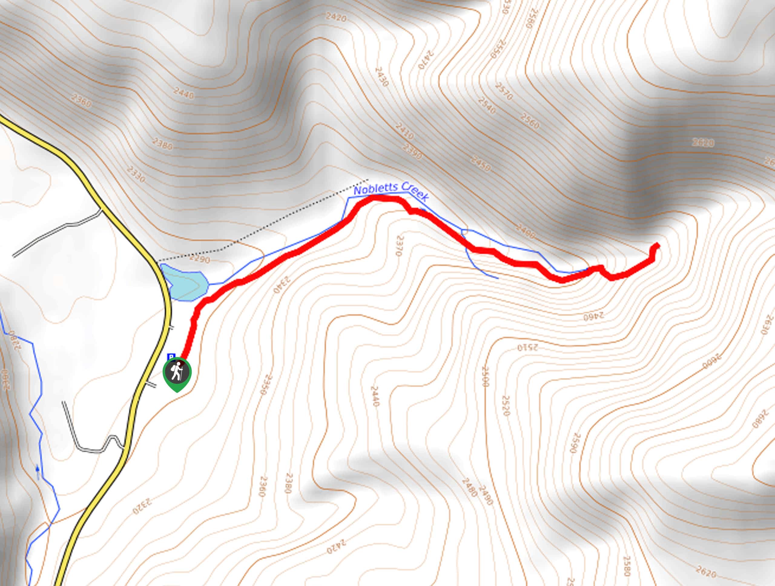
44. Nobletts Creek Trail
Difficulty
The Nobletts Creek Trail is a lovely hike in the western Uintas. This trail is… Read More
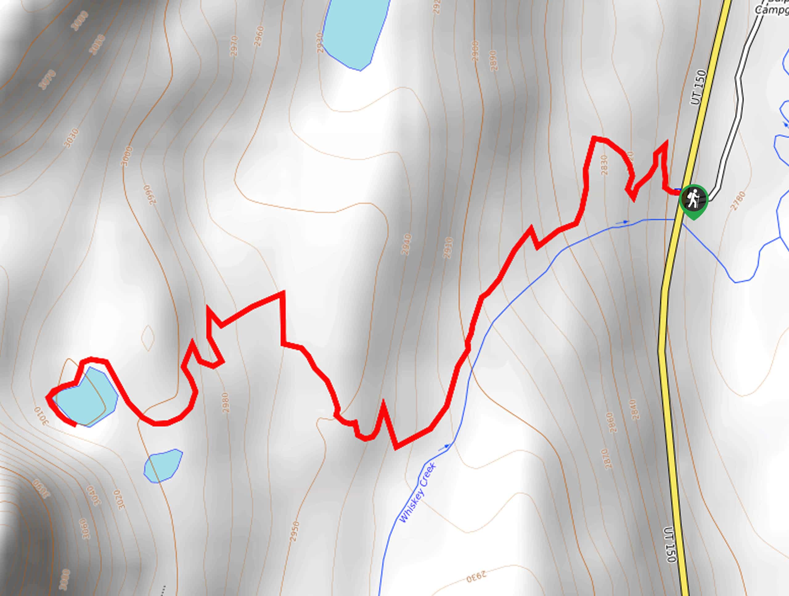
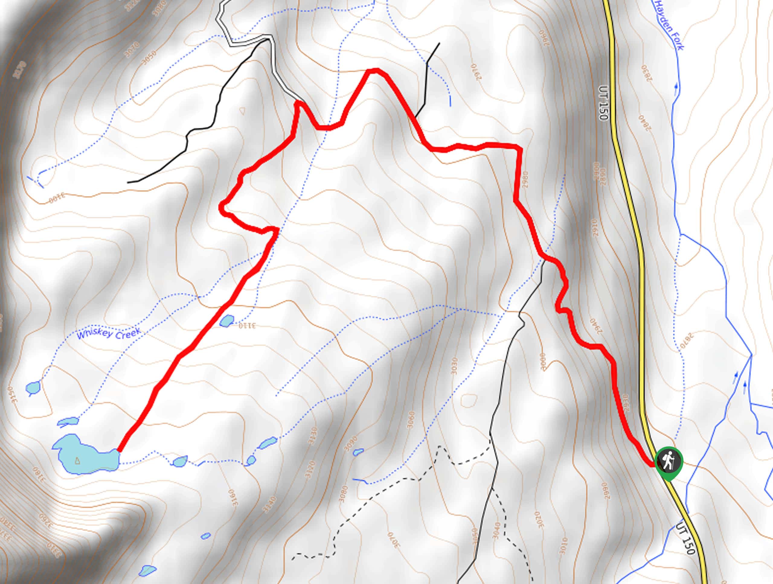
45. Whiskey Creek Trail to Bourbon Lake
Difficulty
Whiskey Creek Trail to Bourbon Lake is a gorgeous hike in the Western Uintas. Despite… Read More
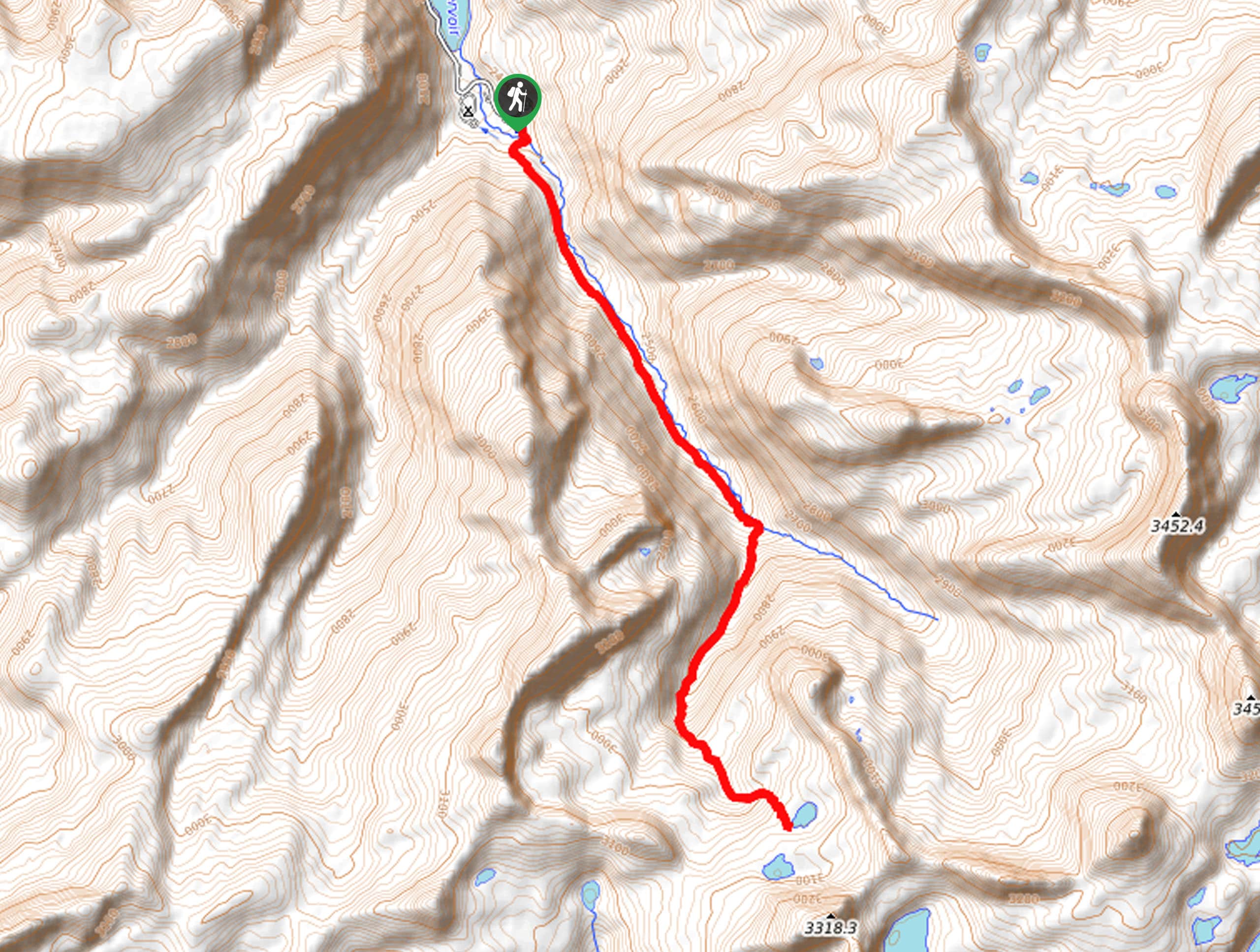
46. Castle Lake Trail
Difficulty
The Castle Lake Trail is a challenging route in the Western Uintas. This hike can… Read More
47. North Erickson Lake Trail
Difficulty
The North Erickson Lake Trail is a gorgeous route in the western Uintas. This trail… Read More
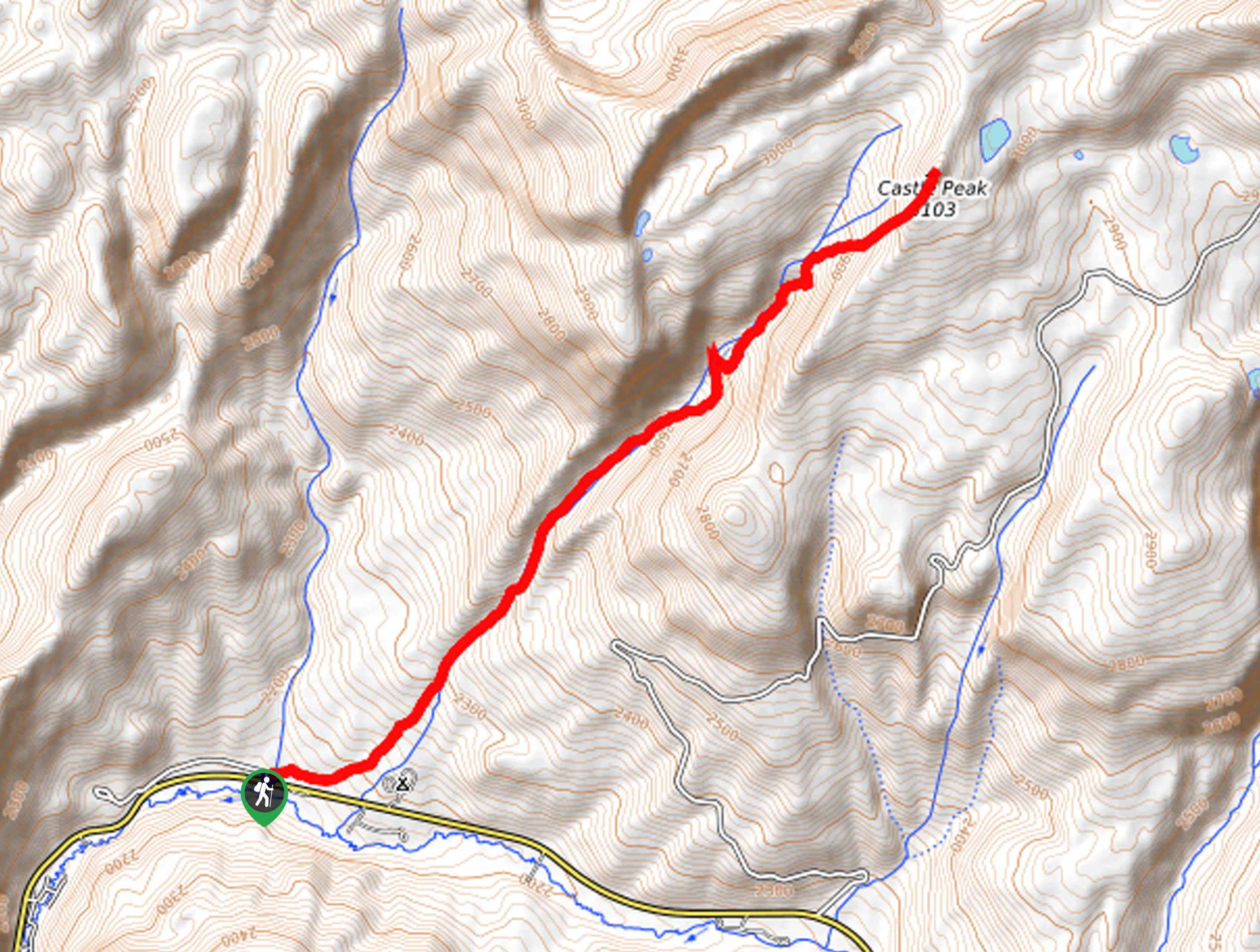
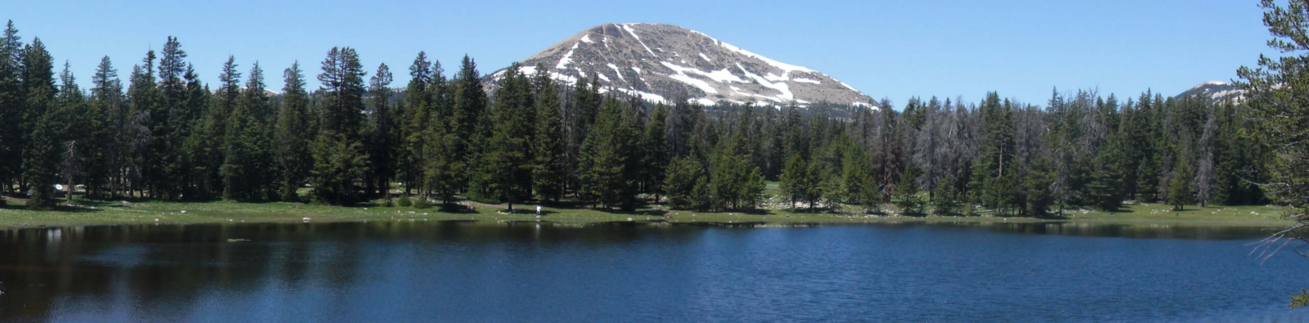
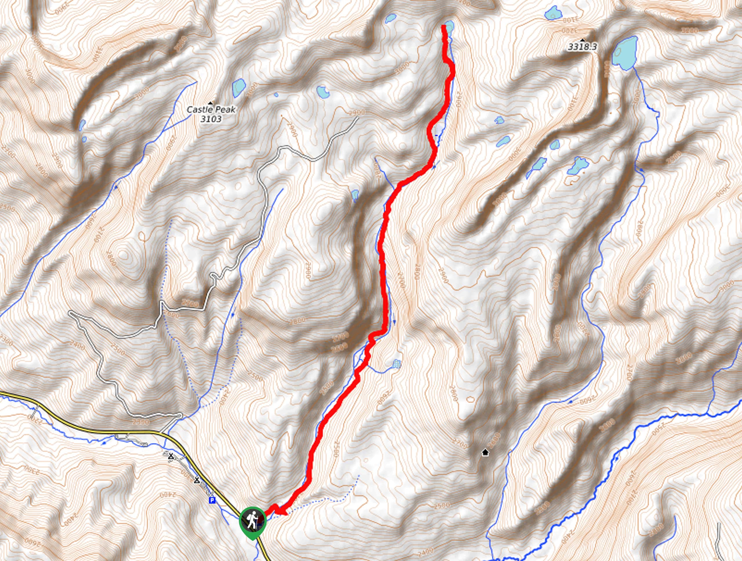
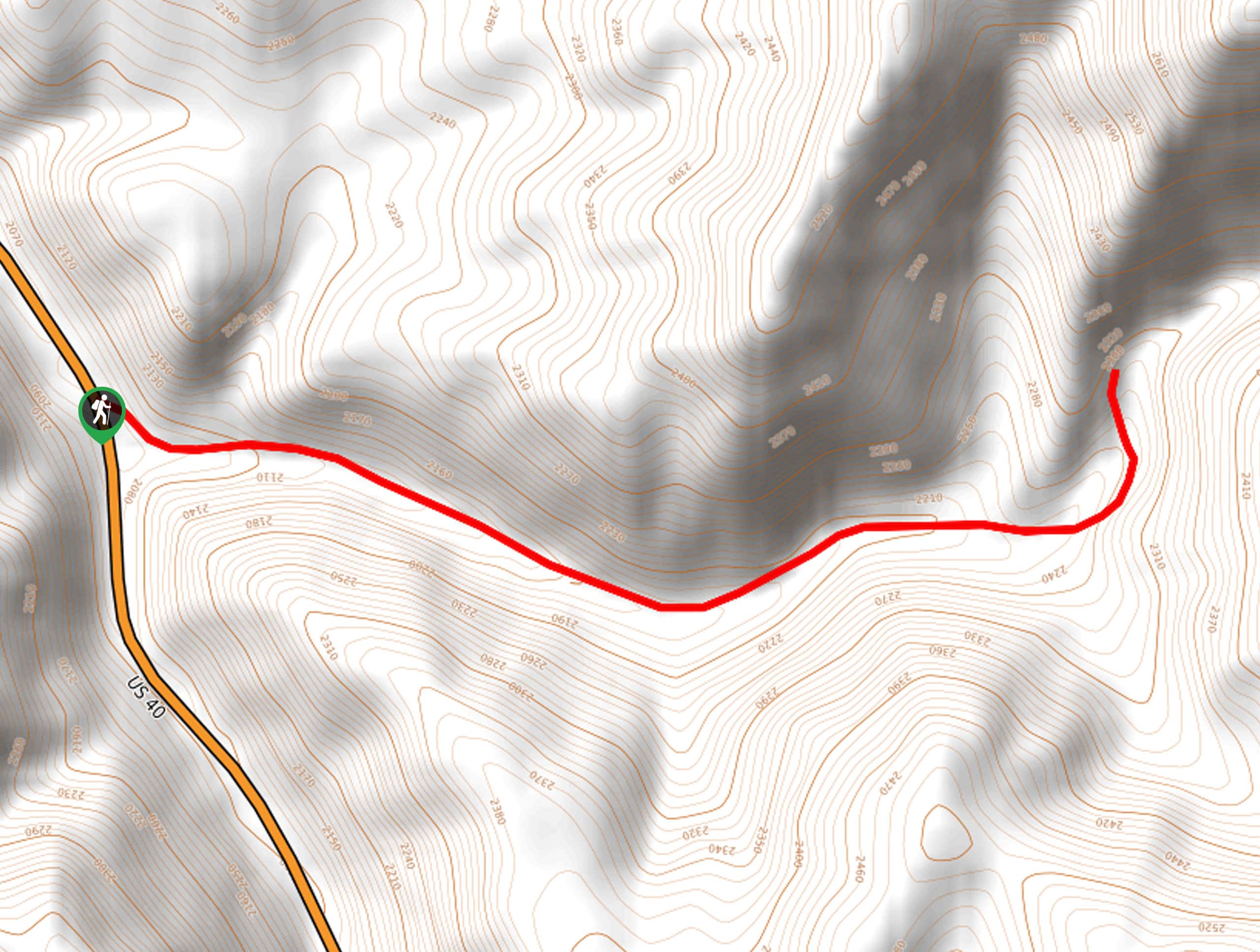
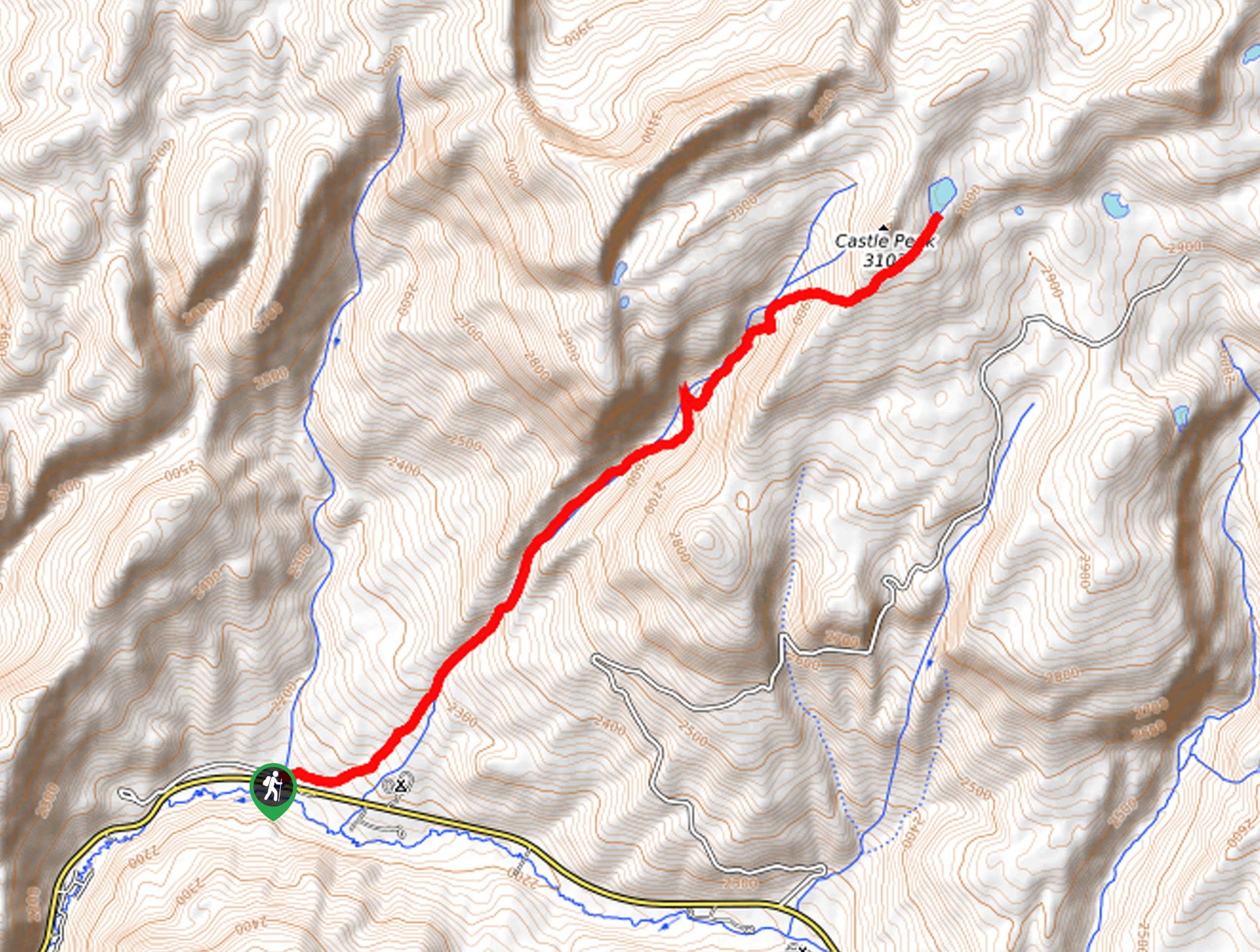
48. Castle Peak Trail
Difficulty
The Castle Peak Trail is a fantastic hike in the western Uintas. This trail is… Read More
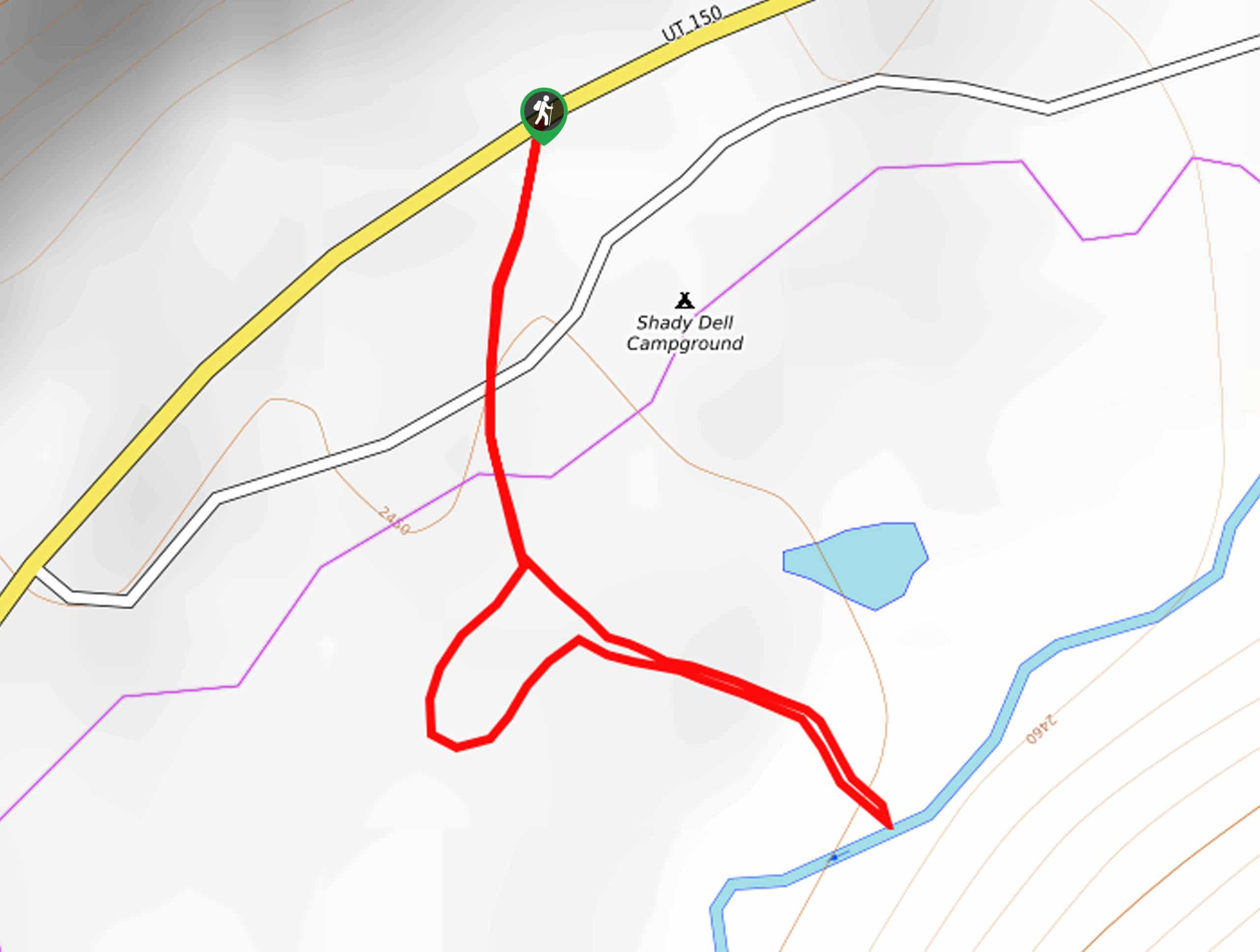
49. Butterfly Lake to Castle Lake Trail
Difficulty
The Butterfly Lake to Castle Lake Trail is a short and sweet hike east of… Read More
50. Marjorie Lake Trail
Difficulty
The Marjorie Lake Trail is a gorgeous hike in the western Uintas. This trail is… Read More
51. The 20 Lakes Trail
Difficulty
The 20 Lakes Trail is a gorgeous route in the western Uintas. This trail is… Read More
52. The Upper Setting Trail to Big Elk Lake and Island Lake
Difficulty
The Upper Setting Lake Trail to Big Elk Lake and Island Lake is a fantastic… Read More
53. Shadow Lake via the Crystal Lake Trailhead
Difficulty
The hike to Shadow Lake via the Crystal Lake Trailhead is an easy hike in… Read More
54. Lillian Lake via The Lakes Country Trail
Difficulty
Lillian Lake via the Lakes Country Trail is a wonderful hike in the Uinta Lake… Read More
55. Weir Lake Trail
Difficulty
The Weir Lake Trail is a beautiful hike in the Western Uintas. This route can… Read More
56. Crystal Lake and Watson Lake Trail
Difficulty
The Crystal Lake and Watson Lake Trail is a gorgeous hike in the western Uintas.… Read More
57. Murdock Mountain Trail
Difficulty
The Murdock Mountain Trail is a short and sweet summit hike. This trail is technical… Read More
58. Main Fork Bear River Trail to Hell Hole Lake
Difficulty
Despite the name, the Main Fork Bear River Trail to Hell Hole Lake is a… Read More
59. Slate Creek Loop
Difficulty
The Slate Creek Loop is a stellar hike just east of Kamas, Utah. This trail… Read More
60. The Dry Canyon Trail
Difficulty
The Dry Canyon Trail is a fantastic hike just northeast of Logan Utah. This trail… Read More
61. Jean Lake and Hell’s Kitchen
Difficulty
The Jean Lake and Hell’s Kitchen Trail is a moderately challenging route in the western… Read More
62. Blythe Lake Trail
Difficulty
The Blythe Lake Trail is a very pretty hike in the western Uintas. This short… Read More
63. Duchesne Ridge to Heart Lake
Difficulty
Duchesne Ridge to Heart Lake is a low-traffic 12.4mi long trail in the… Read More
64. Cedar Hollow Loop
Difficulty
The Cedar Hollow Trail is a great 10.0mi loop east of Kamas, Utah.… Read More
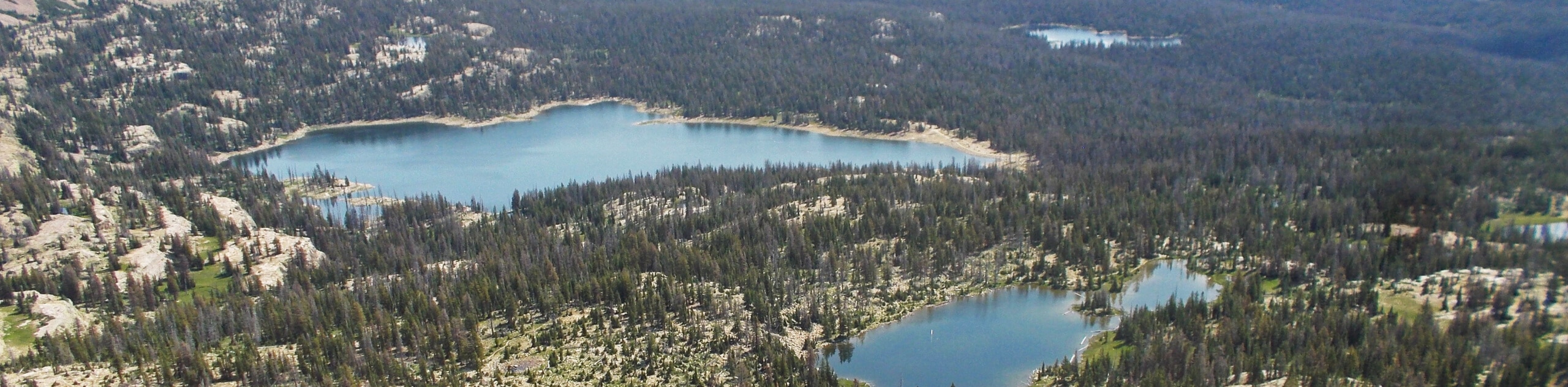
65. Grandaddy Lake via Grandview Trail
Difficulty
The hike to Grandaddy Lake via the Grandview Trail is a fantastic hike in the… Read More
66. Hayden Pass to the Christmas Meadows Campground
Difficulty
Hayden Pass to the Christmas Meadows Campground is a fantastic route in the western Uintas.… Read More
67. Cuberant Lakes Trail
Difficulty
The Cuberant Lakes Trail is a popular hiking route in the western Uintas. This trail… Read More
68. Yellow Pine Trail
Difficulty
The Yellow Pine Trail is a wonderful trail just east of Kamas, Utah. This route… Read More
69. Round, Sand, and Fish Lake Trail
Difficulty
The Round Lake, Sand Lake, and Fish Lake Trail is a beautiful hike in the… Read More
70. Cutthroat Lake Trail
Difficulty
The Cutthroat Lake Trail is a beautiful hike east of Park City, Utah. This trail… Read More
71. North Fork Loop
Difficulty
The North Fork Loop is a gorgeous trail east of Kamas, Utah. This trail is… Read More
72. Abe’s Lake Trail
Difficulty
The Abe’s Lake Trail is a gorgeous route in the Western Uintas. This trail is… Read More
73. Foreman Hollow Nature Trail
Difficulty
The Foreman Hollow Nature Trail is a beautiful hike in the Uinta-Wasatch-Cache National Forest. This… Read More
74. Cataract Gorge Trail
Difficulty
The Cataract Gorge Trail is a moderately challenging trail in the Western Uintas. This trail… Read More
75. Plantation Trail to Taylor Fork
Difficulty
The Plantation Trail to Taylor Fork Trail is a lovely route in the western Uintas.… Read More
76. Clegg Canyon Trail
Difficulty
The Clegg Canyon Trail is a beautiful hike just southeast of Heber City, Utah. This… Read More
77. Riley’s Canyon Trail
Difficulty
Riley’s Canyon Trail is a beautiful route just southeast of Kamas, Utah. This trail is… Read More
78. Lily Lake from Mill Creek Road
Difficulty
The trail from Mill Creek Road to Lily Lake is a beautiful route in the… Read More
79. Reid’s Peak
Difficulty
Reid’s Peak is an adventurous hike in the western Uintas. This trail is unmarked and… Read More
80. Log Hollow Trail
Difficulty
The Log Hollow Trail is a lovely hike in the western Uintas. This trail is… Read More
81. Thornton Hollow Trail
Difficulty
The Thornton Hollow Trail is a gorgeous route in the western Uintas. This trail makes… Read More
82. Fish Lake Alternate Route
Difficulty
The Fish Lake Alternate Route is a challenging hike in the western Uintas. This hike… Read More
83. Fran Lake Trail
Difficulty
The Fran Lake Trail is a lovely hike just east Oakley, Utah. This trail is… Read More
84. Broadhead Trail
Difficulty
The Broadhead Trail is a short and sweet hike in the Western Uintas. It should… Read More
85. Scow Lake Trail
Difficulty
The Scow Lake Trail is a rugged and adventurous route in the western Uinta. This… Read More
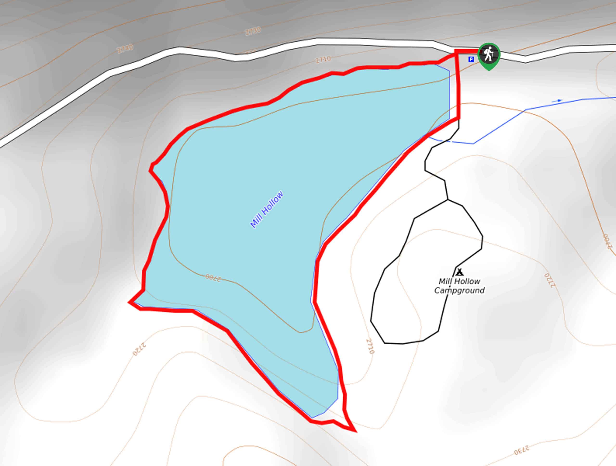
86. Mill Hollow Lake Loop
Difficulty
The Mill Hollow Lake Loop is a short and sweet hike in the Western Uintas.… Read More
87. Hidden Lake via Duck Lake Trail 210
Difficulty
The hike Hidden Lake via Duck Lake Trail 210 is a great route in the… Read More
88. Hell Hole Lake via Stillwater Campground
Difficulty
Hell Hole Lake via the Stillwater Campground is a great hike in the western Uintas.… Read More
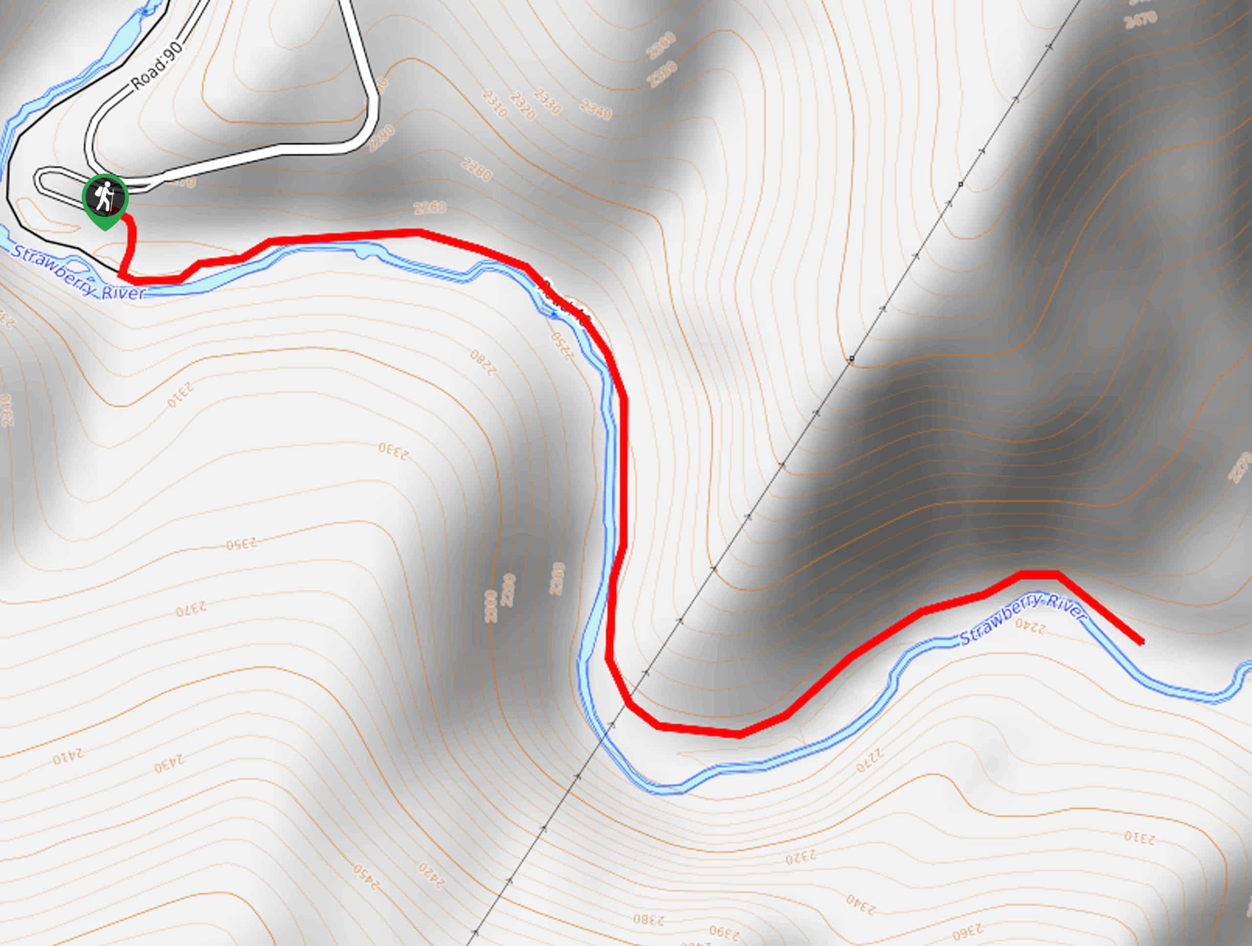
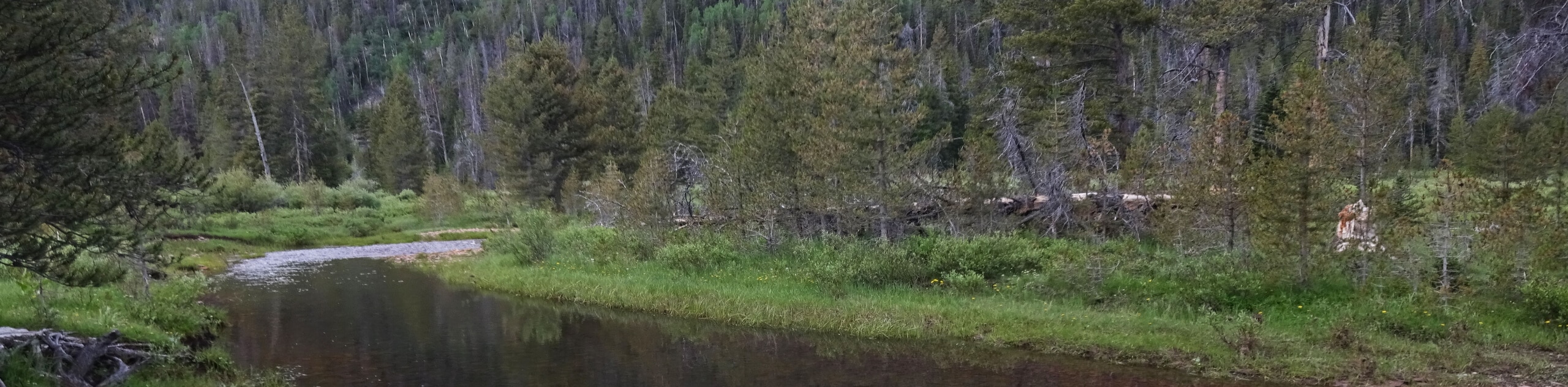
89. Strawberry River Trail
Difficulty
The Strawberry River Trail is a beautiful trail in the Western Uintas. This trail is… Read More
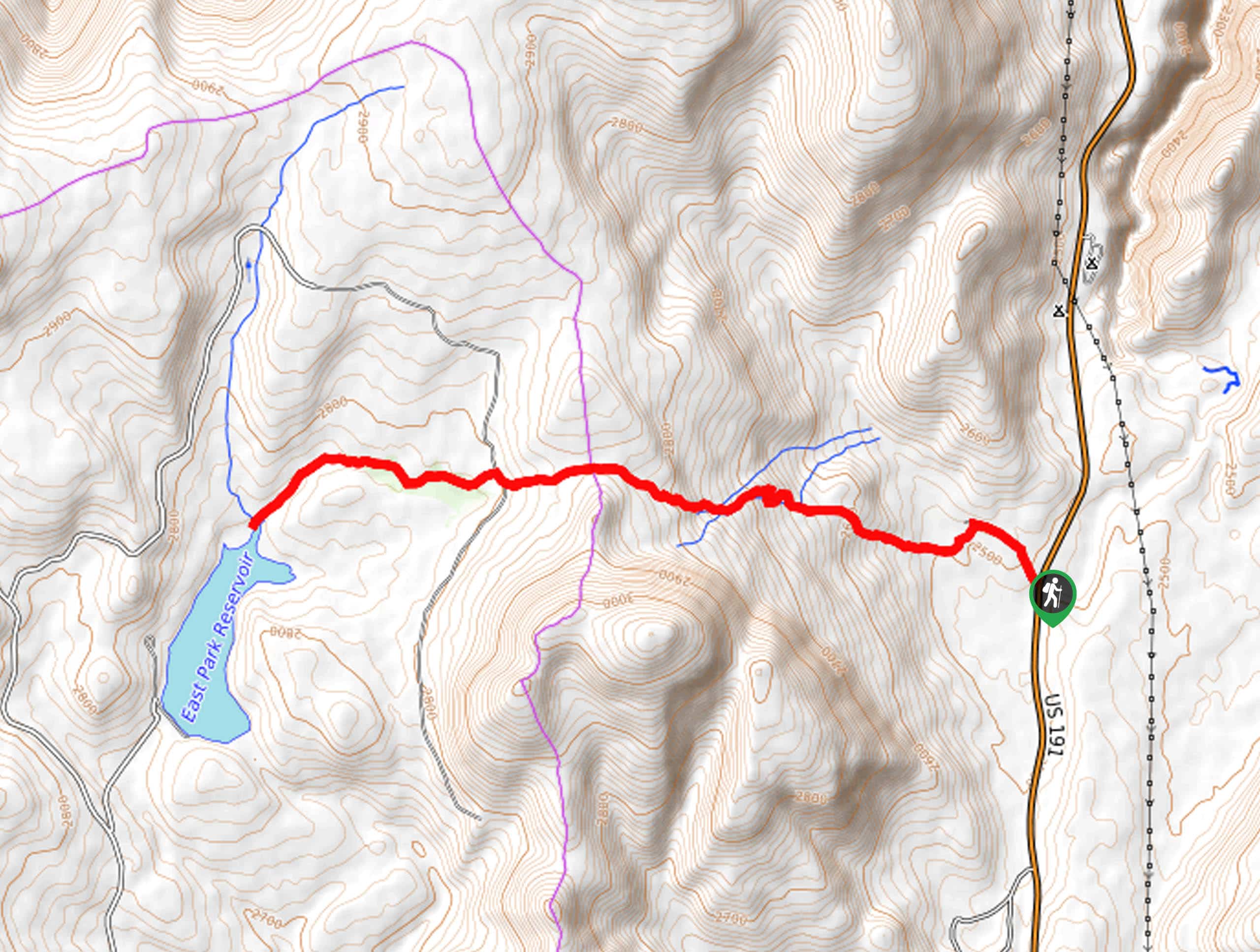
90. Highline Trail to East Park Reservoir
Difficulty
The Highline Trail to the East Park Reservoir is a beautiful route located in eastern… Read More
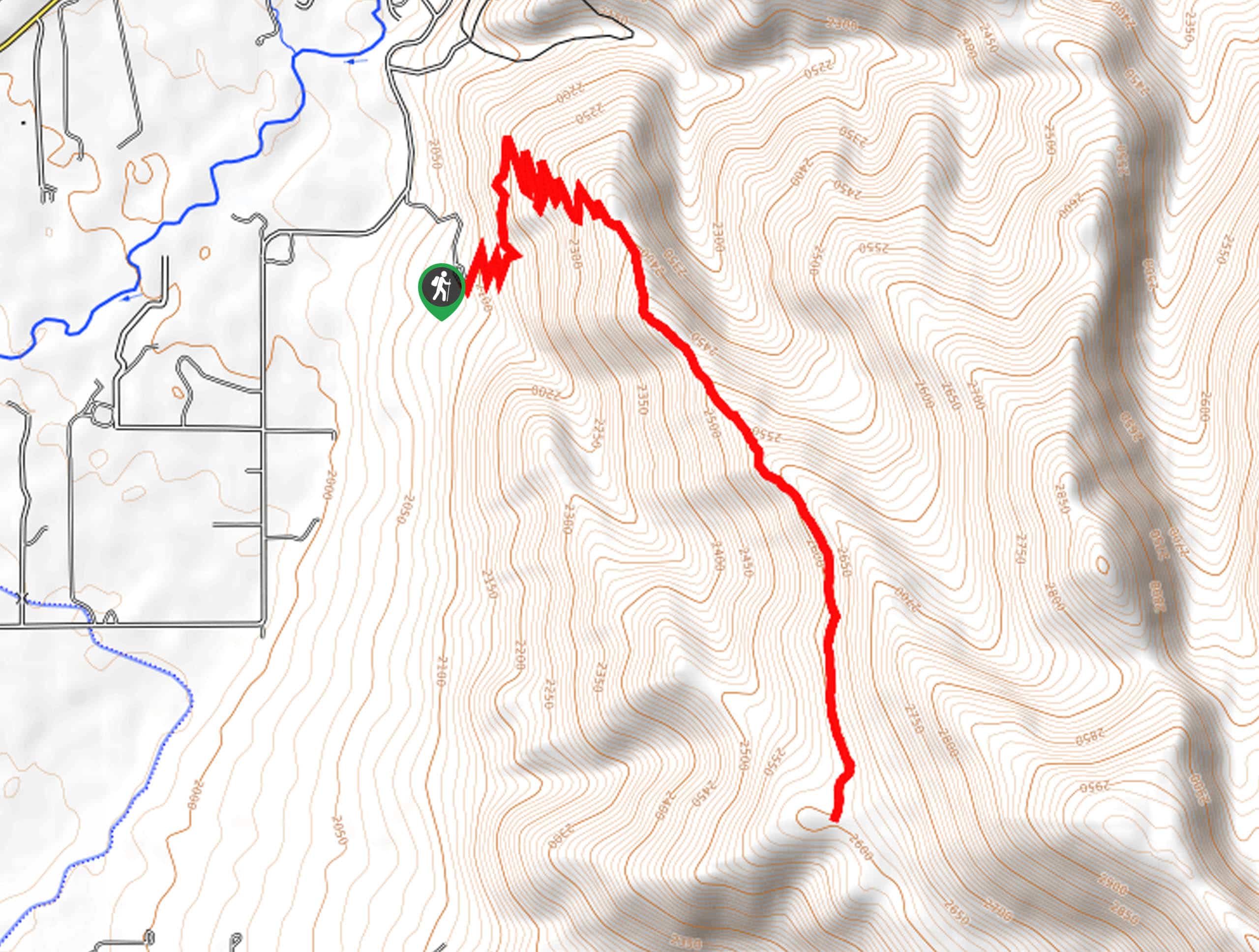
91. Oakley Ridge Trail
Difficulty
The Oakley Ridge Trail is a gorgeous route just east of Oakley, Utah. This trail… Read More
92. Round Lake via Burnt Fork
Difficulty
The Round Lake via Burnt Fork Trail is a challenging route in the Eastern Uintas.… Read More
93. Pine Valley Trail
Difficulty
The Pine Valley Trail is a wonderful route just southeast of Kamas, Utah. This trail… Read More

94. Box Elder Creek Trail
Difficulty
The Box Elder Creek Trail is a lovely hike northeast of Salt Lake City. This… Read More

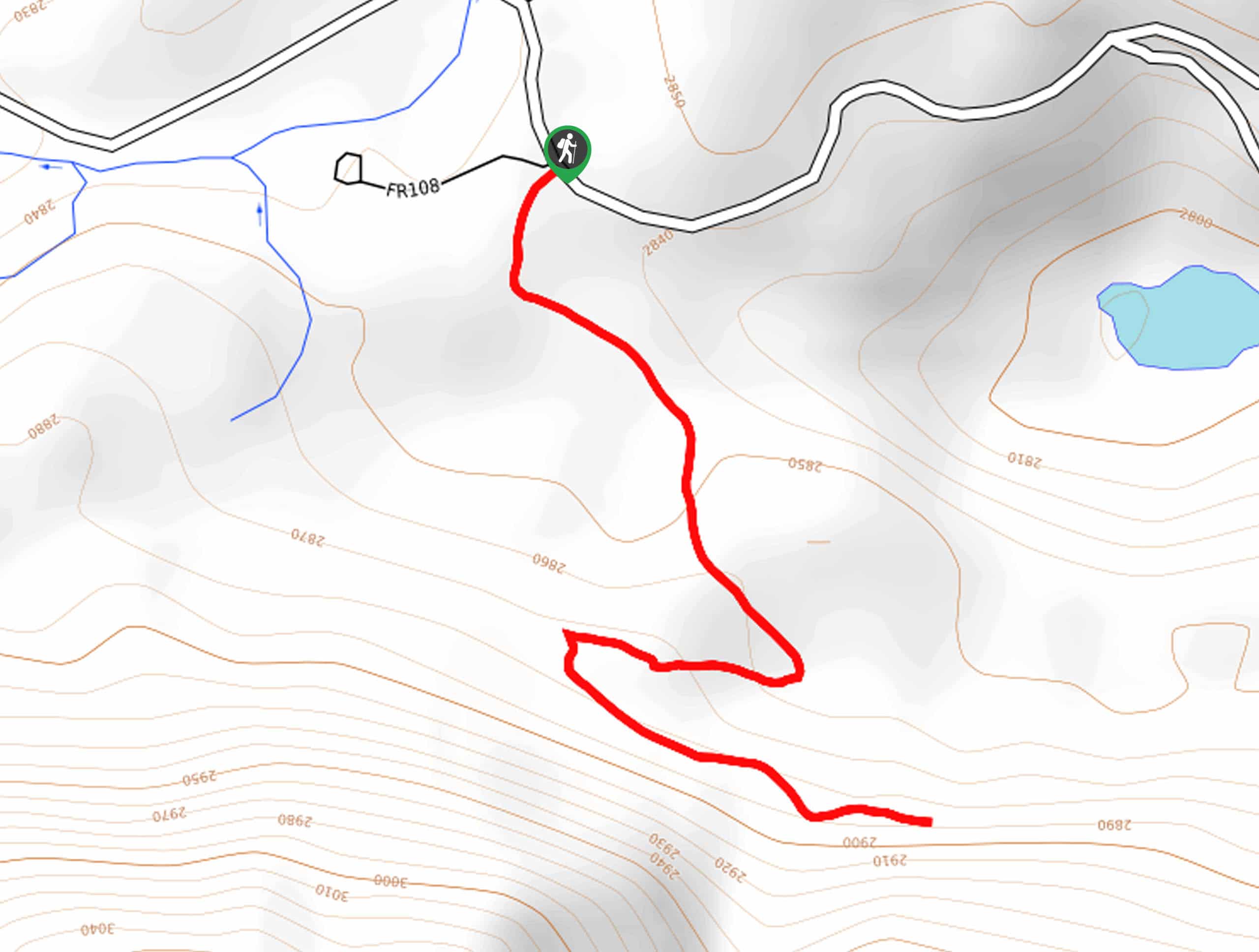
95. Skull Crack Trail
Difficulty
Despite the foreboding name, the Skull Crack Trail is a fantastic hike in the Uinta-Wasatch-Cache… Read More

96. Willard Creek Waterfall Trail
Difficulty
The Willard Creek Trail is an adventurous yet beautiful hike on the eastern edge of… Read More
Are we missing your favourite hike?
Tell us! If you've got photos, a GPS track and know the hike, we'd love to share your favourite hike with the rest of the 10Adventures community.