
Plantation Trail to Taylor Fork
View Photos
Plantation Trail to Taylor Fork
Difficulty Rating:
The Plantation Trail to Taylor Fork Trail is a lovely route in the western Uintas. This trail is a fantastic hiking circuit in the summer and a wonderful snowshoeing route in the winter. Dogs are welcome to join you on this trail but must be kept on leash at all times.
Getting there
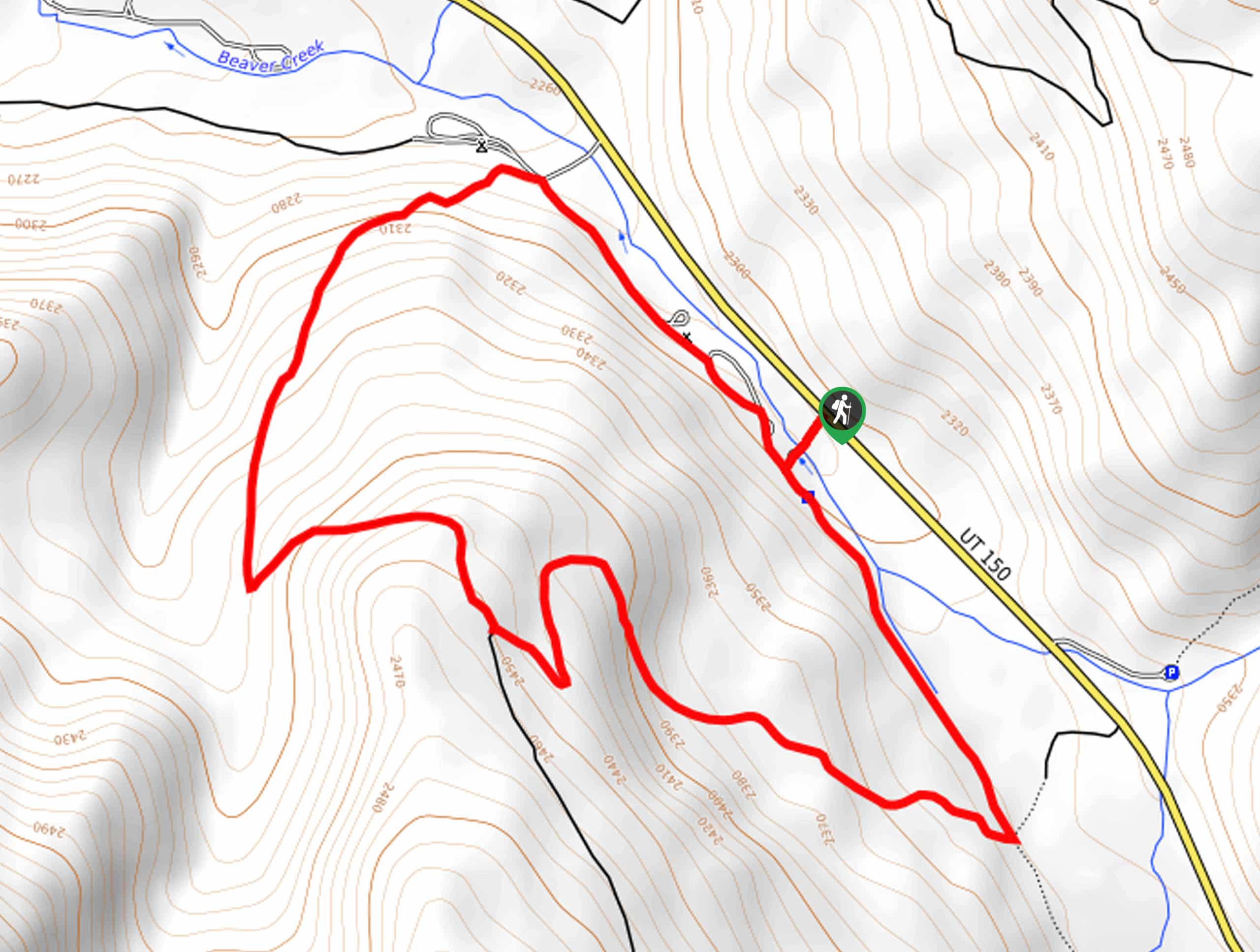
This trail begins at the Shingle Creek Campground on the south side of highway 150, approximately 9.5mi east of Kamas, Utah.

About
| Backcountry Campground | Shingle Creek Campground and Taylors Fork Campground |
| When to do | Year-Round |
| Pets allowed | Yes - On Leash |
| Family friendly | Older Children only |
| Route Signage | Average |
| Crowd Levels | Moderate |
| Route Type | Circuit |
Plantation Trail to Taylor Fork
Elevation Graph
Weather
Plantation Trail to Taylor Fork Description
The Plantation Trail and Taylor Fork Trail hiking circuit is a beautiful route, east of Kamas, Utah. This trail is a bit rocky, but nothing that you can’t handle with a pair of proper hiking shoes. In the summertime, this loop makes an excellent, low-traffic hike. In the winter, this route becomes a wonderful snowshoeing trail. In the seasons in between, the Plantation Trail and Taylor Fork hiking circuit remains absolutely beautiful, with budding wildflowers in the spring and fiery leaves in the fall. No matter what time of year you visit, the Plantation Trail and Taylor Fork Trail circuit is guaranteed to become a family favorite quickly.
From the Shingle Creek Campground parking area, follow the path on your left to hike southeast along Beaver Creek. From here, take the first trail on your right: this is the Plantation Trail. Sticking to your right, follow the trail as it loops around back to the Shingle Creek Campground where you began.
Back at the Campground, you can either pack up and head home or set up the tent for a peaceful night under the Utah stars.
Similar hikes to the Plantation Trail to Taylor Fork hike

Willard Creek Waterfall Trail
The Willard Creek Trail is an adventurous yet beautiful hike on the eastern edge of Willard, Utah. This trail is…

Skull Crack Trail
Despite the foreboding name, the Skull Crack Trail is a fantastic hike in the Uinta-Wasatch-Cache National Forest. This trail follows…

Box Elder Creek Trail
The Box Elder Creek Trail is a lovely hike northeast of Salt Lake City. This trail is used by both…
Comments