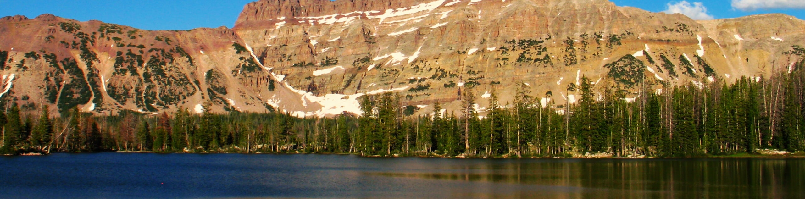
Teal Lake via the Ruth Lake Trail
View Photos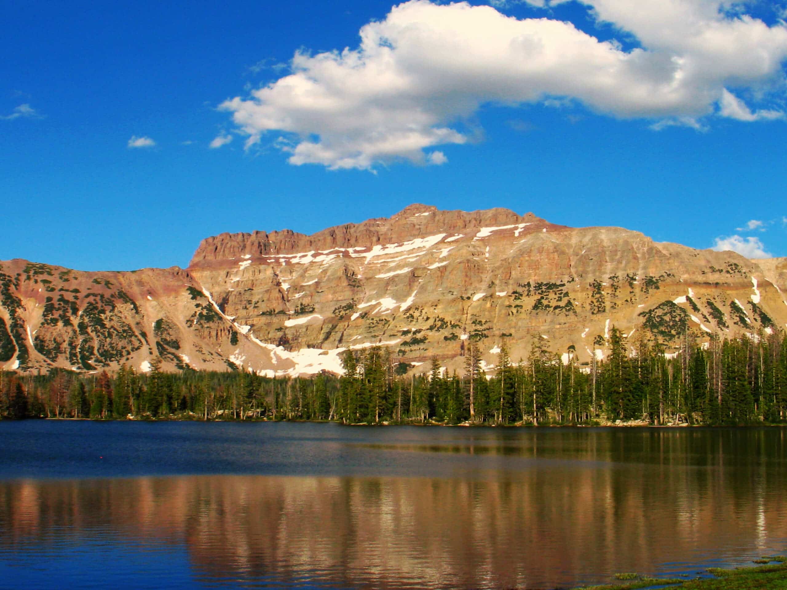
Teal Lake via the Ruth Lake Trail
Difficulty Rating:
The Teal Lake via Ruth Lake Trail is a gorgeous hike in the Uinta-Wasatch-Cache National Forest east of Park City, Utah. This trail is an adventurous route that brings you past four pristine alpine lakes: Ruth Lake, Hayden Lake, Jewel Lake and Teal Lake. Dogs are welcome to join you on this trail, but please respect the on-leash/off-leash area signage.
Getting there
From Kamas, Utah, head east out of town on highway 150. Stay on Highway 150 for 34.0mi and look for the Ruth Lake parking area on the west side of the highway, just past the Butterfly Lake Campground. The Teal Lake via Ruth Lake Trail begins here.

About
| Backcountry Campground | Primitive Camping at Ruth Lake, Jewel Lake, and Teal Lake |
| When to do | April to September |
| Pets allowed | Yes |
| Family friendly | Older Children only |
| Route Signage | Poor |
| Crowd Levels | Low to Moderate |
| Route Type | Out and back |
Teal Lake via the Ruth Lake Trail
Elevation Graph
Weather
Teal Lake via the Ruth Lake Trail Description
The hike to Teal Lake via Ruth Lake is a gorgeous trail in the Western Uinta Mountains. This trail is well marked and well-populated up until Ruth Lake. Past Ruth Lake, the path becomes unclear, and some route finding is required. If you are not experienced in route finding, we recommend printing or downloading a map before starting the hike. If you have a GPS unit, we recommend bringing that along too. If you are up for the adventure, this trail is gorgeous. On the hike to Teal Lake, you will pass three other incredible lakes, meadows of wildflowers, and lush green forest.
From the parking lot on the west side of Highway 150, follow the trail west as it winds along Hayden Fork to a divide; stay right at this divide to make your way to Ruth Lake. At Ruth Lake, continue on the path along the north shore of the lake. Just west of Ruth Lake, look for the rugged trail that branches off to your right. Follow this trail northwest for 0.4mi to Jewel Lake. From the north end of Jewel Lake, make your way west to Teal Lake.
Take a rest and enjoy some peace and solitude on the shores of Teal Lake before turning around and retracing your steps back to the parking area where you began.
Similar hikes to the Teal Lake via the Ruth Lake Trail hike

Willard Creek Waterfall Trail
The Willard Creek Trail is an adventurous yet beautiful hike on the eastern edge of Willard, Utah. This trail is…

Skull Crack Trail
Despite the foreboding name, the Skull Crack Trail is a fantastic hike in the Uinta-Wasatch-Cache National Forest. This trail follows…

Box Elder Creek Trail
The Box Elder Creek Trail is a lovely hike northeast of Salt Lake City. This trail is used by both…
Comments