Ibantik Lake hike
View Photos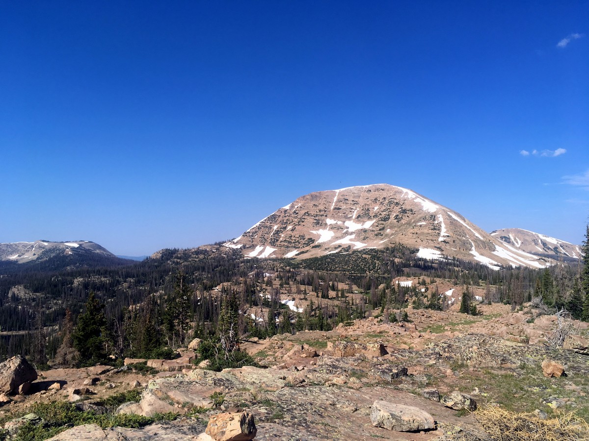
Ibantik Lake hike
Difficulty Rating:
This hike, in the heart of one of the most picturesque valleys of the High Uinta Mountains, walks up over ‘The Notch’ and down to Ibantik Lake immersing you in the paradoxically sterile, yet inviting beauty of the park; it’s almost as if it’s the blank pages of a book, waiting for you to write your adventures on.
Getting there
From Kamas, head east along Utah highway 150 for just over 25.0mi. Take the turnoff for the Trail Lake and Crystal Lake Campgrounds, and the Crystal Lake Trailheads. After turning off the highway, follow signs for the Crystal Lake Trailhead and find a spot in the limited parking area.

About
| When to do | Late June through October |
| Backcountry Campsites | Yes, Dispersed in National Forest |
| Toilets | Yes, at trailhead |
| Family friendly | Yes |
| Route Signage | Average |
| Crowd Levels | High |
| Route Type | Out and back |
Ibantik Lake
Elevation Graph
Weather
Route Description for Ibantik Lake
Do not follow the crowds heading along the wide path directly beside the washroom: that trail heads out to Clyde Lake. Instead, walk approximately 50ft to the right and find the smaller trail heading out towards Ponds Lake and Wall Lake.
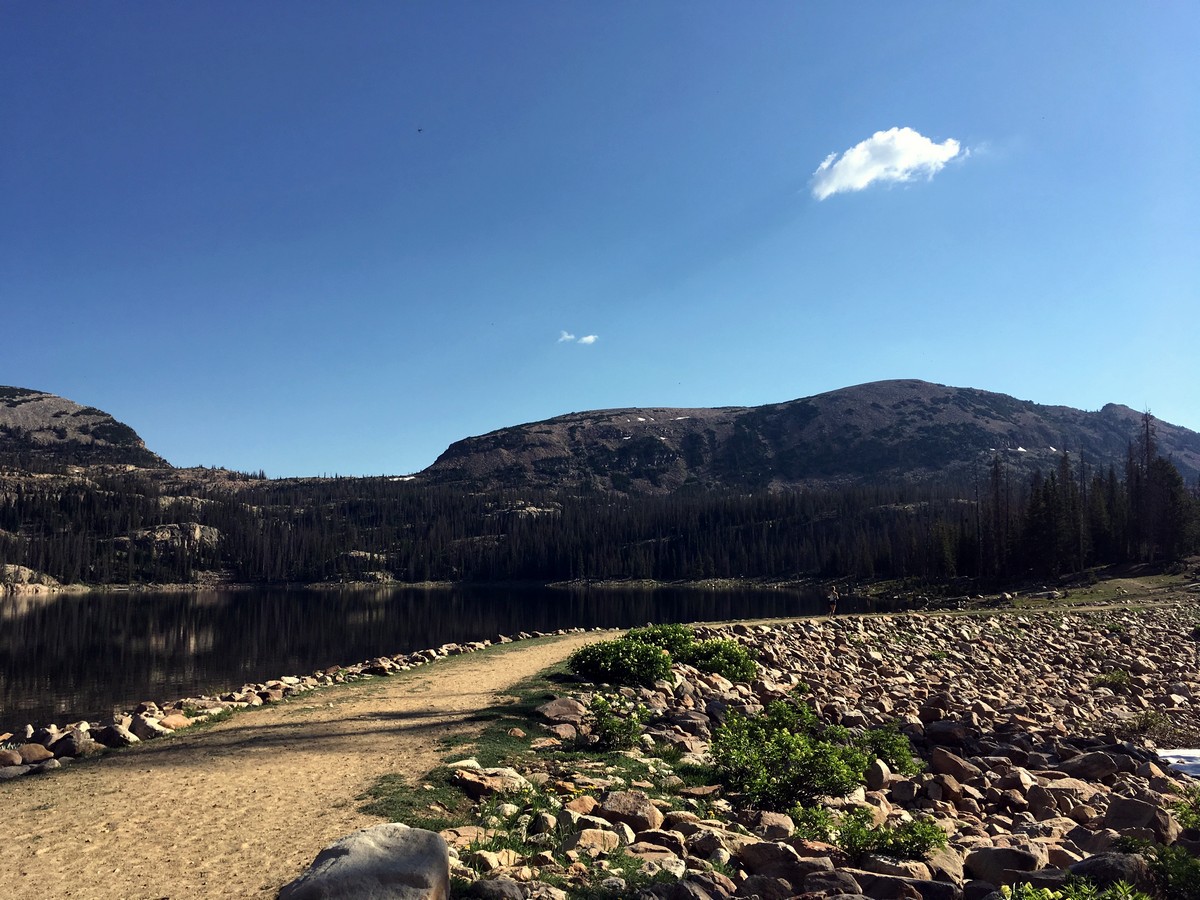
Initially, the trail is quite flat, traversing through the beautiful and sparse alpine forest. After a short climb, you will pass between Ponds Lake and Lily Lake. These are very popular amongst fisherman. Traverse around the right of Ponds Lake and continue hiking along the wide path.
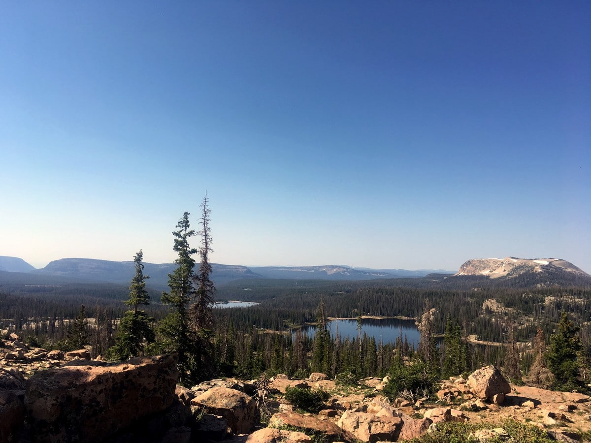
The trail will begin to climb yet again, and you will contour around a knoll as you ascend the Southside of the giant Wall Lake. After passing briefly by the shore, the trail will divert from the lake and continue to climb. You will switchback through forests for a while. After passing by several other small alpine lakes, you will escape the trees and reach a junction. Continue straight here towards ‘The Notch’.
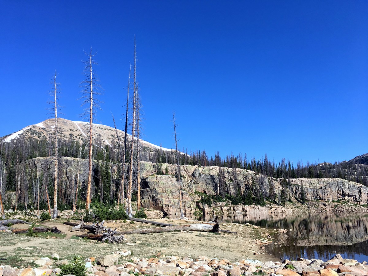
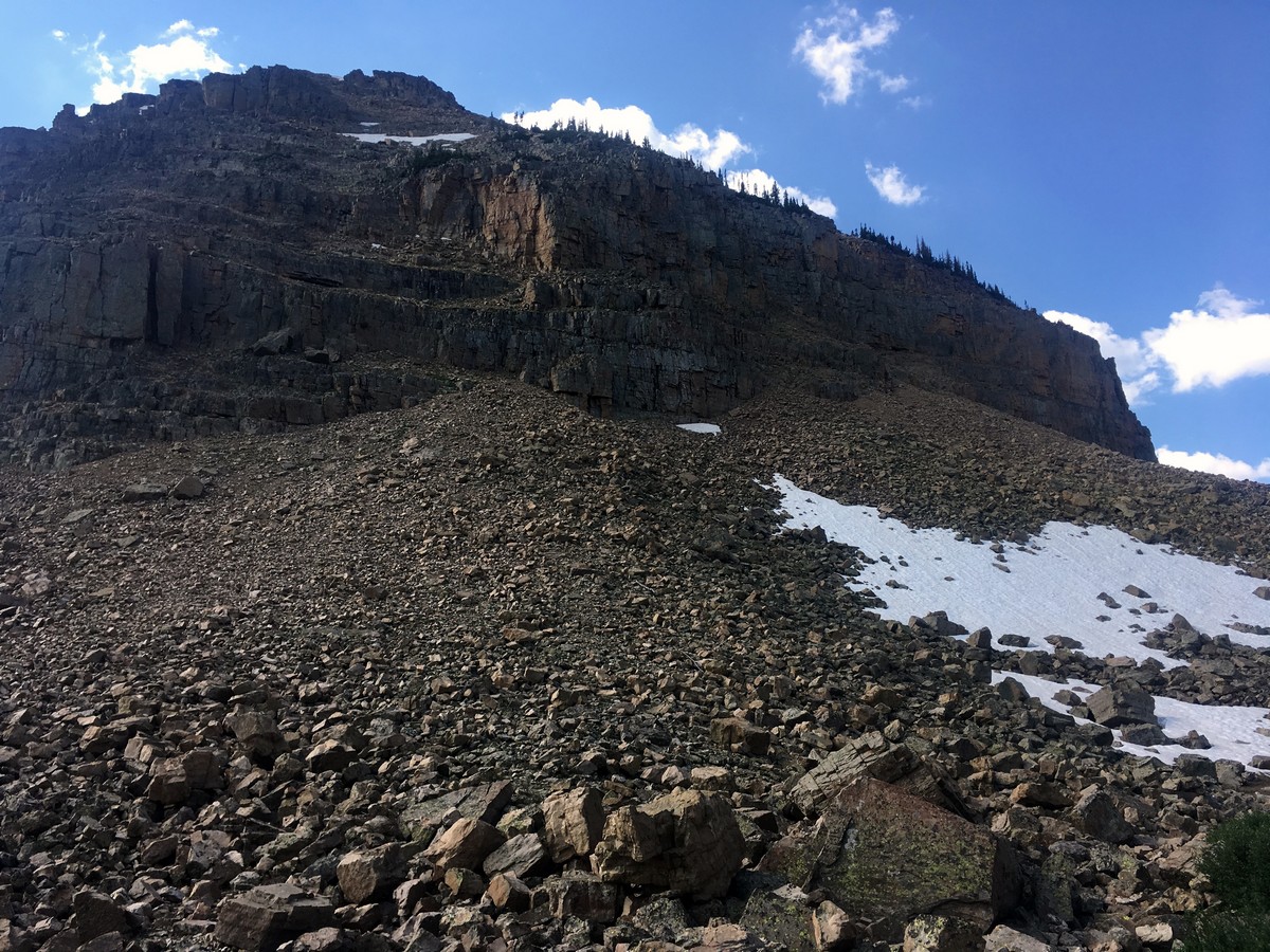
The Notch is a pass right in the middle of Notch Mountain. Ascending the switchbacking trail up to this rocky saddle grants stunning views. After the climb, descend on the North side. You will subsequently enter another valley covered with alpine lakes.
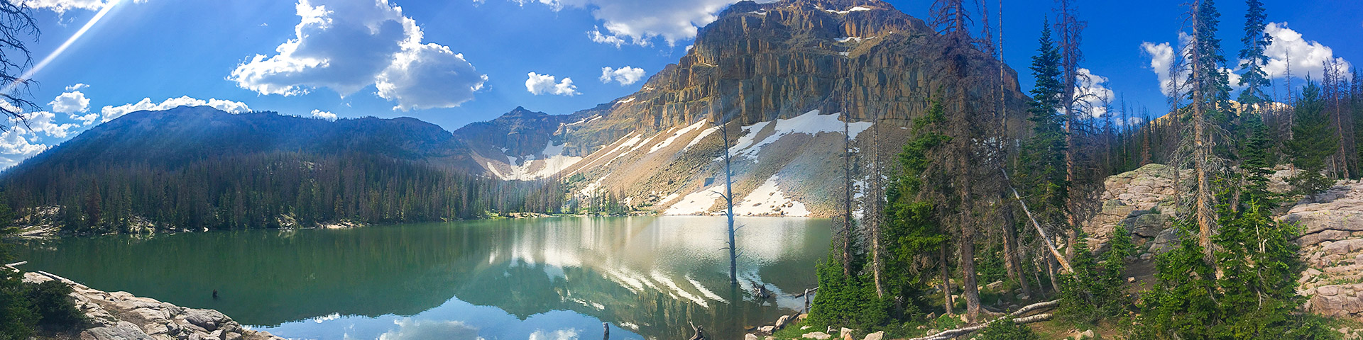
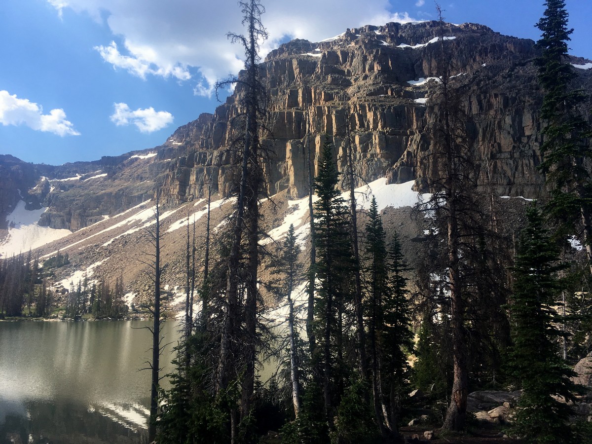
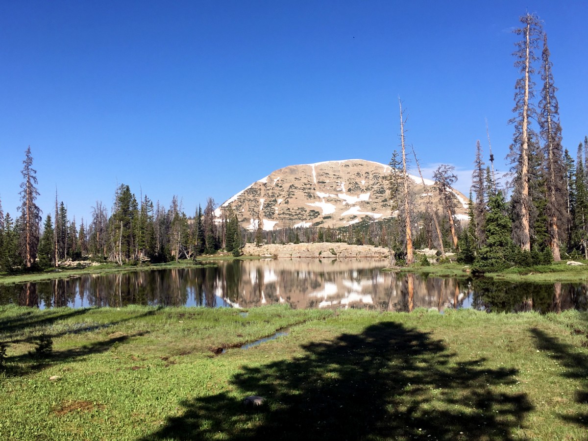
The trail contours around the left side of the valley before making a large switchback to the right. After five narrow switchbacks you will arrive at Ibantik Lake, located at the opening of a canyon formed by the Notch Mountain Massif. This incredible, summit-skyline provides perfect ambiance for the pale blue lake.
Re-climb the notch and return the way you came.
Find more great hikes in the Uinta Mountains:
Insider Hints
The North side of the notch can hold snow late in the season, so take care!
This is an extremely popular and easy one-night backpacking trip.
A recreation pass is required to park in the National Forest, which can be purchased throughout the park; however, a National Parks Pass is also accepted.

Similar hikes to the Ibantik Lake hike

Willard Creek Waterfall Trail
The Willard Creek Trail is an adventurous yet beautiful hike on the eastern edge of Willard, Utah. This trail is…

Skull Crack Trail
Despite the foreboding name, the Skull Crack Trail is a fantastic hike in the Uinta-Wasatch-Cache National Forest. This trail follows…

Box Elder Creek Trail
The Box Elder Creek Trail is a lovely hike northeast of Salt Lake City. This trail is used by both…
Stevie M 4 years ago
This is a fantastic hiking destination with moderate difficulty but offers beautiful views.
BoulderBound 4 years ago
Definitely a moderate hike. Excellent and well marked trail.
Sammy L. 4 years ago
Beautiful hike! Many ponds and lakes
subterry 5 years ago
This hike offers remarkable views perfect for photography sessions. It has a refreshing vibe to it.
Meadow M. 5 years ago
Definitely an easy hike but I enjoyed it. Views from here are just jaw-dropping.
Queenie 5 years ago
Easy hike withlots of beautiful views. Great view of the pond and lakes.
Ithinkimgettingbald 5 years ago
A really nice trail, but I wish I read the part how to escape the crowds before I went there. A really busy trail.
Wyatt Thomas 5 years ago
The Uintas Mountains are amazing, and Ibantik Lake was a great trail.
Freddo 5 years ago
Ibantik lake hike was an amazing experience. Even the crowd did not spoil the experience
mountaincat 5 years ago
What a refreshing spot to get to after hiking in Moab deserts. Uinta felt so big and so secluded, absolutely loved it