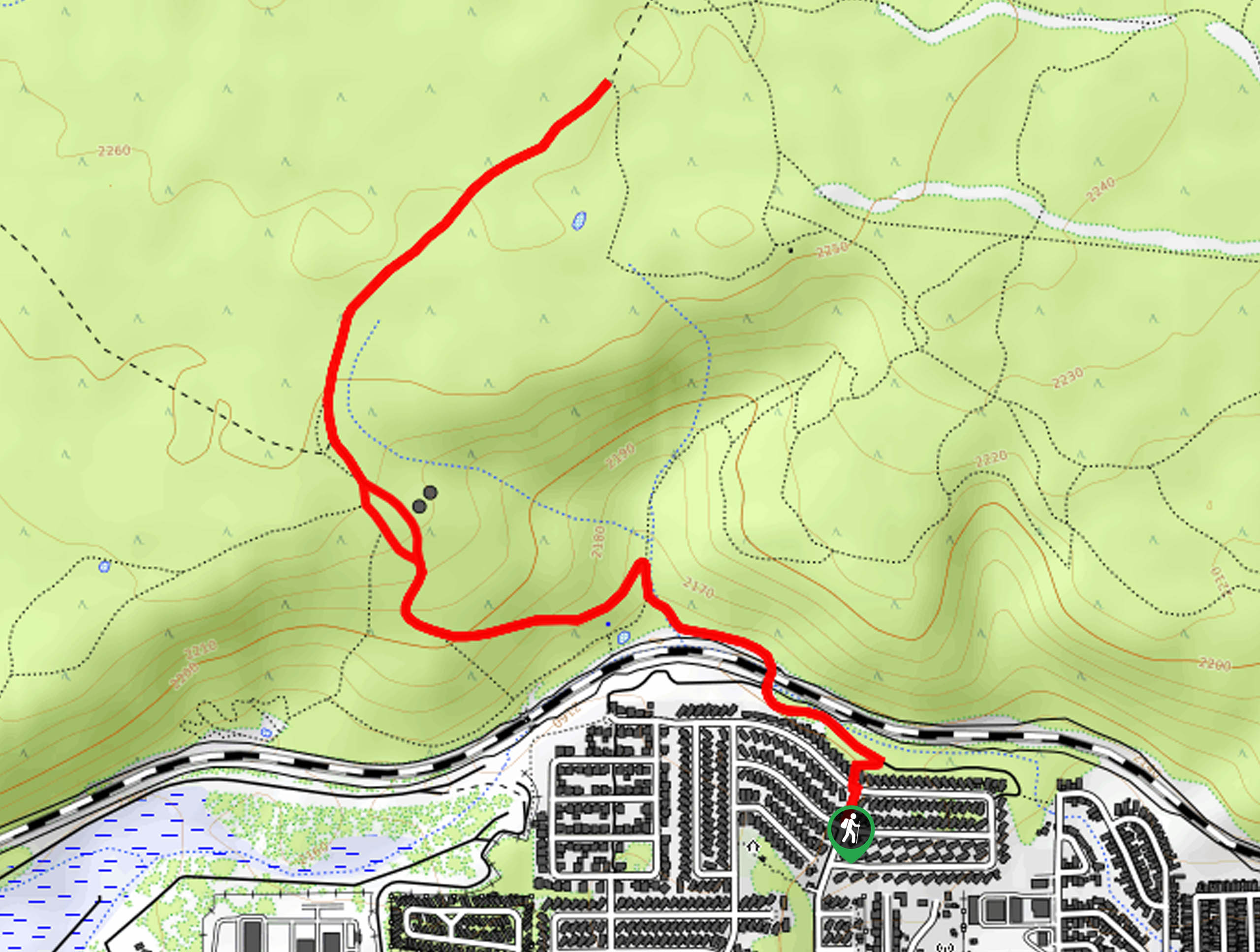
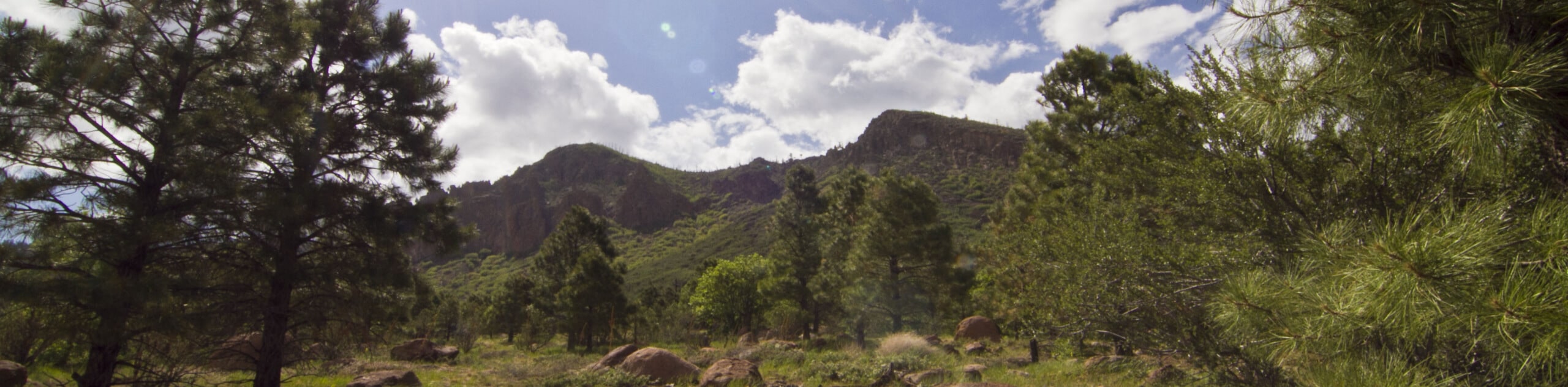
hikes in Flagstaff
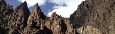
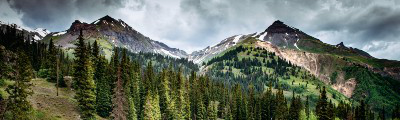
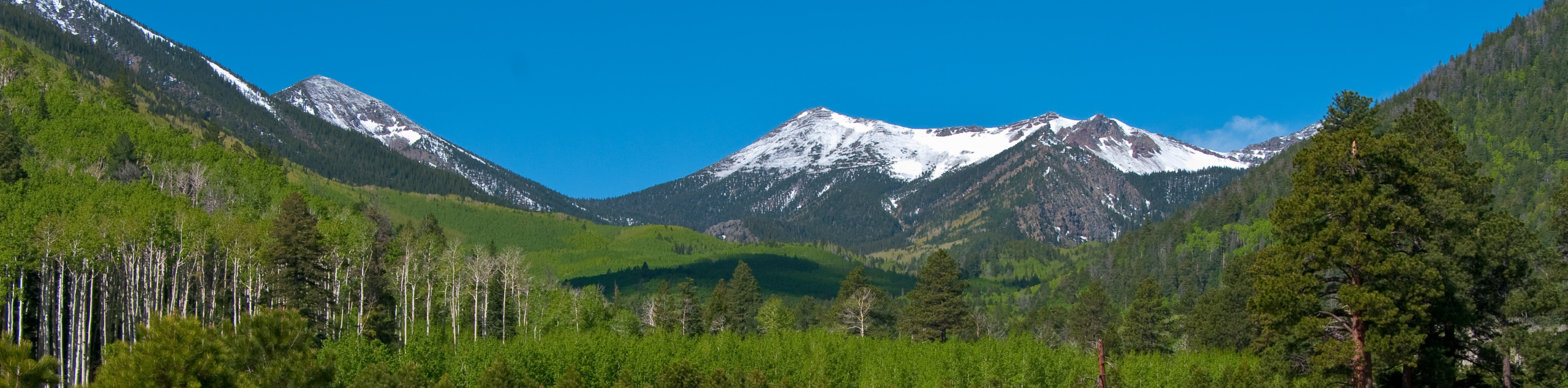
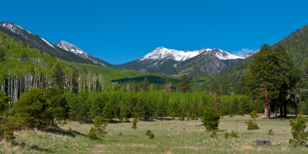
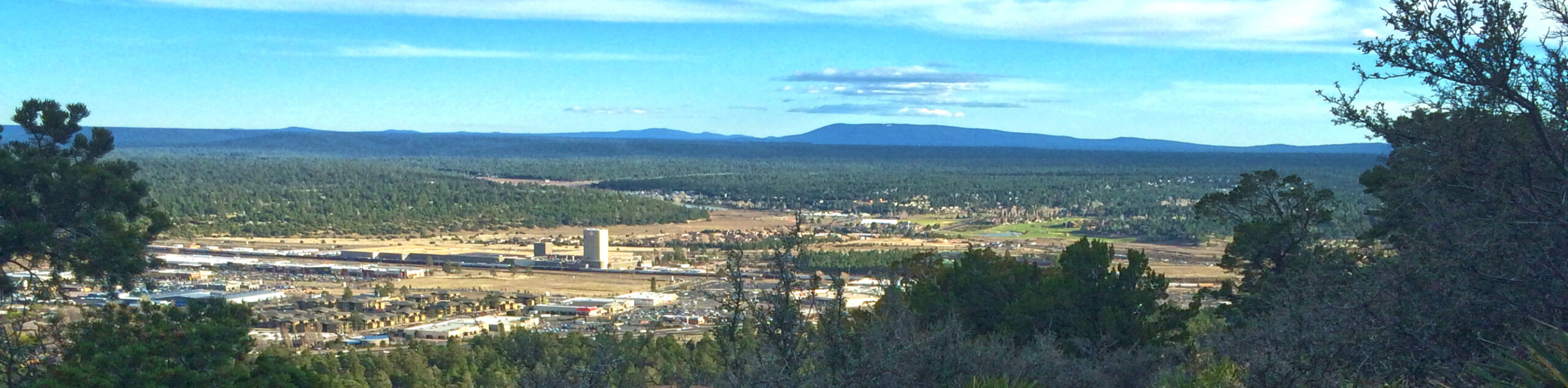
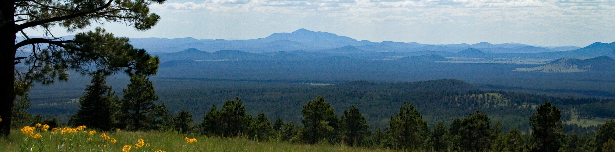
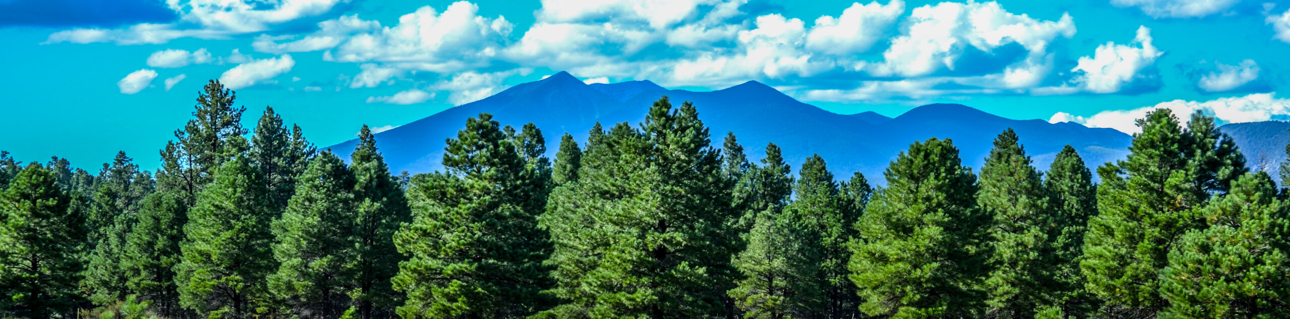
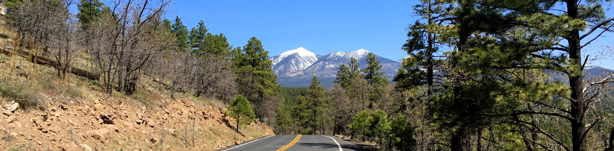
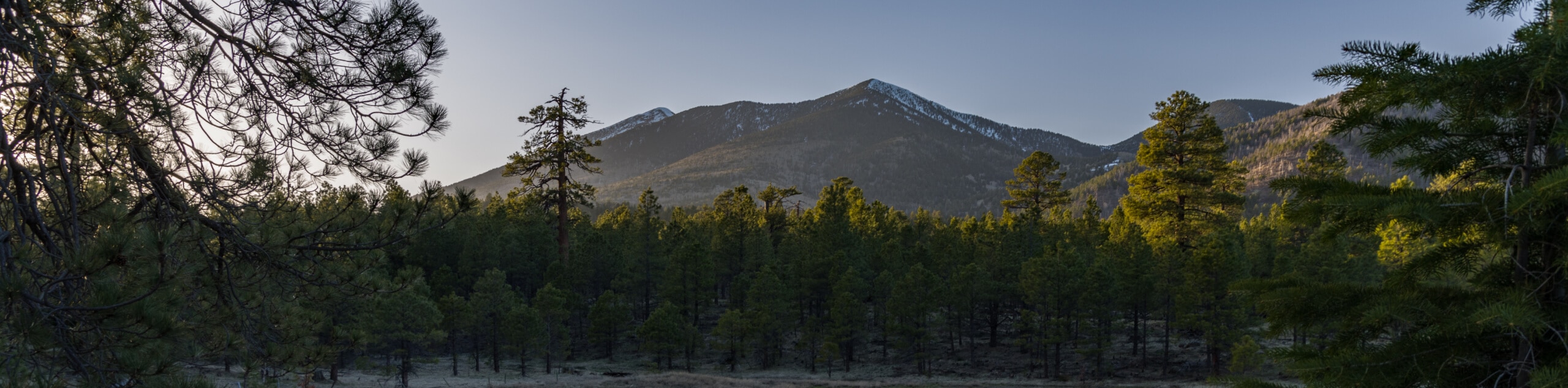
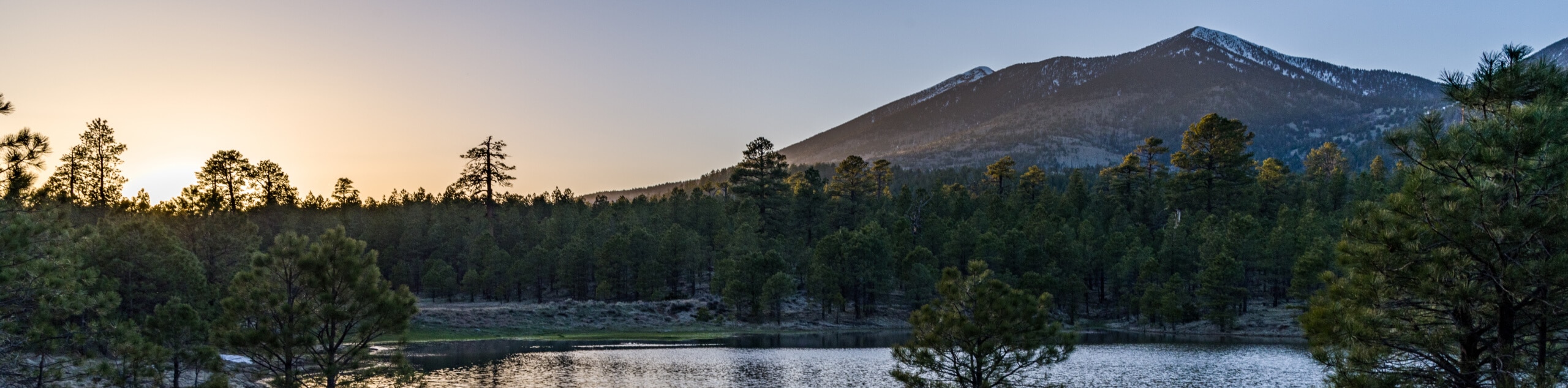
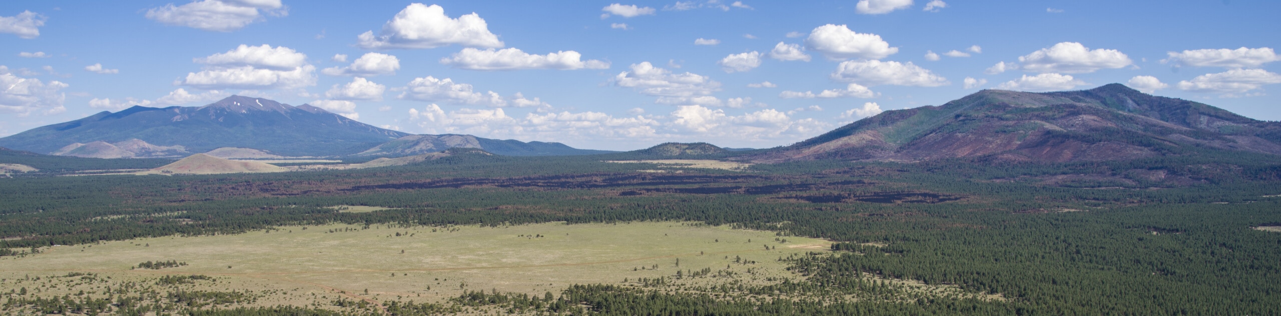
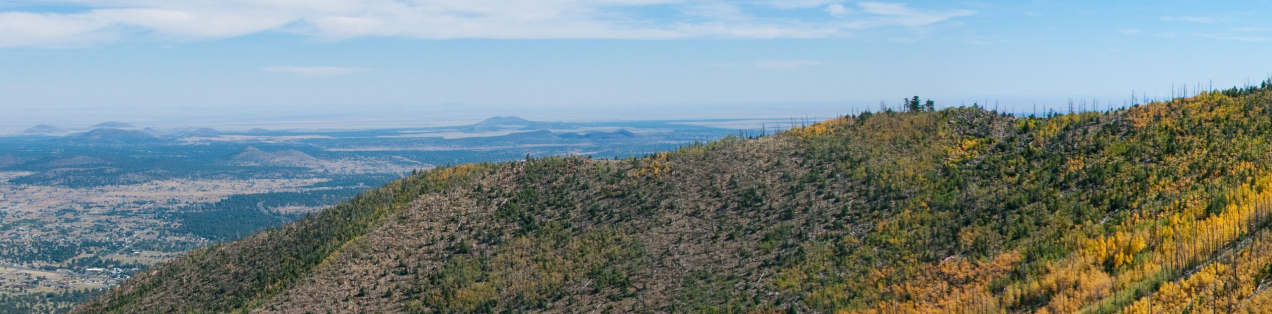
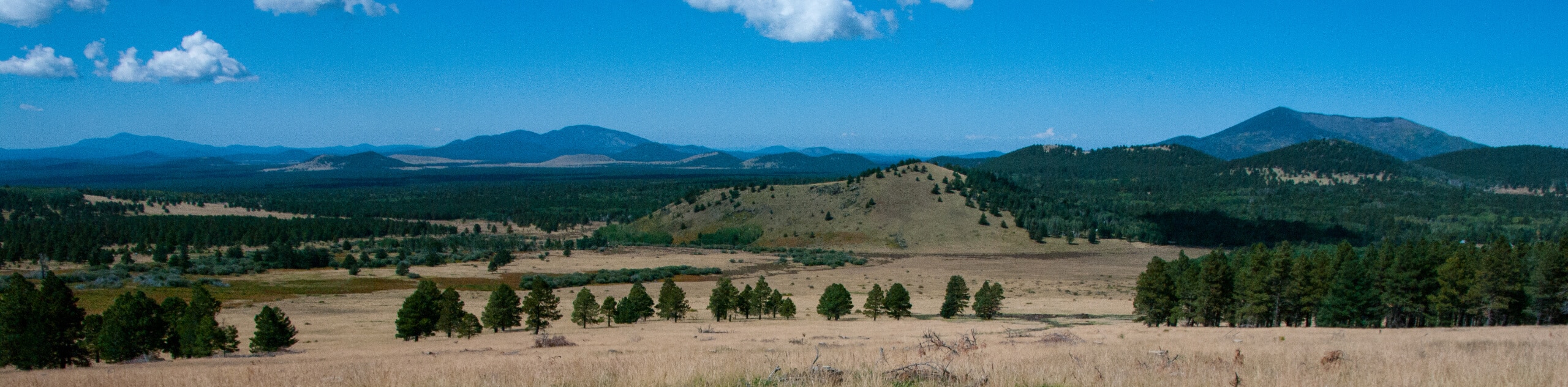
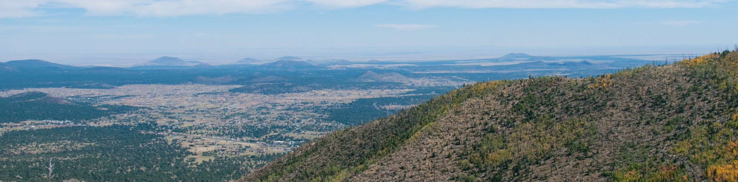
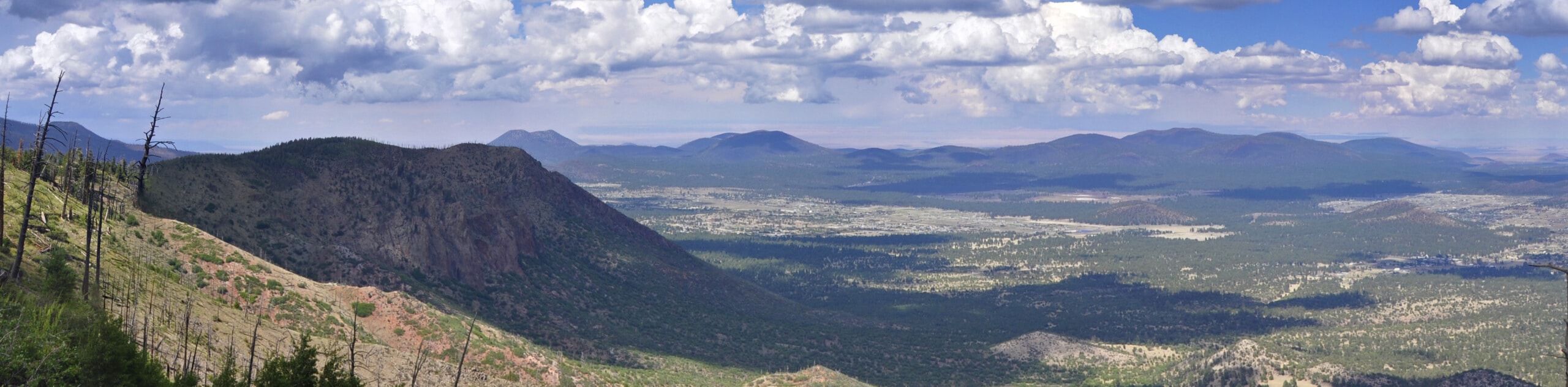
If you’re planning an adventure to the Grand Canyon State, there’s more than cactus and desert to be found. With peaks reaching over 12600ft nestled right near the city, Flagstaff is closer in scenery and hiking opportunities to Colorado in some ways, but with its own fascinating perks. Volcanic craters, golden aspen forests, wildflowers and cacti, deep canyons and ruins–these trails have more to experience than you might have thought! With so many trailheads right within city limits, you can access the outdoors from your doorstep in Flagstaff, and there are trails here for every age and skill level.
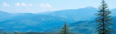
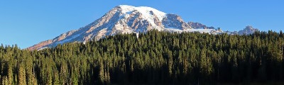
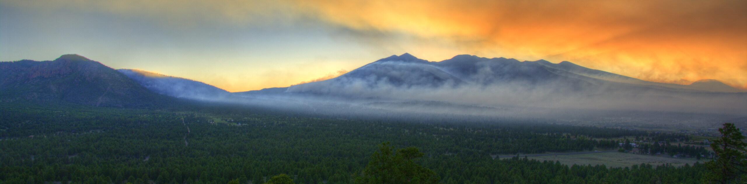
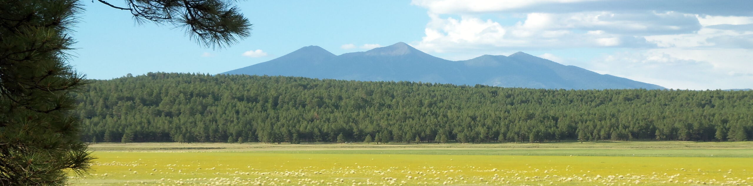
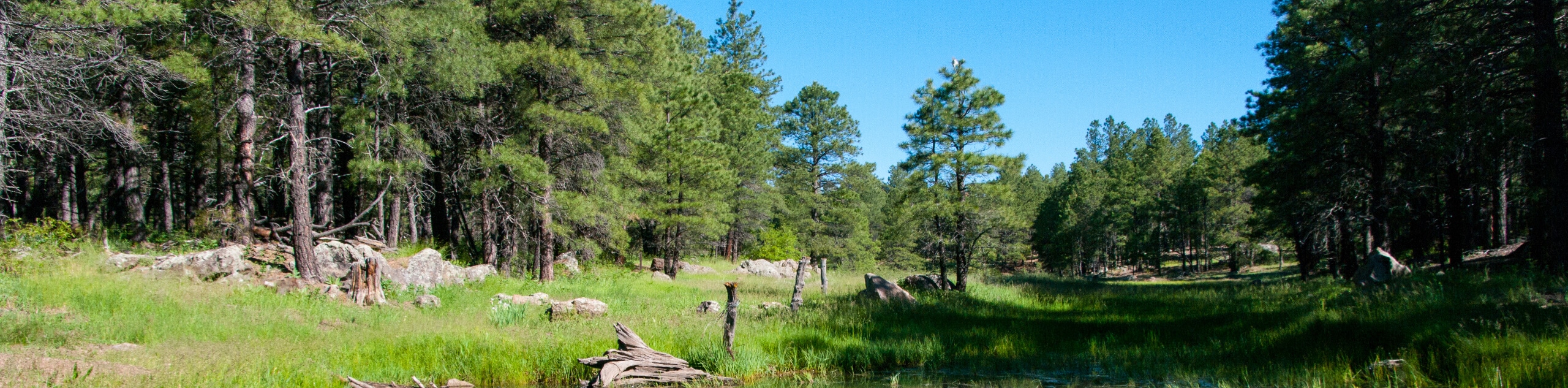
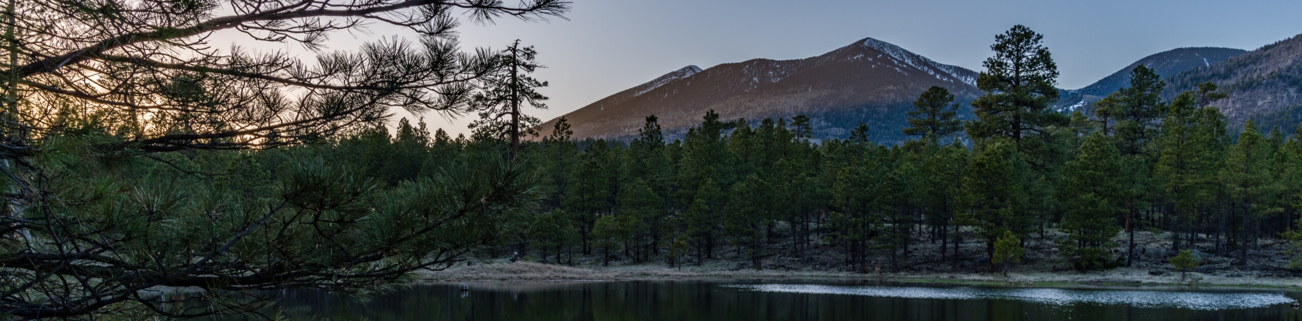
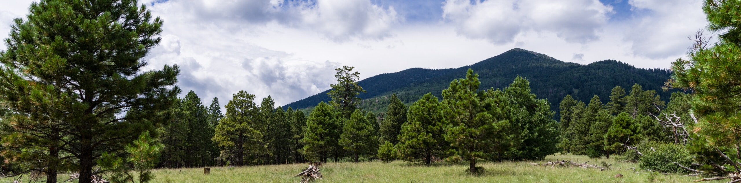
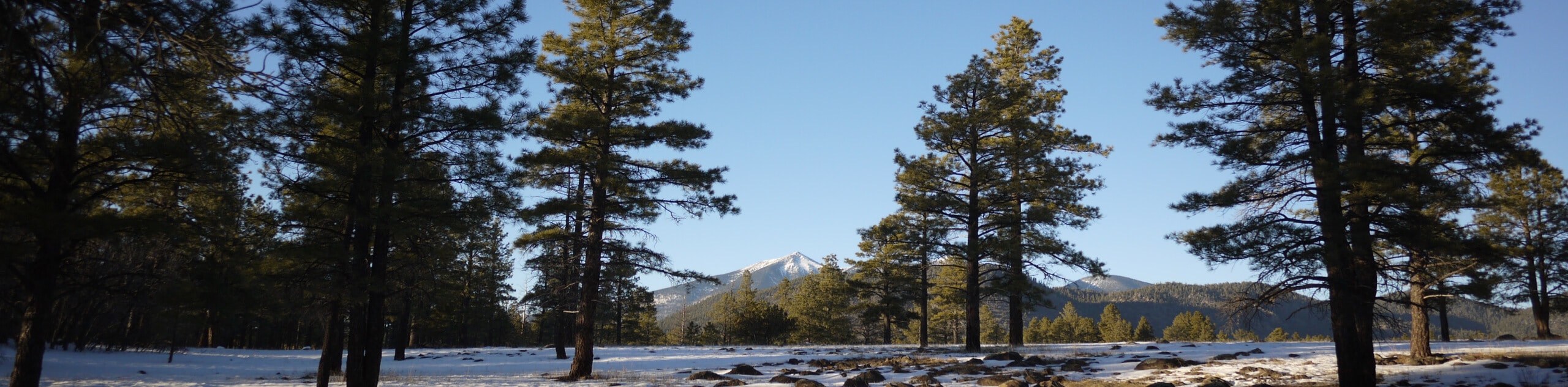
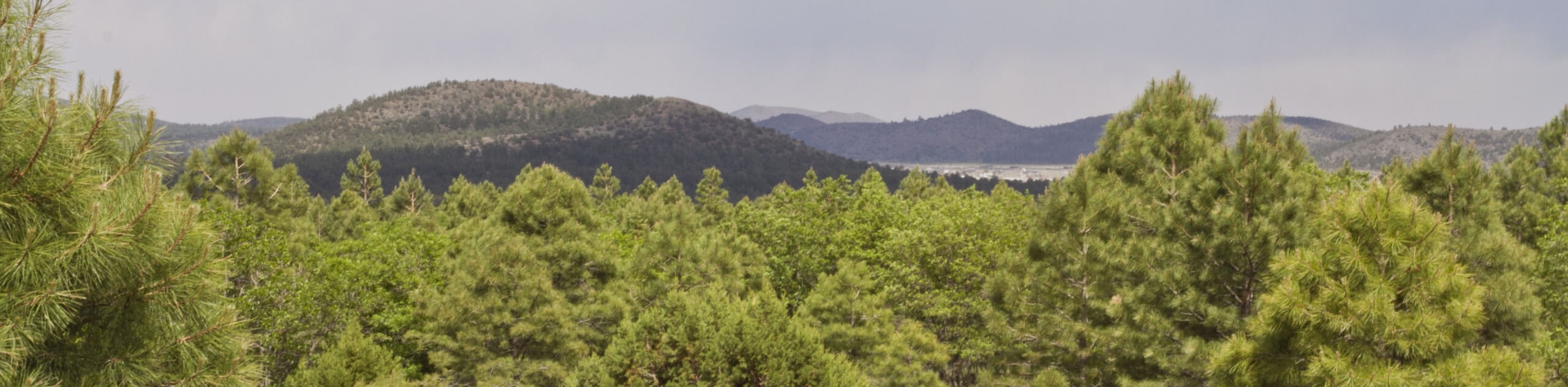
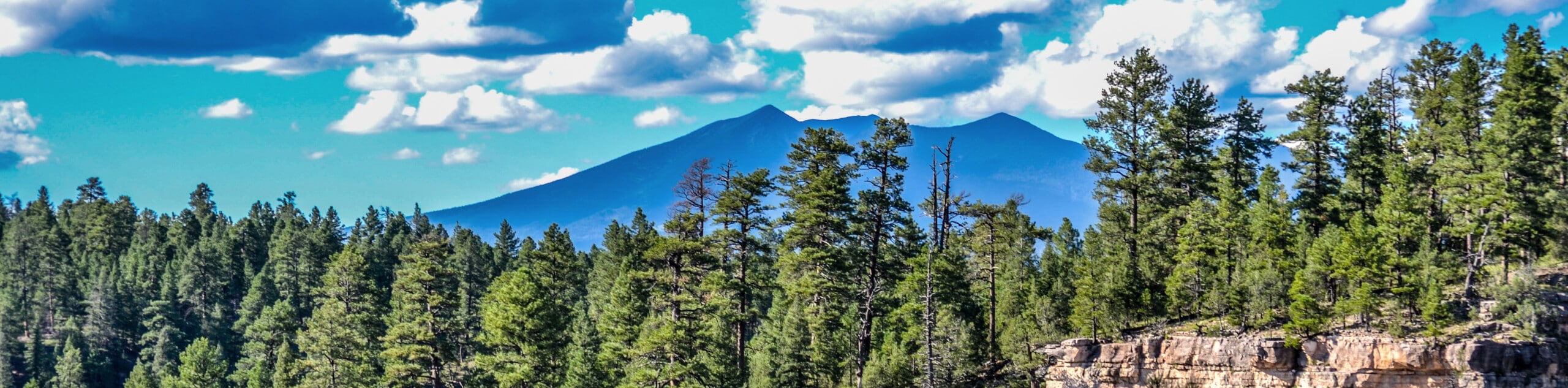
Wherever your adventures in Flagstaff take you, a few things will remain constant: the San Francisco Peaks dominating the sky, the emerald Ponderosa forests stretching in every direction, and the welcoming charm of this down-to-earth city. Whether you’re exploring Flagstaff’s trails on two feet or otherwise, read on to see some of the top trails in and around the city.
15 Must-Do Hikes in Flagstaff
Ready to start exploring? We’re making it easy to get going with 15 of our favorite hikes in Flagstaff. Our list includes short, easy trails, challenging treks, and everything in between. Work your way through as many as you can on the weekends or make the most of your downtime while visiting the city–you’ll want to keep exploring once you get into that pristine mountain air.
Our top hikes in Flagstaff are chosen to show off the highlights of Flagstaff’s landscape, from mountains to volcanic craters and forests. While starting with these 15 hikes is a great way to get acquainted with Flagstaff’s hiking scene, remember that we’ve got plenty more route guides to keep you adventuring.
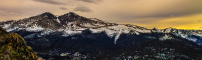
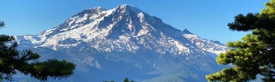
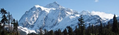
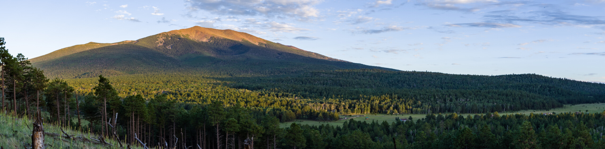
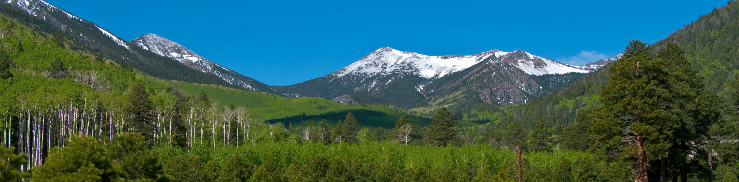
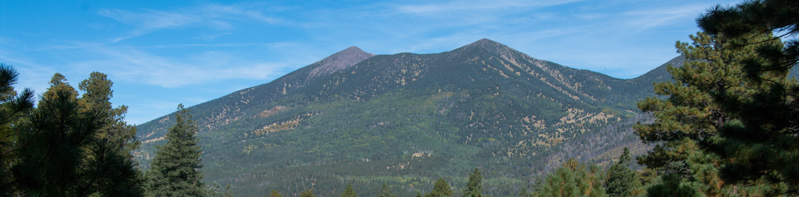
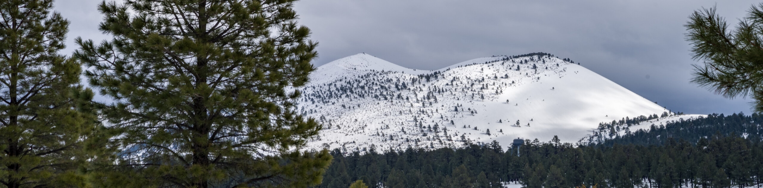
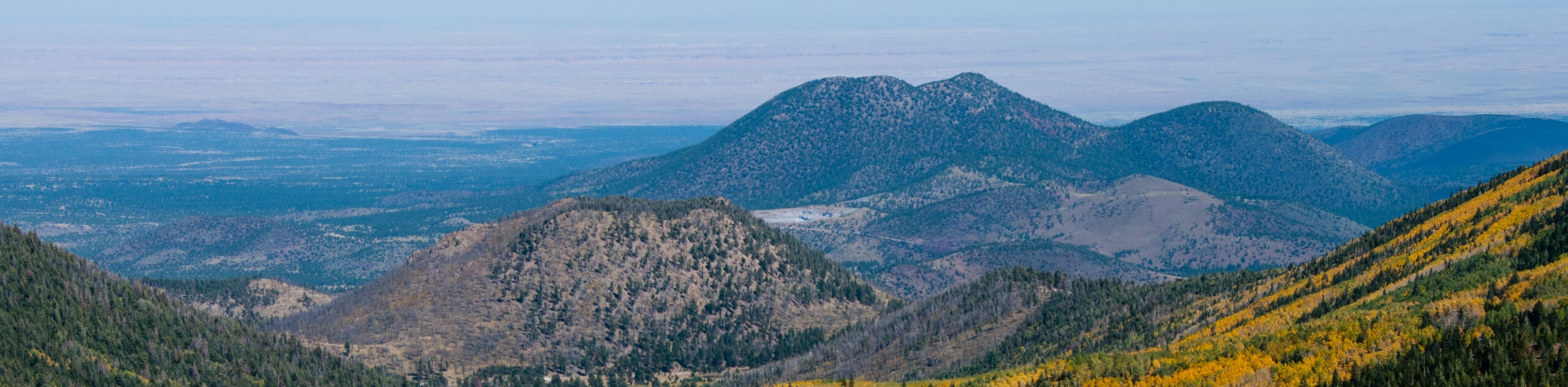
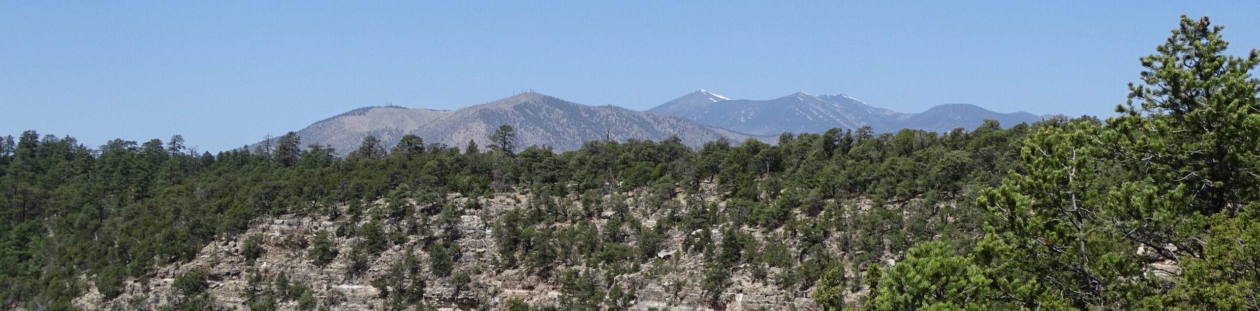
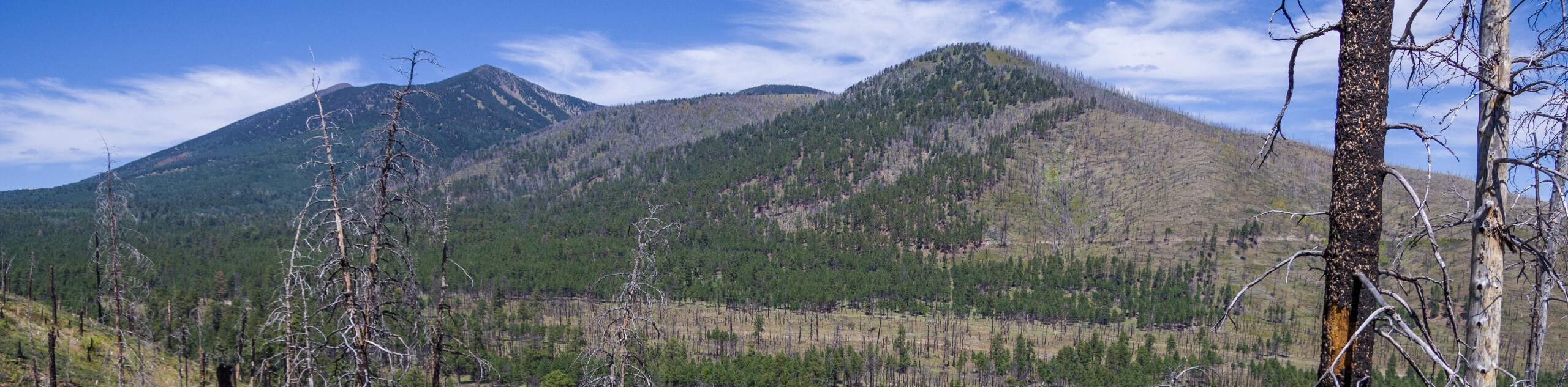
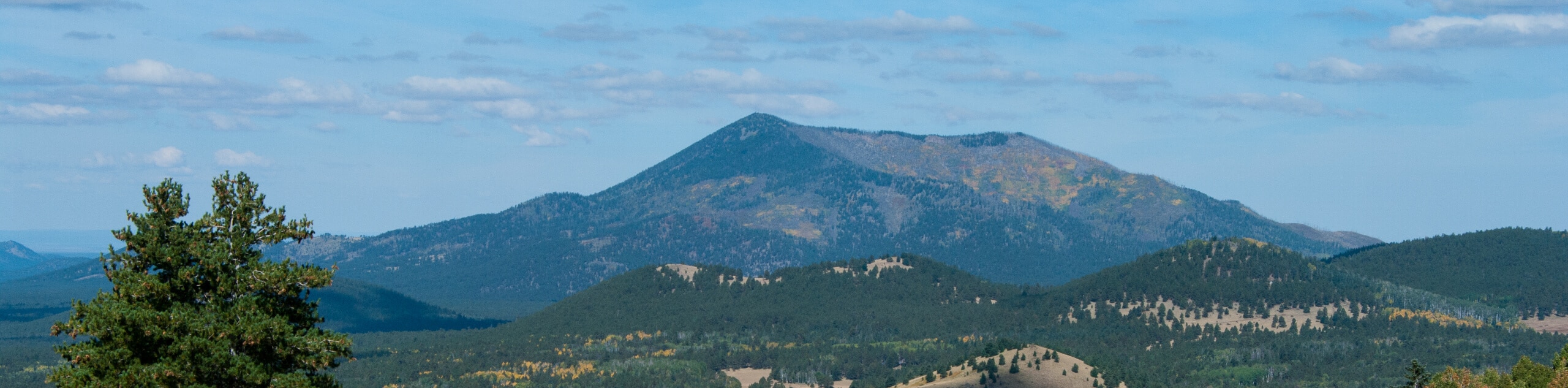
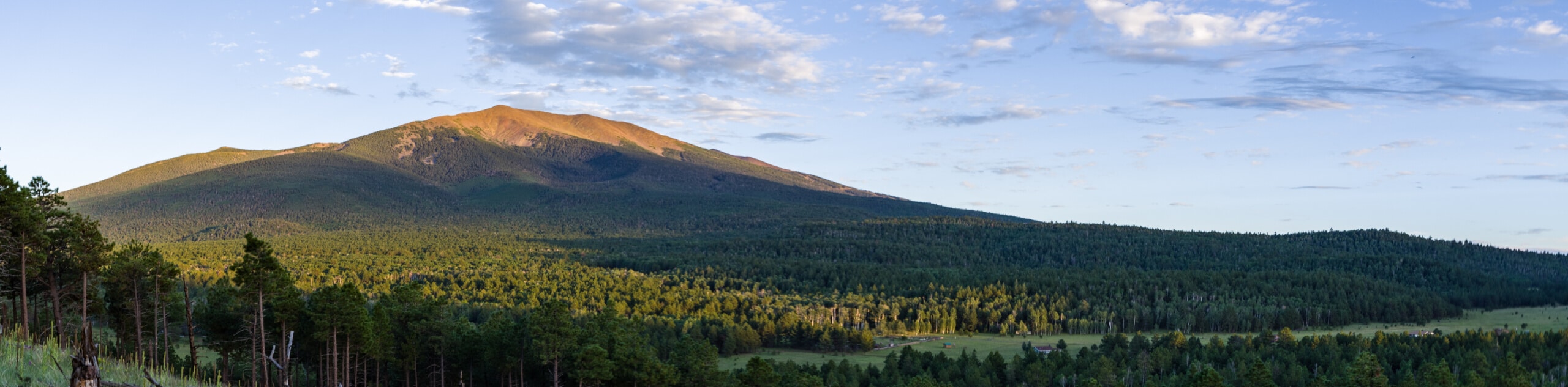
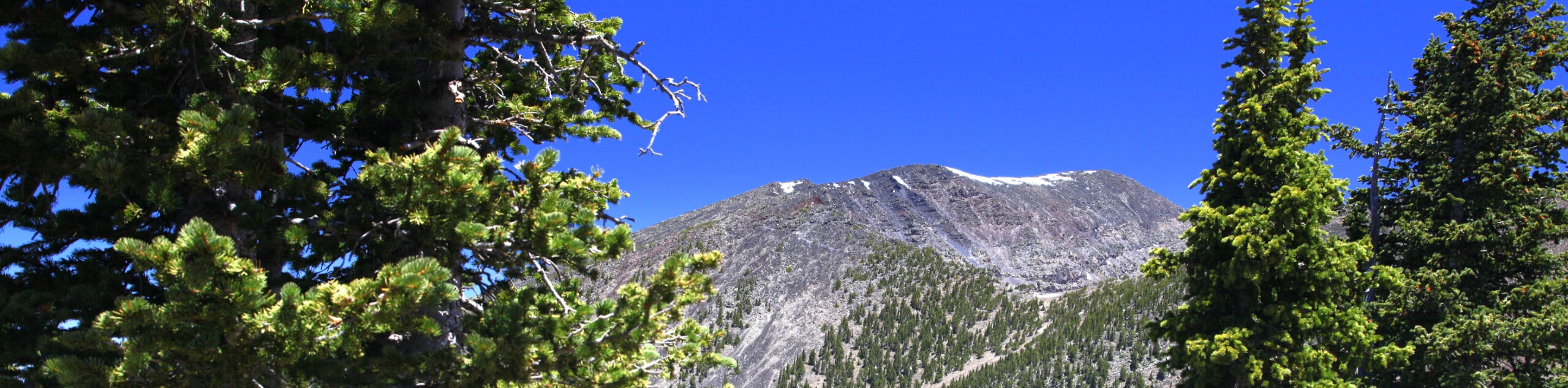
- Humphrey’s Peak - Humphrey’s Peak is on the list for many in the Arizona hiking scene, and no wonder: this is the tallest peak in the entire state, standing at 12633ft. There’s no better view of the Kachina Peaks Wilderness and its sea of mountains, and there’s no higher peak in Arizona you could be standing on. The mountain is sometimes called “Arizona’s Little Colorado” since it seems almost out of place in the state.
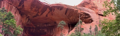
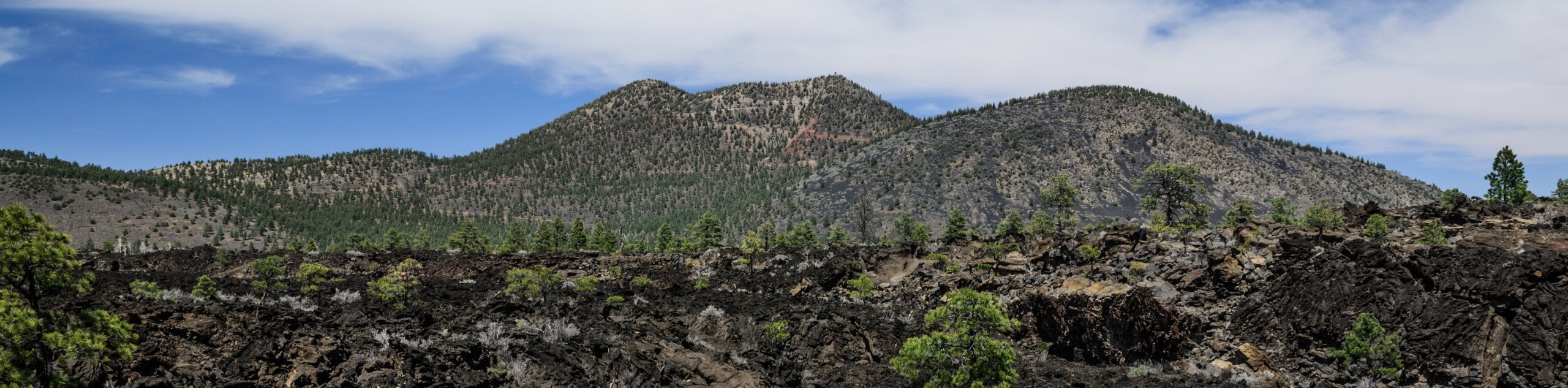
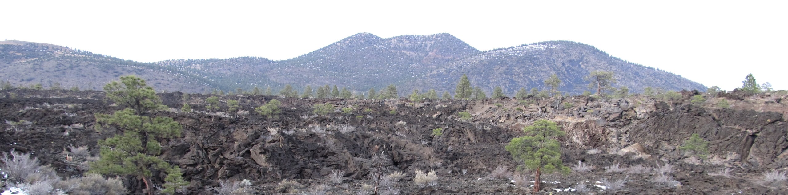
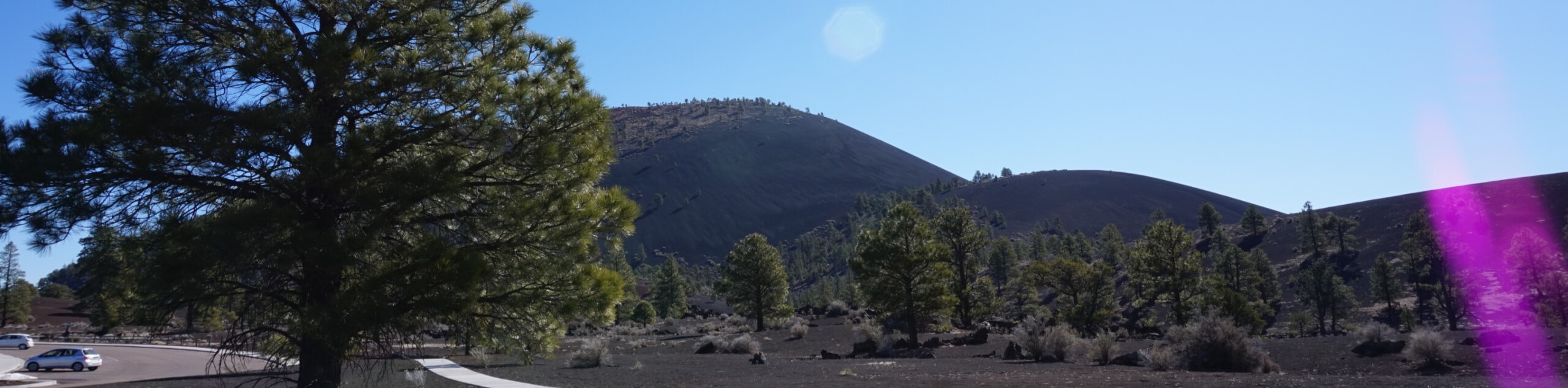
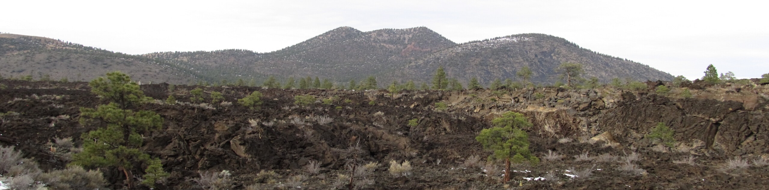
- Lava River Cave Hike - The Lava River Cave is one of the most unique and fascinating hikes in the state of Arizona. Climbing down under the earth, you’ll walk (and sometimes crouch) through an underground cave system formed by a volcanic blast over 700,000 years ago. Here, the lava flowed through the earth, with the top, sides, and bottom cooling first while the middle continued to flow, creating the river-like system that exists today.
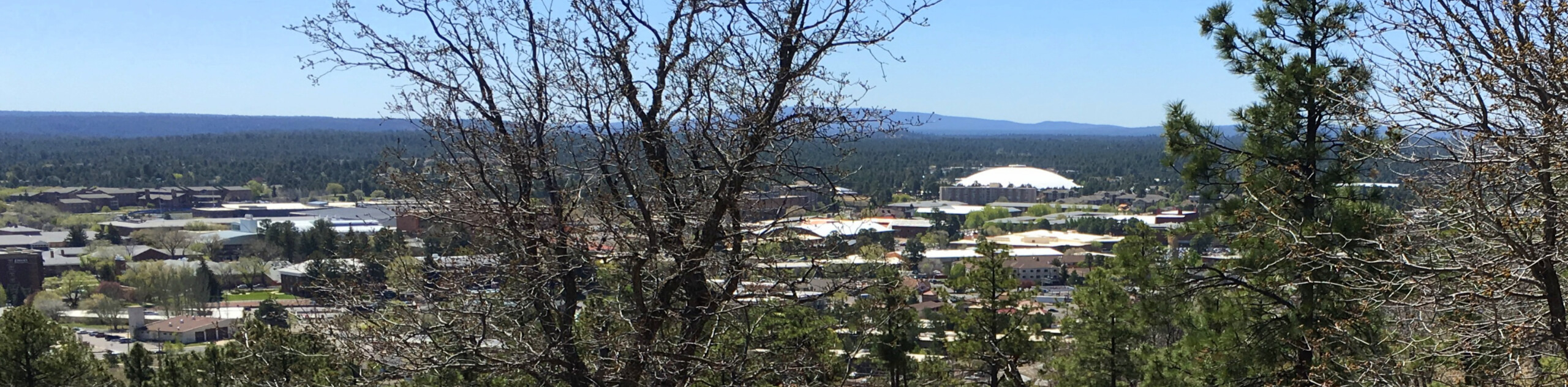
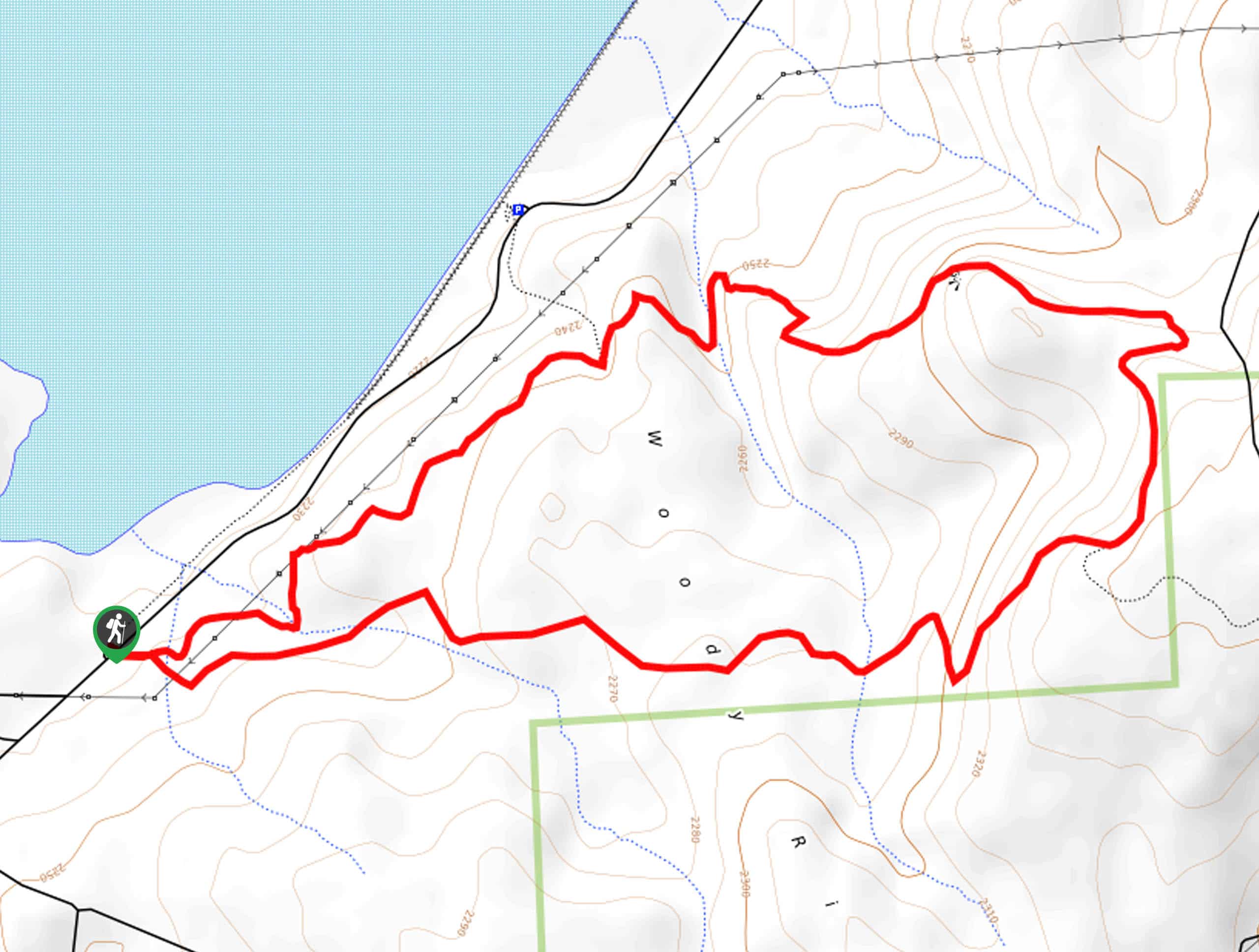
- Buffalo Park Trail - Buffalo Park Trail is one of many parks that serve the outdoorsy people of Flagstaff, but what makes this one so special? We think it’s the park’s location perched atop a mesa that makes it feel just far enough away from the city. With an imposing view of Elden Mountain, it’s a natural oasis that takes only minutes to reach from many neighborhoods in the city.
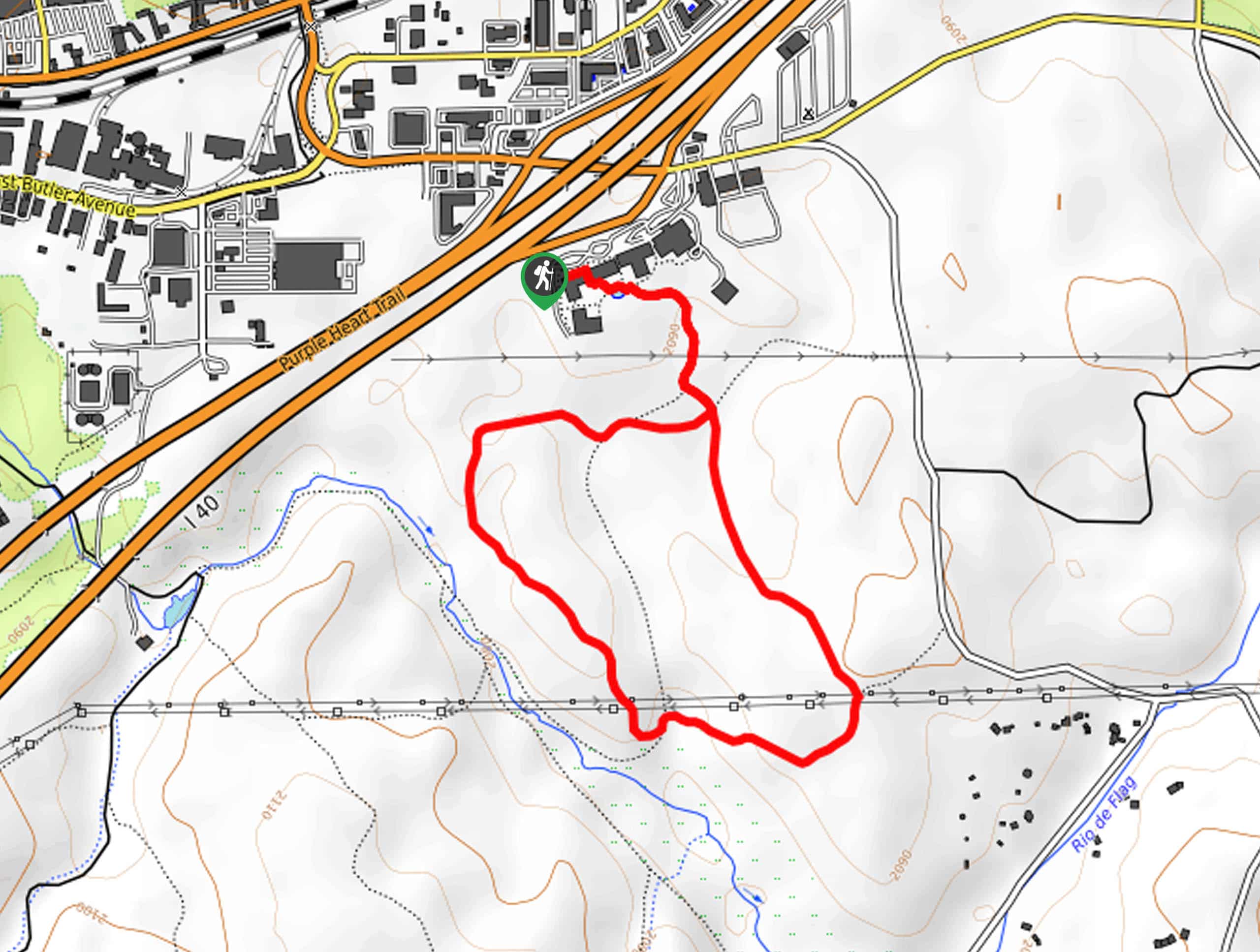
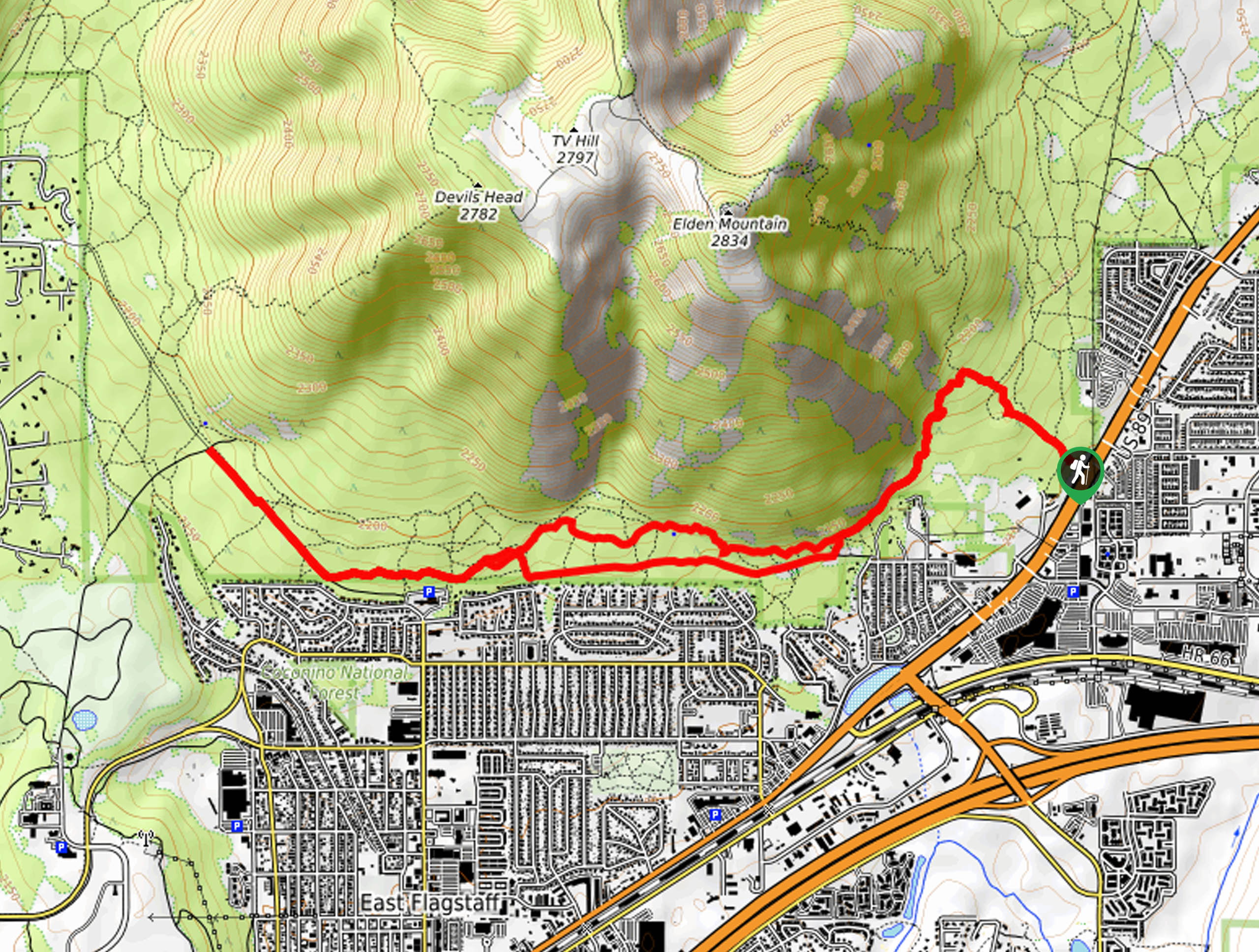
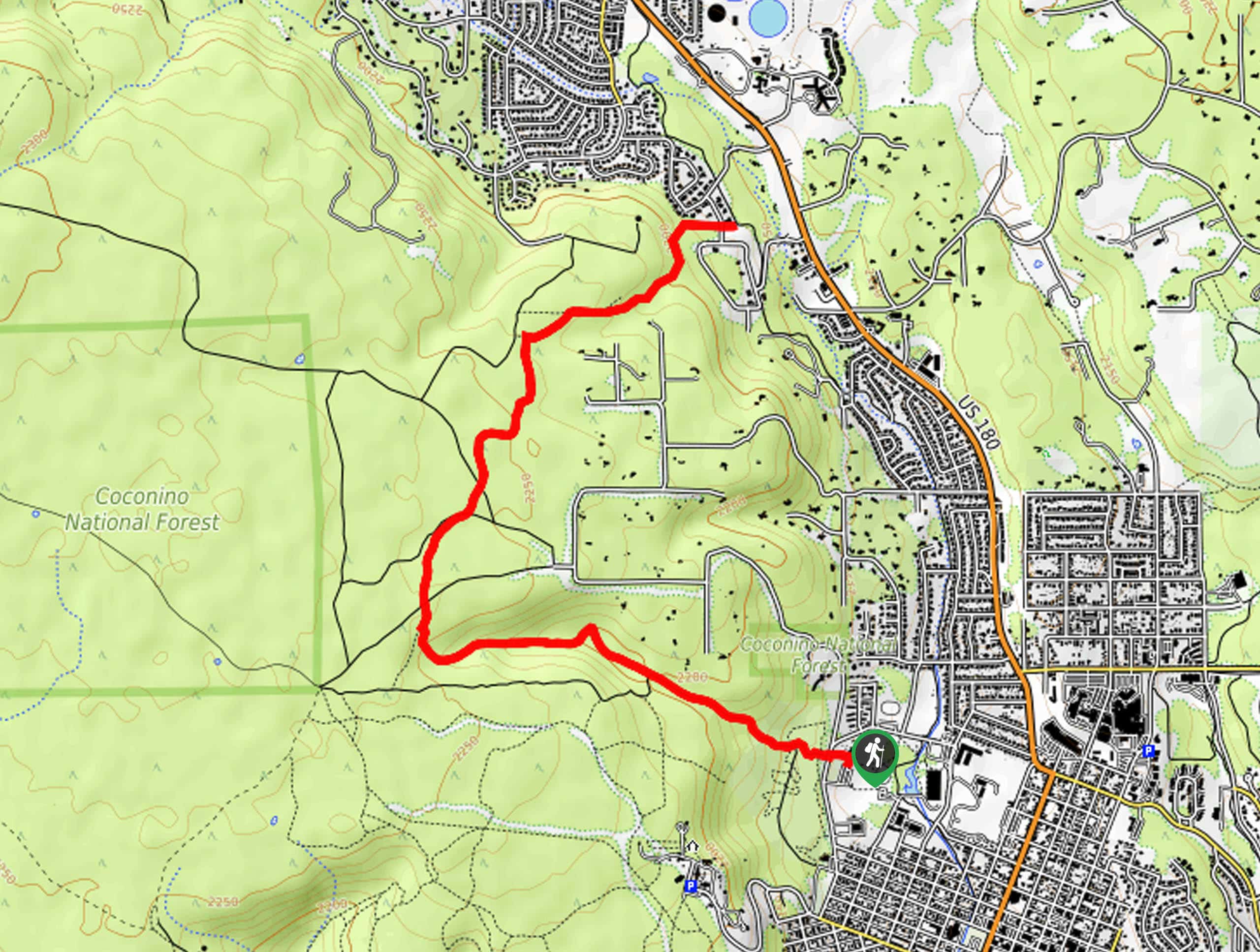
- Fatman’s Loop Trail - The Fatman's Loop Trail is a very popular hike in Flagstaff thanks to its ease of access and unique views. This loop hugs the eastern slopes of Elden Mountain, Flagstaff’s defining local peak. There are interesting rocks on this hike that give it its name: two sloping rocks that touch at the top, requiring you to shimmy through… But there’s lots of room.
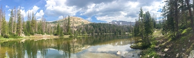
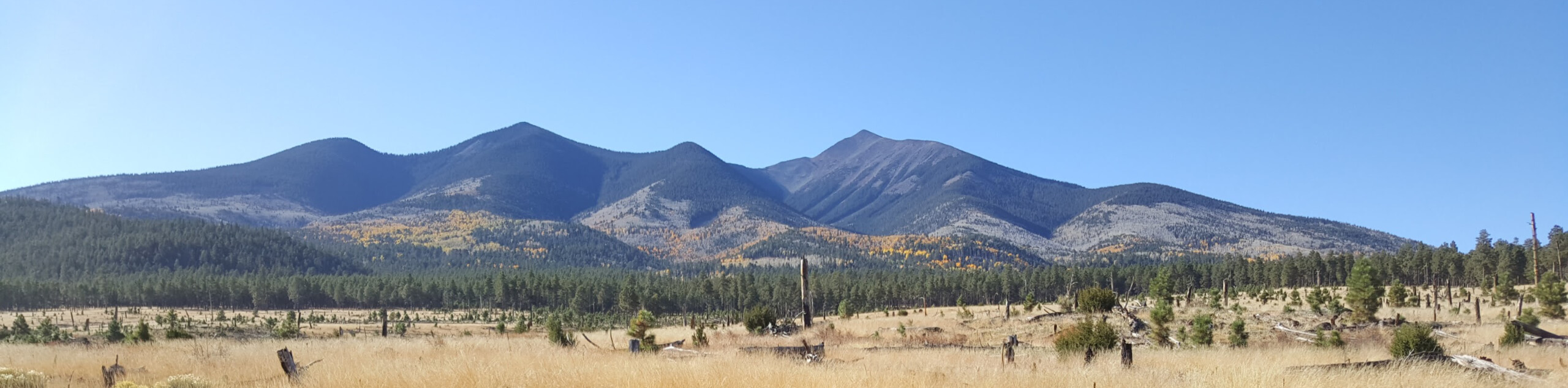
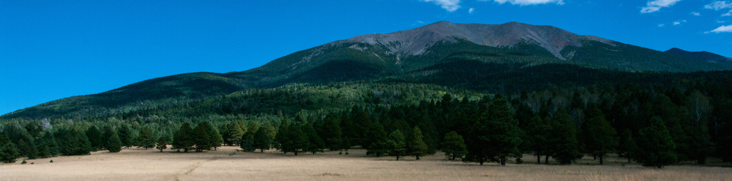
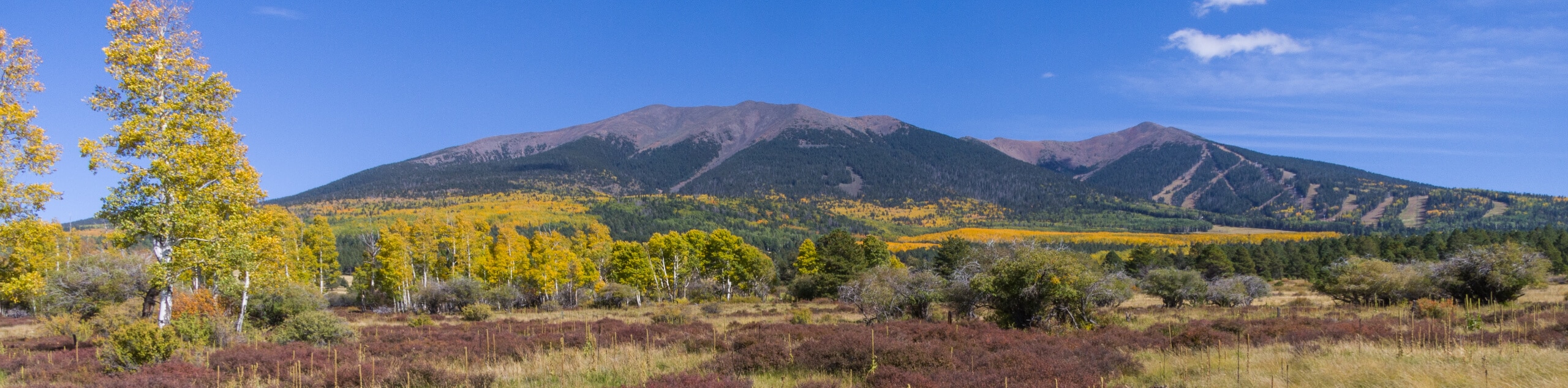
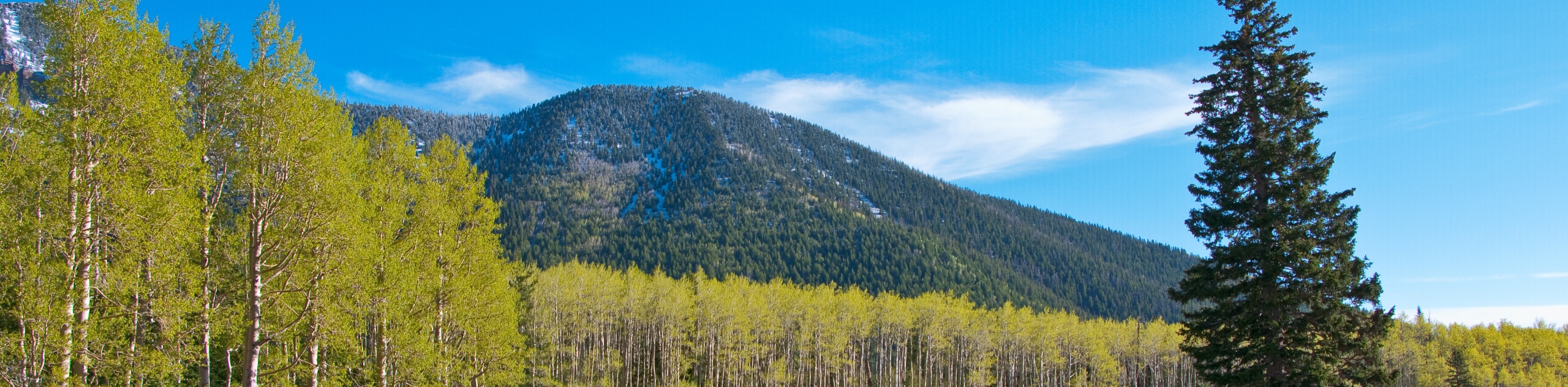
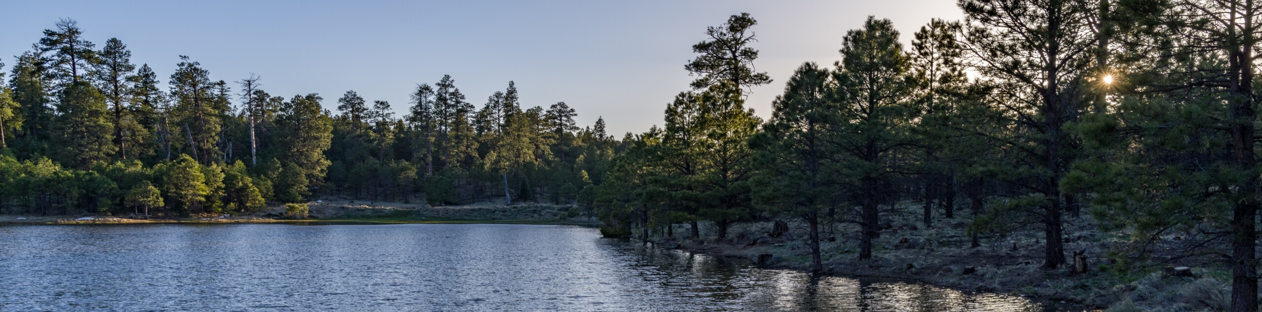
- Lockett Meadow Inner Basin Loop - For hikers and campers spending time in Lockett Meadow, the views just can’t disappoint. This basin is tucked within the San Francisco Peaks of Flagstaff, remnants of stratovolcanoes from many years past. The Inner Basin is on the eastern side of some of the highest mountains in the state (including the highest, Humphreys Peak). The aspen forest on this trail is a real gem in the fall.
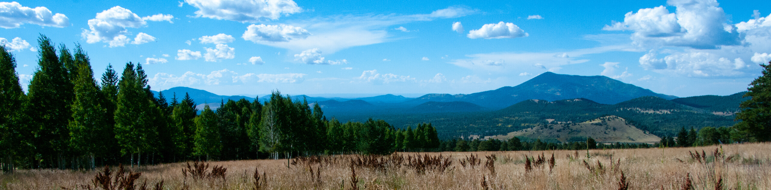
- Mars Hill Trail - Mars Hill Trail is a relaxing route in every sense of the word. This hike leads you through a pine forest, and the dappled light and sound of the wind in the trees is enough to help anyone disconnect from the day-to-day. The viewpoints aren’t as huge as other hikes nearby, but the serene nature of the trail is definitely worth adding it to your list.
- Kachina Trail #150 - The Kachina Trail is one of Flagstaff’s most popular hiking trails. It can be used as a standalone adventure or it can be used as a connector between the Humphreys Peak Trail and Weatherford Trail #102. On its own, it’s a beautiful meandering trail that hugs the southwestern flanks of some of Arizona’s tallest mountains, Agassiz Peak and Fremont Peak.
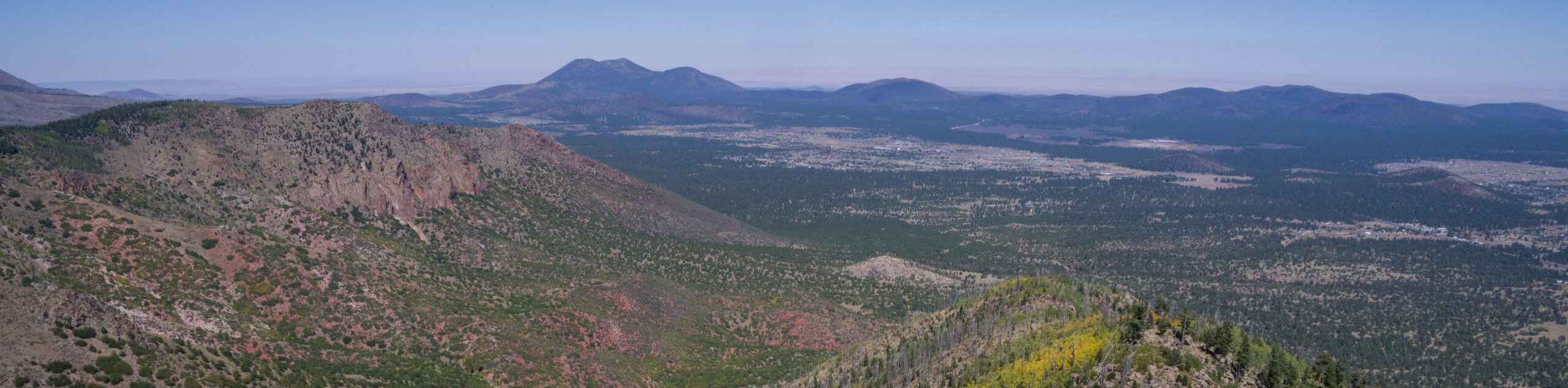
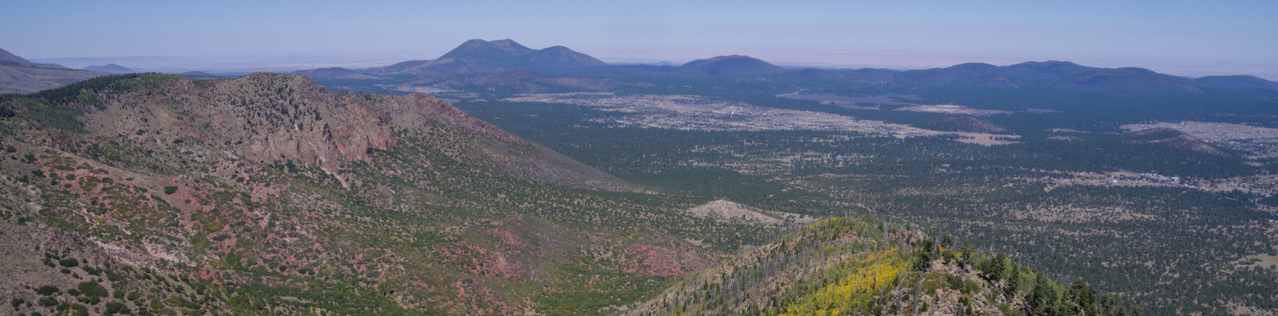
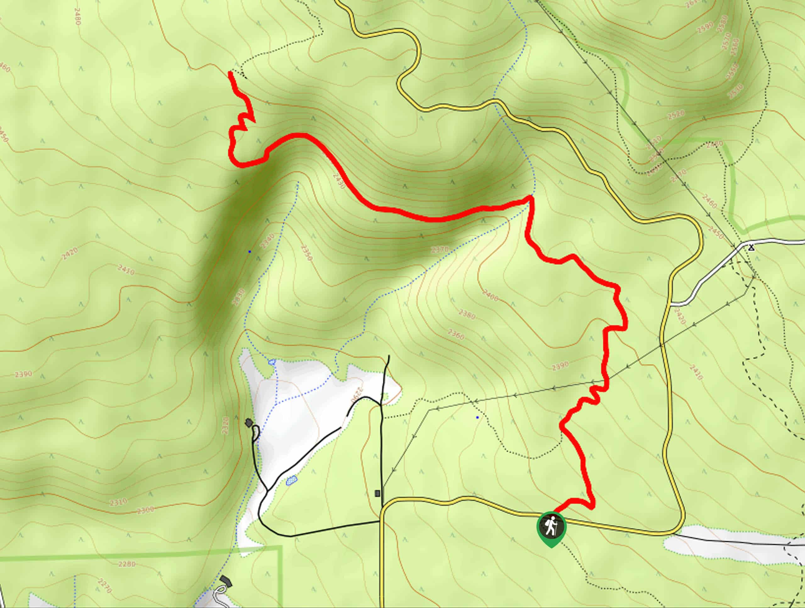
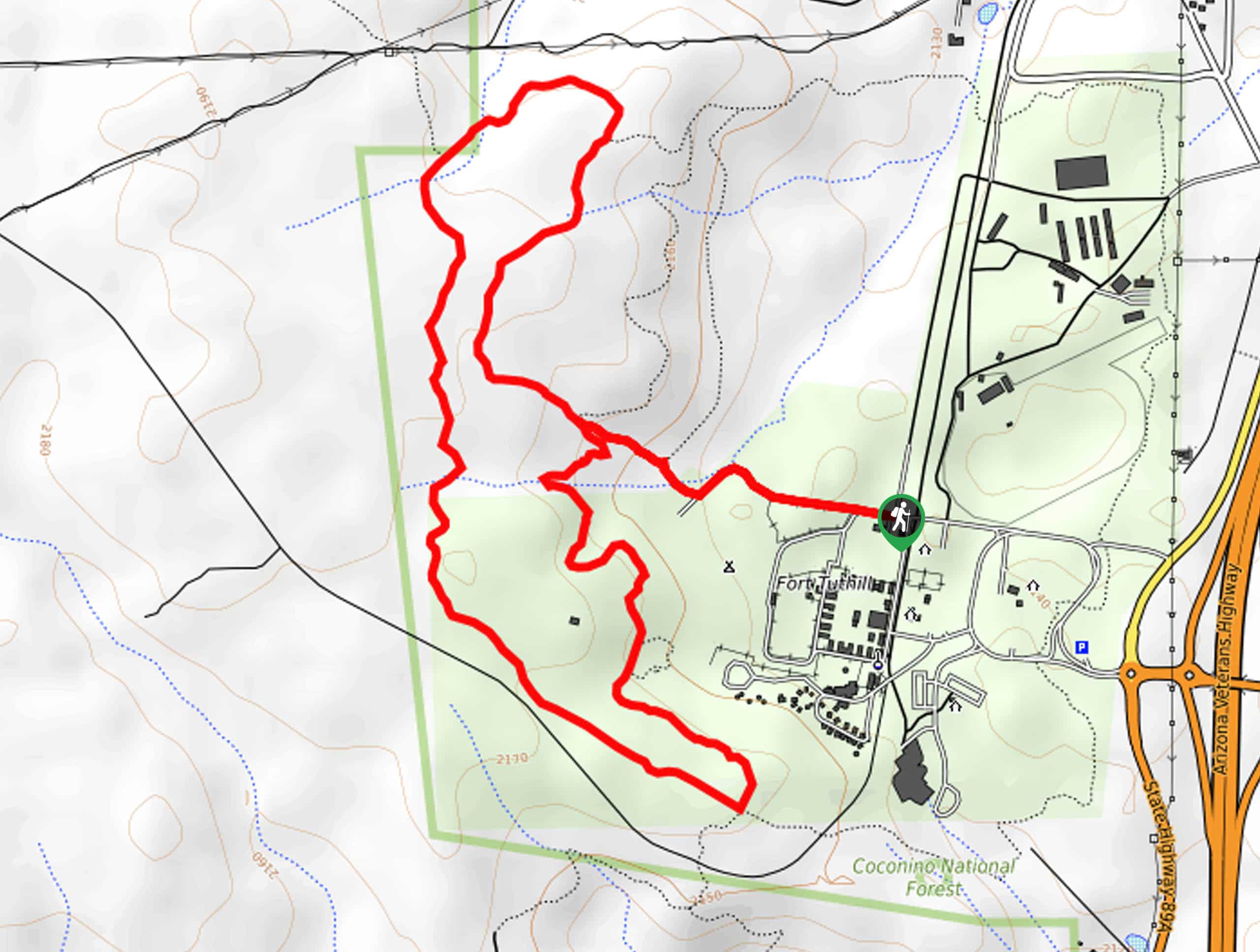
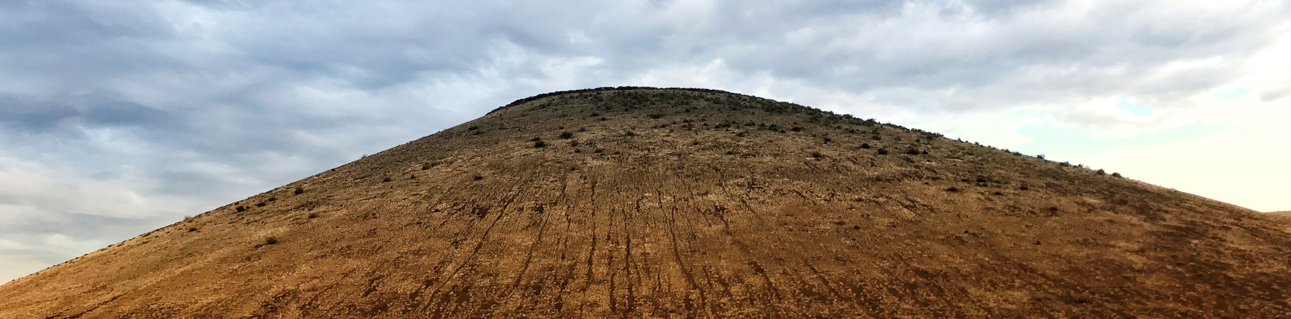
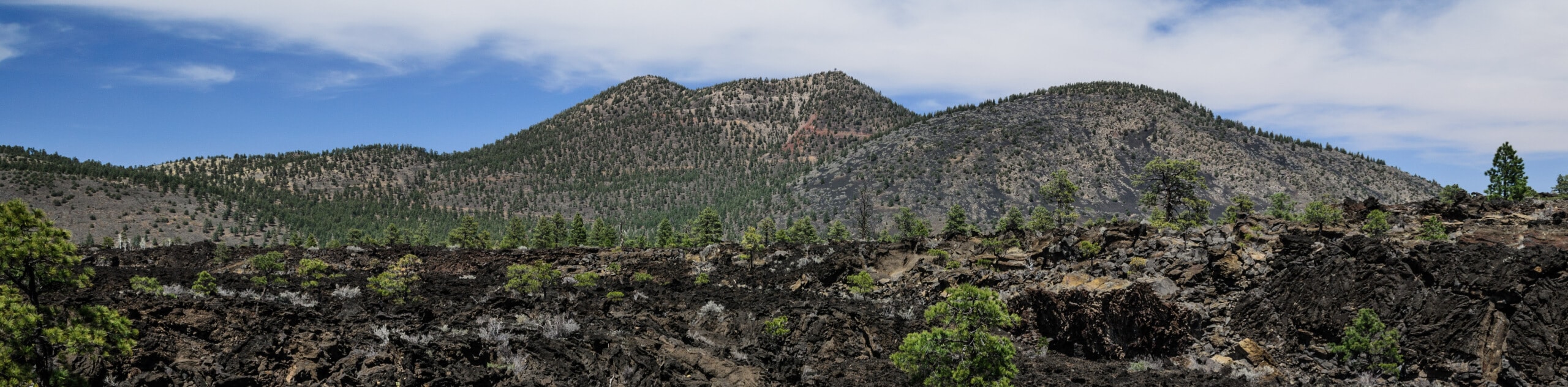
- Old Caves Crater Trail - The Old Caves Crater Trail hints at northern Arizona’s volcanic past. Around 700,000 years ago, a volcanic field in this region experienced multiple eruptions and lava flows that shaped the landscape. The San Francisco Peaks are remnants of this volcanic range, but smaller features, like this crater and its caves, are direct results of volcanic activity many years past.
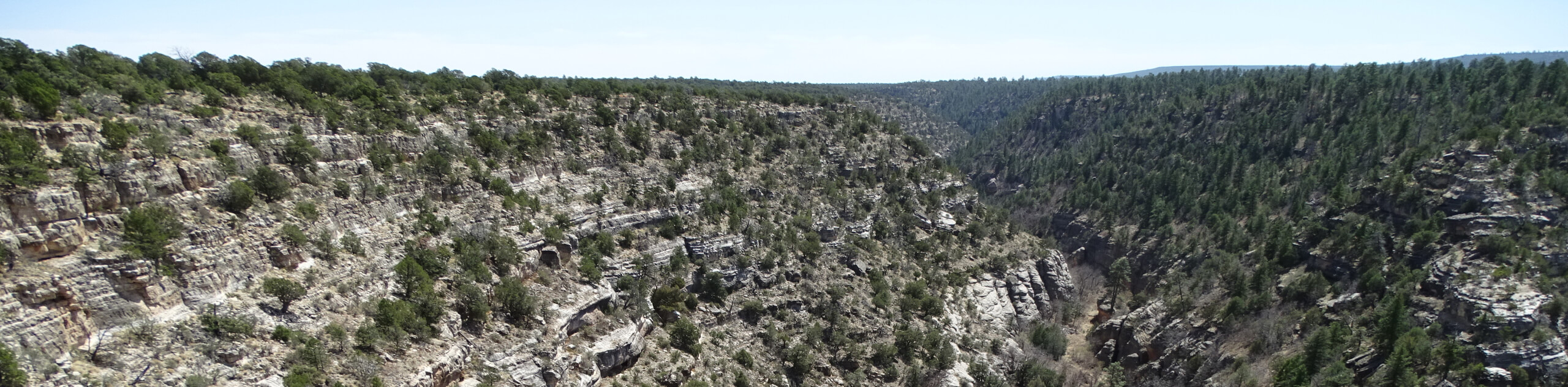
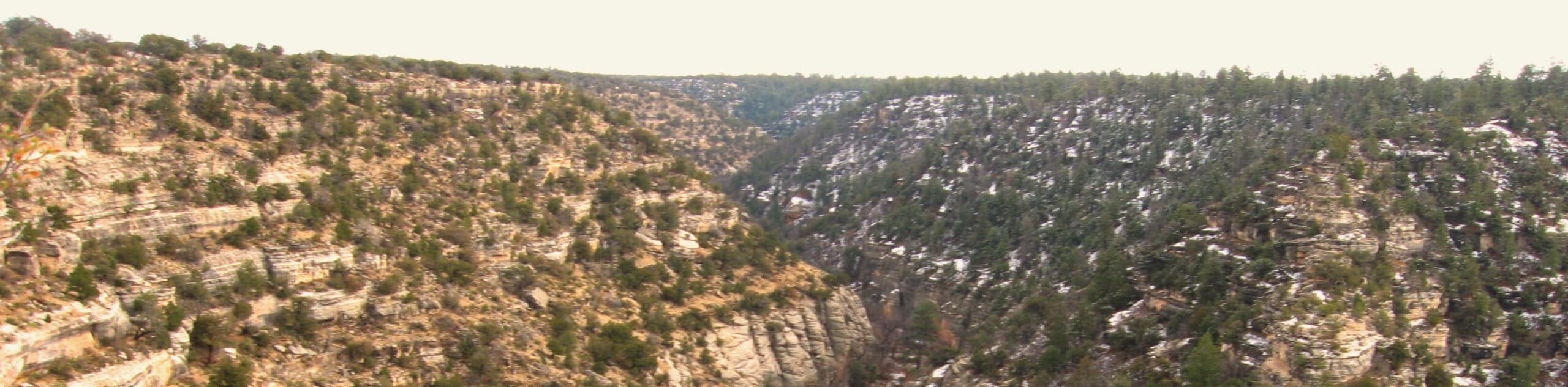
- Sandys Canyon Trail - The Sandys Canyon Trail is an interesting hike not far outside of Flagstaff in the Coconino National Forest. This hike provides a few lovely photo spots as you make your way down into Walnut Canyon. Appreciate the layers of rock visible in the canyon, which are the same layers you’d observe in the nearby Grand Canyon.
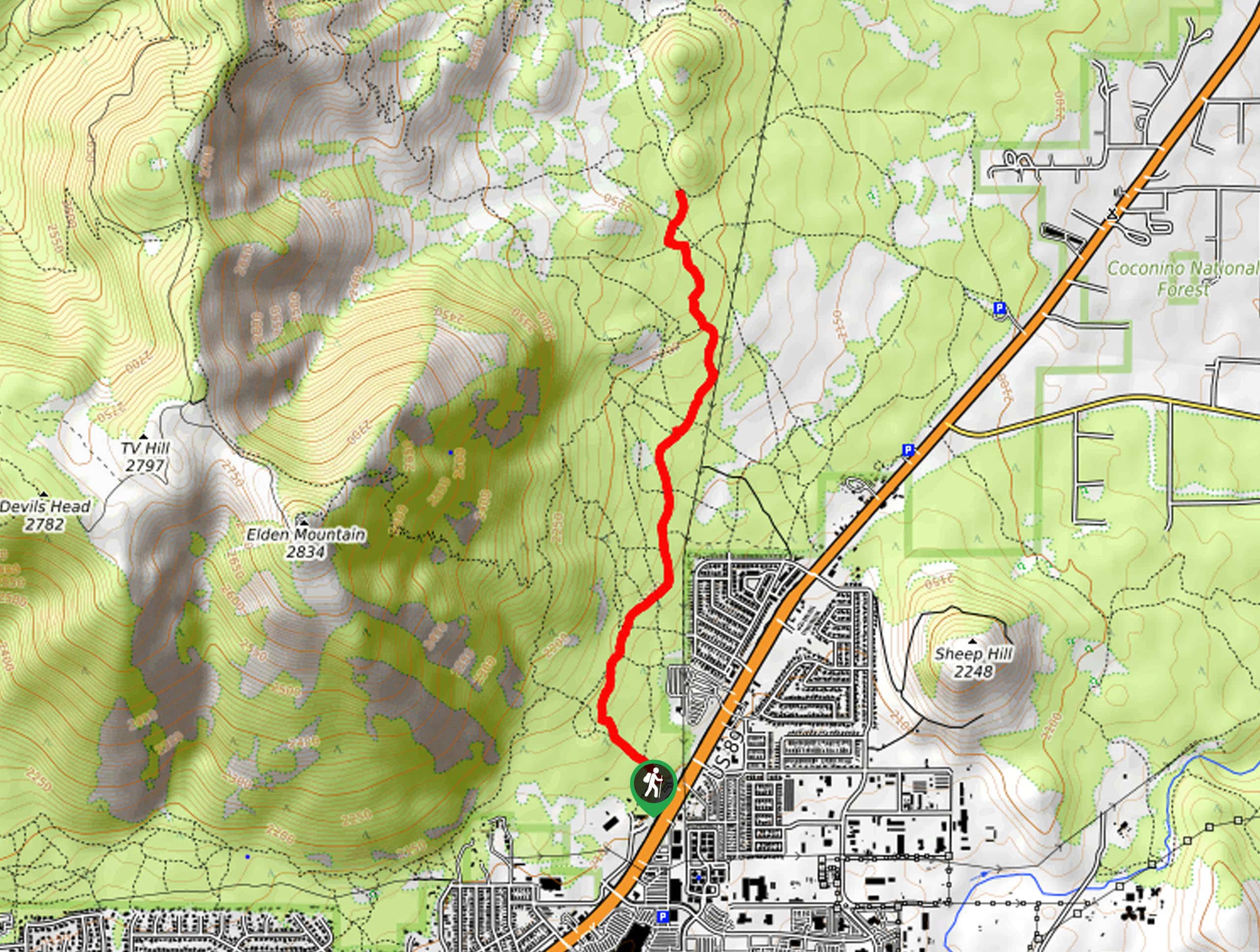
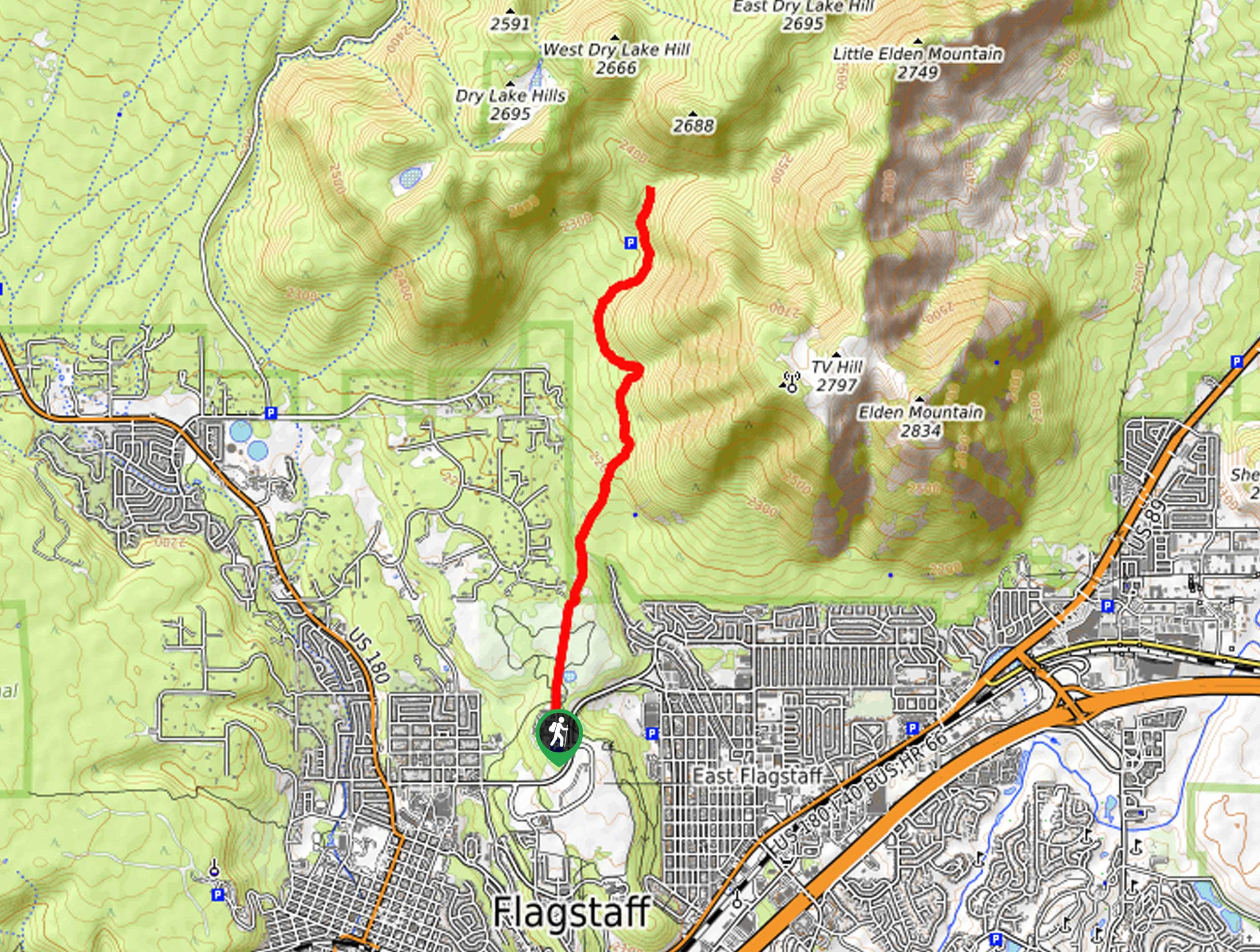
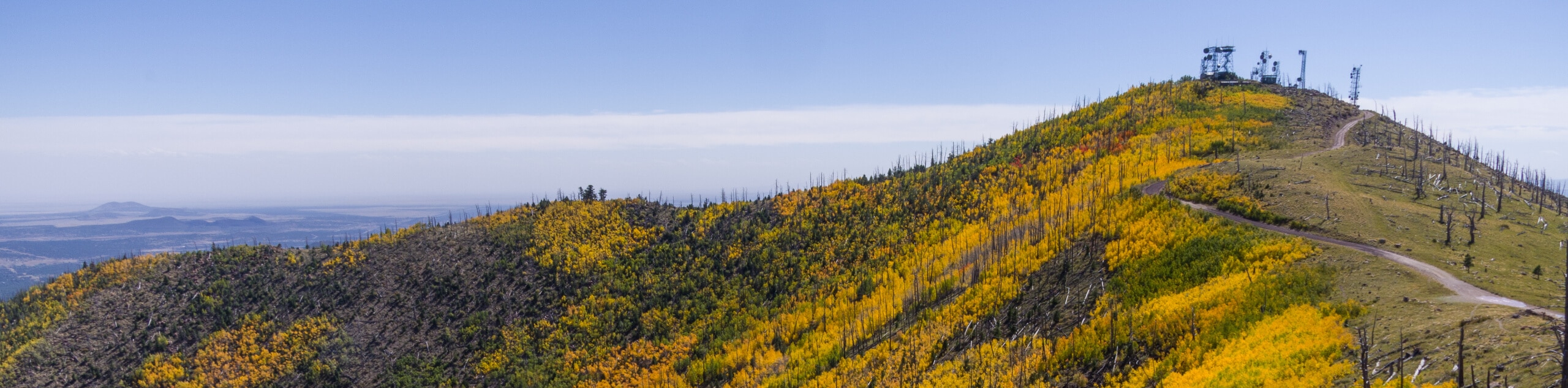
- Elden Lookout Trail - The Elden Lookout Trail is a very popular hike in Flagstaff, thanks to its ease of access and unique views. Starting right within city limits, this hard hike climbs up the eastern side of Elden Mountain, Flagstaff’s defining local peak. Earn great views of the city, mountains, and forests that surround it after a sweaty climb to the top.
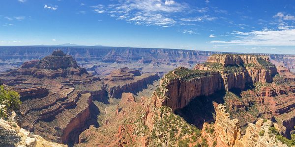
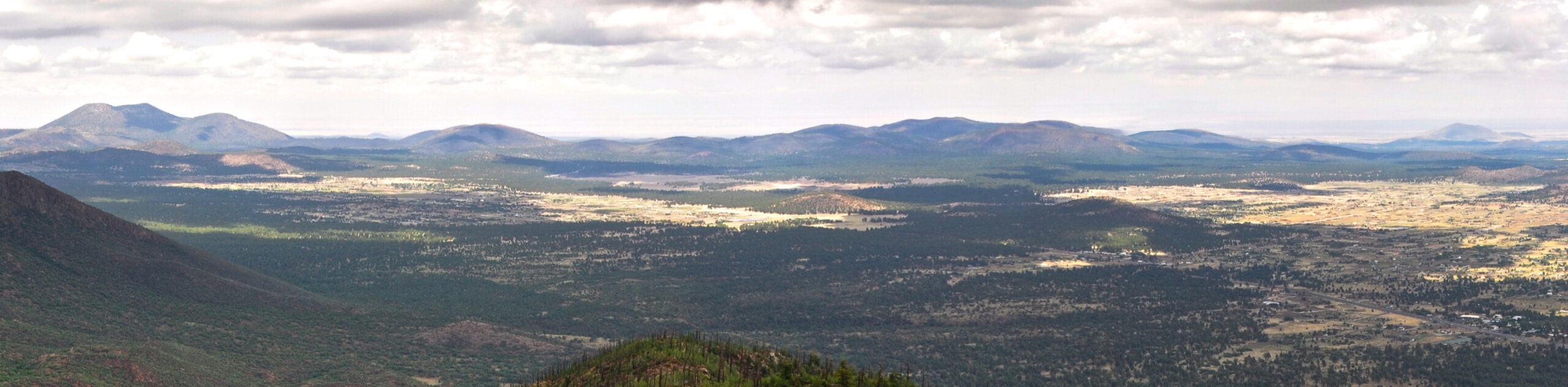
- Abineau-Bear Jaw Loop - The Abineau-Bear Jaw Loop is a fabulous hike that climbs up and through two canyons on the northern flanks of Aubineau Peak and Humphreys Peak. This route is beloved for its varied scenery. The star of the show is the Grand Canyon, which is visible from the top of the loop 70 miles away. For this view alone, we recommend trying to hike this route on a sunny, clear day so that you can see as far as possible.
- Aspen Nature Loop - The Aspen Nature Loop is a delightful hike through most seasons, but it’s very well-known as a fall hike when the forests of aspens go gold. Hikers flock to this loop in the fall, and for good reason–it’s beautiful! Speaking of the trees, some of the pine stands and bristlecones you can spot higher up on the Peaks have been living for over a thousand years!
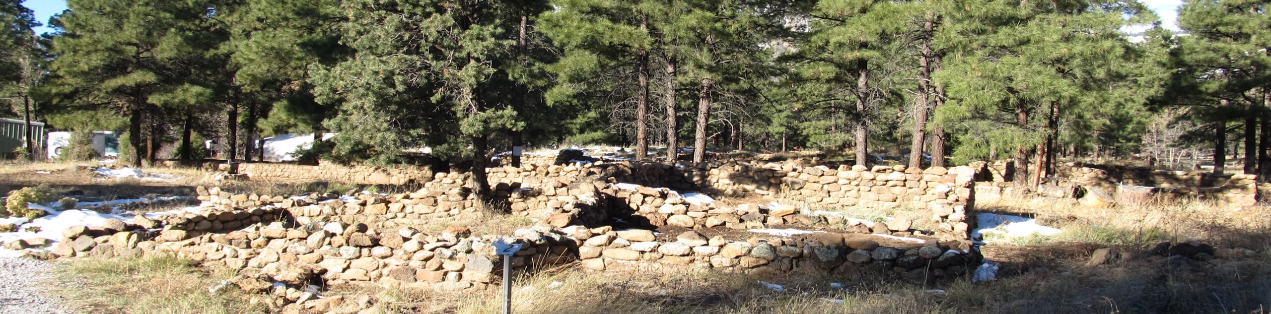
- Walnut Canyon Island Trail - Over 700 years ago, a pueblo community lived within Walnut Canyon. While the community is long gone, their structures still partially stand. Peer into the rooms of their dwellings as you explore this short, interesting historic trail. This is an ideal trail if you want to connect with Native history in Flagstaff.
- Sunset Trail - The Sunset Trail leads you up and across some of the most visible mountains in Flagstaff’s skyline, heading up Little Elden Mountain to the top of T-V Hill, next to Elden Mountain’s summit lookout. This route is used by hikers, trail runners, and mountain bikers, and is enjoyed for its lovely views, especially when the fall colors start to paint the mountainsides.
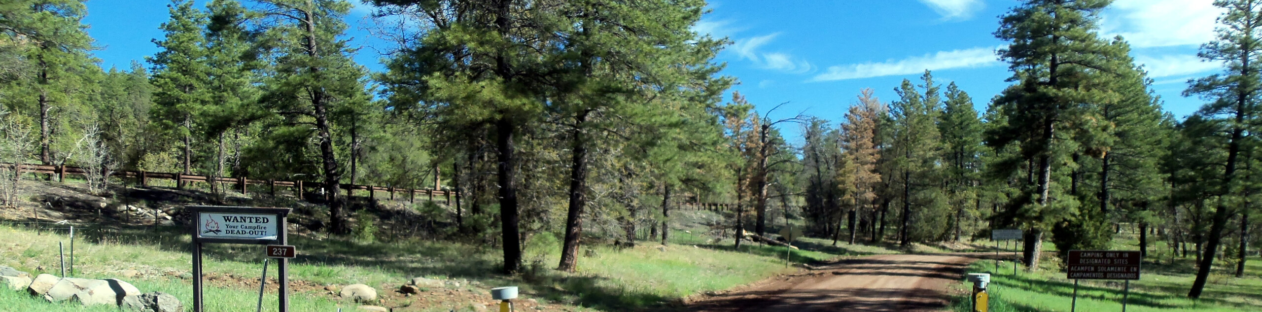
- Tunnel Spring Hike - Some hikes are just made for quiet mornings, and Tunnel Spring is one of them. This is a relaxing route through the forest that leads you to the top of Observatory Mesa. With a calm forest and a route that can be customized with added length, this is a great, relaxing hike.
Scroll down to see the full list of hiking trails in Flagstaff.
When is the Best Time to Hike in Flagstaff
Flagstaff experiences very different weather than what you’d expect from Arizona. Throw your ideas of scorching summers and warm January hikes out the window–we’re playing by different rules here!
Flagstaff has four distinct seasons: a cool spring, a warm summer, a pleasant fall, and a snowy winter. The hiking season normally runs from March through November, but some trails will be accessible year-round and some will become snowed in.
We love hiking in this area between May and mid-October. Spring and summer bring wildflowers and the fall colors in Flagstaff are excellent. Keep in mind that Arizona experiences summer monsoons, which are heavy, brief rainstorms that can bring lightning and flash flooding. Monsoons tend to come in the afternoons, so getting early starts on your hikes is wise.
Other Outdoor Activities in Flagstaff
While the trails are excellent, hiking is certainly not the only way to explore Flagstaff! This region boasts plenty of space for other outdoor activities.
Adventurers on two wheels can take advantage of the many mountain bike trails. Those with four-legged friends can explore horse and dog-friendly trails. Campers can set up their tents in sites near the city, and birders and animal lovers will be spoiled with the fascinating variety of species that call the desert home.
How to Plan a Trip to Flagstaff
Planning a trip to Flagstaff is pleasantly less high-pressure than planning trips to some of Arizona’s other outdoor destinations. You won’t find long lines of cars vying for trailhead parking here, nor will you be strapped for places to stay.
Flagstaff has a good selection of accommodation options, from hotels in each corner of the city to short and long-term vacation rentals. If you’re wanting to prioritize hiking, we suggest staying in the northern or northeastern parts of the city to have easy access to the Dry Lake Hills and Kachina Peaks Wilderness.
Renting a car will make getting around the city as easy as possible, especially since Flagstaff lacks a well-developed transit system. Trailhead parking is normally easy to find, save for the busiest weekends. You may wish to rent a high-clearance vehicle since some of the forest roads that lead to the trailheads are rough.
Some of the parks and recreation areas near Flagstaff charge modest day-use fees, but many of the routes are free to hike. Check in with each area you want to hike in to plan ahead for possible fees.
Arizona Adventure Tours
Some of us love trip planning and some of us just… don’t. Take the stress out of your trip with an expert-planned adventure tour, letting you let go and focus on the fun stuff. Check out some incredible adventure tours in Arizona.
Frequently Asked Questions About Flagstaff
What is Flagstaff known for?
Walnut Canyon, the Arizona Snow Bowl, Grand Falls, Sunset Crater… Flagstaff is known for its incredible landscapes. From volcanoes to canyons, it’s an adventurer’s dream. Flagstaff is also known for very low light pollution (stargazing, anyone?), and its Western culture.
Does Flagstaff get snow?
Oh, yes. Flagstaff averages over 100 inches of snow each year.
What is the population of Flagstaff?
As of 2021, the population of Flagstaff was just under 80,000.
Does it get really hot in Flagstaff?
Flagstaff’s summers are warm but not nearly as scorching hot as the rest of the state. Expect average highs in the 80-88°F range.
Explore other great hiking regions in the United States
Or check out our full range of tour destinations in the United States.
Read MoreThe best hikes in Flagstaff
01. Humphreys Peak Hike
Difficulty
Humphreys Peak is one to put on the top of your Arizona hiking bucket list,… Read More

02. Lava River Cave Hike
Difficulty
Over 700,000 years ago, the Lava River Caves in Flagstaff were formed when molten rock… Read More
03. Buffalo Park Trail
Difficulty
Buffalo Park might just be one of the prettiest parks in all of Arizona, and… Read More
04. Fatman's Loop Trail
Difficulty
Fatman’s Loop Trail is one of Flagstaff’s most popular trails. This moderate 2.4mi… Read More
05. Lockett Meadow Inner Basin Loop
Difficulty
The Lockett Meadow Inner Basin Loop leads you through a gorgeous basin in the Kachina… Read More

06. Inner Basin Trail
Difficulty
The Lockett Meadow Inner Basin is one of the top hikes near Flagstaff. The Inner… Read More
07. Kachina Trail #150
Difficulty
In the Kachina Peaks Wilderness, the Kachina Trail #150 links Humphreys Peak Trail and Weatherford… Read More
08. Old Caves Crater Trail
Difficulty
The Old Caves Crater Trail is a fascinating hike that reveals a small piece of… Read More
09. Sandys Canyon Trail
Difficulty
Sandys Canyon Trail is an interesting hike just outside of Flagstaff that makes for a… Read More
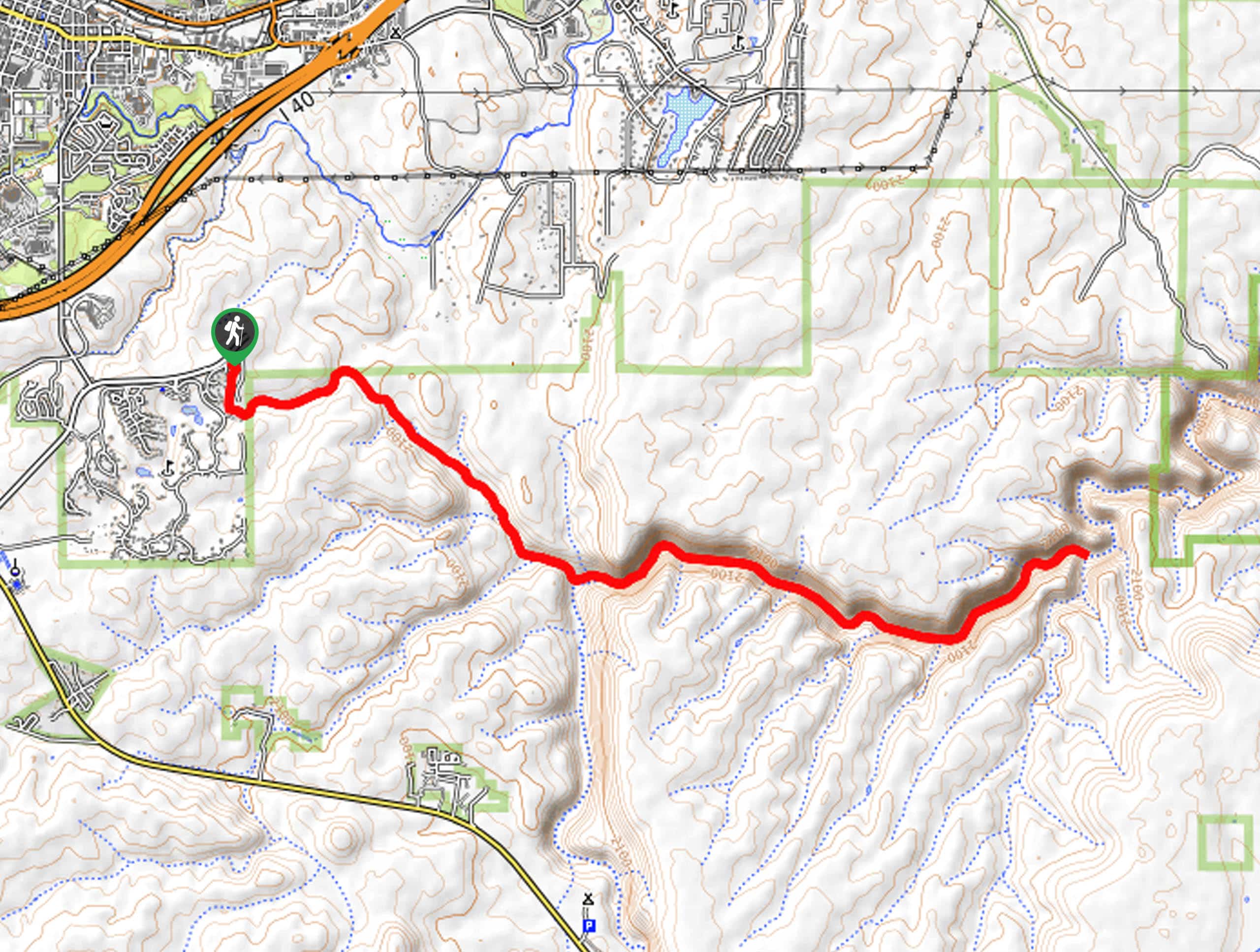
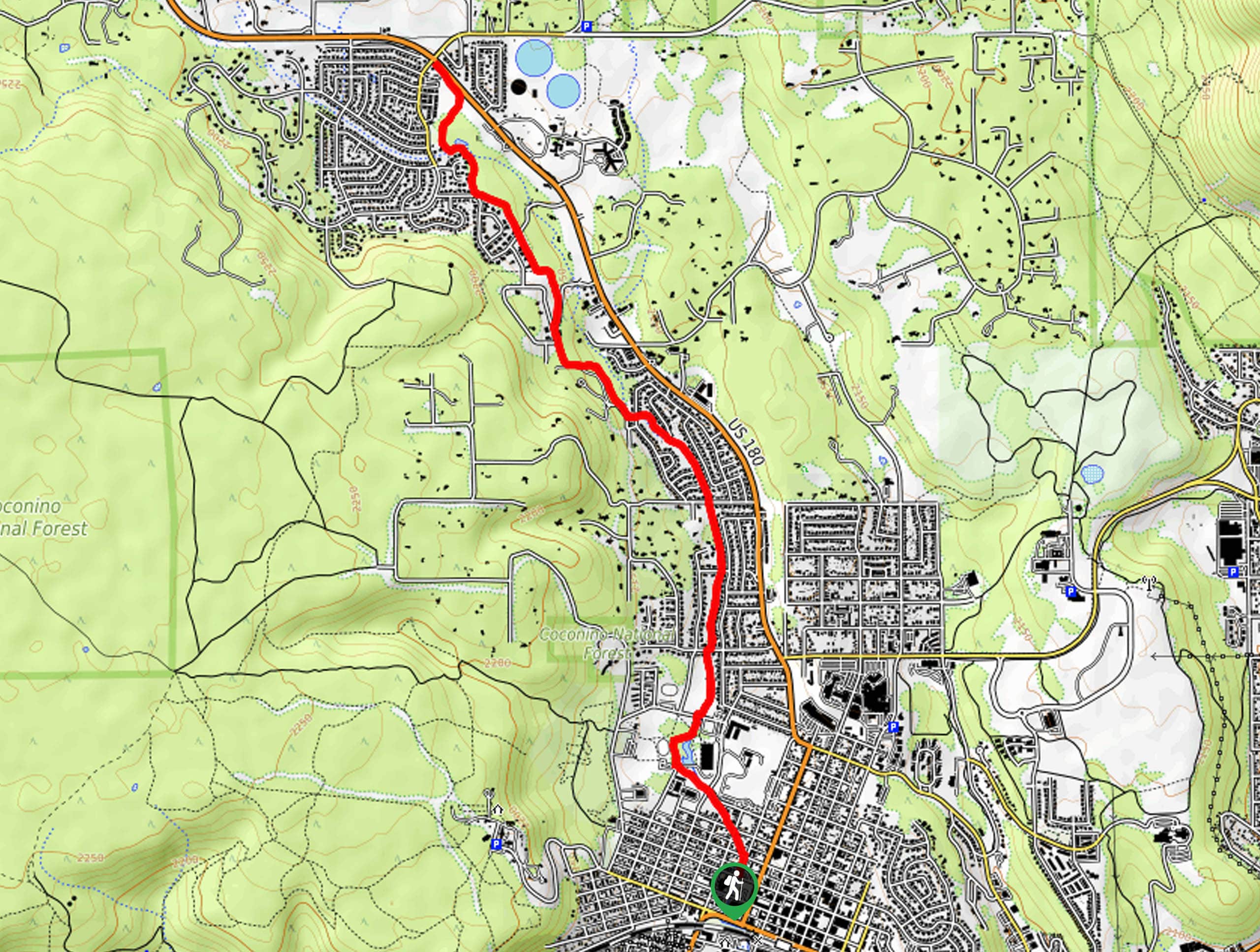
10. Elden Lookout Trail
Difficulty
The Elden Lookout Trail is a hard hike near Flagstaff that leads you up Elden… Read More
Yes, there are more than 10
Flagstaff is so beautiful that we can not give you only 10 hikes. So here is a list of bonus hikes in Flagstaff that you should take a look at as well
11. Abineau-Bear Jaw Loop
Difficulty
The Abineau-Bear Jaw Loop is a hard hike near Flagstaff that is popular for its… Read More
12. Aspen Nature Loop
Difficulty
The Aspen Nature Loop (sometimes also called the Aspen Loop or Aspen Nature Lollipop is… Read More
13. Walnut Canyon Island Trail
Difficulty
Over 700 years ago, a pueblo community lived within Walnut Canyon. While the community is… Read More
14. Sunset Trail
Difficulty
The Sunset Trail leads you up and across some of the most visible mountains in… Read More
15. Tunnel Spring Hike
Difficulty
Some hikes are just made for quiet mornings, and Tunnel Spring is one of them.… Read More
16. Walnut Meadows Loop
Difficulty
Take advantage of the picturesque Walnut Canyon area on the Walnut Meadows Loop, an easy… Read More
17. Pumphouse Wash Hike
Difficulty
If you’ve found yourself in Kachina Village, take a stroll to Raymond Park, where you… Read More
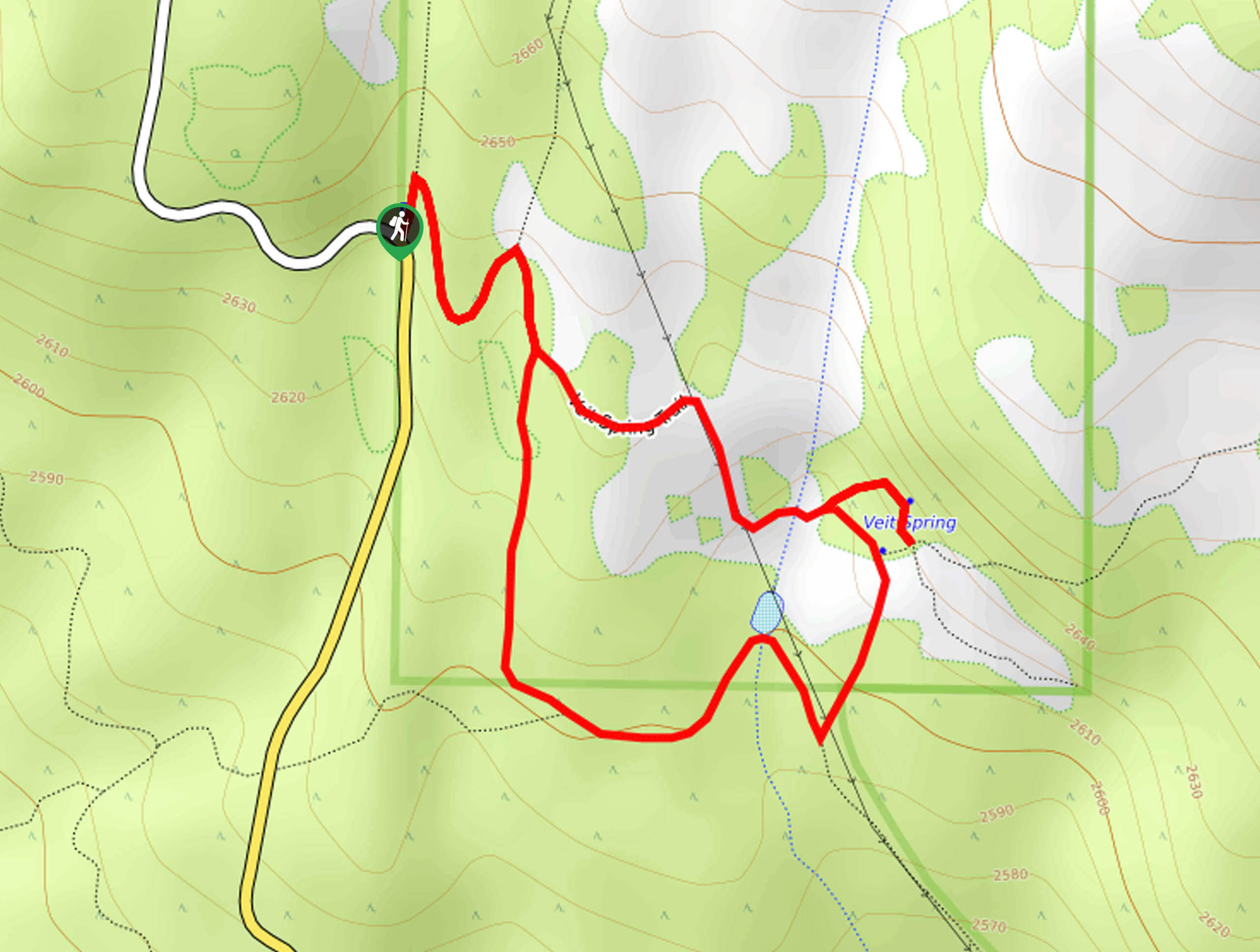
18. Veit Springs Trail
Difficulty
The Veit Springs Trail is a short, easy hike near Flagstaff that we love for… Read More
19. Pumpkin Trail to Bulls Basin Loop
Difficulty
The Pumpkin Trail to Bulls Basin Loop is a 12.3mi hard hike that… Read More
20. Woody Mountain via Rogers Lake Trail
Difficulty
Woody Mountain via Rogers Lake Trail is a moderate hike southwest of Flagstaff. This route… Read More
21. Sinclair Wash Trail
Difficulty
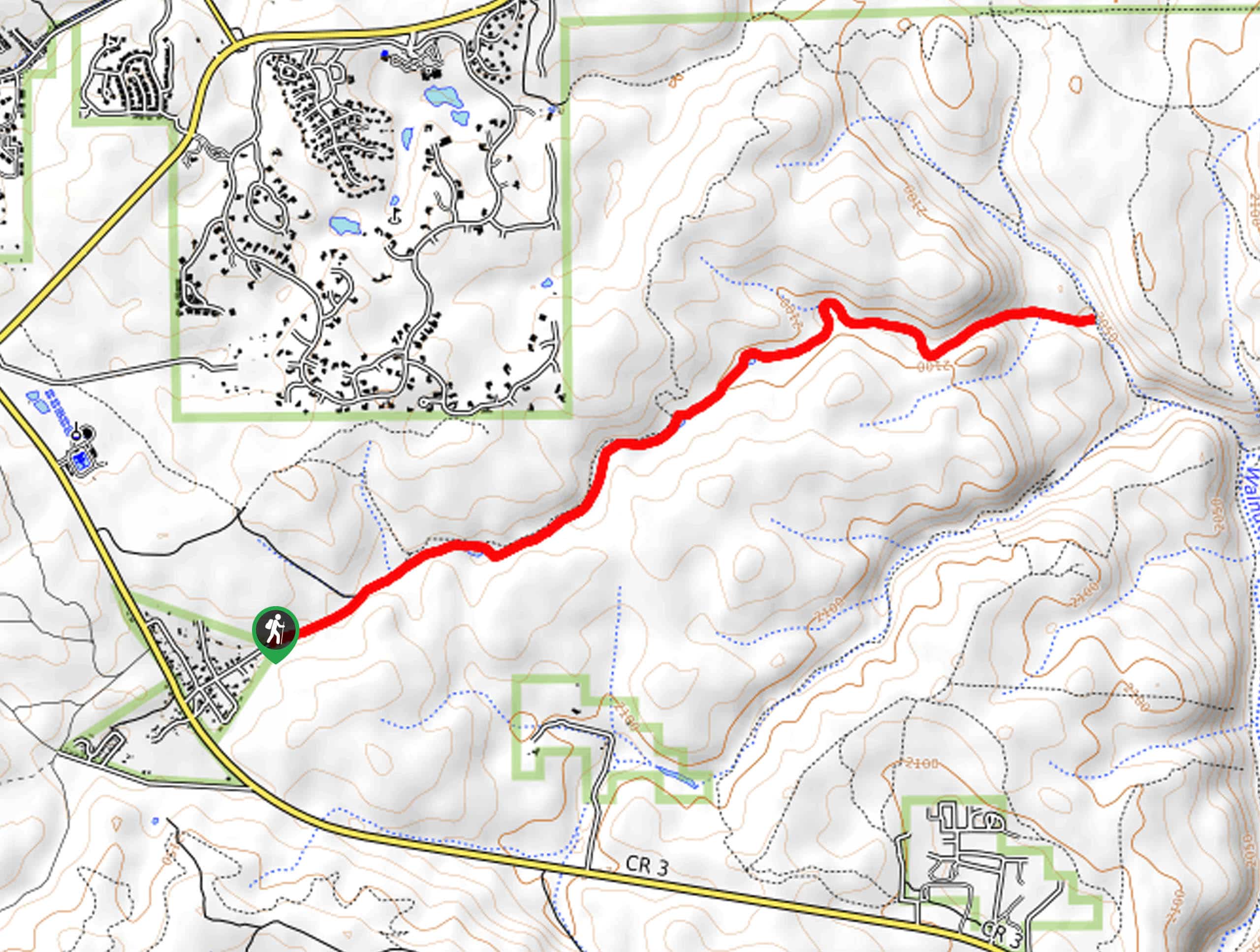
The Sinclair Wash Trail is a scenic, easy multi-use trail that begins in Flagstaff, travels… Read More
22. Bismarck Lake Trail
Difficulty
The Bismarck Lake Trail is a beautiful adventure in the Coconino National Forest north of… Read More
23. Mars Hill Loop
Difficulty
The Mars Hill Loop is a hike is easy to reach for Flagstaff locals and… Read More
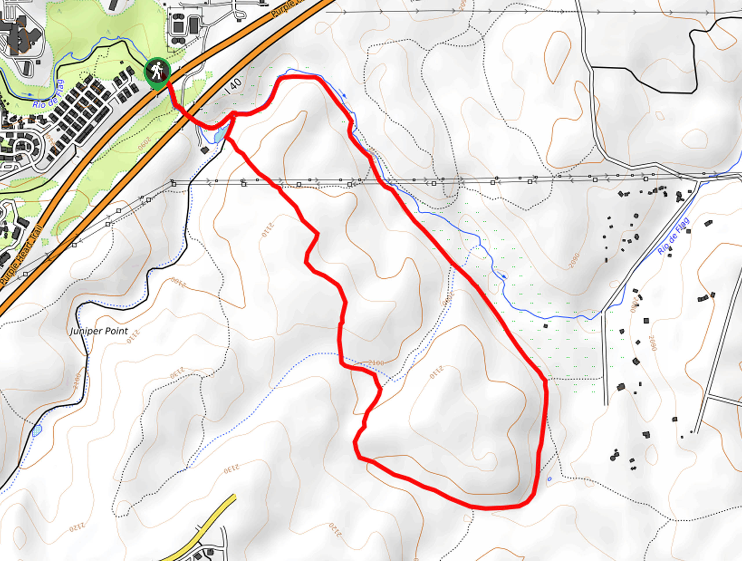
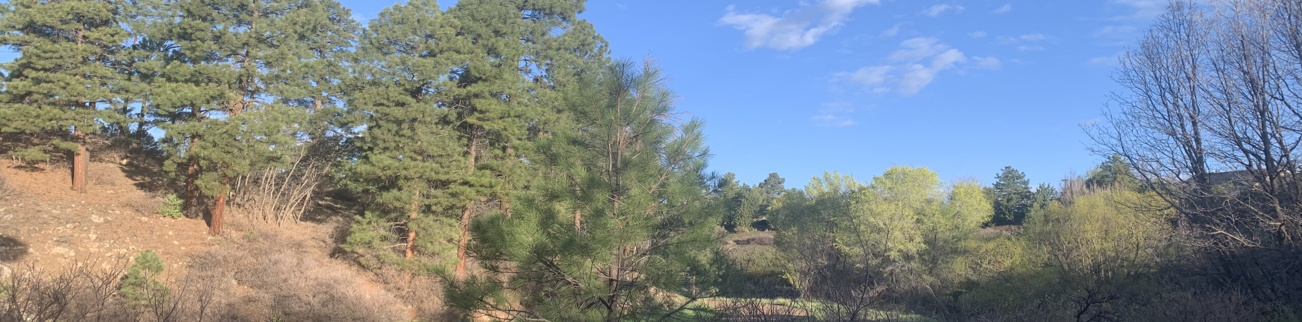
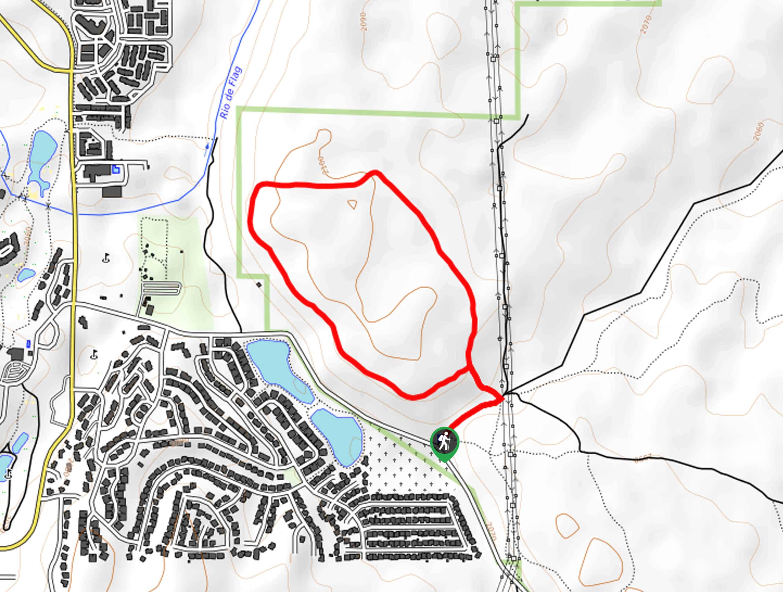
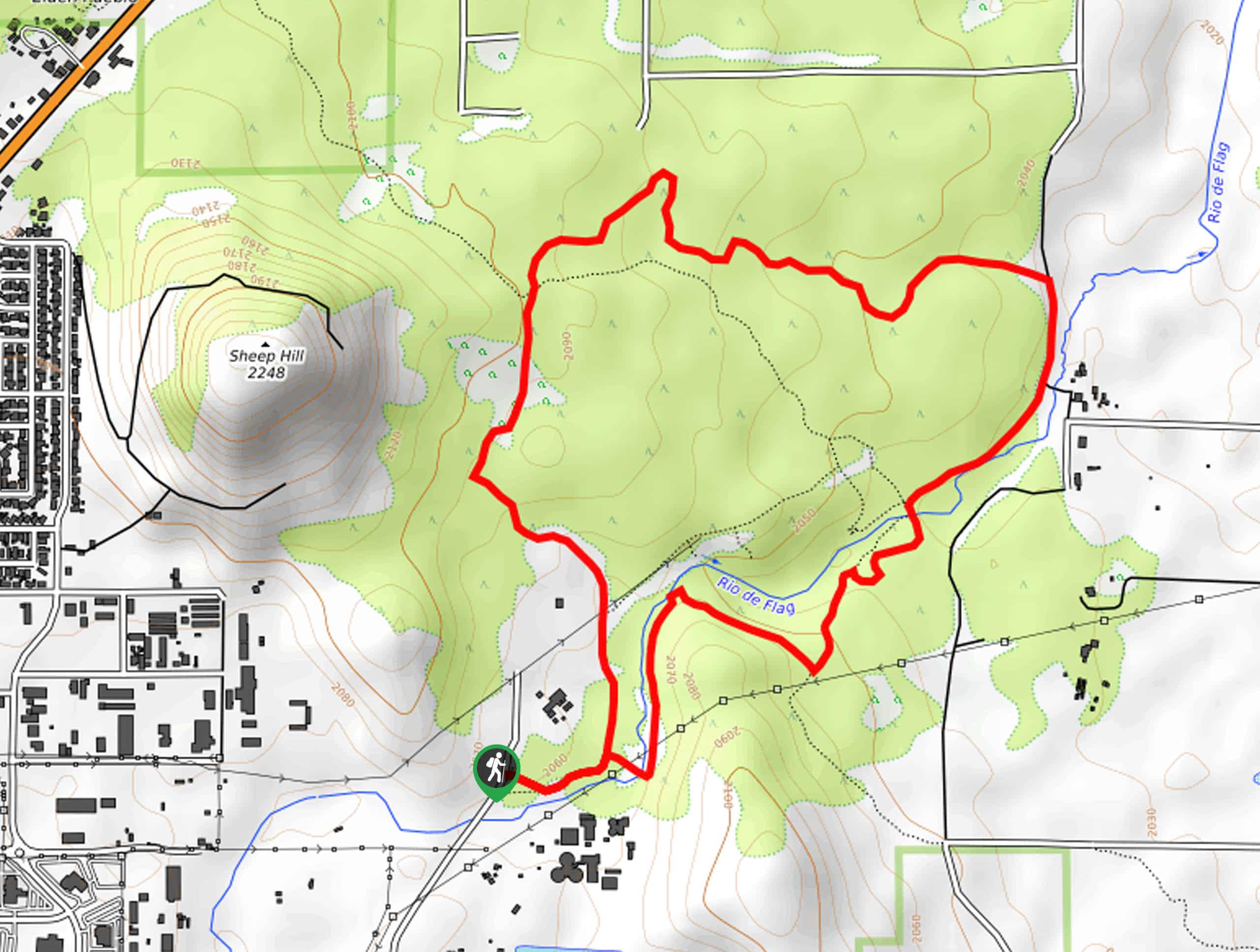
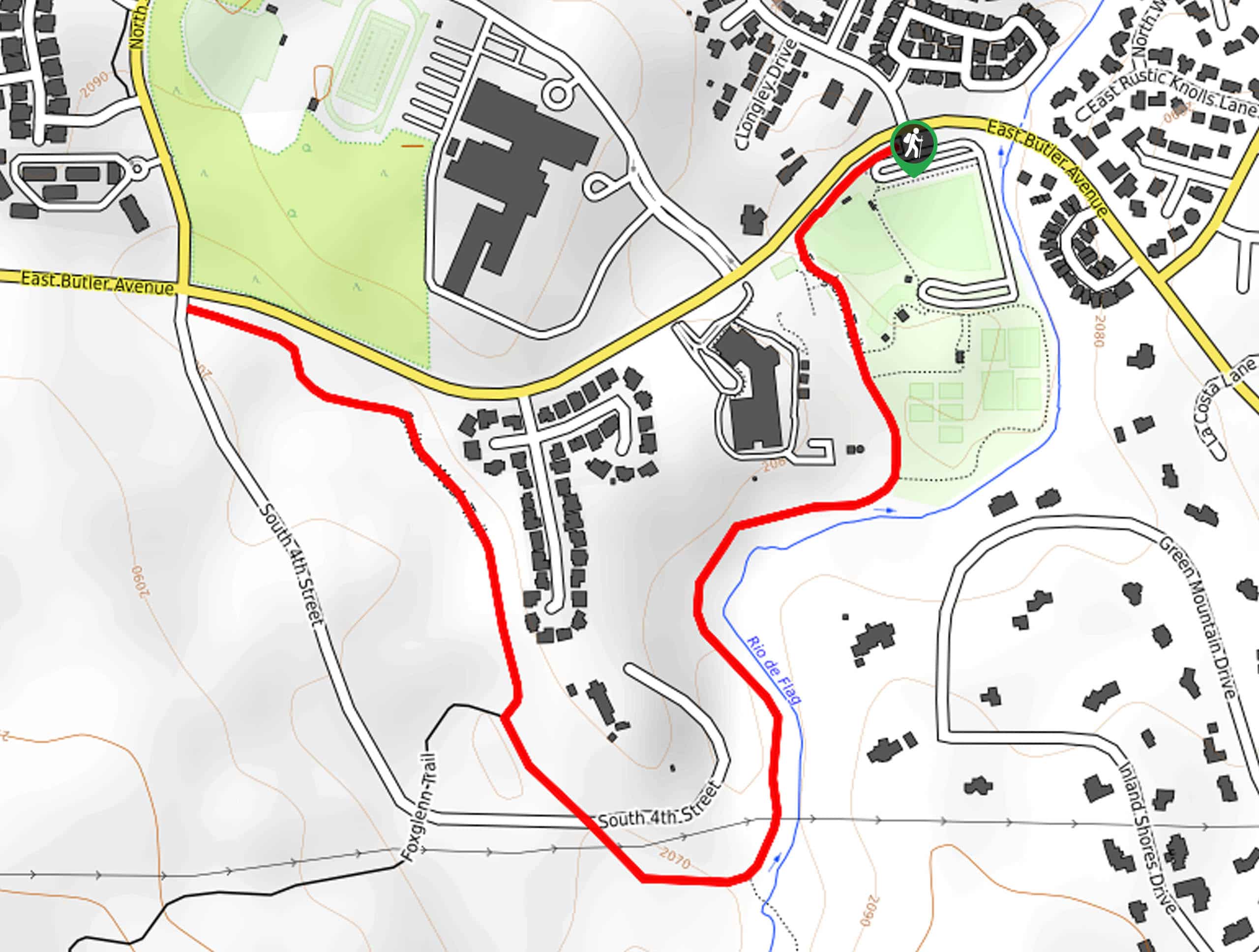
24. Rio de Flag South Trail
Difficulty
The Rio de Flag South Trail is a great option when you want some fresh… Read More
25. Mars Hill Trail
Difficulty
The Mars Hill Trail is a hike that’s very easy to get to in the… Read More
26. Continental Loop
Difficulty
The Continental Loop is a scenic, quick hike in the Walnut Canyon area near Flagstaff.… Read More
27. O'Leary Peak Trail
Difficulty
From the top of O’Leary Peak, you have a great view of nearby Darton Dome,… Read More
28. Walnut Canyon via Sandys Canyon Trail and Fisher Point Trail
Difficulty
Walnut Canyon via Sandys Canyon Trail and Fisher Point Trail is a hiking route that… Read More
29. Fisher Point Hike
Difficulty
Fisher Point is one of the best viewpoints of Walnut Canyon, and it’s reachable on… Read More
30. Old-New Heart Trail Loop
Difficulty
The Old-New Heart Trail Loop is a pretty hike that loops near the base of… Read More
31. Doyle Spring via Inner Basin Trail
Difficulty
This route takes you to Doyle Spring via Inner Basin Trail. This hard hike leads… Read More
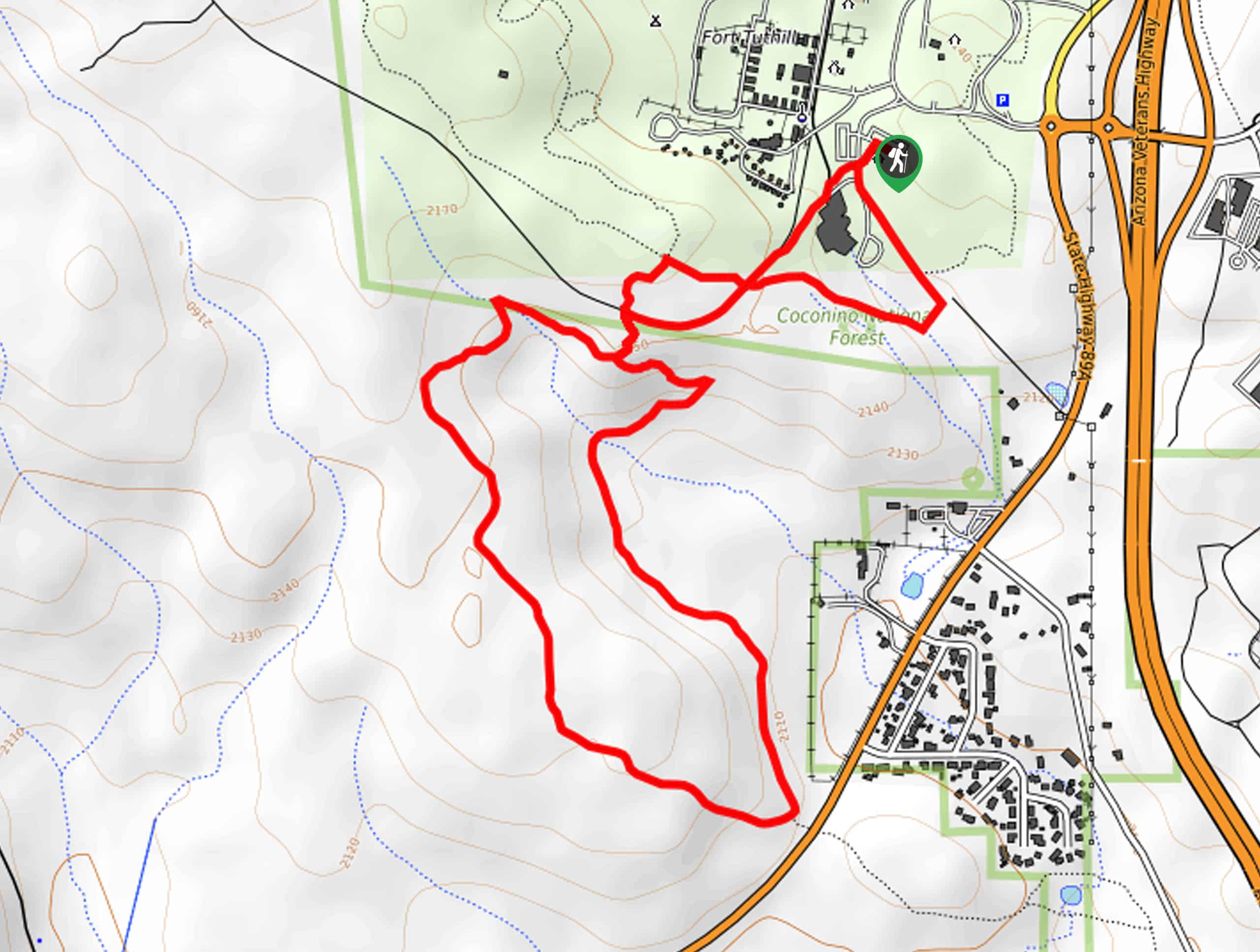
32. Chimney Springs Trail
Difficulty
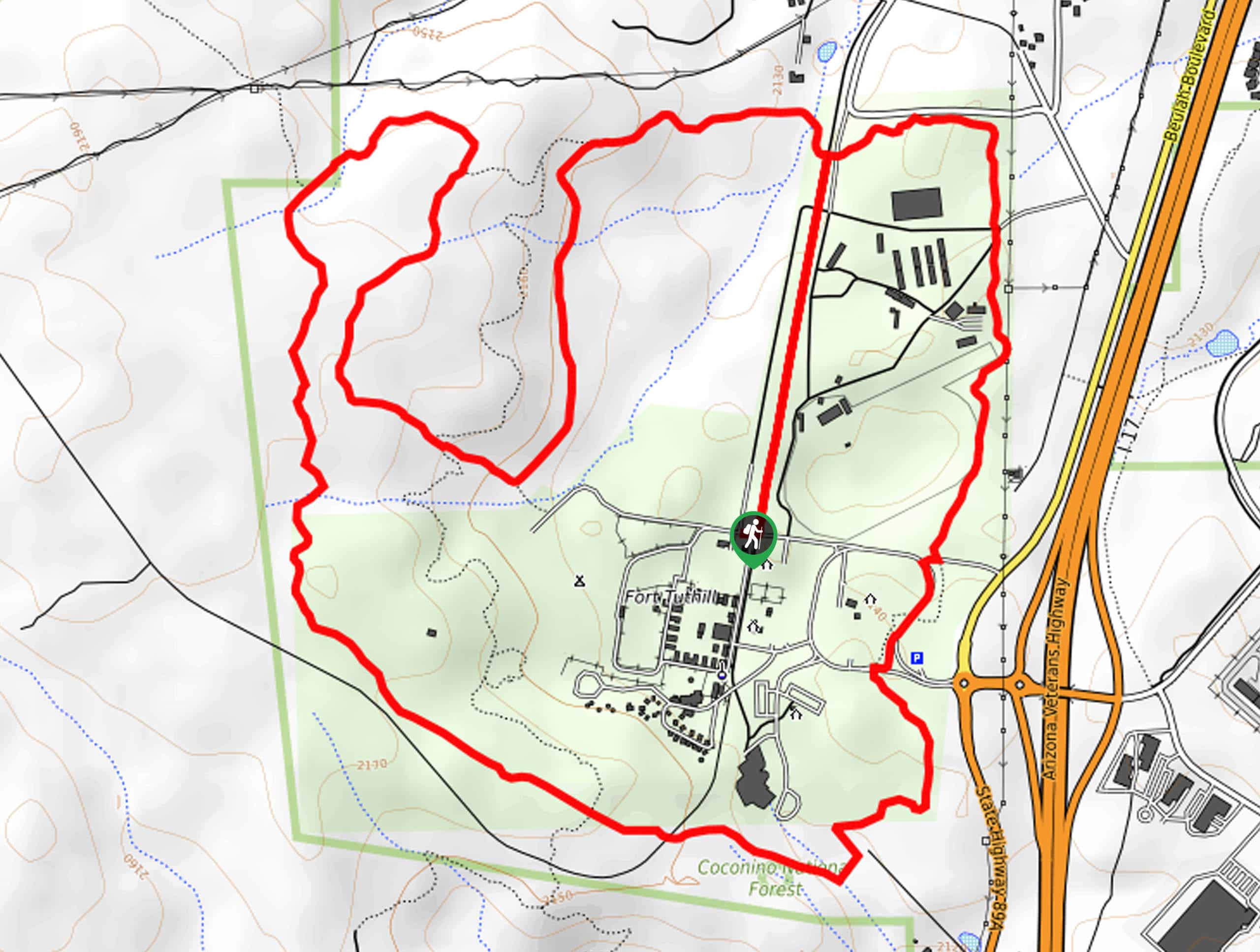
Chimney Springs Trail is a fantastic shorter hike in the Fort Valley Trail System of… Read More
33. Griffith Spring Trail
Difficulty
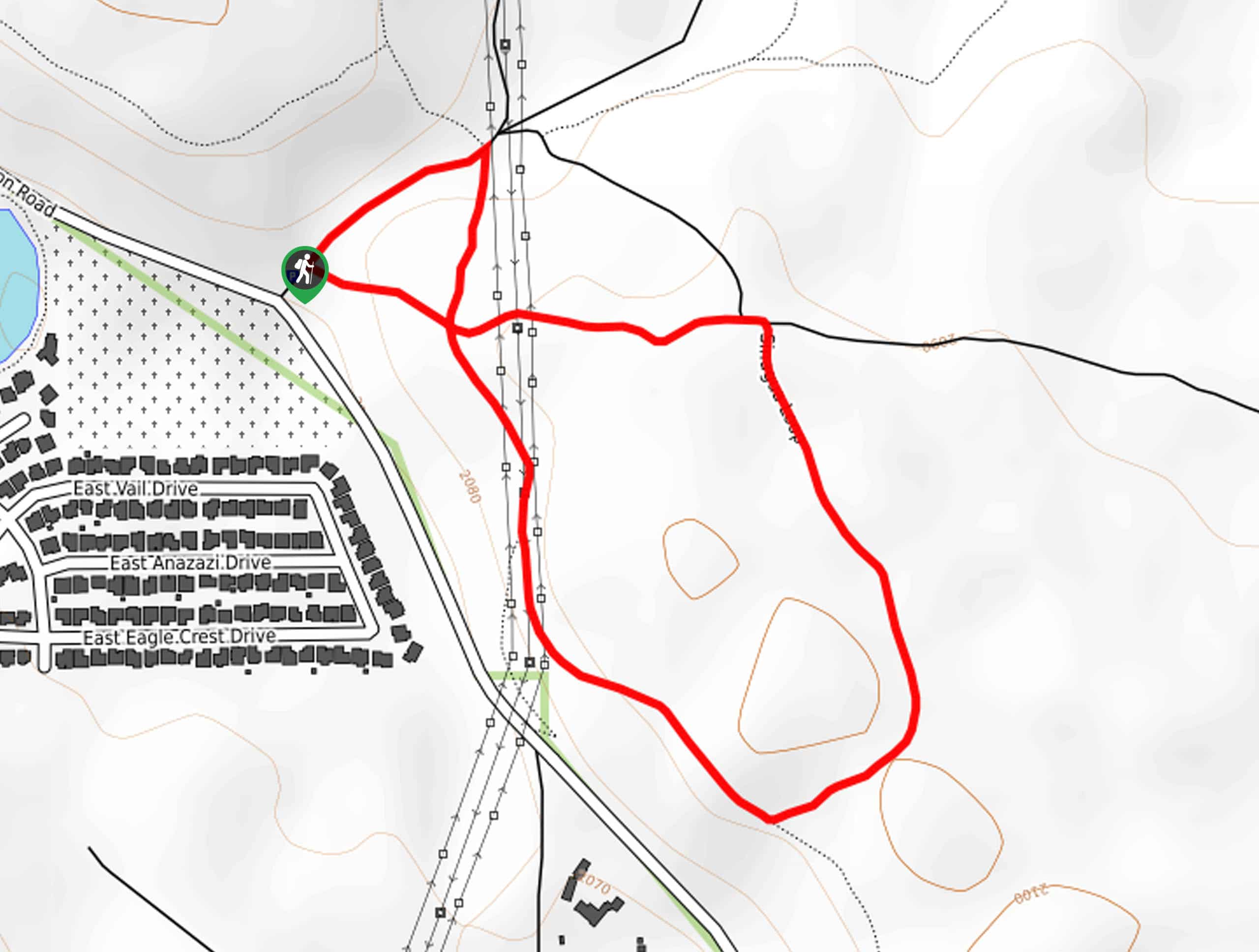
The Griffith Spring Trail is a quick, simple route north of Kachina Village. This is… Read More
34. Lava Flow Trail
Difficulty
If you’re exploring the Sunset Crater Volcano National Monument, the Lava Flow Trail is a… Read More
35. Paved Lava Flow Trail
Difficulty
If you’re exploring the Sunset Crater Volcano National Monument and need an accessible path, the… Read More
36. Strawberry Crater Wilderness Trail
Difficulty
Just outside of the Sunset Crater Volcano National Monument near Flagstaff is the Strawberry Crater… Read More
37. Upper Schultz Pass Loop
Difficulty
The Upper Schultz Pass Loop is a 5.0mie easy hike north of Flagstaff,… Read More
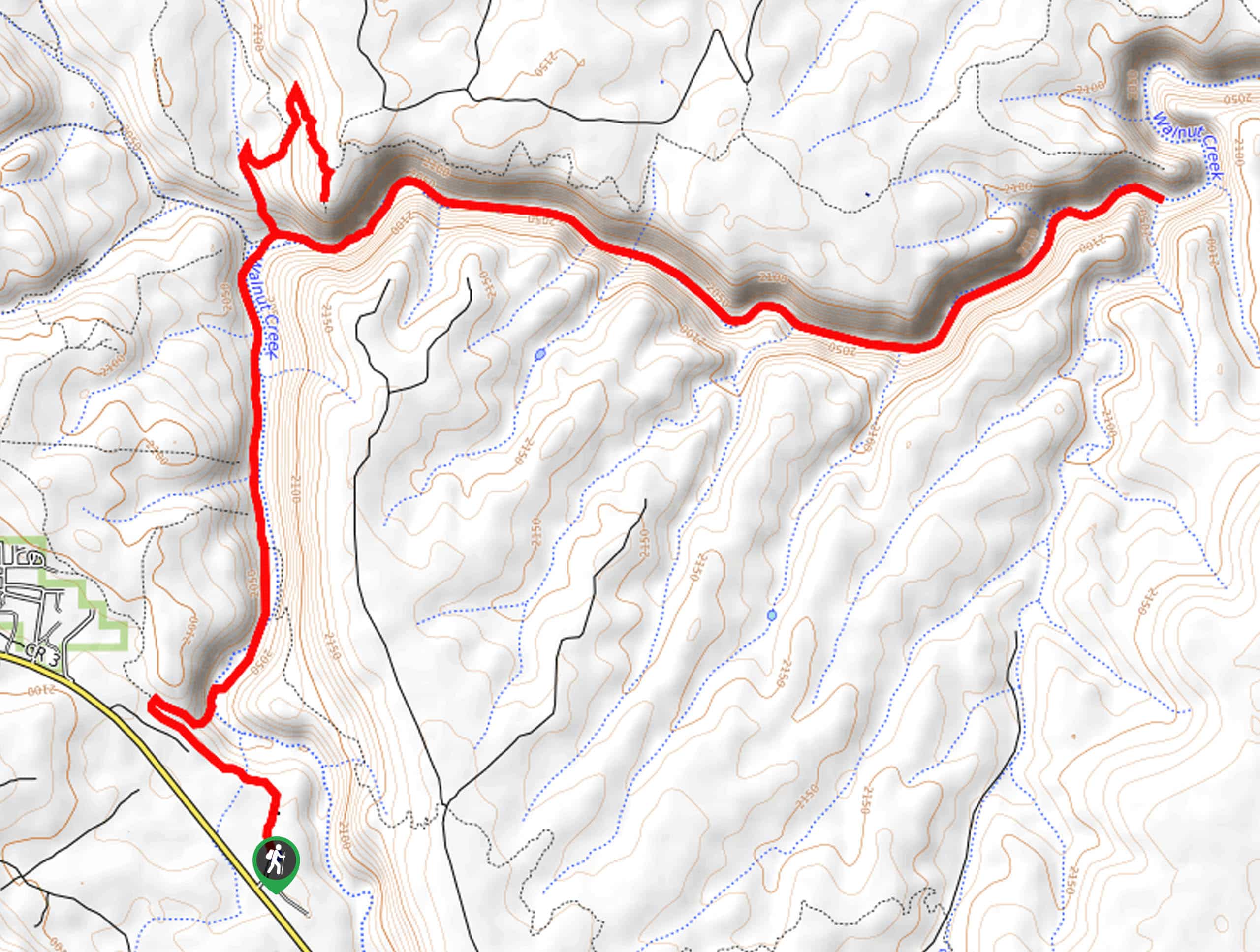
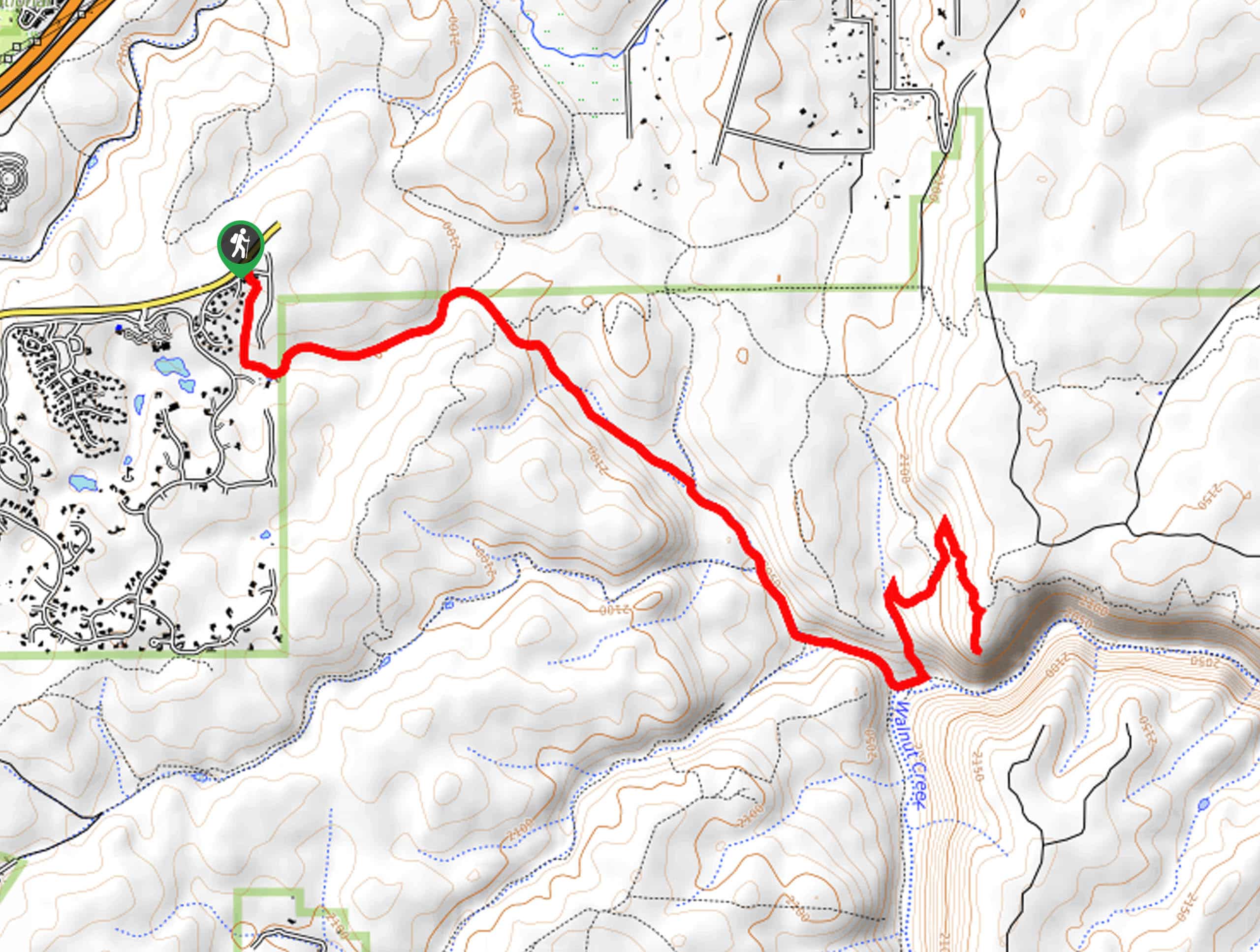
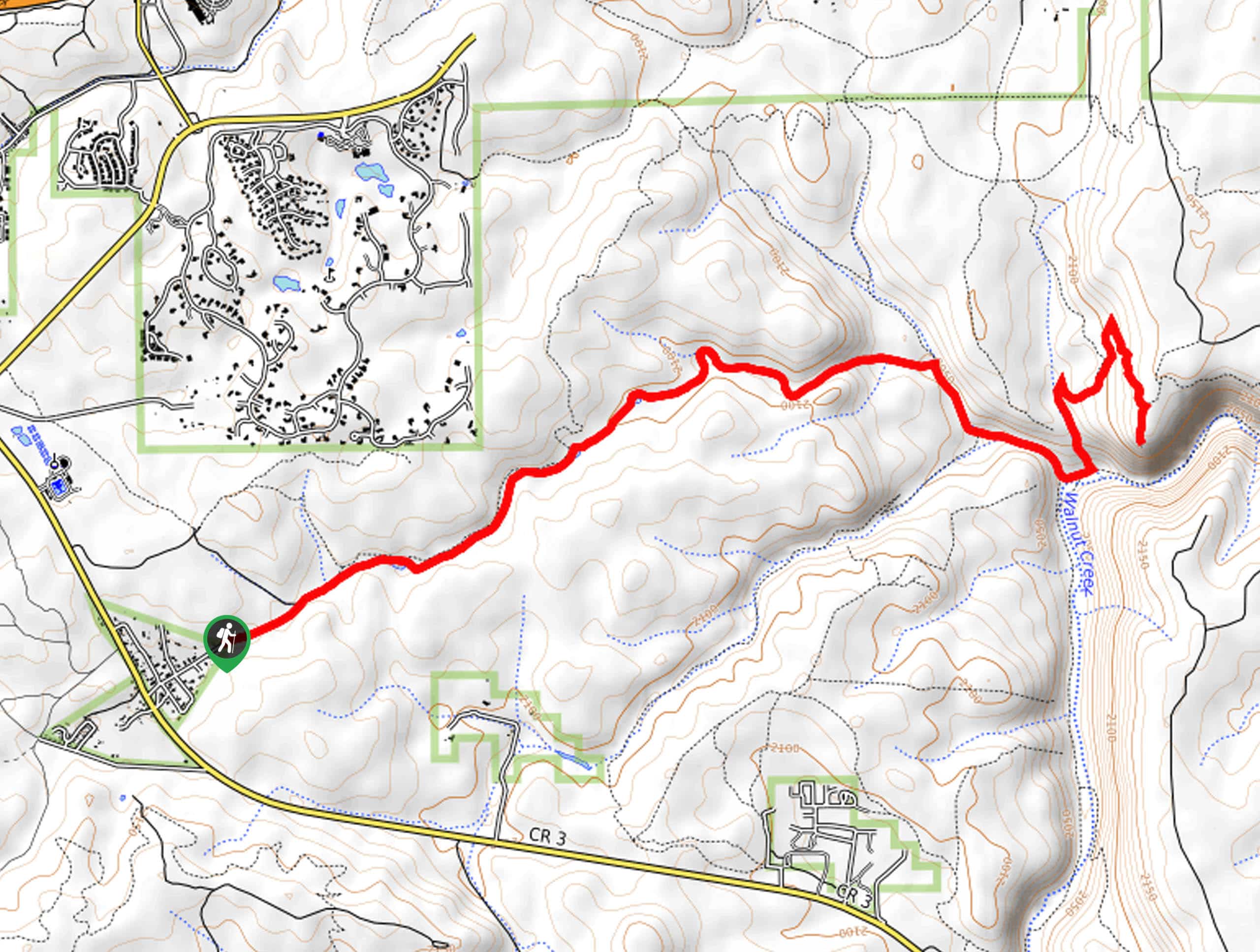
38. Walnut Creek via AZT-Walnut Canyon Trail
Difficulty
Reach Walnut Creek and a viewpoint of Walnut Canyon on the Walnut Creek via AZT-Walnut… Read More
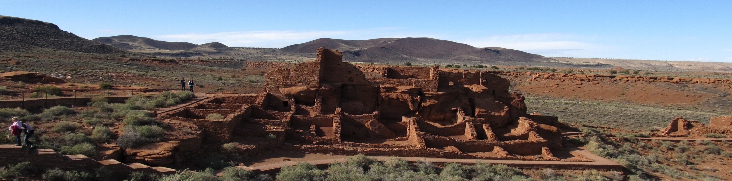
39. Wupatki Pueblo Trail
Difficulty
The Wupatki Pueblo is one of the most impressive pueblos in the Flagstaff area, with… Read More
40. Kelly Pocket Trail
Difficulty
Kelly Pocket Trail is a lovely hike through a shaded forest into a low canyon,… Read More
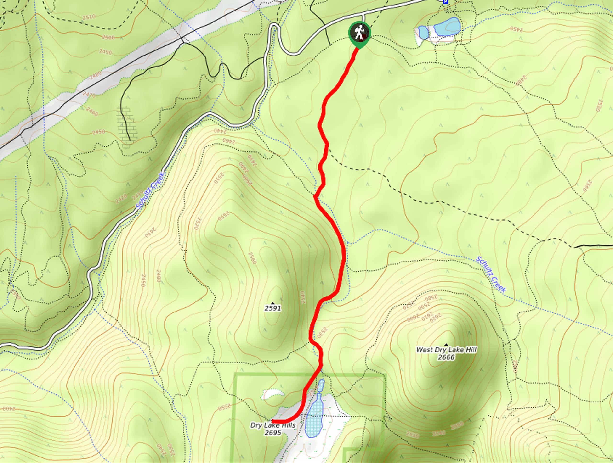
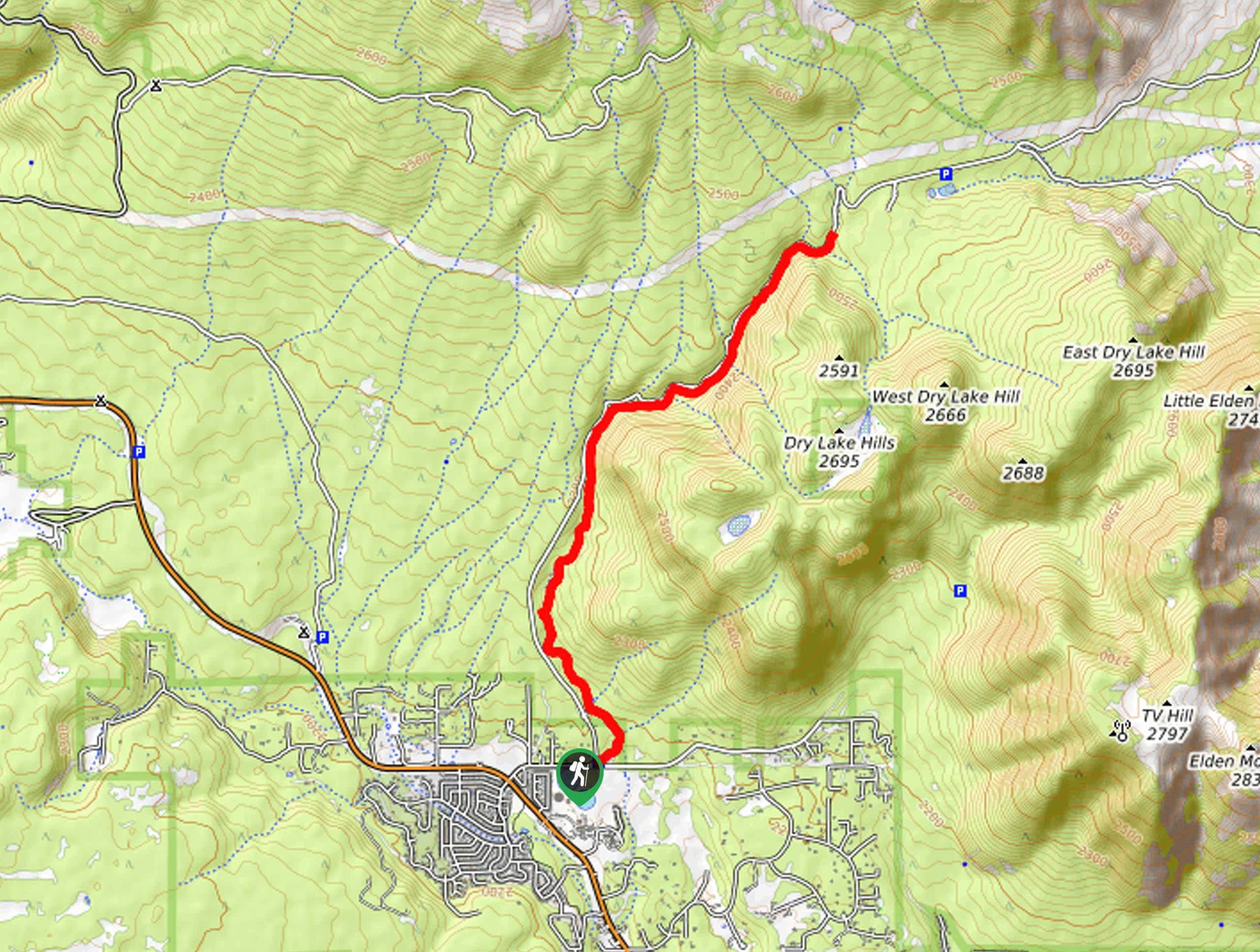
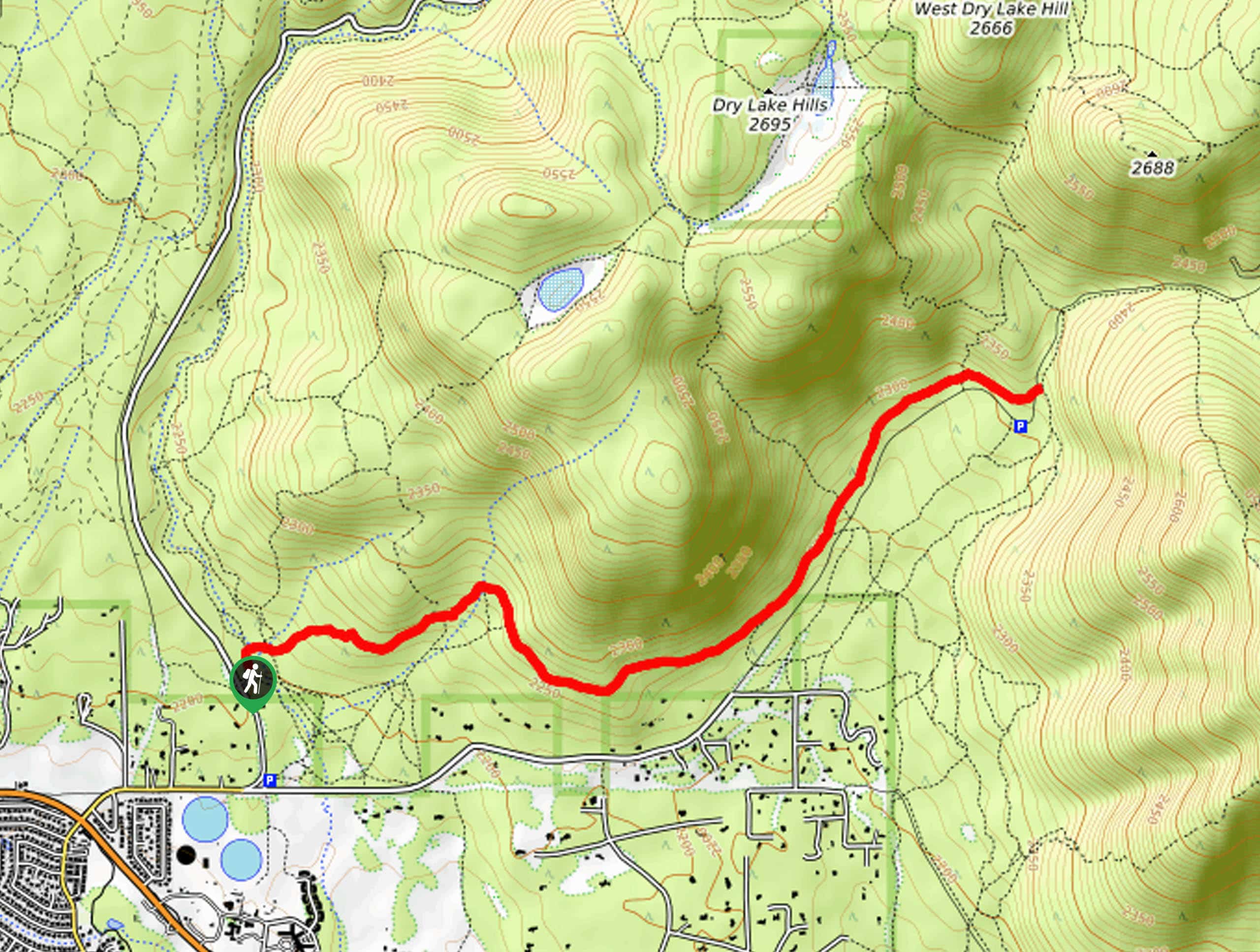
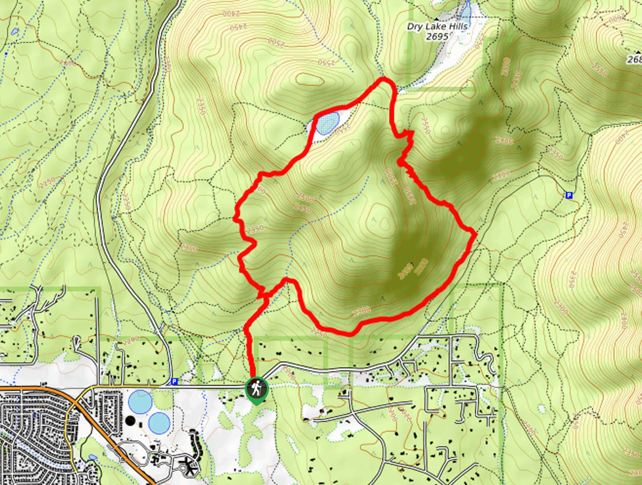
41. Dry Lake Hills Hike
Difficulty
The Dry Lake Hills hike is an easy 3.0mi route north of Flagstaff.… Read More
42. Fort Valley Trail
Difficulty
The Fort Valley Trail is a moderate route in the Fort Valley area north of… Read More

43. Priest Draw Trail
Difficulty
The Priest Draw Trail is a simple pleasure. The route travels through fields lined by… Read More
44. Schultz Pass Loop
Difficulty
The Schultz Pass Loop is an 11.8mi moderate hike north of Flagstaff in… Read More
45. Schultz Pass Road Loop
Difficulty
The Schultz Pass Road Loop is a 6.0mi moderately difficult hike north of… Read More
46. Little Elden Trail
Difficulty
The Little Elden Trail is a scenic 12.6mi out and back trail in… Read More
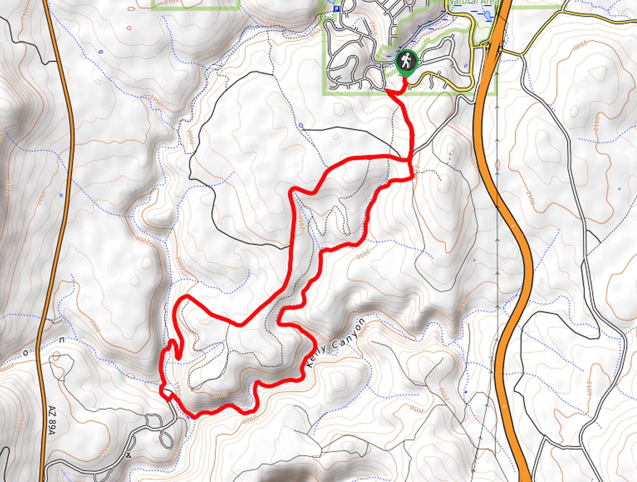
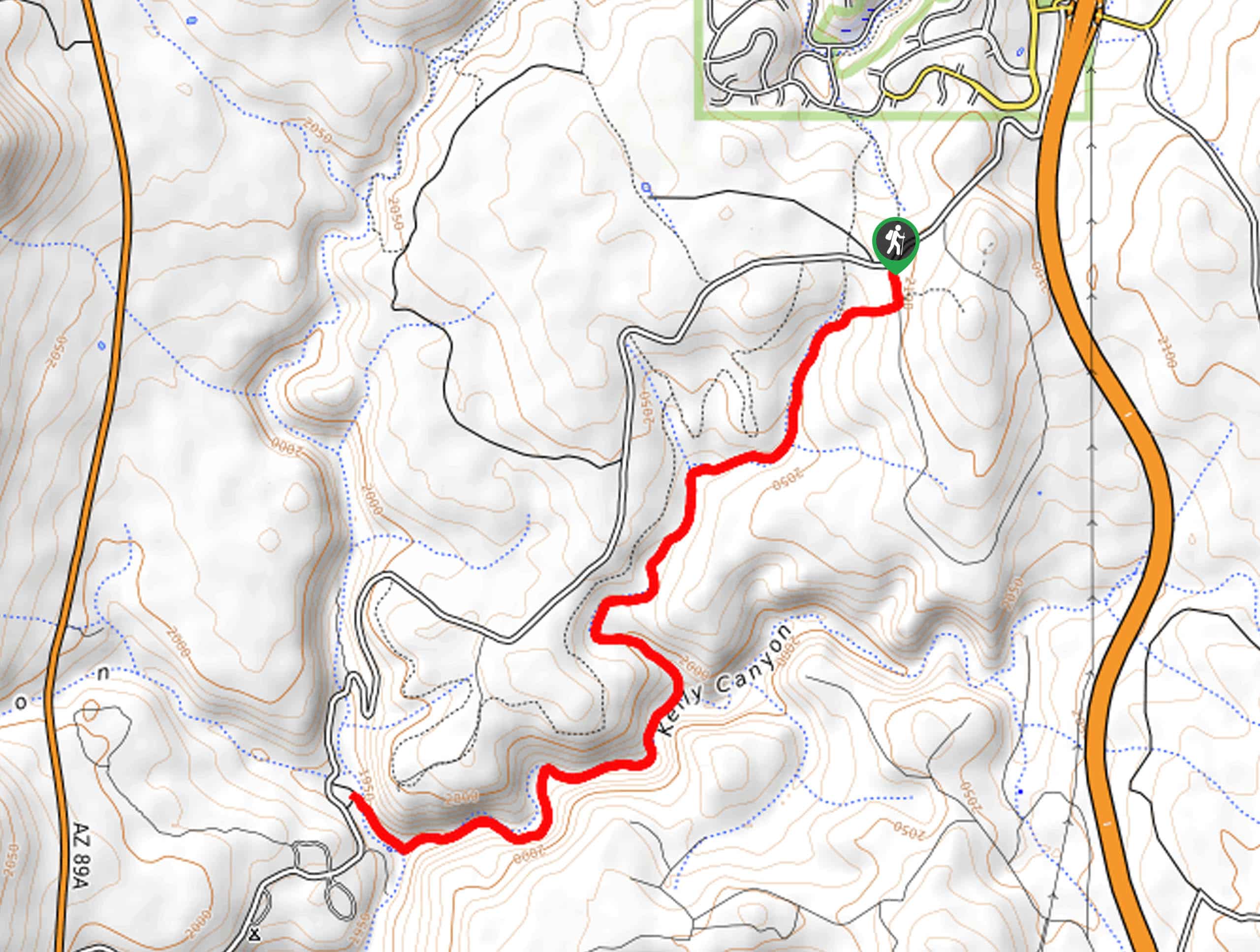
47. Kelly Canyon Trail
Difficulty
The Kelly Canyon Trail is a scenic 17.5mi hike that leads you down… Read More
48. Little Bear to Sunset Loop
Difficulty
The Little Bear to Sunset Loop leads you around a mesa near some of the… Read More
49. Hart Prairie Loop Trail
Difficulty
The Hart Prairie Loop is definitely an underappreciated hike. With views like this, it’s a… Read More
50. Slate Mountain Trail
Difficulty
Slate Mountain Trail is a 4.0mi out and back hike in the Kachina… Read More
51. Elden Pueblo Loop
Difficulty
Discover the ruins of a pueblo right at the base of Elden Mountain in Flagstaff… Read More
52. Christmas Tree Trail
Difficulty
The Christmas Tree Trail is a moderate route in Flagstaff that runs along the base… Read More
53. Mount Elden Loop via Lookout Road
Difficulty
The Mount Elden Loop via Lookout Road is a full-day adventure that shows off the… Read More
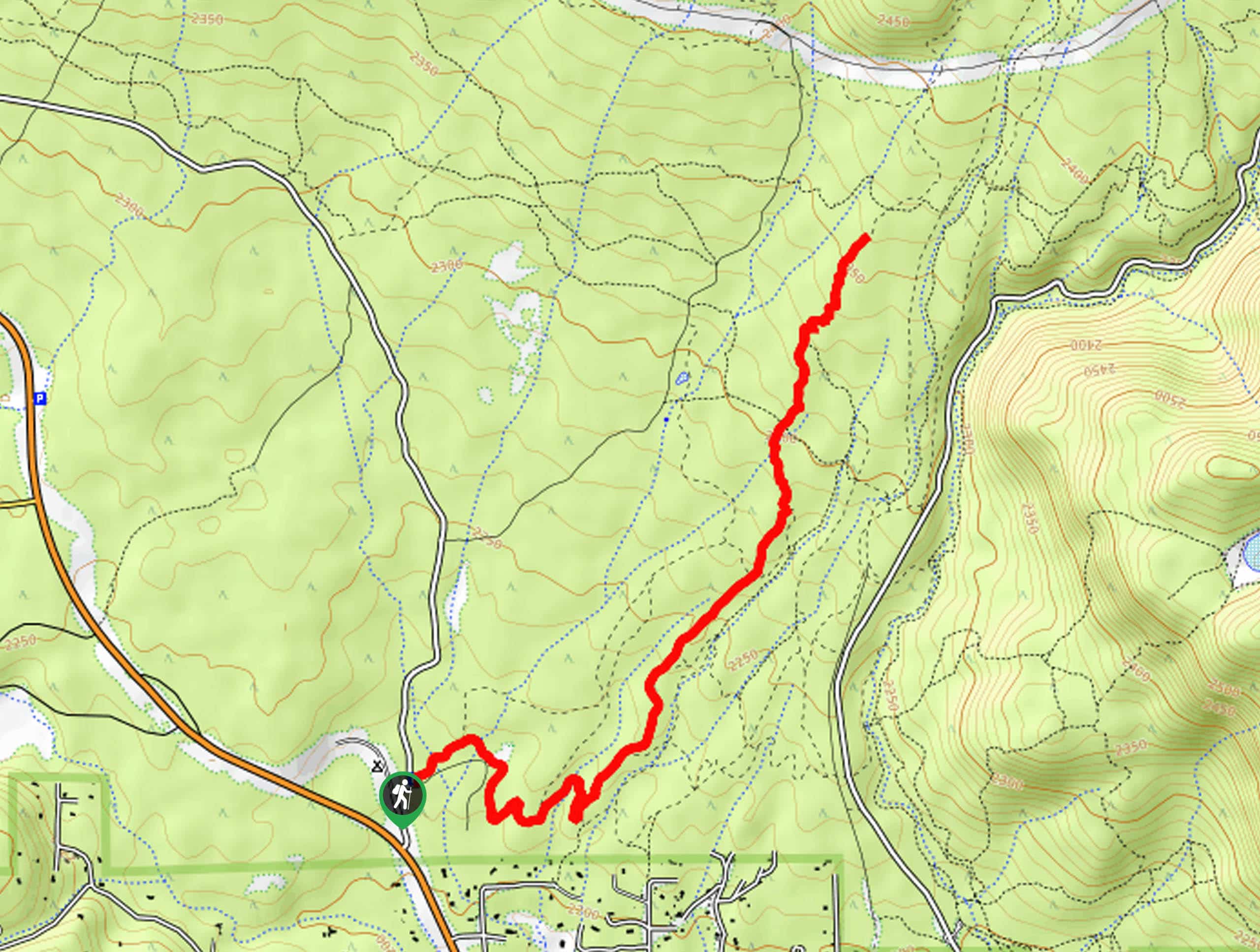
54. Schultz Creek Trail
Difficulty
The Schultz Creek Trail is one of the main routes in Flagstaff’s Dry Lake Hills,… Read More
55. Weatherford Trail
Difficulty
The Weatherford Trail is a hard hike in the Kachina Peaks Wilderness that leads you… Read More
56. Buffalo Park to Paradise Spring Hike
Difficulty
Buffalo Park might just be one of the prettiest parks in all of Arizona, and… Read More
57. Lenox Crater Trail
Difficulty
In the far corner of Sunset Crater Volcano National Monument near Flagstaff is the Lenox… Read More
58. Island Trail and Walnut Canyon Loop
Difficulty
Over 700 years ago, a pueblo community lived within Walnut Canyon. While the community is… Read More
59. Walker Lake Trail
Difficulty
Walker Lake Trail is a short, easy hike up to a lake in the middle… Read More
60. Soldier and Highlands Loop
Difficulty
Stroll underneath oak trees and pine forests on the Soldier and Highlands Loop, a fairly… Read More
61. Kachina Wetlands Hike
Difficulty
The Kachina Wetlands hike is an easy, quick loop hike around a set of ponds… Read More
62. Little America Loop
Difficulty
The Little America Loop is a short, easy hike that starts from the Little America… Read More
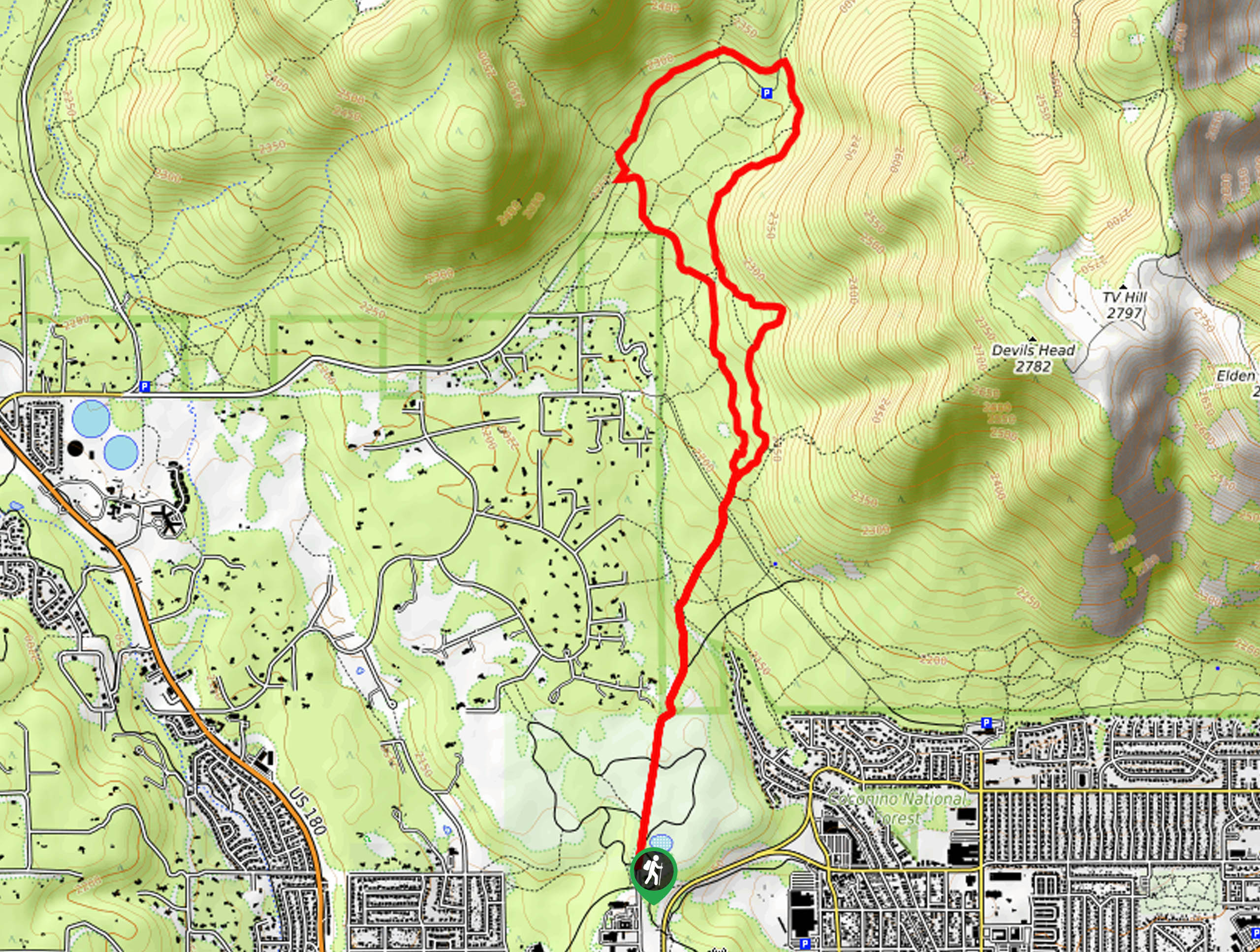
63. Elden Mountain via Upper Oldham Trail
Difficulty
Oldham Trail is one of the routes available to reach the top of Elden Mountain.… Read More
64. Freidlein Prairie Trail
Difficulty
The Freidlein Prairie Trail is a 5.0mi out and back trail in Coconino… Read More
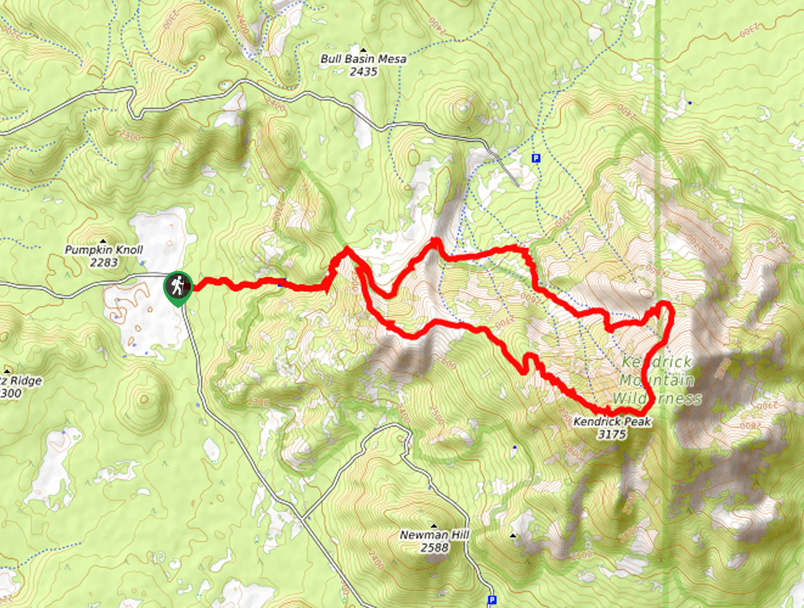
65. Kendrick Peak Trail
Difficulty
The Kendrick Peak Trail is a hard hike that leads up to the top of… Read More
66. Sandy Seep to Little Elden Spring
Difficulty
Sandy Seep to Little Elden Spring is a 7.8mi out and back trail… Read More
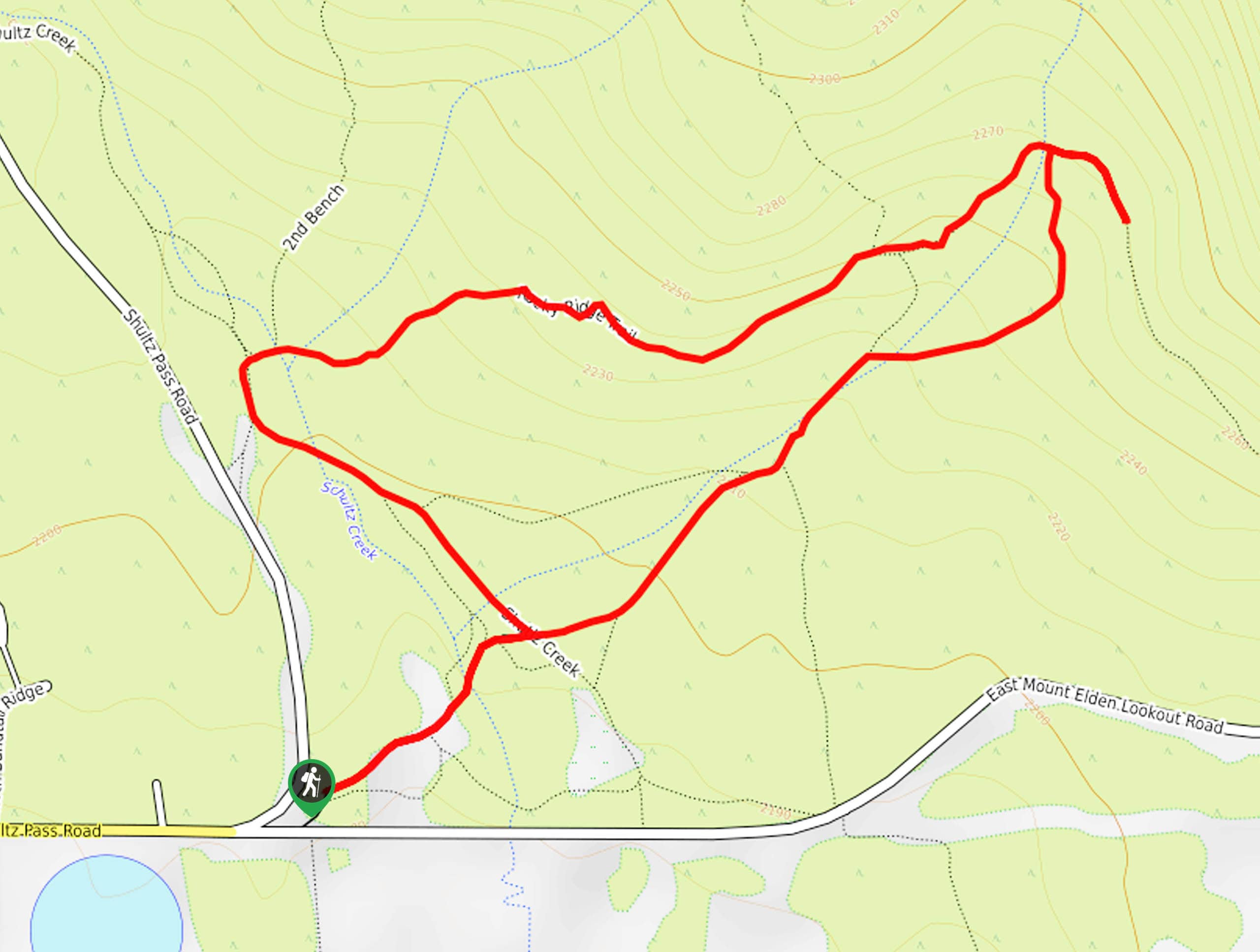
67. Rocky Ridge Loop
Difficulty
The Rocky Ridge Loop is a short, easy hike in the Schultz Creek Trail System… Read More
68. Rocky Ridge Trail
Difficulty
The Rocky Ridge Trail is a moderate hike in the Schultz Creek Trail System in… Read More

69. Marshall Lake to Fisher Point Hike
Difficulty
Fisher Point is one of the best viewpoints of Walnut Canyon. If you want to… Read More
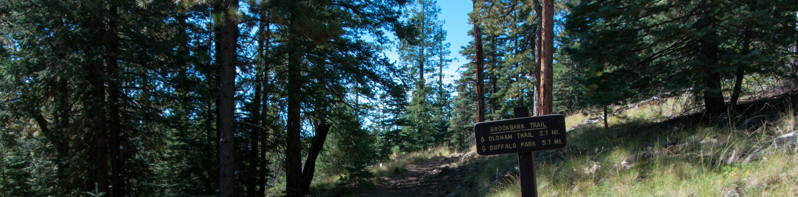
70. Lower Oldham Trail Loop
Difficulty
The Oldham Trail Loop begins from Buffalo Park, the most popular park in Flagstaff, and… Read More
71. Forces of Nature to Pipeline Loop
Difficulty
The Forces of Nature to Pipeline Loop is a pretty hike that hugs the base… Read More
72. Oldham Trail
Difficulty
The Oldham Trail begins from Buffalo Park, the most popular park in Flagstaff, and heads… Read More
73. Gold Digger to Two Spot Loop
Difficulty
The Gold Digger to Two Spot Loop is located near Rogers Lake (which isn’t actually… Read More
74. Ponderosa Trails Park Hike
Difficulty
In the neighborhood of Ponderosa Trails in Flagstaff, there is a trail system that centers… Read More
75. Observatory Mesa Trail
Difficulty
The Observatory Mesa Trail takes you through the forest to the top of Observatory Mesa.… Read More
76. Brandis Way Hike
Difficulty
The Brandis Way hike is a lesser-known trail near the Kachina Peaks Wilderness on the… Read More
77. Tom Moody Extended Loop
Difficulty
The Tom Moody Extended Loop is a beautiful hike in the Picture Canyon Natural and… Read More
78. Campbell Mesa Loop
Difficulty
The Campbell Mesa Loop is an easy 5.5mi hiking trail that sees heavy… Read More
79. Fisher Point and Walnut Canyon via Arizona Trail
Difficulty
Fisher Point is one of the best viewpoints of Walnut Canyon. If you want to… Read More
80. Raspberry Spring via Inner Basin Trail
Difficulty
Raspberry Spring via Inner Basin Trail leads you through a stunning aspen forest into a… Read More
81. Humphreys Peak, Weatherford, and Kachina Loop
Difficulty
Find some of the best mountain views of the Kachina Peaks Wilderness on the Humphreys… Read More
82. Sandy Seep Trail
Difficulty
Sandy Seep Trail is an easy route in the Coconino National Forest that leads you… Read More
83. Elden Lookout, Sunset, and Heart Loop
Difficulty
The Elden Lookout, Sunset, and Heart Loop is a hard hike near Flagstaff that leads… Read More
84. Campbell Mesa to Arizona Trail Loop
Difficulty
The Campbell Mesa to Arizona Trail Loop is a 14.5mi hike that adds… Read More
85. Campbell Mesa and Anasazi Loop
Difficulty
The Campbell Mesa and Anasazi Loop is an easy 3.0mi hiking trail that… Read More
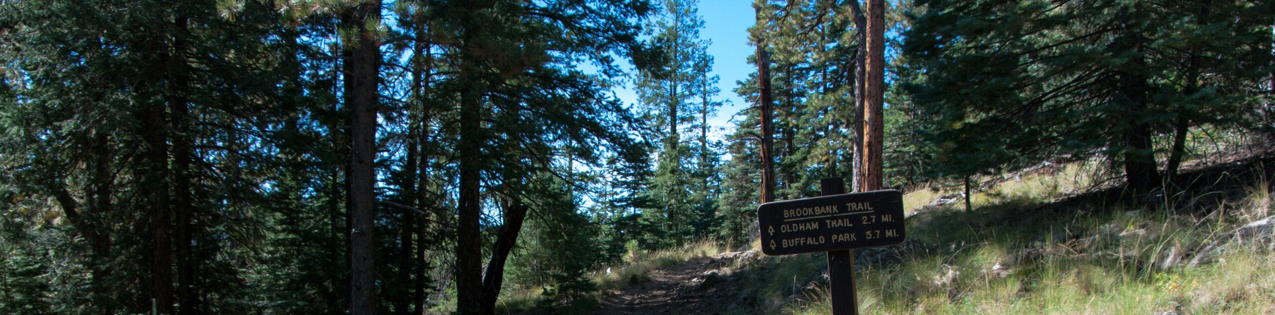
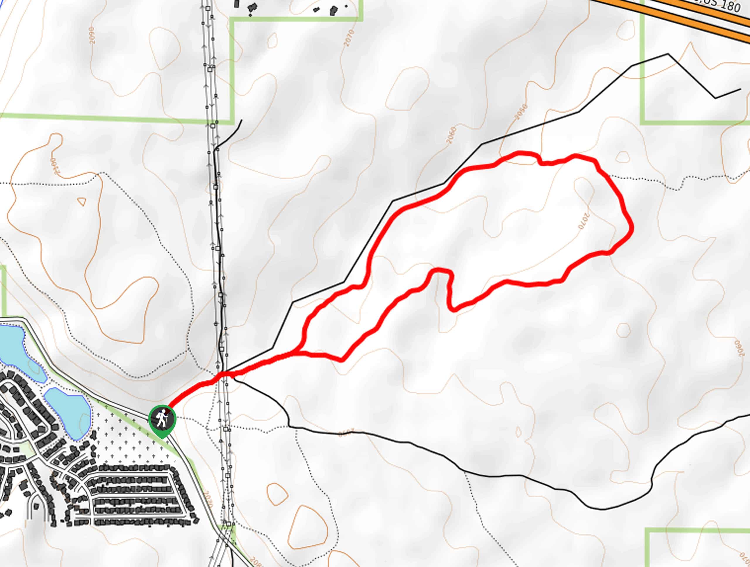
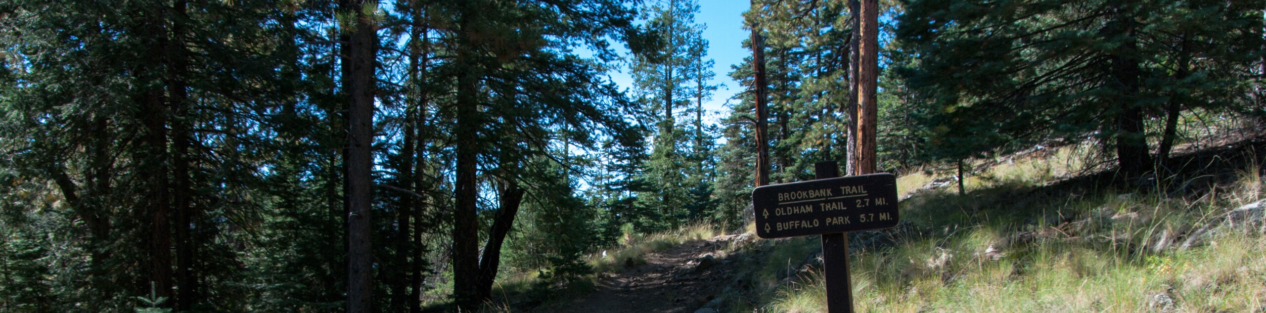
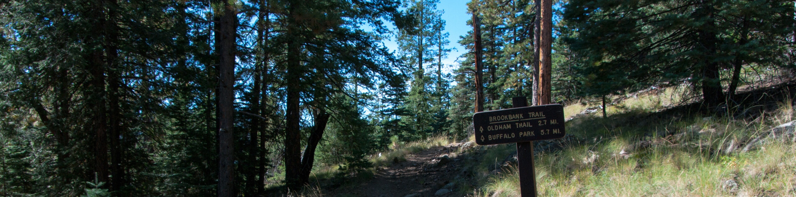
86. Sunset Trail to Brookbank Trail Loop
Difficulty
The Sunset Trail to Brookbank Trail Loop leads you through the Dry Lake Hills of… Read More
87. Soldier Loop Trail
Difficulty
Stroll underneath wildflower-dotted pine forests on the Soldier Loop Trail, a picturesque hiking, mountain biking,… Read More
88. Sinagua Loop
Difficulty
The Sinagua Loop is a short, easy hiking trail in the Walnut Canyon National Monument… Read More
89. Sandys Canyon, Walnut Canyon, and Fay Canyon Loop
Difficulty
The Sandys Canyon, Walnut Canyon, and Fay Canyon Loop explores three canyons. It’s an easy-moderate… Read More
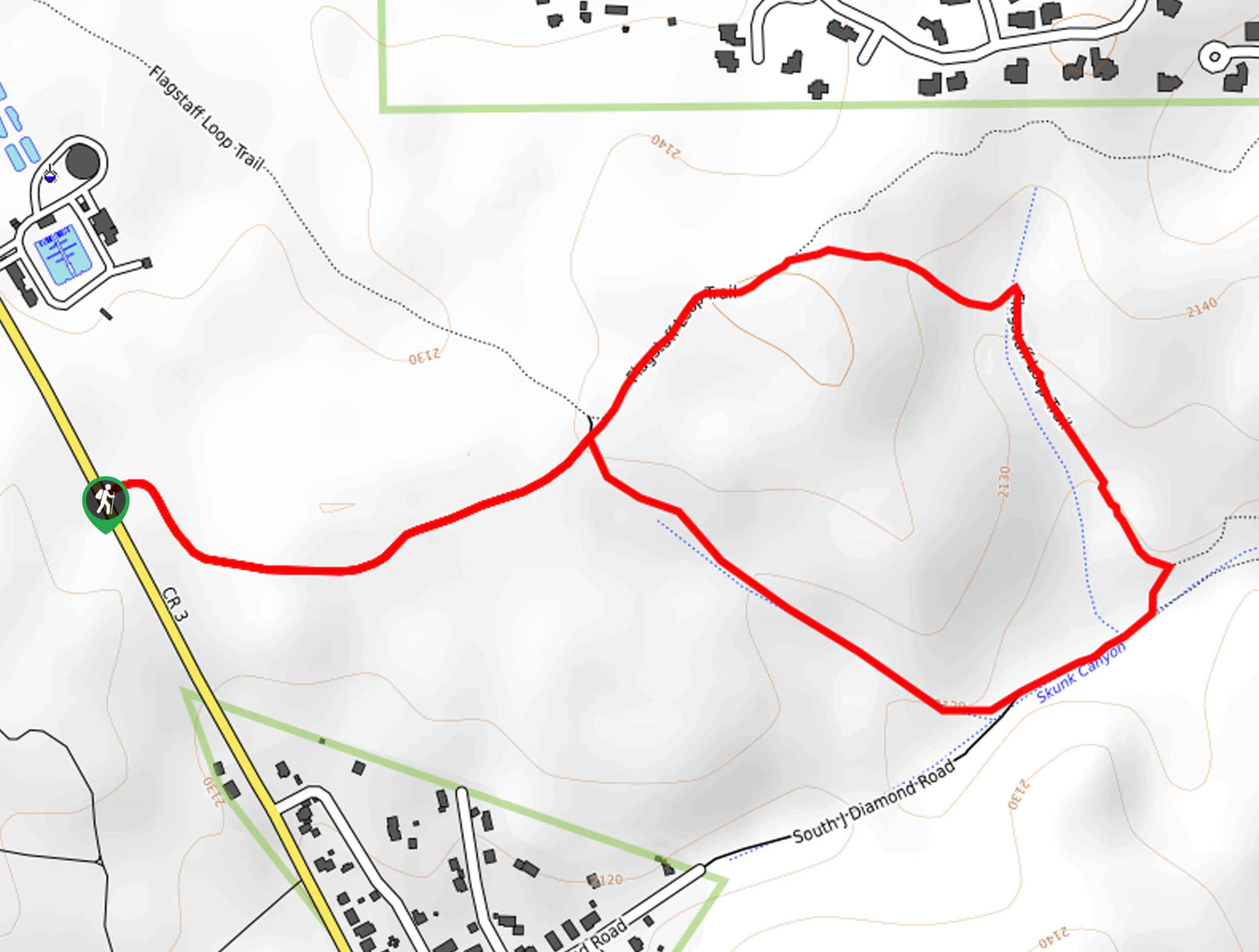
90. Skunk Canyon Hike
Difficulty
The Skunk Canyon hike takes you through one of the scenic canyons in the Walnut… Read More
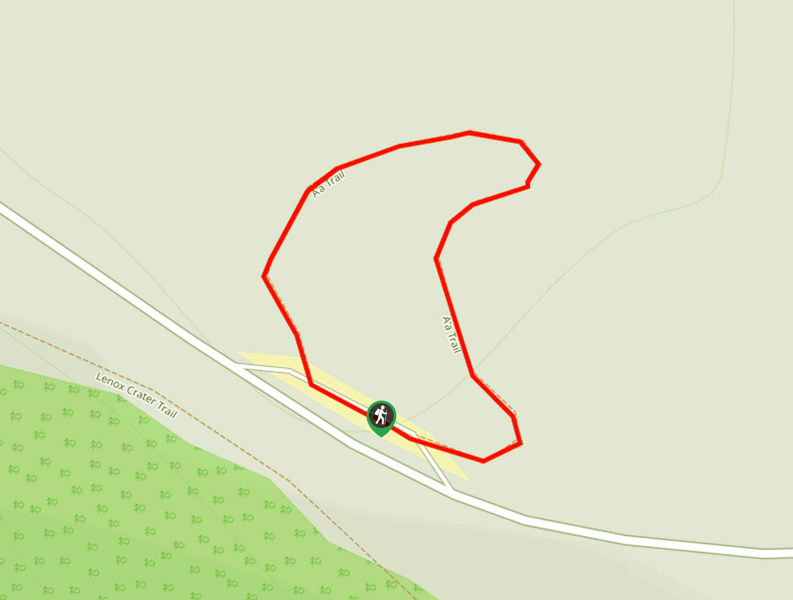
91. A'Ah Lava Trail
Difficulty
The A'Ah Lava Trail is a quick way to appreciate the interesting scenery of Sunset… Read More
92. Alfa Fia Tank Loop
Difficulty
The Alfa Fia Tank Loop is a short and sweet hike near the Kachina Peaks… Read More
93. Walnut Canyon Viewpoint Trail
Difficulty
Walnut Canyon Viewpoint Trail is a hiking route that takes you to a viewpoint over… Read More
94. Lava's Edge Trail
Difficulty
The Lava's Edge Trail is a great way to appreciate the interesting scenery of Sunset… Read More
95. Soldier Trail and Bridge Trail Loop
Difficulty
Hike through wildflower-dotted pine forests on the Soldier Trail and Bridge Trail Loop, a great… Read More
96. SP Crater Trail
Difficulty
While most hikers are exploring the Sunset Crater Volcano National Monument, a ways outside of… Read More
97. AZT-Schultz Creek Loop
Difficulty
The AZT-Schultz Creek Loop is a wonderful moderate loop hike in the Dry Lake Hills… Read More
98. Lost Burrito Loop
Difficulty
The Lost Burrito Loop is a lightly trafficked moderate hike in the Dry Lake Hills… Read More
99. Sunset Trail South to North
Difficulty
The Sunset Trail South to North covers the whole length of one of the main… Read More
100. Skunk Canyon to Fisher Point
Difficulty
Skunk Canyon to Fisher Point is a hike that leads you through one of the… Read More
101. Bonito Vista Trail
Difficulty
Sunset Crater Volcano National Monument is full of trails that reveal the evidence of volcanic… Read More
102. Sparky's Pond via Lower Brookbank Trail
Difficulty
Sparky’s Pond in the Dry Lake Hills is often accessed from the Schultz Creek side… Read More
103. Karen Cooper Trail
Difficulty
Karen Cooper Trail is a 6.7mi out and back route that follows a… Read More
104. Schultz Creek Downhill Trail
Difficulty
The Schultz Creek Downhill Trail is a route that hugs Flagstaff’s Dry Lake Hills, a… Read More
105. Skunk Canyon Loop
Difficulty
The Skunk Canyon Loop takes you through one of the scenic canyons in the Walnut… Read More
106. Brookbank to Upper Oldham to Sunset Loop
Difficulty
The Brookbank to Upper Oldham to Sunset Loop is a hike that makes use of… Read More
107. Lower Brookbank, Upper Brookbank, Upper Red Onion Loop
Difficulty
The Lower Brookbank, Upper Brookbank, and Upper Red Onion Loop is a hike that makes… Read More
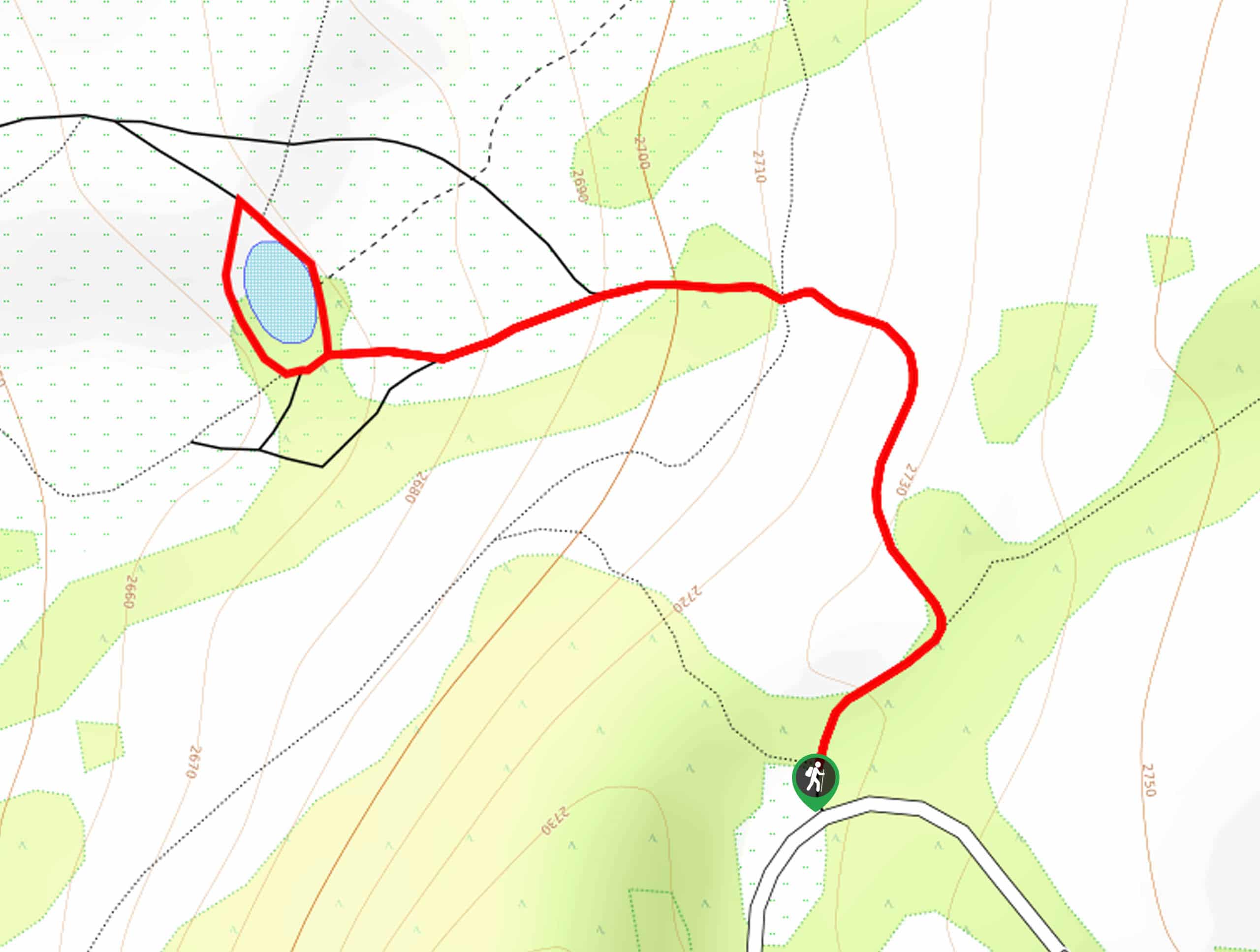
108. Humphrey's Peak via Inner Basin Trail
Difficulty
Humphrey's Peak via Inner Basin Trail leads you through a stunning aspen forest in the… Read More
109. Two Spot Loop
Difficulty
The Two Spot Loop is an easy hike southwest of Flagstaff at Rogers Lake. This… Read More

110. Sandy Steps, Heart, and Upper Oldham Trail
Difficulty
The Sandy Steps, Heart, and Upper Oldham hike makes use of several different trails to… Read More
111. Switzer Wash Trail via Foxglenn Trail
Difficulty
Switzer Wash Trail via Foxglenn Trail is a short but sweet hike in Flagstaff. This… Read More
112. Doney Mountain Trail
Difficulty
Doney Mountain Trail is a short hike in the far northeastern corner of Sunset Crater… Read More
113. Pumphouse Nature Trail
Difficulty
Pumphouse Nature Trail is a short and pleasant walk in Kachina Village, Arizona. This route… Read More

114. Fay Canyon Loop
Difficulty
Fay Canyon is one of several main canyons in the Walnut Canyon National Monument. This… Read More

115. Fisher Point via Fay Canyon
Difficulty
Fisher Point is one of the best viewpoints into the gorgeous Walnut Canyon. This route… Read More
Are we missing your favourite hike?
Tell us! If you've got photos, a GPS track and know the hike, we'd love to share your favourite hike with the rest of the 10Adventures community.