Doyle Spring via Inner Basin Trail
View Photos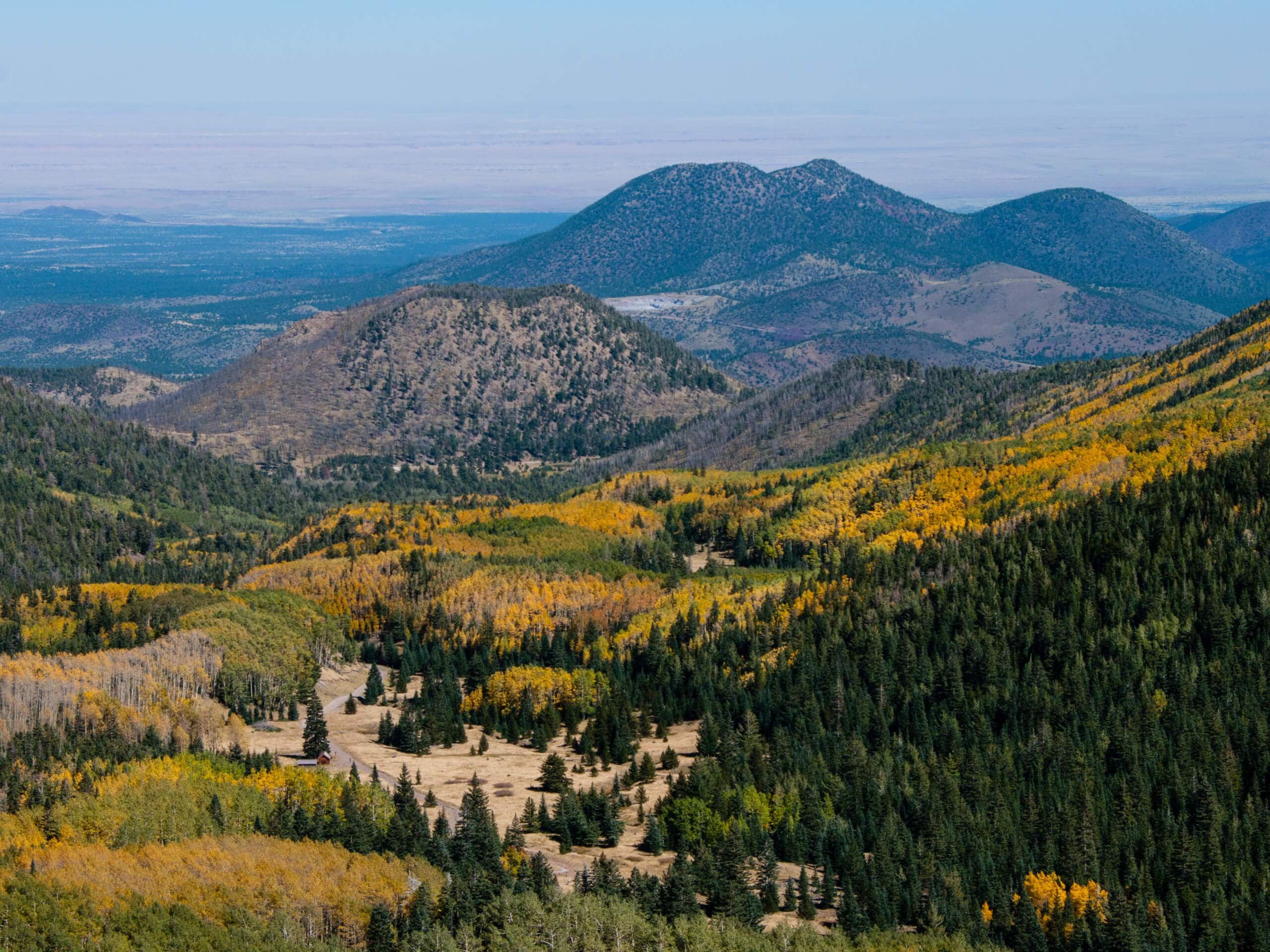
Doyle Spring via Inner Basin Trail
Difficulty Rating:
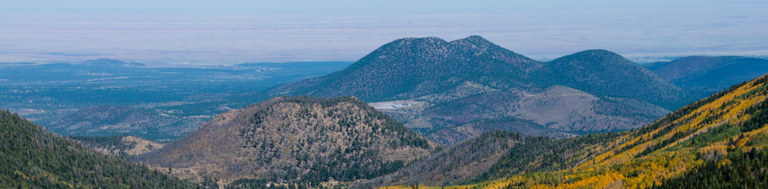
This route takes you to Doyle Spring via Inner Basin Trail. This hard hike leads you through a stunning aspen forest to a basin in the Kachina Peaks Wilderness. The basin is tucked underneath some of Arizona’s tallest mountains–Humphreys Peak, Aubineau Peak, and Rees Peak. This route leads you through a meadow that’s accessible from the Lockett Meadow Campground, making it a perfect trip for campers. Note that this trail is different from the popular Lockett Meadow Inner Basin Loop.
Getting there
The trailhead for the Doyle Spring via Inner Basin Trail is in the Lockett Meadow Campground.

About
| Backcountry Campground | Lockett Meadow Campground |
| When to do | April-October |
| Pets allowed | Yes - On Leash |
| Family friendly | Yes |
| Route Signage | Average |
| Crowd Levels | Moderate |
| Route Type | Out and back |
Doyle Spring via Inner Basin Trail
Elevation Graph
Weather
Doyle Spring via Inner Basin Trail Description
The hike to Doyle Spring via Inner Basin Trail leads you to a spring in a basin that is underneath the tallest mountains in the state, and the path to it takes you through a beautiful aspen forest. In the fall when the aspens turn color, this is an even more enjoyable hike. Note that this isn’t the Lockett Meadow Loop, which is the most popular trail in this area (we have a route guide for it if that’s what you’re after!).
This hike takes you through beautifully varied terrain, leading from the campsite through the pine trees and aspens and up to the foothills, where the mountain views are visible. We recommend this hike either when the wildflowers are in bloom, which tends to be early-mid summer, or when the fall colors are at their best, which is normally late September through late October.
Note that the road to the trailhead is precarious, with steep, winding curves and narrow lanes. We do not recommend the drive for trailers, RVs, or large vehicles. The road is closed in the winter. The trailhead for Doyle Spring via Inner Basin Trail is at the very back of the day-use parking area. You’ll start by hiking through a mature pine forest. The pine trees give way to aspens before you begin a set of switchbacks towards the inner basin. Continue up to the spring, hiking through the trees. Where the route ends at the spring, turn back and retrace your steps.
Similar hikes to the Doyle Spring via Inner Basin Trail hike

Fay Canyon Loop
Fay Canyon is one of several main canyons in the Walnut Canyon National Monument. This loop hike explores part of…

Sandy Steps, Heart, and Upper Oldham Trail
The Sandy Steps, Heart, and Upper Oldham hike makes use of several different trails to create a hike that stretches…

Fisher Point via Fay Canyon
Fisher Point is one of the best viewpoints into the gorgeous Walnut Canyon. This route leads you to the point…
Comments