

Fay Canyon Loop
View Photos
Fay Canyon Loop
Difficulty Rating:
Fay Canyon is one of several main canyons in the Walnut Canyon National Monument. This loop hike explores part of the canyon that most hikers don’t visit, so it’s a unique trip with great views in store. This hike is rated as moderate and is suitable for beginners and families. The canyon can be hot in the summer and icy in the winter, so prepare accordingly. Expect moderate traffic on this trail.
Getting there
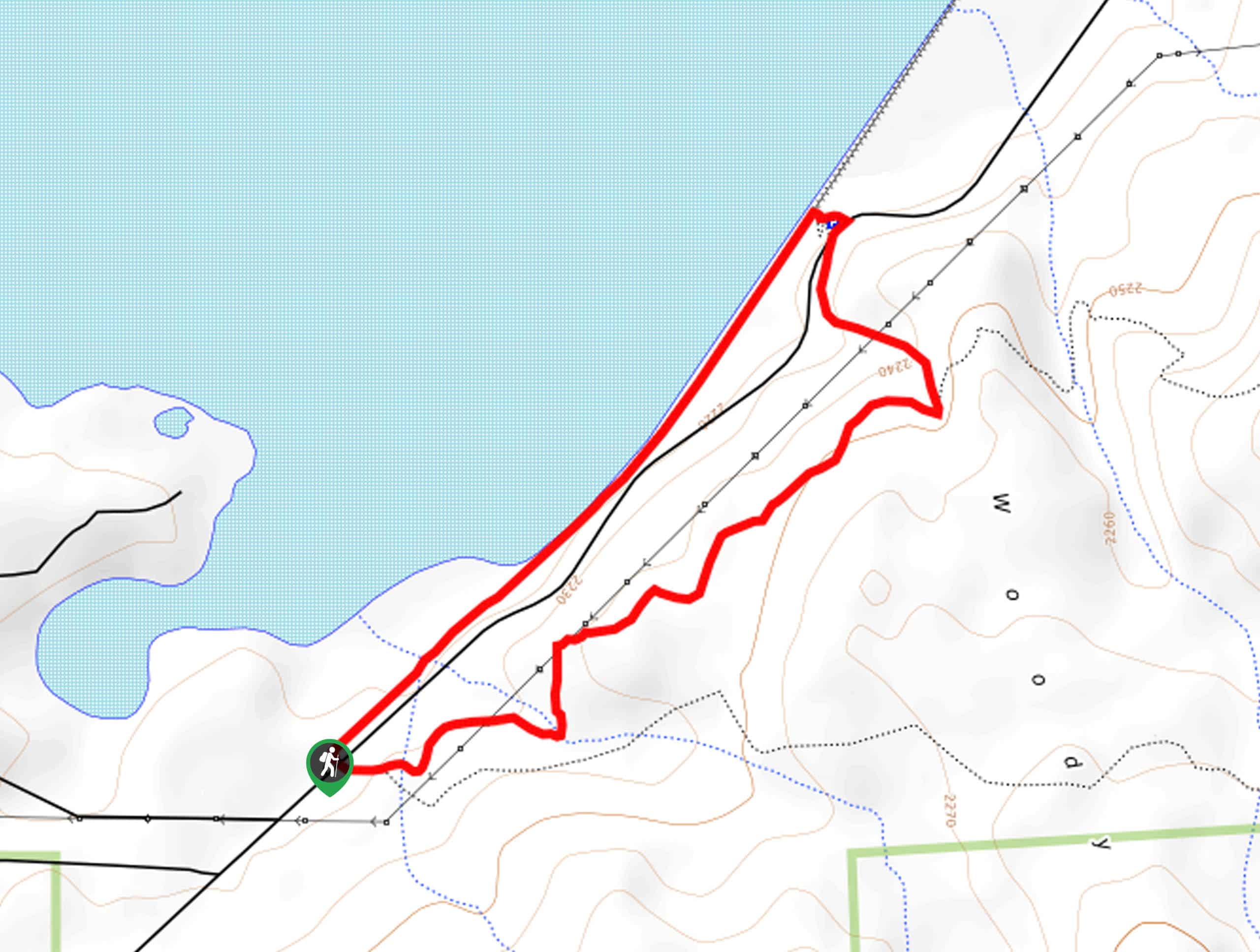
The trailhead for Fay Canyon Loop is off Lake Mary Road.

About
| Backcountry Campground | No |
| When to do | April-November |
| Pets allowed | Yes - On Leash |
| Family friendly | Yes |
| Route Signage | Average |
| Crowd Levels | Moderate |
| Route Type | Loop |
Fay Canyon Loop
Elevation Graph
Weather
Fay Canyon Loop Description
Fay Canyon is one of the main canyons in the Walnut Canyon National Monument. This beautiful trail actually shows you part of the canyon that gets fewer visitors, so it’s a fresh take on the usual Fay Canyon hiking experience. This hike is great for all ages and skill levels.
The canyon can get quite hot in the summertime, so we suggest bringing lots of water and grabbing a hat. In the wintertime, it can be very icy and snowy, so microspikes are recommended.
From the trailhead, go right to follow the trail as it wraps around south before turning north onto the Airport Loop. Follow this route beside the canyon, then take a left once you reach the canyon. Stay right at the fork to loop around on the Airport Loop, then turn left once you reach the canyon again to follow it back to the trailhead.
Similar hikes to the Fay Canyon Loop hike

Sandy Steps, Heart, and Upper Oldham Trail
The Sandy Steps, Heart, and Upper Oldham hike makes use of several different trails to create a hike that stretches…

Fisher Point via Fay Canyon
Fisher Point is one of the best viewpoints into the gorgeous Walnut Canyon. This route leads you to the point…
Two Spot Loop
The Two Spot Loop is an easy hike southwest of Flagstaff at Rogers Lake. This route wanders beside the shore…
Comments