
Two Spot Loop
View Photos
Two Spot Loop
Difficulty Rating:
The Two Spot Loop is an easy hike southwest of Flagstaff at Rogers Lake. This route wanders beside the shore of Rogers Lake, which is actually a basin that fills with water when it has rained. This can be a great place to birdwatch or to see wildlife. In the summer, the flowers can be lovely. You might just want to keep exploring in this picturesque spot! Expect light traffic on this hike.
Getting there
The trailhead for Two Spot Loop is on Woody Mountain Road.

About
| Backcountry Campground | No |
| When to do | March-November |
| Pets allowed | Yes - On Leash |
| Family friendly | Yes |
| Route Signage | Average |
| Crowd Levels | Low |
| Route Type | Loop |
Two Spot Loop
Elevation Graph
Weather
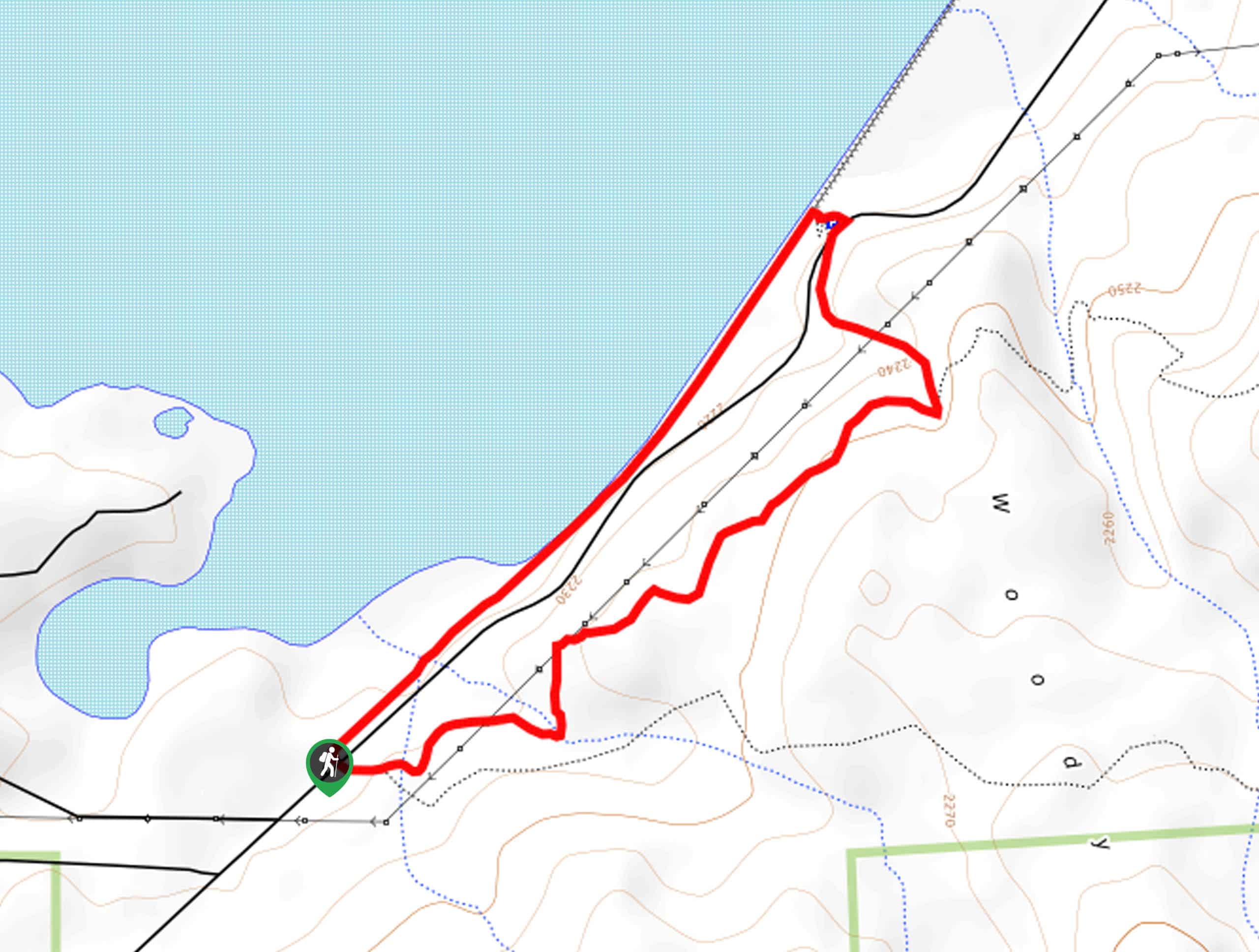
Two Spot Loop Description
Two Spot Loop is a super easy and relaxed hiking trail that follows the shore of Rogers Lake. Rogers Lake is a basin that fills with water when it’s rained recently, so try to hike this trail in the spring when there’s a better chance of it being more lake-like. This can be a very good spot to birdwatch or look for wildlife.
You might want to keep exploring after this hike, and the connecting trails make this possible. Consider downloading a GPS map to help you if you want to keep going.
From the trailhead, the loop heads right (take the middle trail of the three that meet here). You’ll stroll with a view of nearby Woody Mountain on your right. Stay left and then take a sharp left to return along the shore of the lake. If you brought bug spray, you might want to apply it now since the bugs can be a bit bothersome near the water in the summertime. The shore will lead you back to the trailhead
Similar hikes to the Two Spot Loop hike

Fay Canyon Loop
Fay Canyon is one of several main canyons in the Walnut Canyon National Monument. This loop hike explores part of…

Sandy Steps, Heart, and Upper Oldham Trail
The Sandy Steps, Heart, and Upper Oldham hike makes use of several different trails to create a hike that stretches…

Fisher Point via Fay Canyon
Fisher Point is one of the best viewpoints into the gorgeous Walnut Canyon. This route leads you to the point…
Comments