Humphrey's Peak via Inner Basin Trail
View Photos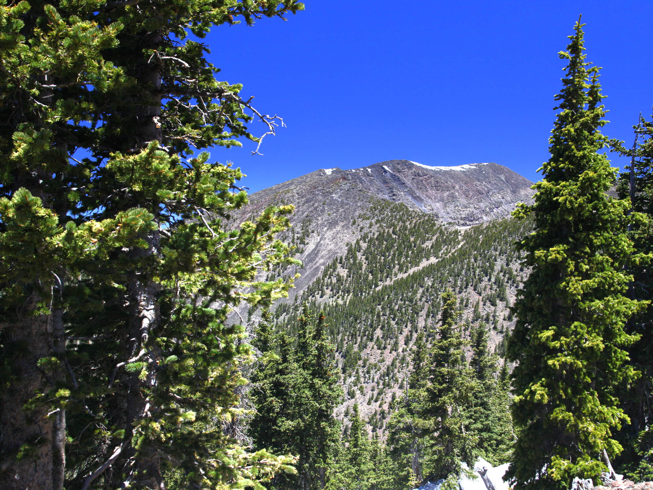
Humphrey's Peak via Inner Basin Trail
Difficulty Rating:
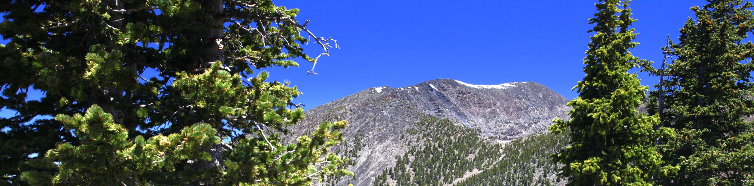
Humphrey's Peak via Inner Basin Trail leads you through a stunning aspen forest in the Kachina Peaks Wilderness all the way to the highest point in the state of Arizona. While not the typical approach to Humphrey’s Peak, it’s a beautiful way to experience this mountain. This is a very popular hike in the fall when the aspens at the beginning of the hike are in their full fall colors. You’ll need lots of water, nutrition, good boots, poles, and layers to take on this route.
Getting there
The trailhead for Humphrey's Peak via Inner Basin Trail is in the Lockett Meadow Campground.

About
| Backcountry Campground | Lockett Meadow Campground |
| When to do | May-October |
| Pets allowed | Yes - On Leash |
| Family friendly | No |
| Route Signage | Average |
| Crowd Levels | Moderate |
| Route Type | Out and back |
Humphrey's Peak via Inner Basin Trail
Elevation Graph
Weather
Humphrey's Peak via Inner Basin Trail Description
The Lockett Meadow Inner Basin is renowned for its gorgeous views, making it a perfect starting point for your adventure up the tallest mountain in Arizona, Humphrey’s Peak. This route leads you through a beautiful aspen forest, then up, up, and up to the top. You should be comfortable acclimatized to Flagstaff’s elevation before attempting this climb. Hikers should bring lots of water to avoid symptoms of altitude sickness. Bring lots of warm layers for the often-chilly summit.
The trailhead for this hike is at the very back of the day-use parking area. You’ll start by hiking through a mature pine forest. The pine trees give way to aspens. Begin a set of switchbacks towards the inner basin. This part of the hike follows a dirt road, and you’ll soon turn right onto a service road that leads you into the basin. At the signed fork, continue along the basin trail.
In the basin, continue to Doyle Spring Trail. You’ll hike west across the east face of Agassiz Peak to find the Humphrey’s Peak Trail (you’ll meet up with hikers here who started on the Snow Bowl side). Hike north along the ridgeline in your final push to the top. From here, retrace your steps.
Similar hikes to the Humphrey's Peak via Inner Basin Trail hike

Fay Canyon Loop
Fay Canyon is one of several main canyons in the Walnut Canyon National Monument. This loop hike explores part of…

Sandy Steps, Heart, and Upper Oldham Trail
The Sandy Steps, Heart, and Upper Oldham hike makes use of several different trails to create a hike that stretches…

Fisher Point via Fay Canyon
Fisher Point is one of the best viewpoints into the gorgeous Walnut Canyon. This route leads you to the point…
Comments