
Chimney Springs Trail
View Photos
Chimney Springs Trail
Difficulty Rating:
Chimney Springs Trail is a fantastic shorter hike in the Fort Valley Trail System of Flagstaff. This route offers gorgeous views of the nearby San Francisco Peaks and it’s a haven for wildflowers in the spring and summertime. The trail doesn’t get very busy, so try it out when you want classic northern Arizona views mostly to yourself. This route is good for beginners and families.
Getting there
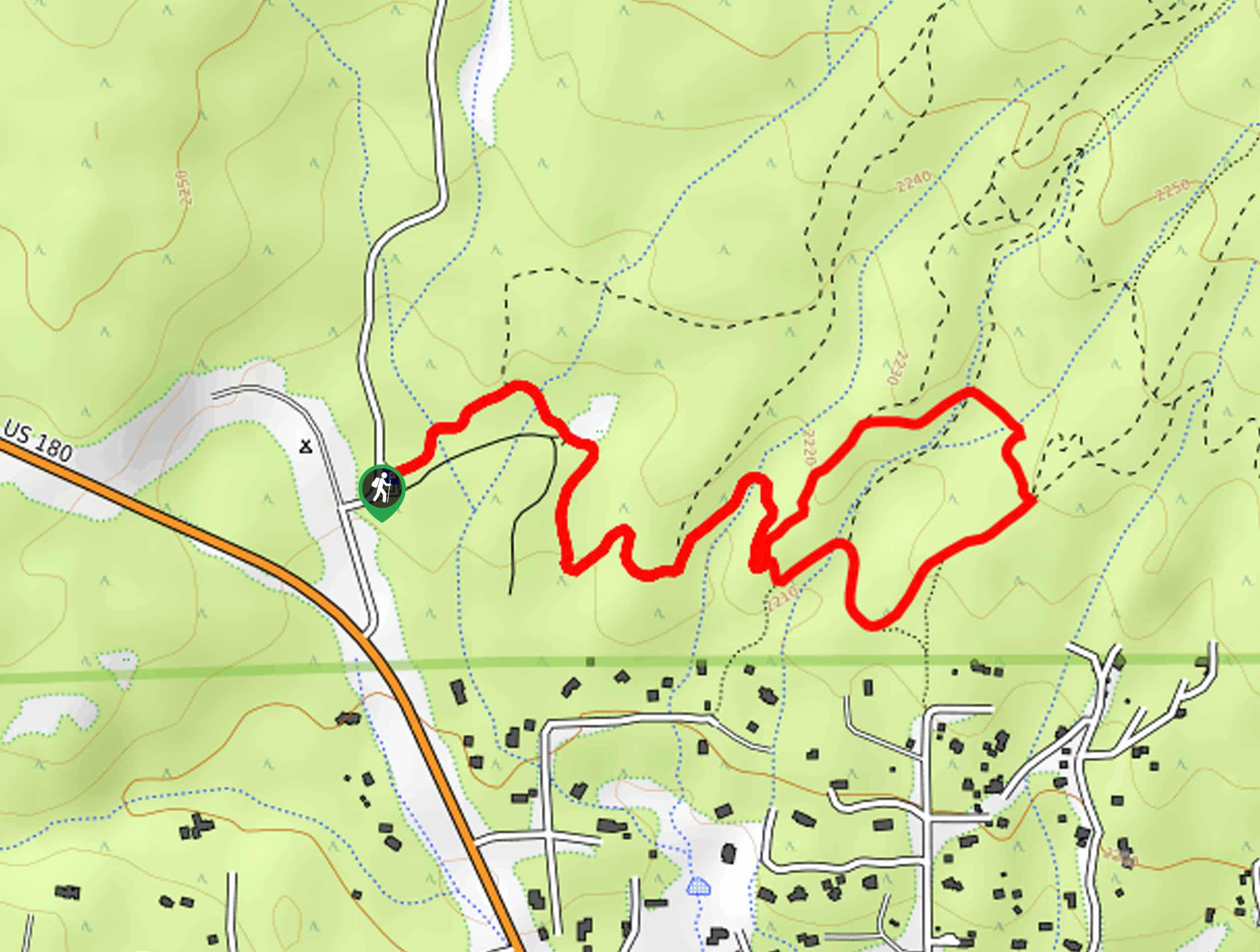
The trailhead for the Chimney Springs Trail is off Fort Valley Road.

About
| Backcountry Campground | Flagstaff Forest Free Camping |
| When to do | April-October |
| Pets allowed | Yes |
| Family friendly | Yes |
| Route Signage | Average |
| Crowd Levels | Moderate |
| Route Type | Out and back |
Chimney Springs Trail
Elevation Graph
Weather
Chimney Springs Trail Description
Chimney Springs Trail is part of the Fort Valley Trail System, a collection of routes that offer great views and, often, some peace and quiet. This route shows off the ponderosa pine forests, fields of wildflowers, and the San Francisco Peaks. You’ll likely only share the trail with a few others, if anyone. This is a good pick for beginners and families.
The signage in this area is alright, but you may want to download a GPS track for this hike since there are lots of intersecting trails on this route. This does offer the chance to explore a bit further in the area if this hike is a bit shorter than you’d prefer.
From the trailhead, take Moto Trail as it winds its way across creeks, undulating gradually. The trail splits (stay on Moto Trail) and then splits again, where you’ll stay right onto Damper Trail. Take this to a T-junction, where you’ll stay right onto Flue Trail. Flue Trail will lead you back to the original trail split, where you can retrace your steps to the trailhead.
Similar hikes to the Chimney Springs Trail hike

Fay Canyon Loop
Fay Canyon is one of several main canyons in the Walnut Canyon National Monument. This loop hike explores part of…

Sandy Steps, Heart, and Upper Oldham Trail
The Sandy Steps, Heart, and Upper Oldham hike makes use of several different trails to create a hike that stretches…

Fisher Point via Fay Canyon
Fisher Point is one of the best viewpoints into the gorgeous Walnut Canyon. This route leads you to the point…
Comments