
Lower Oldham Trail Loop
View Photos
Lower Oldham Trail Loop
Difficulty Rating:
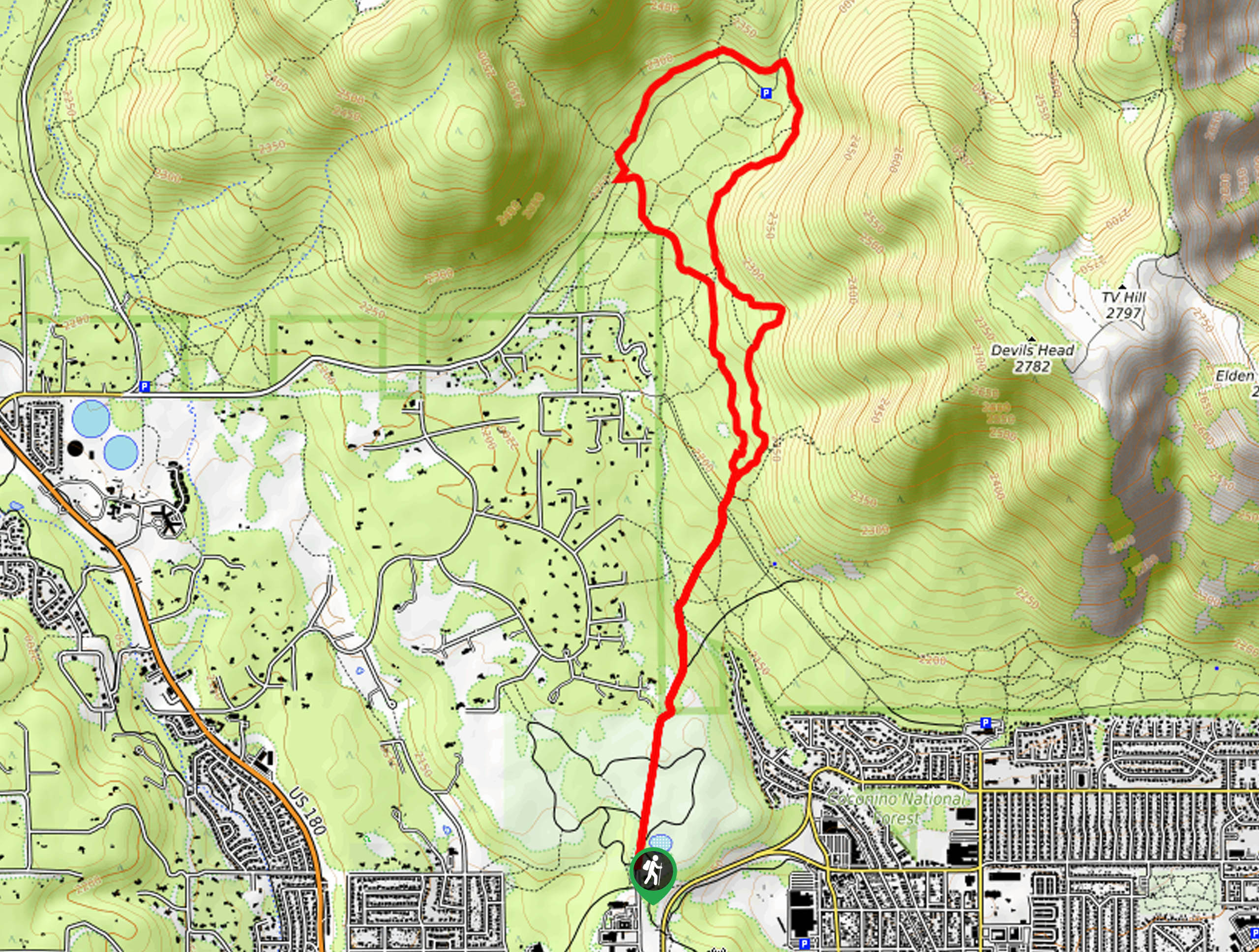
The Oldham Trail Loop begins from Buffalo Park, the most popular park in Flagstaff, and heads north through the forest to the base of the Dry Lake Hills. This hike is a good pick for when you want to be immersed in the trees on a less busy route. It’s a bit rocky, so you’ll want sturdy boots. Expect light traffic on this hike.
Getting there
The trailhead for Lower Oldham Trail Loop is at the end of N Gemini Drive.

About
| Backcountry Campground | No |
| When to do | June-October |
| Pets allowed | Yes - On Leash |
| Family friendly | Yes |
| Route Signage | Poor |
| Crowd Levels | Low |
| Route Type | Lollipop |
Lower Oldham Trail Loop
Elevation Graph
Weather
Lower Oldham Trail Loop Description
The Lower Oldham Trail Loop is a relaxing route that leads you from Buffalo Park to the Dry Lake Hills, traveling under the canopy of the forest. It’s not a hike that offers huge views (the section through the park is more scenic), but it’s nice and calm and doesn’t get too busy. Dogs on leash are welcome and active families should be able to complete this hike.
You’ll want to wear sturdy boots for this hike since the trail is quite rocky. Additionally, some of the junctions in this area aren’t marked well, so a GPS route can help you find your way if needed.
From the trailhead, hike north through the park. Leaving the park, continue on the Arizona Trail-Lower Oldham and stay left. Cross Pipeline Trail and then reach the fork that forms the base of the loop.
Stay right here to trace the base of the hills, continuing around the loop until you turn left onto the Arizona Trail Rocky Ridge Connector. Take this until you can bear left onto the Oldham Alternate Trail, then retrace your steps to the park and back to the trailhead.
Similar hikes to the Lower Oldham Trail Loop hike

Fay Canyon Loop
Fay Canyon is one of several main canyons in the Walnut Canyon National Monument. This loop hike explores part of…

Sandy Steps, Heart, and Upper Oldham Trail
The Sandy Steps, Heart, and Upper Oldham hike makes use of several different trails to create a hike that stretches…

Fisher Point via Fay Canyon
Fisher Point is one of the best viewpoints into the gorgeous Walnut Canyon. This route leads you to the point…
Comments