
Brandis Way Hike
View Photos
Brandis Way Hike
Difficulty Rating:
The Brandis Way hike is a lesser-known trail near the Kachina Peaks Wilderness on the east side of the San Francisco Peaks, which are the highlight of your view on this hike. This route sees light traffic–so light, in fact, that you might want to prepare for a bit of overgrowth. Long pants donned, you can enjoy the mountain views and the peaceful atmosphere out here.
Getting there
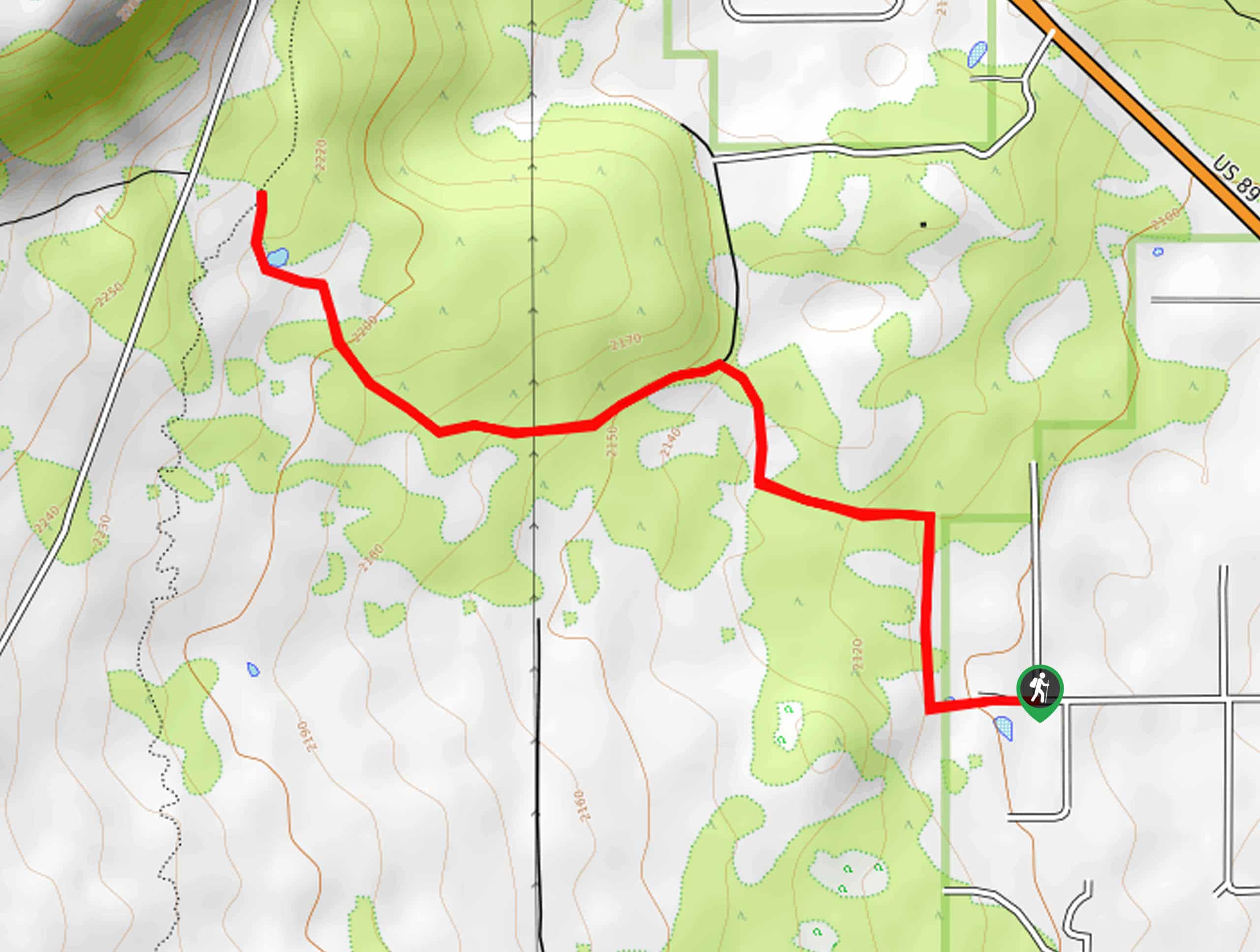
The trailhead for the Brandis Way Hike is at the intersection of Ostrich Lane and Brandis Way.

About
| Backcountry Campground | No |
| When to do | March-November |
| Pets allowed | Yes - On Leash |
| Family friendly | Yes |
| Route Signage | Average |
| Crowd Levels | Low |
| Route Type | Out and back |
Brandis Way Hike
Elevation Graph
Weather
Brandis Way Hike Description
The Brandis Way hike is a very lightly traveled route that starts from the far northern reaches of Flagstaff. This route leads you towards the San Francisco Peaks, which are the highlight of your view. The hike travels through an area recovering from a forest fire, but the unusual advantage to this section is that (until it’s fully regrown), it opens up the view of the mountains.
This hike can suffer from a bit of overgrowth, so long pants can be helpful, especially if it’s rained recently. Since there tend to be so few people out here, GPS mapping can be helpful.
From the trailhead, pass the ponds and then take a right. The route will then curve to your left before beginning its gradual ascent in the direction of the peaks. Enjoy the views and the atmosphere. After Lenoux Tank, the route ends where it reaches Deer Hill Trail. From here, turn around and retrace your steps.
Similar hikes to the Brandis Way Hike hike

Fay Canyon Loop
Fay Canyon is one of several main canyons in the Walnut Canyon National Monument. This loop hike explores part of…

Sandy Steps, Heart, and Upper Oldham Trail
The Sandy Steps, Heart, and Upper Oldham hike makes use of several different trails to create a hike that stretches…

Fisher Point via Fay Canyon
Fisher Point is one of the best viewpoints into the gorgeous Walnut Canyon. This route leads you to the point…
Comments