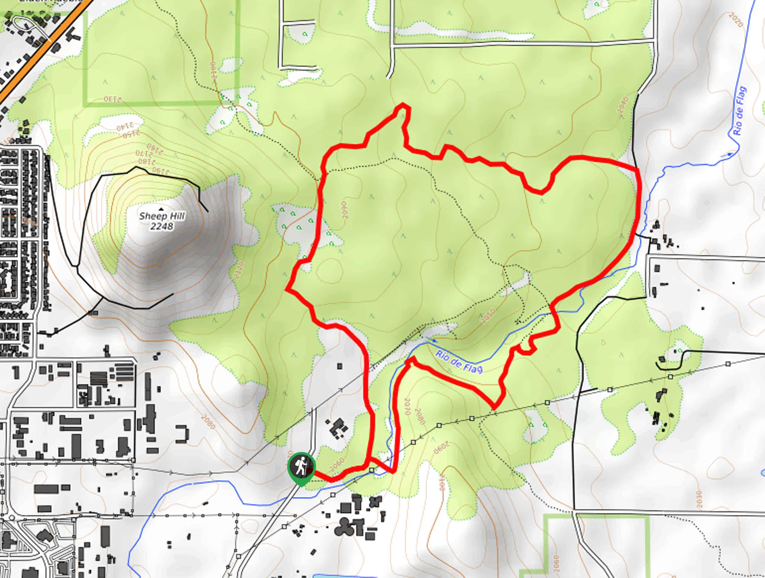
Tom Moody Extended Loop
View Photos
Tom Moody Extended Loop
Difficulty Rating:
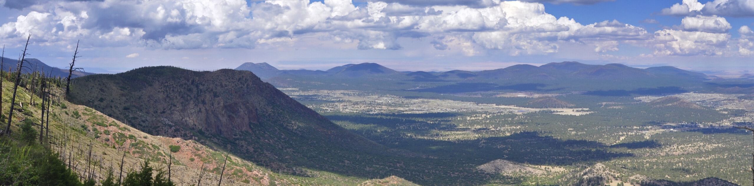
The Tom Moody Extended Loop is a beautiful hike in the Picture Canyon Natural and Cultural Preserve. The route is 3.7mi long and rated as easy, making it great for all ages and skill levels. The Picture Canyon Natural and Cultural Preserve is just 15 minutes from downtown Flagstaff, and it serves as an important riparian habitat, recreational area, and historical site. One of the features of the Tom Moody Loop is the extensive collection of petroglyphs.
In addition to petroglyphs, this hike features canyon vistas and interpretive areas. It’s a fabulous hike for families with curious children, but we’d recommend it for hikers of any age who want to appreciate the unique natural and historical highlights of the Flagstaff area. Expect heavy traffic on this route.
Getting there
The trailhead for the Tom Moody Extended Loop is on N El Paso Flagstaff Road.

About
| Backcountry Campground | No |
| When to do | March-November |
| Pets allowed | Yes - On Leash |
| Family friendly | Yes |
| Route Signage | Good |
| Crowd Levels | High |
| Route Type | Loop |
Tom Moody Extended Loop
Elevation Graph
Weather
Tom Moody Extended Loop Description
The Tom Moody Extended Loop is a popular hike in the Picture Canyon Natural and Cultural Reserve, an area of natural and cultural significance just 15 minutes from downtown Flagstaff. This reserve protects a sensitive riparian habitat, a gorgeous canyon, and extensive collections of petroglyphs, which the Tom Moody Extended Loop takes you to.
The preserve is inhabited by owls, elk, bats, turkey, eagles, and more. It’s a designated Watchable Wildlife Site, which means you can hide behind the blind near the reserve’s pond to spot animals. Picture Canyon is also one of the top birding sites in northern Arizona.
Aside from its natural importance, Picture Canyon is an area of cultural and historical significance. Inhabited by the Northern Sinagua people from 700-1300 AD, the canyon holds the most concentrated collection of petroglyphs in the area. The 126+ panels depict archers, mammals, turtles, birds, and geometric designs.
The Tom Moody Extended Loop is the longer version of the park’s main trail, which offers interpretive signage, great canyon views, and the chance to inspect the petroglyphs. As with all sensitive sites, make sure to stay on the marked trails, keep pets leashed and on the trail, and don’t touch the petroglyphs.
From the trailhead, the route heads towards the Rio de Flag. At the fork, stay right and then hike north along the river to the waterfall overlook, a beautiful picture spot. There’s a petroglyph overlook next to the waterfall. Follow the route to the T-junction, and then take a left onto AZT-Mount Elden.
Stay right and then cross the Rio, arriving at the main petroglyphs viewing area. Take your time inspecting these ancient drawings before continuing on the Tom Moody Loop Trail, bearing left at the next fork. You’ll go straight through the intersection with the Arizona Trail and follow the route back to the trailhead.
Once you’re done with your loop, feel free to check out the viewing blind at the pond or return to your favorite canyon viewpoints before leaving the area.
Hiking Route Highlights
Petroglyphs
The Tom Moody Extended Loop reveals the petroglyphs of the Northern Sinagua people, who inhabited this area between 700 and 1300 AD. This is the most concentrated collection of petroglyphs in the region, with images depicting different mammals, birds, people, and geometric designs. The petroglyphs are easily appreciated from this loop trail, which also offers an excellent view of Picture Canyon.
Frequently Asked Questions
How far is Picture Canyon from Flagstaff?
Picture Canyon is only about 15 minutes from downtown Flagstaff.
Is the Picture Canyon hike long?
The Tomy Moody Extended Loop is 3.7mi long, but there are other trails in the reserve you can enjoy, too
Insider Hints
Hiking after a recent rain will make the view at the waterfall as impressive as possible.
Similar hikes to the Tom Moody Extended Loop hike

Fay Canyon Loop
Fay Canyon is one of several main canyons in the Walnut Canyon National Monument. This loop hike explores part of…
Pumphouse Nature Trail
Pumphouse Nature Trail is a short and pleasant walk in Kachina Village, Arizona. This route is only 1.1mi…
Doney Mountain Trail
Doney Mountain Trail is a short hike in the far northeastern corner of Sunset Crater Volcano National Monument. This route…
Comments