
Rocky Ridge Trail
View Photos
Rocky Ridge Trail
Difficulty Rating:
The Rocky Ridge Trail is a moderate hike in the Schultz Creek Trail System in the Dry Lake Hills in Flagstaff. This route is used by hikers, those with dogs, and mountain bikers. It mostly travels through the forest on varied terrain and you’ll have the best experience if you hike when the wildflowers are out. This route can get a bit snowed in during the wintertime. Expect moderate traffic.
Getting there
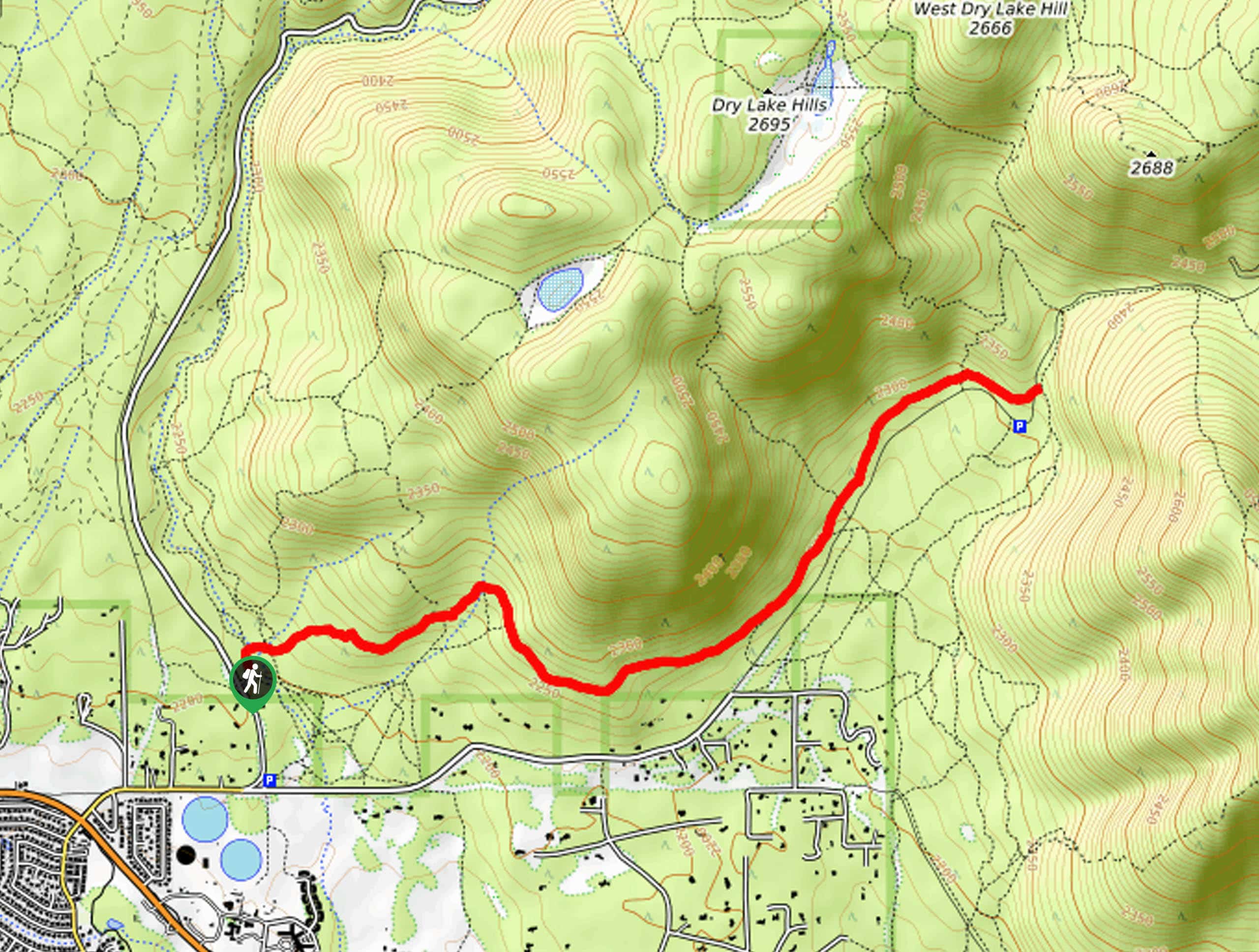
The trailhead for Rocky Ridge Trail is on Schultz Pass Road.

About
| Backcountry Campground | No |
| When to do | March-November |
| Pets allowed | Yes - On Leash |
| Family friendly | Yes |
| Route Signage | Average |
| Crowd Levels | Moderate |
| Route Type | Out and back |
Rocky Ridge Trail
Elevation Graph
Weather
Rocky Ridge Trail Description
The Rocky Ridge Trail is a hike that leads you through the trees at the base of the Dry Lake Hills in Flagstaff. This route mostly shows off the forest and includes varied, interesting terrain. This trail is also sometimes used by mountain bikers, so keep an eye out and share the trail if you come across one another. Dogs are permitted on this hike as long as they’re on leash.
There are a lot of interconnecting trails in this area, so consider bringing a GPS route or map if you’re unfamiliar with the routes. Sturdy boots are recommended as, true to the name, this trail can be a bit rocky.
From the trailhead, cross Schultz Creek and go left onto the Arizona Trail-Rocky Ridge. Follow this route as it hugs the base of the hills. Watch for birds, deer, or elk as you go. The route becomes the Rocky Ridge Trail as you go. It ends at the junction with Elden Lookout Trail, where you can turn back and retrace your steps.
Similar hikes to the Rocky Ridge Trail hike

Fay Canyon Loop
Fay Canyon is one of several main canyons in the Walnut Canyon National Monument. This loop hike explores part of…

Sandy Steps, Heart, and Upper Oldham Trail
The Sandy Steps, Heart, and Upper Oldham hike makes use of several different trails to create a hike that stretches…

Fisher Point via Fay Canyon
Fisher Point is one of the best viewpoints into the gorgeous Walnut Canyon. This route leads you to the point…
Comments