
Walnut Canyon via Sandys Canyon Trail and Fisher Point Trail
View Photos
Walnut Canyon via Sandys Canyon Trail and Fisher Point Trail
Difficulty Rating:
Walnut Canyon via Sandys Canyon Trail and Fisher Point Trail is a hiking route that takes you into the historical Walnut Canyon, where a vibrant pueblo community used to live. The terrain and surroundings are varied and fascinating, from canyons and caves to the woods. This hike is easy enough for most skill levels and ages and tends to see moderate traffic. It’s a good pick for campers at Canyon Vista.
Getting there
The trailhead for Walnut Canyon via Sandys Canyon Trail and Fisher Point Trail is off Lake Mary Road.

About
| Backcountry Campground | Canyon Vista Campground |
| When to do | April-November |
| Pets allowed | Yes - On Leash |
| Family friendly | Yes |
| Route Signage | Poor |
| Crowd Levels | Moderate |
| Route Type | Out and back |
Walnut Canyon via Sandys Canyon Trail and Fisher Point Trail
Elevation Graph
Weather
Walnut Canyon via Sandys Canyon Trail and Fisher Point Trail Description
Walnut Canyon via Sandys Canyon Trail and Fisher Point Trail is a naturally beautiful hike not far outside of Flagstaff in the Coconino National Forest. With varied scenery as you move through this canyon, it’s a beautiful hike. Appreciate the layers of rock visible in the canyon, which are the same layers you’d observe in the nearby Grand Canyon. Also, appreciate that there used to be a thriving pueblo community in this canyon!
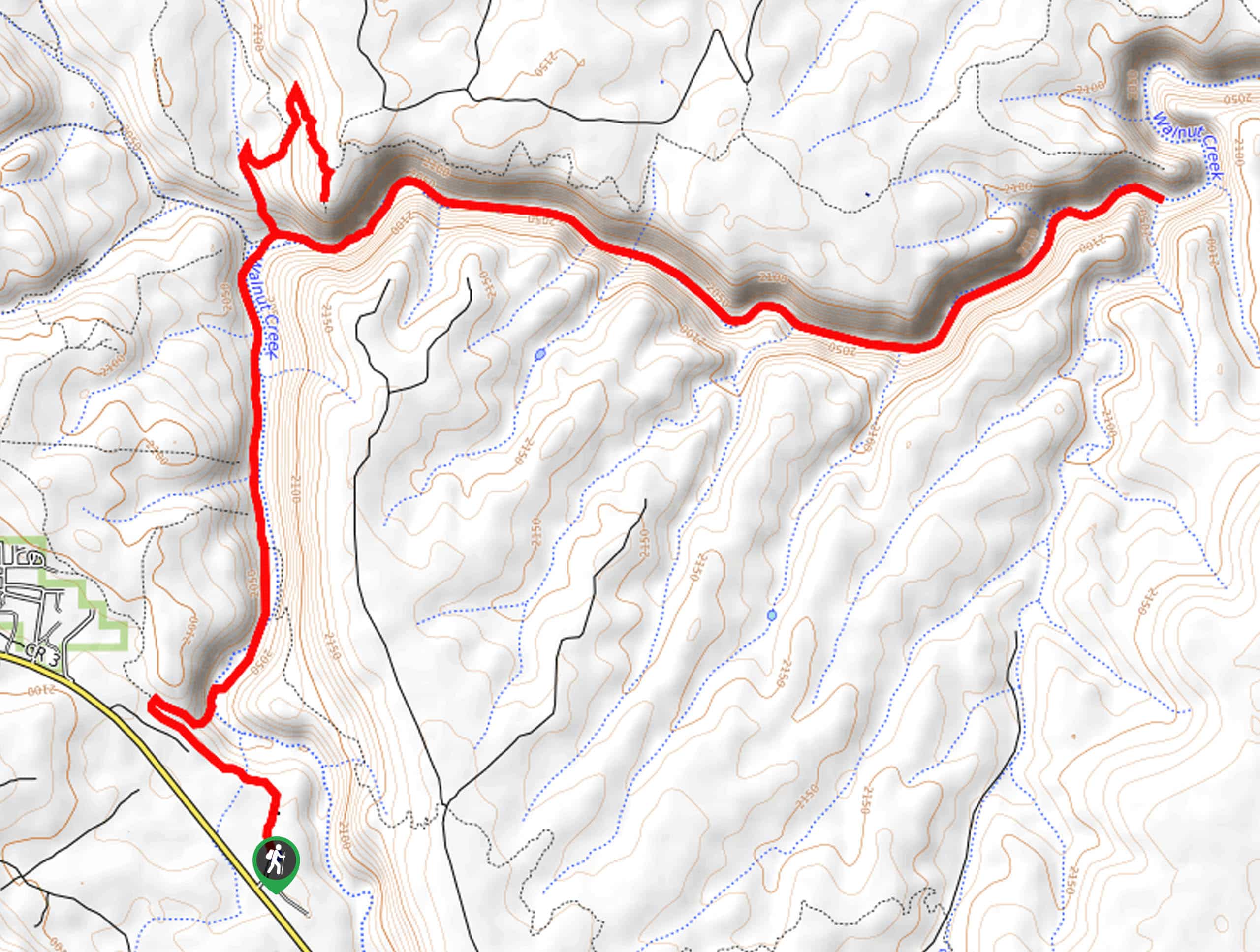
From the trailhead, hike north towards Canyon Vista Campground. You’ll hike through the campground. The trail crosses a creek as it turns northwest. Around a looping right turn, make sure to keep right where another trail heads off to the right. You’ll begin a short descent that takes you down to the bottom of Walnut Canyon.
Cross Walnut Creek and then cross back over. Trek along the canyon floor, enjoying the scenery and the flat route. Once you reach the base of Fisher Point, the trail climbs up and around to this viewpoint, which is gorgeous. Climb back down into the canyon and hike east, travelling through the canyon to the trail’s end. From here, head back through the canyon to the trailhead.
Similar hikes to the Walnut Canyon via Sandys Canyon Trail and Fisher Point Trail hike

Fay Canyon Loop
Fay Canyon is one of several main canyons in the Walnut Canyon National Monument. This loop hike explores part of…

Sandy Steps, Heart, and Upper Oldham Trail
The Sandy Steps, Heart, and Upper Oldham hike makes use of several different trails to create a hike that stretches…

Fisher Point via Fay Canyon
Fisher Point is one of the best viewpoints into the gorgeous Walnut Canyon. This route leads you to the point…
Comments