
Pumpkin Trail to Bulls Basin Loop
View Photos
Pumpkin Trail to Bulls Basin Loop
Difficulty Rating:
The Pumpkin Trail to Bulls Basin Loop is a 12.3mi hard hike that sees light to moderate traffic. This route travels through the Kendrick Mountain Wilderness to the top of Kendrick Mountain itself. It’s a longer approach than the typical trail to the summit, but it’s a bit less steep on average and offers more varied views. This route is not a good choice for kids, but dogs are allowed on leash.
Getting there
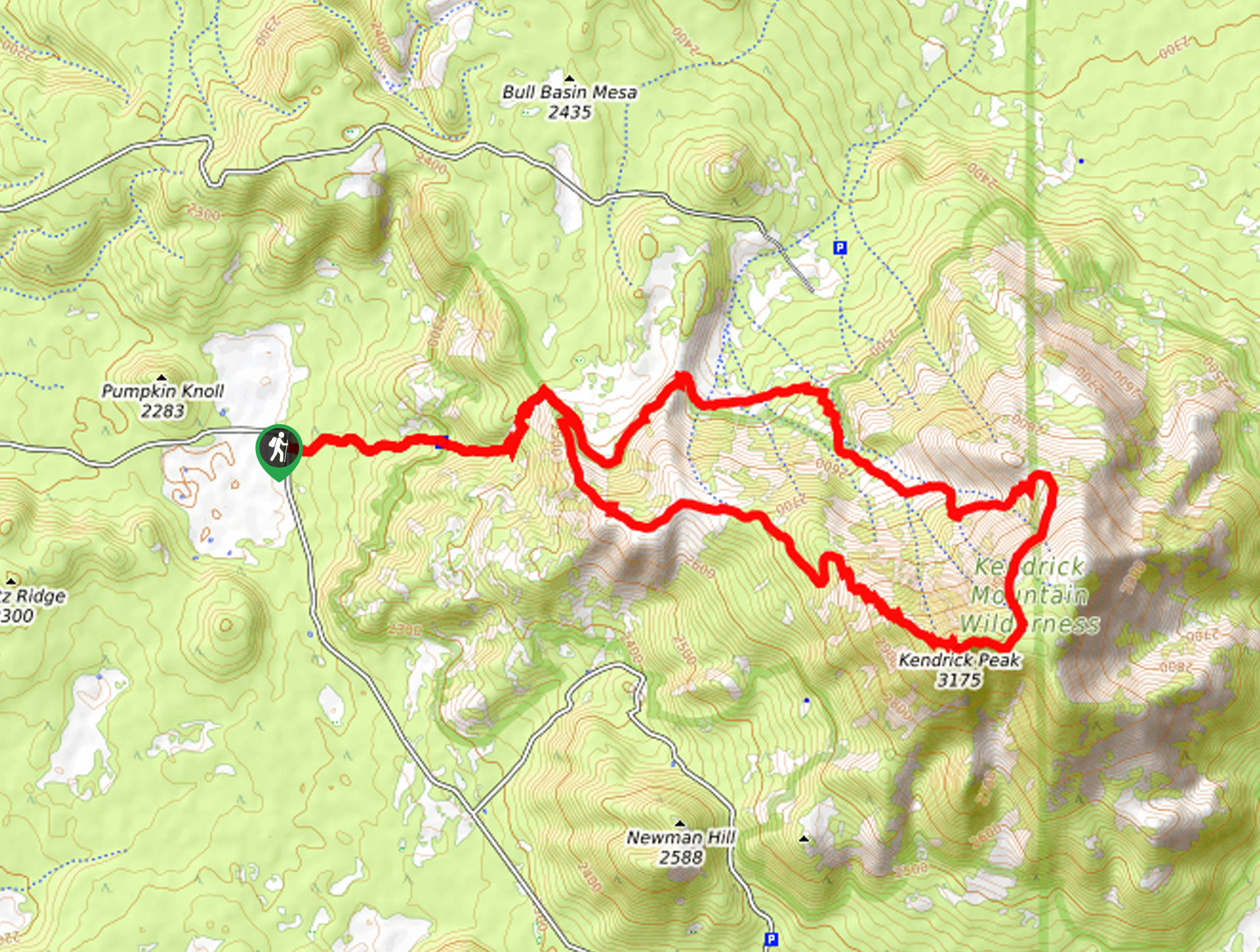
The trailhead for the Pumpkin Trail to Bulls Basin Loop is on County Road 171.

About
| Backcountry Campground | No |
| When to do | March-November |
| Pets allowed | Yes - On Leash |
| Family friendly | No |
| Route Signage | Average |
| Crowd Levels | Low |
| Route Type | Loop |
Pumpkin Trail to Bulls Basin Loop
Elevation Graph
Weather
Pumpkin Trail to Bulls Basin Loop Description
The Pumpkin Trail to Bulls Basin Loop is a 12.3mi hard hike in the Kendrick Mountain Wilderness north of Flagstaff, Arizona. This hike is demanding, but the views from the highpoint atop Kendrick Mountain are beautiful. There is a shorter, more direct route to the summit, but this approach offers a somewhat less steep ascent and more varied scenery.
This is a tough hike with very little shade, so make sure you come prepared with lots of water and dress in layers. Poles and sturdy boots are recommended. Users report relying on offline navigation in some spots, so a downloaded GPS route is also recommended.
The hike begins from the trailhead on the road, but if you have a high-clearance vehicle, you can drive a mile further to a parking area. Hike east towards the base of the mountains on Pumpkin Trail #39, ascending to your left before reaching the split of the loop. Keep right on Pumpkin Trail, climbing up the ridge to the peak of Kendrick Mountain. You’ll settle into steep, narrow switchbacks to the top. From here, continue off the other side of the summit and then stay left onto Bull Basin Trail #40. You’ll descend along the side of the basin to the loop split, where you can retrace your steps to the trailhead.
Similar hikes to the Pumpkin Trail to Bulls Basin Loop hike

Fay Canyon Loop
Fay Canyon is one of several main canyons in the Walnut Canyon National Monument. This loop hike explores part of…

Sandy Steps, Heart, and Upper Oldham Trail
The Sandy Steps, Heart, and Upper Oldham hike makes use of several different trails to create a hike that stretches…

Fisher Point via Fay Canyon
Fisher Point is one of the best viewpoints into the gorgeous Walnut Canyon. This route leads you to the point…
Comments