
Oldham Trail
View Photos
Oldham Trail
Difficulty Rating:
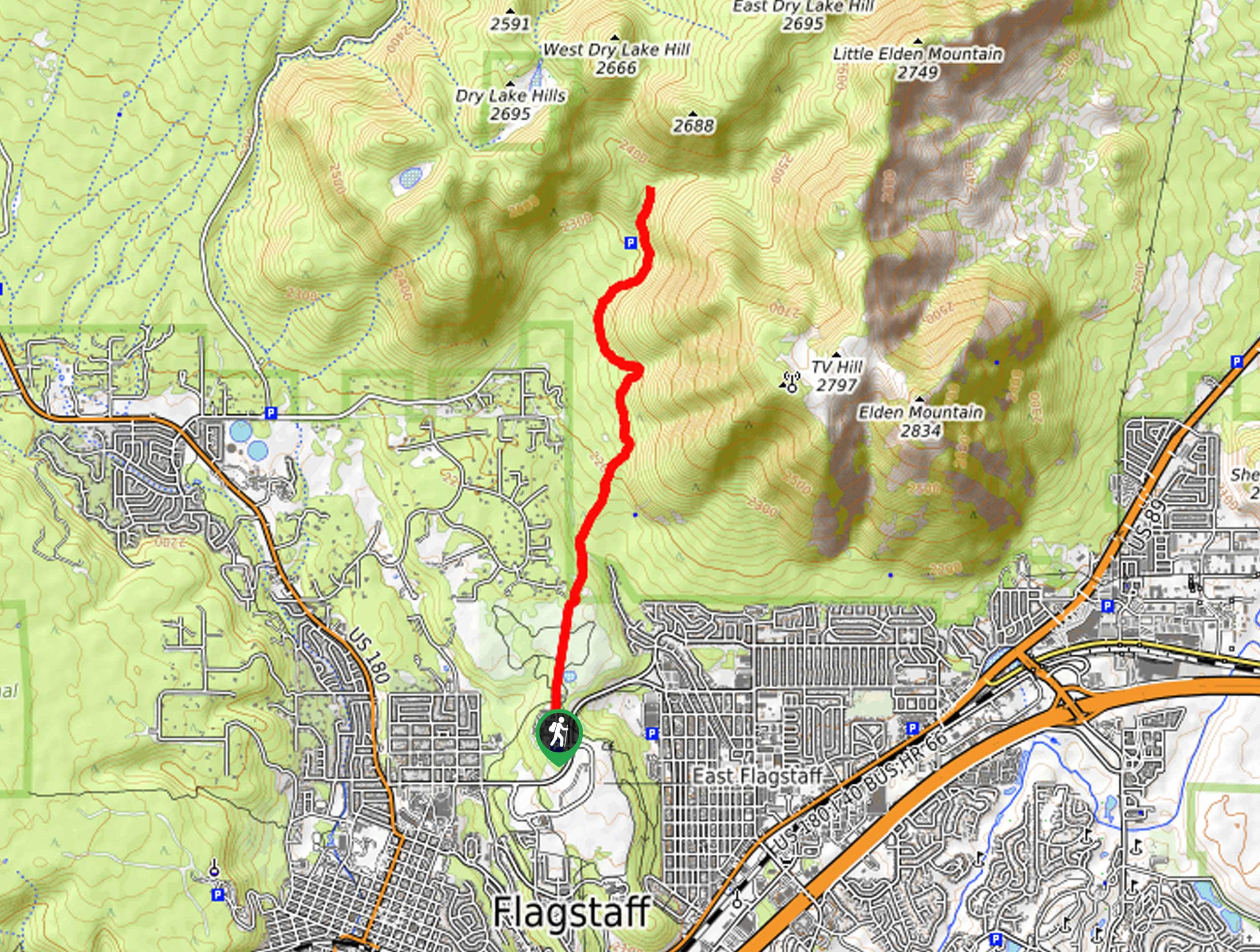
The Oldham Trail begins from Buffalo Park, the most popular park in Flagstaff, and heads north through the forest to the base of the Dry Lake Hills. The route hugs the hills in a gentle climb, ending on the north side of T V Hill. This hike is a good pick for when you want to be immersed in the trees. It’s a bit rocky, so you’ll want sturdy boots. Expect light traffic on this hike.
Getting there
The trailhead for Oldham Trail is at the end of N Gemini Drive.

About
| Backcountry Campground | No |
| When to do | April-November |
| Pets allowed | Yes - On Leash |
| Family friendly | Yes |
| Route Signage | Average |
| Crowd Levels | High |
| Route Type | Out and back |
Oldham Trail
Elevation Graph
Weather
Oldham Trail Description
The Oldham Trail is a scenic route that leads you from Buffalo Park to the Dry Lake Hills, climbing along the western base of T V Hill. This hike shows off mountain views from the park and nice forest views on the trail. Dogs on leash are welcome and active families should be able to complete this hike.
You’ll want to wear sturdy boots for this hike since the trail is quite rocky. Additionally, some of the junctions in this area aren’t marked well, so a GPS route can help you find your way if needed.
From the trailhead, hike north through the park. Leaving the park, continue on the Arizona Trail-Lower Oldham and stay left. Cross Pipeline Trail and bear left to stay on the AZT. The route will hug the base of the mountain and follow its curvature, climbing very gently to its endpoint at the junction with the Elden Lookout Road. From here, turn around and retrace your steps to the trailhead.
Similar hikes to the Oldham Trail hike

Fay Canyon Loop
Fay Canyon is one of several main canyons in the Walnut Canyon National Monument. This loop hike explores part of…

Sandy Steps, Heart, and Upper Oldham Trail
The Sandy Steps, Heart, and Upper Oldham hike makes use of several different trails to create a hike that stretches…

Fisher Point via Fay Canyon
Fisher Point is one of the best viewpoints into the gorgeous Walnut Canyon. This route leads you to the point…
Comments