Lava River Cave Hike
View Photos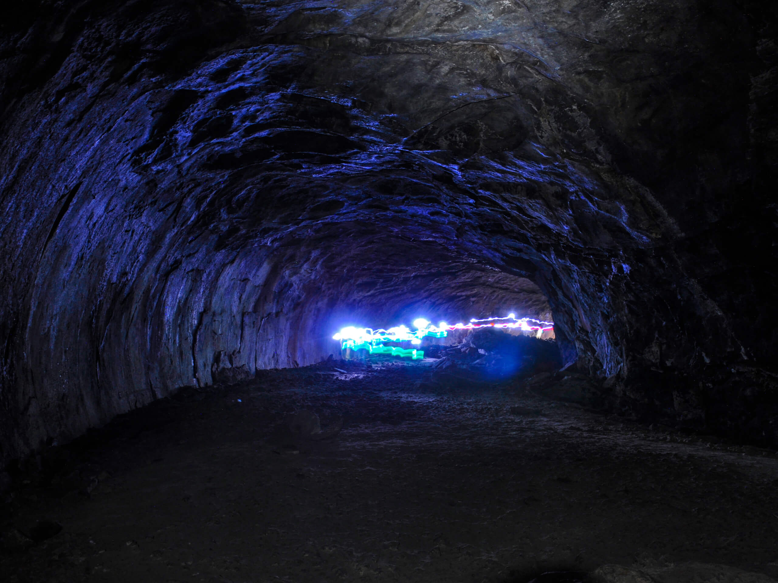
Lava River Cave Hike
Difficulty Rating:
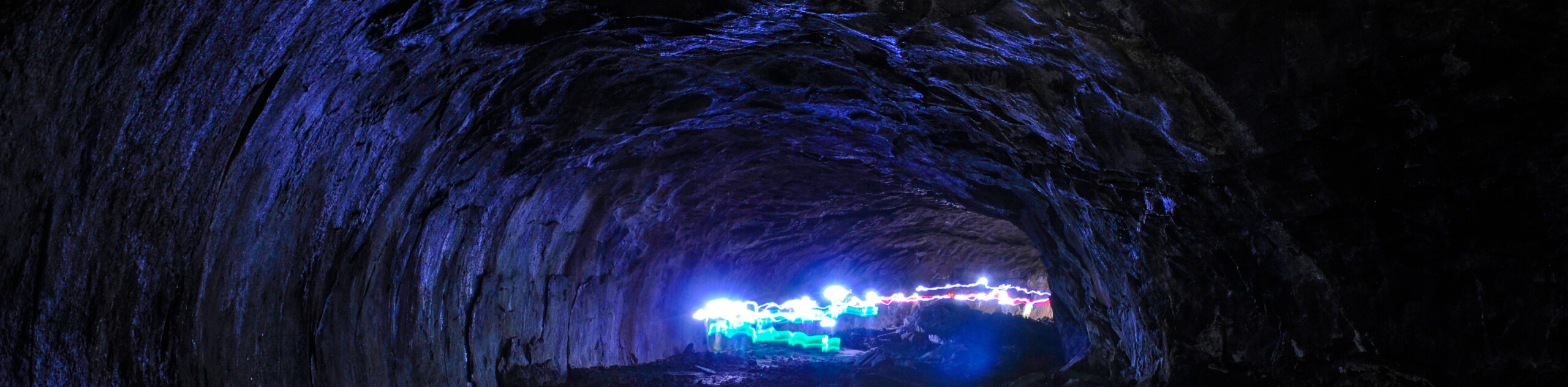
Over 700,000 years ago, the Lava River Caves in Flagstaff were formed when molten rock erupted from a volcanic vent near Hart Prairie. The lava flow cooled from the outside in, while the center continued to flow, creating the hollowed-out caves that are present today. Evidence of this molten-hot activity can be found in the stone icicles that hang from the ceiling, which were formed when blasts of heat melted the rock ceiling, allowing it to drip down as it cooled.
The hike itself is very unique. You’ll climb down the rock into the cave, which is pitch-black without the help of headlamps and flashlights. Consistently about 42 degrees year-round, it’s a dark, cool environment to explore. Sturdy boots are a must due to the sharp rock footing, and you definitely need to come prepared with two or three sources of light. A dead battery down here will leave you over a mile from the nearest light source.
Getting there
The trailhead for the Lava River Cave hike is on FR 171B.

About
| Backcountry Campground | No |
| When to do | March-November |
| Pets allowed | No |
| Family friendly | Yes |
| Route Signage | Good |
| Crowd Levels | High |
| Route Type | Out and back |
Lava River Cave Hike
Elevation Graph
Weather
Lava River Cave Hike Description
The Lava River Cave hike is one of the most unique and fascinating hikes in the state of Arizona. Climbing down under the earth, you’ll walk (and sometimes crouch) through an underground cave system formed by a volcanic blast over 700,000 years ago. As the lava flowed through the earth, the top, sides, and bottom cooled first while the middle continued to flow, creating the river-like system that exists today.
As final blasts of heat re-liquefied rock, drips cooled as they dropped from the ceiling, creating the rocky icicles you’ll see today. When taken into consideration alongside the nearby SP Crater, Sunset Crater, and caldera of the San Francisco Peaks, you can start to understand the volatile volcanic activity that defined the region many years ago.
This hike isn’t difficult in traditional terms of elevation gain, but it does present some unique challenges. First off, you have to be able to scramble your way down the cave entrance. Hikers with mobility challenges, elderly hikers, and very young kids may not be able to complete this. There is work being done to improve this access point to the trail.
This hike isn’t a good fit for individuals who have claustrophobia or a fear of the dark. Some sections of the route are very narrow, some require you to crouch down to get through, and the entire cave system is pitch black, save for the light of user’s flashlights and headlamps.
Please pack 2 or 3 light sources (phone lights won’t be strong enough) as there is no natural light in the caves. Headlamps and flashlights are recommended.
Definitely wear sturdy shoes as the cave floors are sharp and jagged. The cave is a consistent 42 degrees throughout the year, so bring a jacket. While the cave is open year-round, the access road is often closed in the winter due to snow and mud. Dogs are not permitted in this cave. The footing could cut their paws, and animals brought into the cave against the rules in years past have caused days of continuous stink after going to the bathroom inside.
From the trailhead, you’ll climb down the steep rock descent. If you have a large backpack, consider taking your valuables with you and leaving the rest, or you might get stuck along the way. Turn on your lights and make your way through the underground tunnel.
At one point, the route splits in half. The trail to the left is easier, and the trail to the right requires some crouching and squeezing. Watch your head on the low ceilings.
At the end of the cave system, turn back and follow the tunnel back to the entrance, where you’ll have to climb back out to find the light of day again.
Hiking Route Highlights
Lava River Caves
Evidence of northern Arizona’s volcanic past, the underground tunnel and cave system you’ll explore on this hike was created by a lava flow from an eruption near Hart Prairie. As the middle of the lava flowed, the outside began to cool, creating the tunnels you see today. Blasts of heat melted the tunnel’s ceiling, and rock dripped down into icicle shapes before cooling again. Today, the caves are a fascinating stop for hikers local to Arizona and visiting from elsewhere alike.
Frequently Asked Questions
Is the Lava River Cave closed?
The cave has been closed intermittently in the last while to allow for construction to improve access to the caves. Otherwise, the hike is open year-round.
How long is the Lava River Cave?
The entire tunnel system is 3820ft long. The hikeable route reflected in this guide is 0.4mi long.
How deep is the Lava River Cave?
The deepest part of the cave is 4350ft above sea level, compared to the entrance’s elevation of 4500ft above sea level.
Insider Hints
There can be ice on the floor of the cave. Watch your step.
Remember a jacket if you’re visiting in the summer
Open-toed shoes are not recommended.
Similar hikes to the Lava River Cave Hike hike

Fay Canyon Loop
Fay Canyon is one of several main canyons in the Walnut Canyon National Monument. This loop hike explores part of…

Sandy Steps, Heart, and Upper Oldham Trail
The Sandy Steps, Heart, and Upper Oldham hike makes use of several different trails to create a hike that stretches…

Fisher Point via Fay Canyon
Fisher Point is one of the best viewpoints into the gorgeous Walnut Canyon. This route leads you to the point…
Comments