Humphreys Peak Hike
View Photos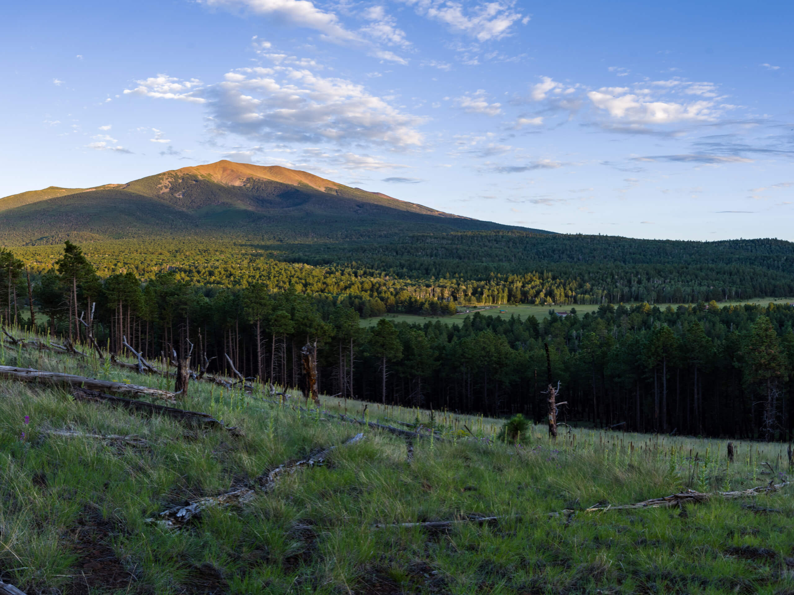
Humphreys Peak Hike
Difficulty Rating:
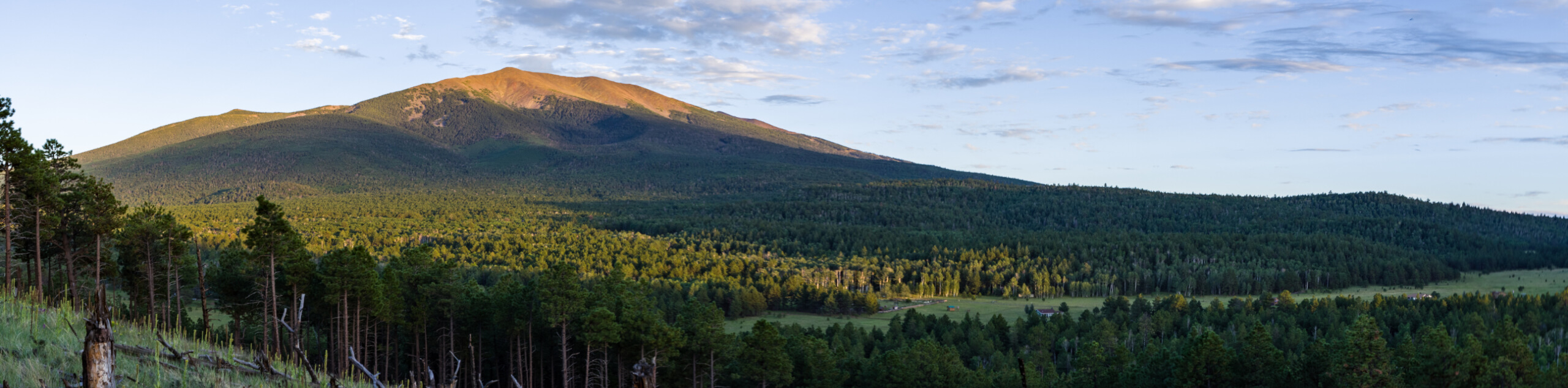
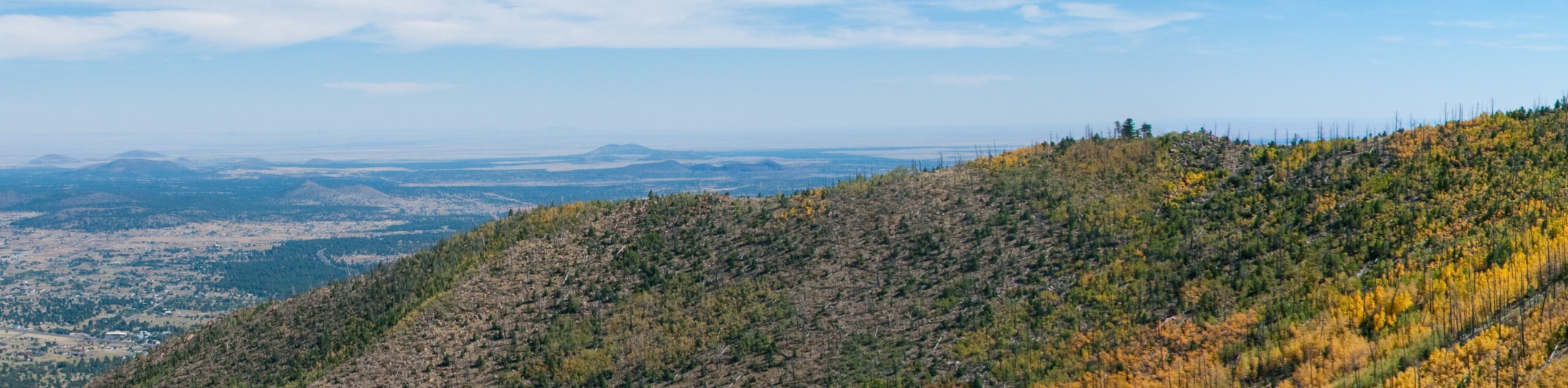
Humphreys Peak is one to put on the top of your Arizona hiking bucket list, as this mountain is the tallest point in the entire state at 12633ft. It’s a challenging route with stiff elevation gain, but most strong hikers can find their way to the top thanks to the lack of technical challenges (aside from some light scrambling) and the clearly defined trail. From the top, you’ll enjoy an expansive view of the Kachina Peaks Wilderness.
Humphreys Peak can be hiked year-round, but the winter months make for a more demanding climb. You’ll need snowshoes and you may benefit from packing ice axes and microspikes, too. Navigating the route is more difficult in the winter when the trail is covered in snow. Try the summer ascent first, which is generally easier to follow and more suitable for less experienced hikers. Bring a camera for that top-of-the-state view!
Getting there
The trailhead for Humphreys Peak is off Snow Bowl Road.

About
| Backcountry Campground | No |
| When to do | March-November |
| Pets allowed | Yes - On Leash |
| Family friendly | No |
| Route Signage | Poor |
| Crowd Levels | High |
| Route Type | Out and back |
Humphreys Peak Hike
Elevation Graph
Weather
Humphreys Peak Hike Description
Humphrey’s Peak is on the list for many in the Arizona hiking scene and it’s no wonder why, as this is the highest peak in the entire state, standing tall at 12633ft. There’s no better view of the Kachina Peaks Wilderness and its sea of mountains, and there’s no higher peak in Arizona you could be standing on. The mountain is sometimes called “Arizona’s Little Colorado” since it seems almost out of place in the state. It’s not all deserts here, folks!
Despite its status as the state’s highest point, the hike is surprisingly accessible for strong hikers. Aside from a bit of light scrambling, the route isn’t technically demanding, just fairly steep and strenuous.
Of all the hikers planning their trips up Humphreys Peak, there is a subset that seeks to climb the mountain in the wintertime. While the peak is open year-round, keep in mind that winter ascents face a few extra challenges. You’ll definitely need snowshoes, and you may want microspikes and ice axes in some spots. The route is much harder to follow in the winter, so a good map or GPS route is important.
In the summer, you’ll just want to consider the frequency of afternoon storms (monsoons) around the summit. These storms can bring lightning and down trees that you will have to climb over. Get your hike started early in the morning if you can and bring layers of clothing to adapt to the changing conditions. Expect the summit to be windy and chilly!
Prepare for 3000ft of elevation gain with lots of water, some snacks, weather-appropriate clothing, sturdy boots, and poles. Speaking of elevation gain, users from low-altitude locations have reported symptoms of altitude sickness on this hike. If you’re concerned about the altitude, take a day or two to acclimatize in Flagstaff before hiking, and plan to bring extra water with you on the trail. The route is easy to follow in the summer, so GPS navigation is helpful but not a necessity.
The route starts at the Snow Bowl, and the first 3.0mi climb gradually. Stay left on the second switchback and then continue through wide, consistent switchbacks. You’ll pass not far from the B-24 bomber crash site, where there’s a viewpoint.
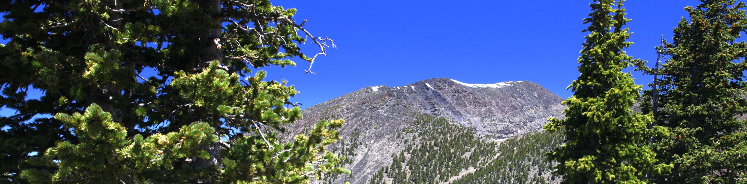
After passing a fire pit, you will climb up to the saddle. The trail is not as well-marked past the saddle, but it’s clear enough to make it to the top. There will be more and more loose rock as you approach the peak, so watch your step.
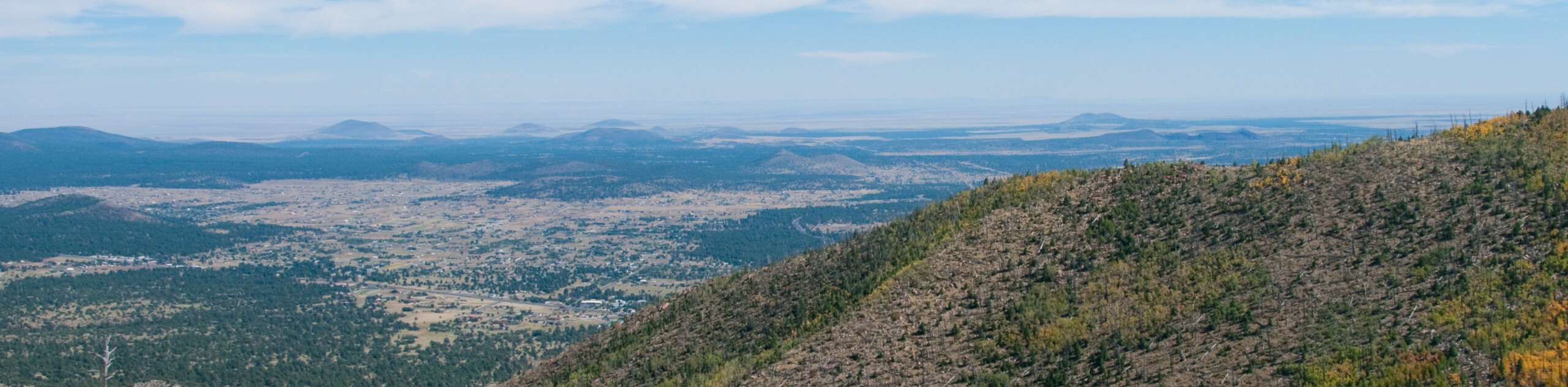
From the saddle, turn north and begin climbing the ridge to the summit. It’s rocky and loose, but there are no significant scrambling challenges. Once you make it to the summit, take a moment to appreciate the wide views around you. Look to the north to see all the way to the North Rim of the Grand Canyon. To the east, you can see the White Mountains, and the desert mountains of Phoenix are visible to the south.
If you feel good at the peak, take your time enjoying the fruits of your labor. Should you be feeling headachy, nauseous, or unwell, you may be experiencing ill effects from the altitude, and it’s best to swig some water and begin your descent.
When you’re ready, simply retrace your steps to the trailhead. Take care as you descend through the last few miles of the route, as the Ponderosa roots are easy to trip on.
Hiking Route Highlights
Kachina Peaks Wilderness
The Kachina Peaks Wilderness is an 18,616-acre designated wilderness area in the Coconino National Forest north of Flagstaff, Arizona. The wilderness area includes Arizona’s highest peak, Humphreys Peak, in addition to the next-tallest mountains in the San Francisco Peaks range. The Kachina Peaks Wilderness was named for the Hopi gods, the Kachinas. According to Hopi legend, these gods lived in this area for part of the year, flying from the top of the mountains to the Hopi mesas as clouds, which was where the monsoons originated. Many of the mountains in the Kachina Peaks Wilderness are sacred to local Indigenous tribes.
Frequently Asked Questions
Can you drive up to the top of Humphreys Peak?
No, there is no road to the top of Humphreys Peak, but you can drive Farm Road 418 around the base of the mountain for some very pleasant views.
Is there always snow on Humphreys Peak?
There usually isn’t snow on Humphreys Peak in the summer (July and August), but snow may cling to the top as late as June and can begin to accumulate as early as September.
Is it cold on top of Humphreys Peak?
Usually, yes! Due to the elevation of the peak, expect strong, cold winds and temperatures that can range from warm to below freezing. Bring appropriate layers if you plan to hike to the top.
Insider Hints
Good, grippy boots are essential for this hike, especially if there’s some leftover snow near the top.
A warm hat and glasses or goggles can help you appreciate the view from the top longer if it’s quite windy out.
Similar hikes to the Humphreys Peak Hike hike
Humphrey's Peak via Inner Basin Trail
Humphrey's Peak via Inner Basin Trail leads you through a stunning aspen forest in the Kachina Peaks Wilderness all the…
Sunset Trail South to North
The Sunset Trail South to North covers the whole length of one of the main routes that travels up and…
Elden Lookout, Sunset, and Heart Loop
The Elden Lookout, Sunset, and Heart Loop is a hard hike near Flagstaff that leads you up Elden Mountain and…
Comments