
Sunset Trail South to North
View Photos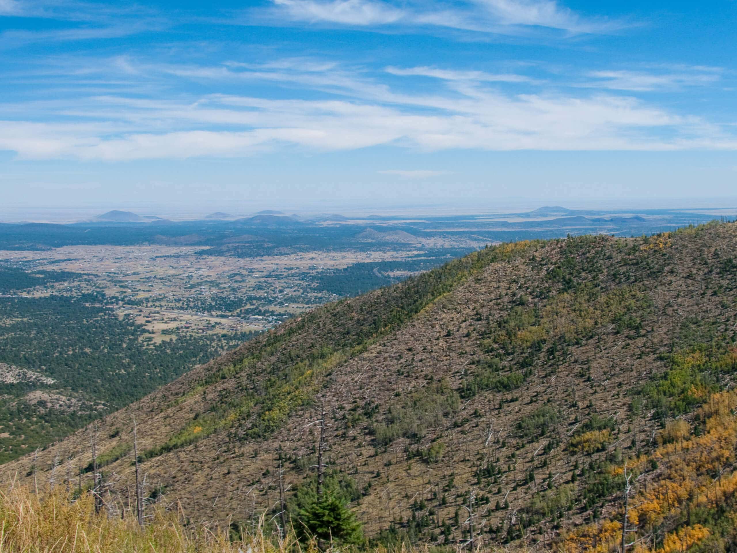
Sunset Trail South to North
Difficulty Rating:
The Sunset Trail South to North covers the whole length of one of the main routes that travels up and over Elden Mountain and its surrounding peaks. This route is challenging, but if you can get a car shuttle arranged, you can hike it as a point-to-point route instead. You’ll find that the beginning is the most demanding, then you’ll be cruising with incredible views as you go. Expect moderate traffic on this route.
Getting there
The trailhead for the Sunset Trail South to North is off US-89.

About
| Backcountry Campground | No |
| When to do | April-October |
| Pets allowed | Yes - On Leash |
| Family friendly | No |
| Route Signage | Average |
| Crowd Levels | Moderate |
| Route Type | Out and back |
Sunset Trail South to North
Elevation Graph
Weather
Sunset Trail South to North Description
The Sunset Trail climbs up Elden Mountain and along the ridge to Little Elden Mountain, dropping off the mountains with spectacular views of the San Francisco Peaks, Flagstaff, Sunset Crater, and more. This hike is challenging at the start as you battle up Elden, but it does even out after the stiff start. This isn’t the best fit for families or beginners. Bring lots of water.
The first 2.5mi of the route take you up Elden Lookout Trail. You’ll switchback your way up the steep face. Take breaks if you need to. Once you crest Elden Mountain, you can either make the 0.2mi side trip to the summit or continue straight along the trail to the ridge.
Cross the saddle between Elden and Little Elden. At the fork, go left towards Schultz Tank. As you descend you’ll have some awesome views down to the tank, at which point you’ll turn around and retrace your steps. If you have poles, it’ll make the descent off Elden Mountain quite a bit easier.
Similar hikes to the Sunset Trail South to North hike

Fay Canyon Loop
Fay Canyon is one of several main canyons in the Walnut Canyon National Monument. This loop hike explores part of…

Sandy Steps, Heart, and Upper Oldham Trail
The Sandy Steps, Heart, and Upper Oldham hike makes use of several different trails to create a hike that stretches…

Fisher Point via Fay Canyon
Fisher Point is one of the best viewpoints into the gorgeous Walnut Canyon. This route leads you to the point…
Comments