
Lost Burrito Loop
View Photos
Lost Burrito Loop
Difficulty Rating:
The Lost Burrito Loop is a lightly trafficked moderate hike in the Dry Lake Hills of Flagstaff. With a big meadow at the top, it’s an enjoyable and rewarding hike, but it might not be the best choice for families or beginners. This route is best done when the flowers are blooming, which is usually from late spring through mid-summer. We don’t recommend this hike in the winter as the snow can get very deep.
Getting there
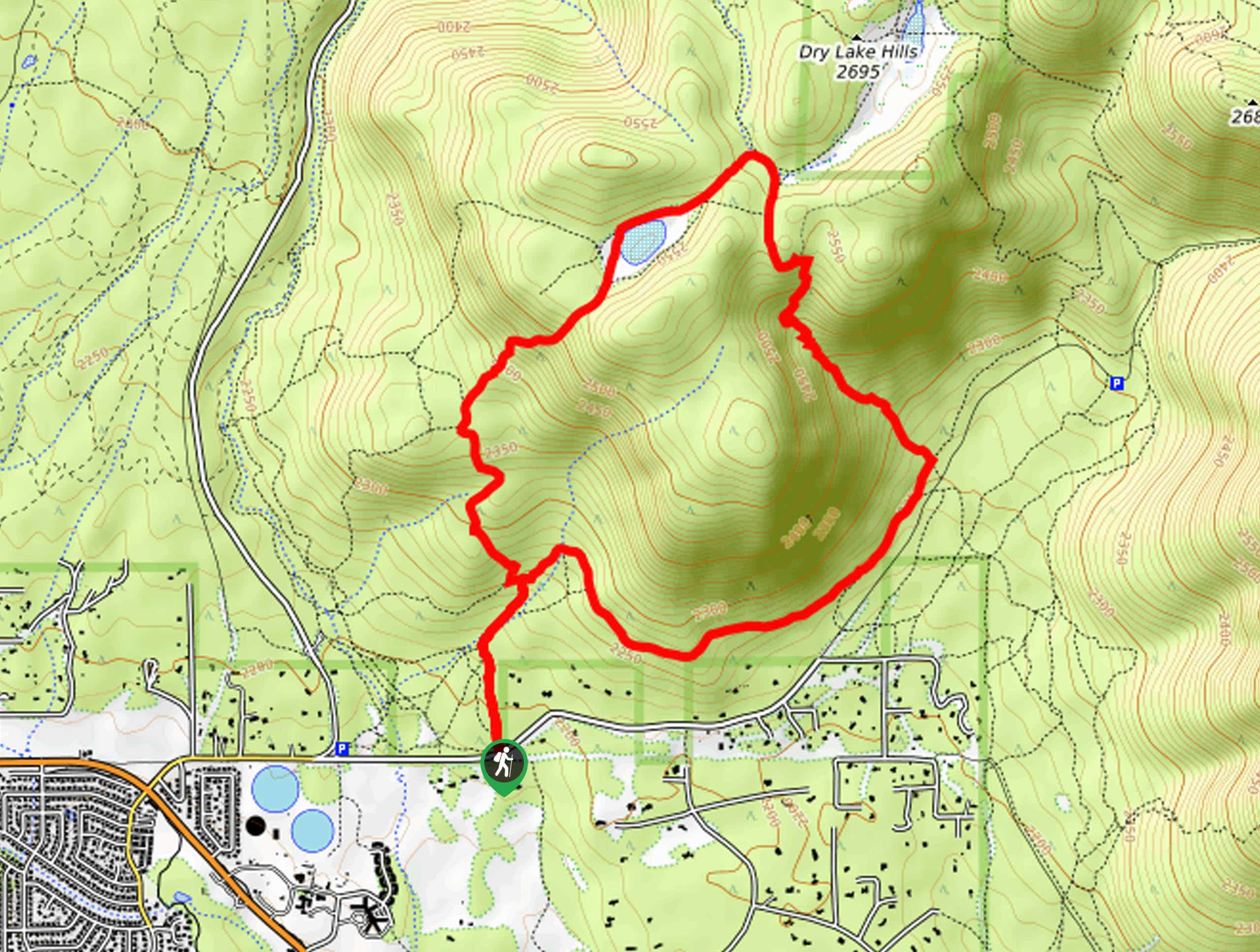
The trailhead for the Lost Burrito Loop is on E Mt Elden Lookout Road.

About
| Backcountry Campground | No |
| When to do | April-October |
| Pets allowed | Yes - On Leash |
| Family friendly | Older Children only |
| Route Signage | Average |
| Crowd Levels | Low |
| Route Type | Lollipop |
Lost Burrito Loop
Elevation Graph
Weather
Lost Burrito Loop Description
The Lost Burrito Loop is a lightly trafficked adventure in the Dry Lake Hills of Flagstaff, a popular area for hiking and mountain biking. This hike is an interesting one–not only is there a famed lost burrito somewhere, but you’ll have to hike through a burn and flood area with steep, loose footing and an unclear trail. We recommend keeping an eye on your GPS track and keeping your burritos close.
This route isn’t the best fit for young families or beginners because of the fire/flood-affected portion of the trail. Wear good boots and consider poles.
From the trailhead, hike up the Rocky Ridge Access Trail to the split of the loop, where you’ll take a left and then an immediate right onto Lost Burrito Trail. Stay right on this trail at the junction, climbing up to the meadow and the pond. Take a right to head down into the ravine, which is where you’ll need to watch your step and forge your own path a bit. Once you reach the junction at the bottom of the hill, go right onto Arizona Trail-Rocky Ridge and follow this back to the trailhead.
Similar hikes to the Lost Burrito Loop hike

Fay Canyon Loop
Fay Canyon is one of several main canyons in the Walnut Canyon National Monument. This loop hike explores part of…

Sandy Steps, Heart, and Upper Oldham Trail
The Sandy Steps, Heart, and Upper Oldham hike makes use of several different trails to create a hike that stretches…

Fisher Point via Fay Canyon
Fisher Point is one of the best viewpoints into the gorgeous Walnut Canyon. This route leads you to the point…
Comments