Walnut Canyon Viewpoint Trail
View Photos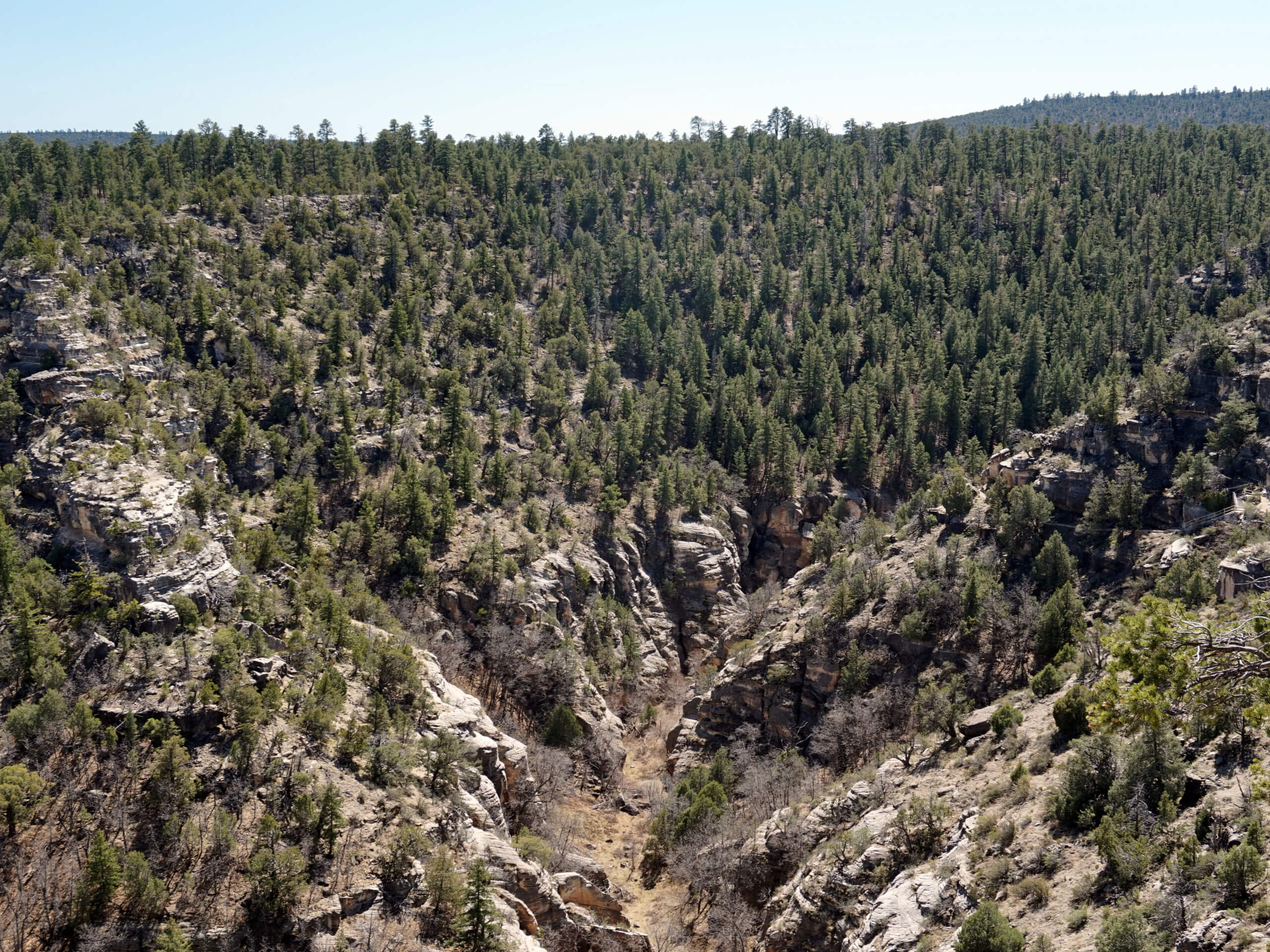
Walnut Canyon Viewpoint Trail
Difficulty Rating:
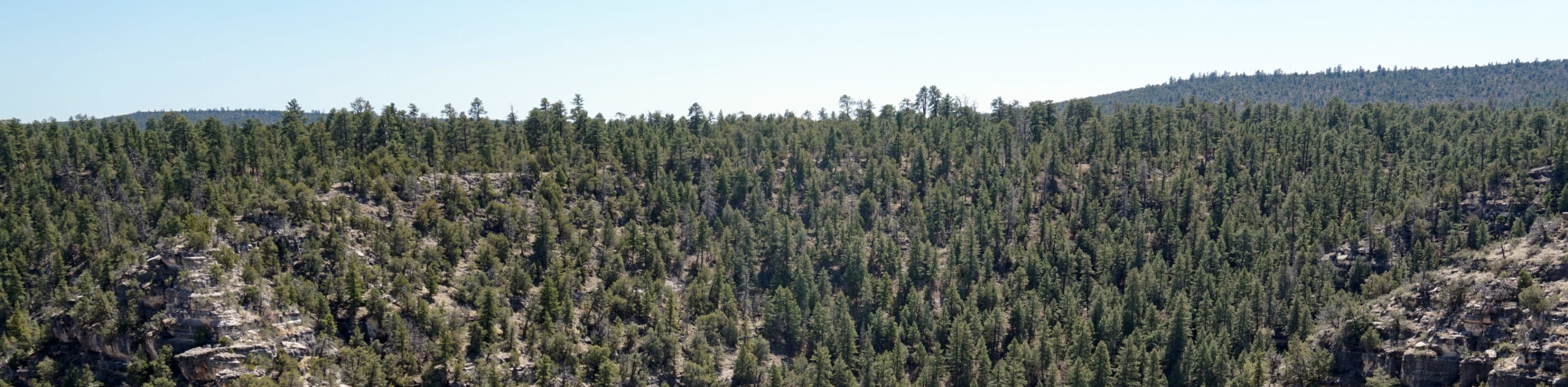
Walnut Canyon Viewpoint Trail is a hiking route that takes you to a viewpoint over the historical Walnut Canyon, where a vibrant Pueblo community used to live. This route mostly travels through the trees until the view opens up. This hike is easy enough for most skill levels and ages and tends to see light traffic.
Getting there
The trailhead for Walnut Canyon Viewpoint Trail is Old Walnut Canyon Road.

About
| Backcountry Campground | No |
| When to do | April-November |
| Pets allowed | Yes - On Leash |
| Family friendly | Yes |
| Route Signage | Average |
| Crowd Levels | Low |
| Route Type | Out and back |
Walnut Canyon Viewpoint Trail
Elevation Graph
Weather
Walnut Canyon Viewpoint Trail Description
The Walnut Canyon Viewpoint Trail is a lovely hike not far outside of Flagstaff in the Walnut Canyon National Monument. You’ll hike through a serene forest to an impressive viewpoint into the canyon. Appreciate the layers of rock visible in the canyon, which are the same layers in the nearby Grand Canyon.
From the trailhead, hike south on the AZT-WC Connector. At the T-junction, take a right and continue on until you eventually hit the road, which you’ll follow for a few steps. Taking a right onto the trail to the canyon, follow the route across the canyon arm to the main overlook, staying left at the fork and then ending your outbound trip at the viewpoint. After taking it all in, turn around and retrace your steps.
Similar hikes to the Walnut Canyon Viewpoint Trail hike

Fay Canyon Loop
Fay Canyon is one of several main canyons in the Walnut Canyon National Monument. This loop hike explores part of…

Sandy Steps, Heart, and Upper Oldham Trail
The Sandy Steps, Heart, and Upper Oldham hike makes use of several different trails to create a hike that stretches…

Fisher Point via Fay Canyon
Fisher Point is one of the best viewpoints into the gorgeous Walnut Canyon. This route leads you to the point…
Comments