
Soldier Trail and Bridge Trail Loop
View Photos
Soldier Trail and Bridge Trail Loop
Difficulty Rating:
Hike through wildflower-dotted pine forests on the Soldier Trail and Bridge Trail Loop, a great hiking, mountain biking, and running route in the Fort Tuthill area to the south of Flagstaff. Come for the day or spend the weekend exploring this area at the Fort Tuthill Campground. Expect moderate traffic on this easy hike.
Getting there
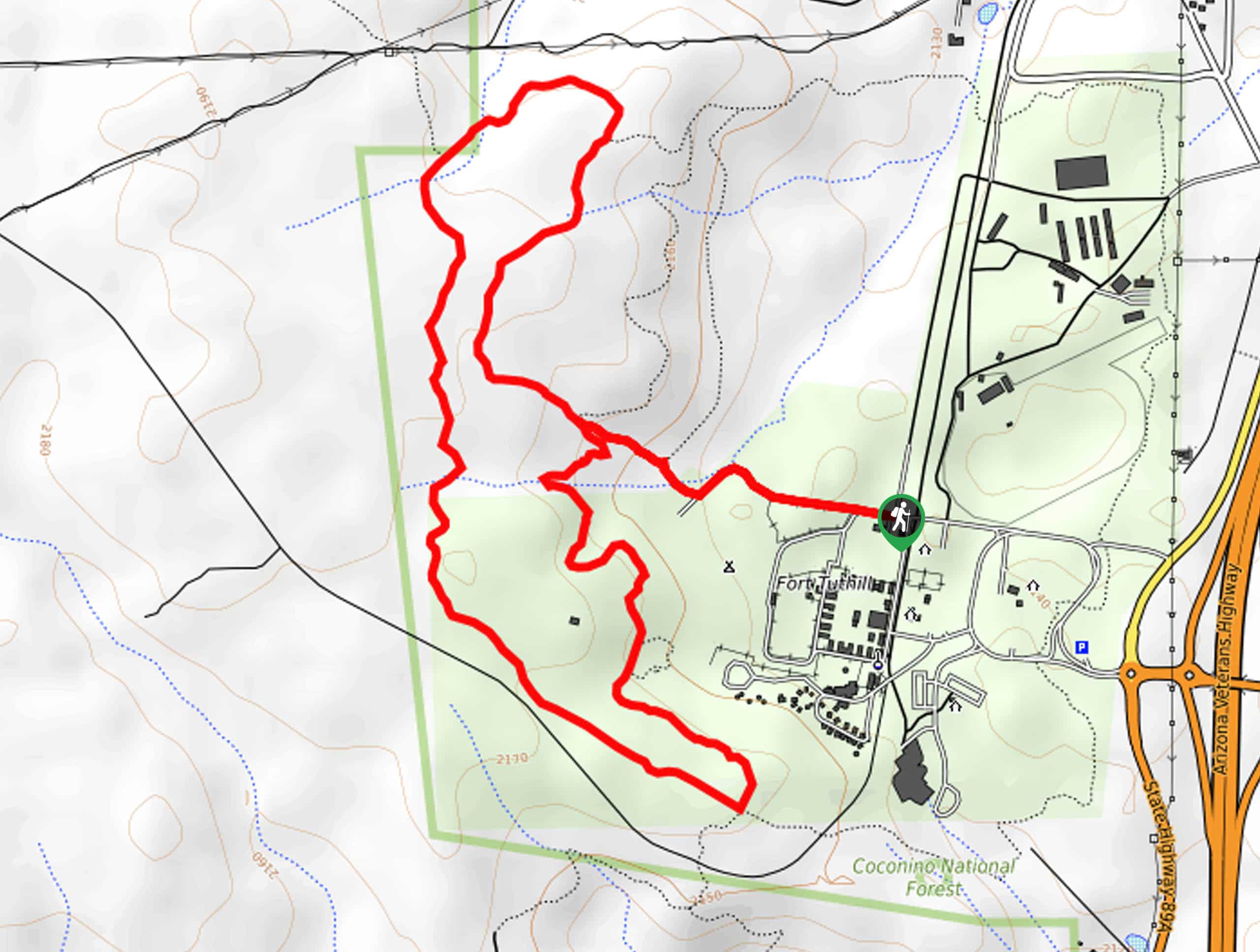
The trailhead for the Soldier Trail and Bridge Trail Loop is on Regiment Road.

About
| Backcountry Campground | Fort Tuthill Campground |
| When to do | March-November |
| Pets allowed | Yes - On Leash |
| Family friendly | Yes |
| Route Signage | Poor |
| Crowd Levels | Moderate |
| Route Type | Lollipop |
Soldier Trail and Bridge Trail Loop
Elevation Graph
Weather
Soldier Trail and Bridge Trail Loop Description
The Soldier Trail and Bridge Trail Loop is a scenic, moderately difficult hiking and running route north of Flagstaff. This route doesn’t deliver huge views, but being in the forest here is quite spectacular and the route doesn’t get too busy. Try to time your hike for when the leaves are turning colors in the fall or for when the wildflowers are at their peak in the summertime.
The signage on this hike leaves a bit to be desired, especially at the beginning of the hike. A downloaded GPS route can help you find the way. You might need GPS help to locate the trailhead, too.
From the trailhead, head west along the road and then take a left at the fork. Meander south on Bridge Trail past the campground. Where Soldier Trail intersects, take a right to head up the far side of the loop. Follow this trail all the way back to the original loop split, then retrace your steps to the trailhead.
Similar hikes to the Soldier Trail and Bridge Trail Loop hike

Fay Canyon Loop
Fay Canyon is one of several main canyons in the Walnut Canyon National Monument. This loop hike explores part of…

Sandy Steps, Heart, and Upper Oldham Trail
The Sandy Steps, Heart, and Upper Oldham hike makes use of several different trails to create a hike that stretches…

Fisher Point via Fay Canyon
Fisher Point is one of the best viewpoints into the gorgeous Walnut Canyon. This route leads you to the point…
Comments