Fatman's Loop Trail
View Photos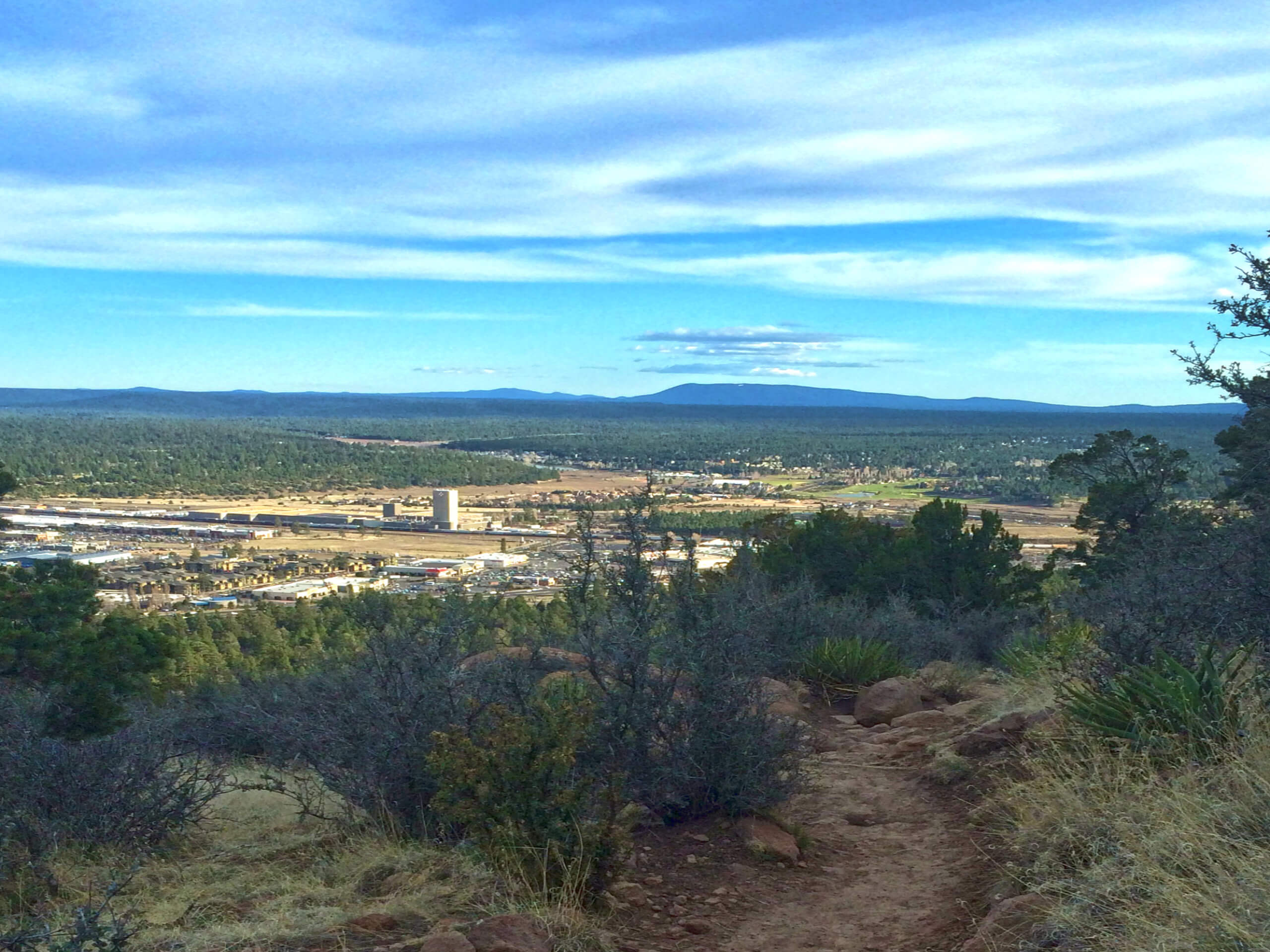
Fatman's Loop Trail
Difficulty Rating:
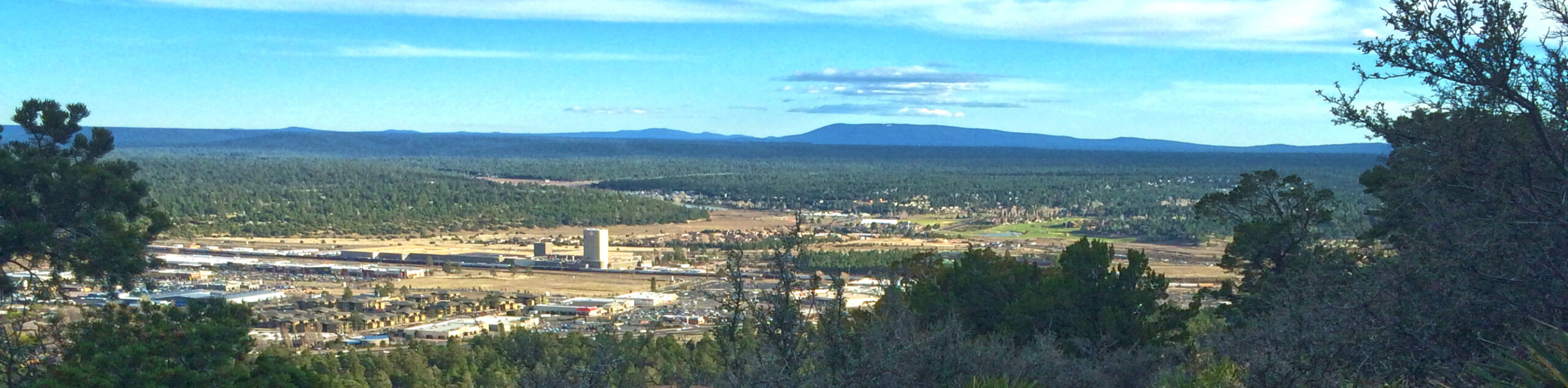
Fatman’s Loop Trail is one of Flagstaff’s most popular trails. This moderate 2.4mi loop climbs along the eastern slopes of Elden Mountain, which is a main focal point from many parts of the city. The coolest parts of the trail are the rocks and trees, as you’ll see rocks with face-like caves in them. Along the route, you will climb between rocks tipped over towards each other, and make your way up smooth stone steps. It’s an interesting peek at the volcanic past of the Flagstaff area and lots of fun for kids and adults alike.
The trees on this route are excellent, with several different species displaying their individual quirks. Take the time to revel in your surroundings on this loop and you’ll find lots to appreciate. The hike itself is moderately difficult, but still suitable for most skill levels. We do advise bringing a downloaded GPS track to help at unmarked junctions.
Getting there
The trailhead for the Fatman's Loop Trail is off AZ SR 89.

About
| Backcountry Campground | No |
| When to do | April-November |
| Pets allowed | Yes - On Leash |
| Family friendly | Yes |
| Route Signage | Poor |
| Crowd Levels | High |
| Route Type | Lollipop |
Fatman's Loop Trail
Elevation Graph
Weather
Fatman's Loop Trail Description
The Fatman’s Loop Trail is a very popular hike in Flagstaff thanks to its ease of access and unique views. This moderate 2.4-mile loop hugs the eastern slopes of Elden Mountain, Flagstaff’s defining local peak. Although it’s best done in the warmer months, this loop can be hiked all year long.
There are a few things that make the Fatman’s Loop so interesting, such as the variety of interesting rocks. Evidence of the area’s volcanic past, there are big, irregular boulders all over this trail. Some have caves that resemble eyes or mouths, some lean precariously close to one another (and you’ll have to scoot through the middle), and some are unusually smooth and rounded. Take the time to appreciate the rocks on this route!
The trees on this route are also excellent, with beautiful oaks, mountain juniper, pinon pine, ponderosa pine, yucca, and alligator juniper lining your trail. Some of the trees are very old and gnarled, some have interesting bark patterns, and some house unique species of birds. If you’re a tree fan, you’ll enjoy this hike.
Along with the rocks and the trees, you can look for birds, deer, rabbits, and lizards. As the presence of wildlife is common on this trail, remember that dogs need to be kept on leash.
Fatman’s Loop can be hiked all year, but winter adventurers should expect ice/snow, and microspikes are definitely recommended.
This loop can be hiked either clockwise or counterclockwise. Clockwise, which is the direction our guide follows, starts out at a steeper grade, and counterclockwise is more gradual. No matter which way you go, we recommend bringing a downloaded GPS route. Despite the traffic on this route, it can get hard to follow in some spots, and a map or track can mitigate navigational challenges.
From the trail’s beginning, hike a few steps to the split. Go left and continue up the base of the mountain. You’ll take on a few quick switchbacks to gain elevation, before the route evens out and you begin a gradual ascending traverse northeast.
At the junction with a route that climbs steeply uphill, stay right. This route switchbacks up to the top of the mountain, which could perhaps be a fun adventure another day if you’re up for it.
For now, continue with your traverse. The top of the loop is pleasantly graded with only a bit of elevation gain at first, leveling out into a nice nearly-flat stretch.
At the next junction, take a sharp right. Continuing straight will take you off the mountain the wrong way. Up ahead is Fatman’s Rock, where you’ll stroll between two rocks leaning towards one another. We say stroll because, as the name suggests, the gap offers plenty of space to freely move.
Soon after Fatman’s Rock, there are some other interesting rocks to see. Take your time on this section of the route. As you make your way south to the trailhead, there are many junctions and intersecting trails. Stay to the main trail and refer to your GPS if you’re unsure.
When you arrive back at the base of the loop, retrace your steps back to the trailhead to complete your hike.
Hiking Route Highlights
Elden Mountain
Fatman’s Loop Trail climbs along the eastern base of Elden Mountain. Standing at 9301ft of elevation with 1219ft of prominence, Elden Mountain was named for John Elden, one of the earliest settlers of the Flagstaff area. He established a homestead near the mountain’s base in the 19th century. The mountain, which is part of the San Francisco volcanic field, is a prominent feature from many parts of the city. You’ll be strolling where his sheep once grazed on this hike.
Frequently Asked Questions
Is the Fatman’s Loop in Coconino National Forest?
Yes, this trail falls within the bounds of the forest.
Is Fatman’s Loop hard?
This is a moderate hike, and we’d say it’s on the easy side of moderate. Strong beginners can normally complete it without any issues.
Insider Hints
Bring a picnic to enjoy on your hike. There are some broad, smooth rocks that make for fine seats.
Counterclockwise is recommended in the winter as it lets you climb up the parts of the trail that get the iciest instead of trying to descend them.
Similar hikes to the Fatman's Loop Trail hike

Fay Canyon Loop
Fay Canyon is one of several main canyons in the Walnut Canyon National Monument. This loop hike explores part of…

Sandy Steps, Heart, and Upper Oldham Trail
The Sandy Steps, Heart, and Upper Oldham hike makes use of several different trails to create a hike that stretches…

Fisher Point via Fay Canyon
Fisher Point is one of the best viewpoints into the gorgeous Walnut Canyon. This route leads you to the point…
Comments