Lockett Meadow Inner Basin Loop
View Photos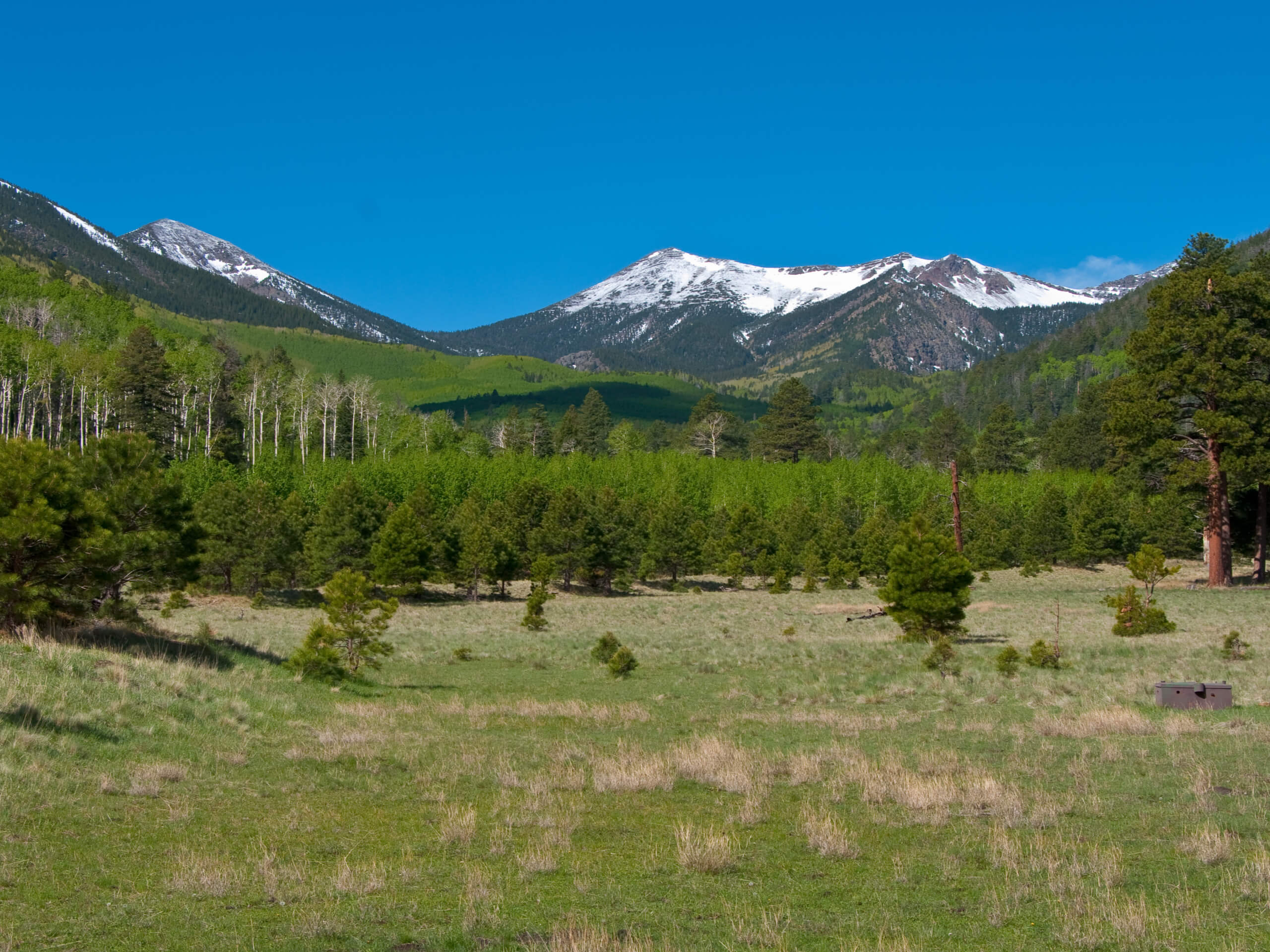
Lockett Meadow Inner Basin Loop
Difficulty Rating:
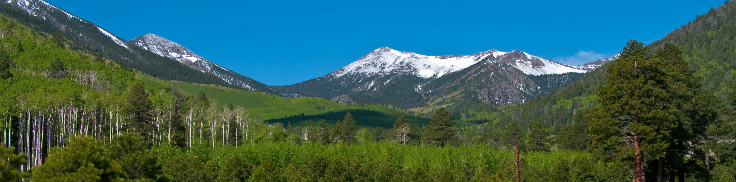
The Lockett Meadow Inner Basin Loop leads you through a gorgeous basin in the Kachina Peaks Wilderness underneath some of Arizona’s tallest mountains–Humphreys Peak, Aubineau Peak, and Rees Peak. With those kinds of mountains surrounding you, the views have to be good. This route leads you through a meadow that’s easily accessible from the Lockett Meadow Campground, making it a perfect trip for campers.
This route is moderately difficult, but we’d say it’s on the easier side of moderate. Hikers of most skill levels and ages will be able to complete this route. It’s especially brilliant in the fall when the aspens at the start of the route are alive with bright color. The drive to the trailhead might be the most intimidating part of the whole trip; buses, trailers, and RVs are not recommended up here.
Getting there
The trailhead for the Lockett Meadow Inner Basin Loop is in the Lockett Meadow Campground.

About
| Backcountry Campground | Lockett Meadow Campground |
| When to do | May-October |
| Pets allowed | Yes - On Leash |
| Family friendly | Yes |
| Route Signage | Average |
| Crowd Levels | High |
| Route Type | Loop |
Lockett Meadow Inner Basin Loop
Elevation Graph
Weather
Lockett Meadow Inner Basin Loop Description
For hikers and campers spending time in Lockett Meadow, the views just can’t disappoint! This basin is tucked within the San Francisco Peaks of Flagstaff, remnants of stratovolcanoes from many years past. The Inner Basin is on the eastern side of some of the highest mountains in the state (including the highest, Humphreys Peak).
This hike takes you through beautifully varied terrain, leading from the meadow campsite through the aspens and up to the foothills, where the mountain views are fabulous. We recommend this hike either when the wildflowers are in bloom, which tends to be early-mid summer, or when the fall colors are at their best, which is normally late September through late October.
The route itself is easy-moderate, and there are no major challenges to note. Hikers of most ages and skill levels will be able to complete this trail.
Since this route starts from the Lockett Meadow Campground, it’s a natural pick for a half-day adventure for campers staying the night. Note that the road to the trailhead is precarious, with steep, winding curves and narrow lanes. We do not recommend this trip for trailers, RVs, or large vehicles. The road is closed in the winter.
The trailhead for the Inner Basin Trail is at the very back of the day-use parking area. You’ll start by hiking through a mature pine forest. Since most of the elevation gain on this hike occurs near the midpoint, you can enjoy a fairly relaxed beginning.
The pine trees give way to aspens, and the contrast of the white bark against green grass is a treat to see. There are sometimes people and families taking photos in these trees. It’s a popular spot!
Begin hiking through a set of switchbacks towards the inner basin. This part of the hike follows a dirt road, and you’ll soon turn right onto a service road that leads you into the basin. At the signed fork, continue along the basin trail.
In the basin, your views of the mountains are spectacular. Stroll through the meadow, Rees Peak and Aubineau Peak towering right overhead. There are some wooden shelters in the basin if you want to sit in the shade and take in the view for a while.
To leave the basin and start your return trip, you’ll follow the trail down along the Inner Basin Creek. It’s a straightforward hike back to the campground.
Hiking Route Highlights
San Francisco Peaks
The San Francisco Peaks are a volcanic mountain range in the San Francisco volcanic field north of Flagstaff, Arizona. These peaks are a remnant of former San Francisco Mountain. The range is anchored by Humphreys Peak, the highest mountain in the state, and complemented by Aubineau Peak, Rees Peak, and more. The mountain range is a very popular destination for hikers, campers, and skiers from Northern Arizona and beyond.
Frequently Asked Questions
Is Lockett Meadow a hard hike?
No, this hike is easy-moderate.
Is Lockett Meadow open?
The access road to the meadow is normally open from spring to mid-October.
When is the best time to see fall leaves in Flagstaff?
Fall foliage usually starts to turn colors in mid-September and continues to change until the leaves drop around late October.
Insider Hints
Day-use parking is free. Take care not to accidentally park in overnight spaces, which are not free.
Arizona’s summer monsoons can hit hard and fast. If there is any rain in the forecast, consider postponing your hike until it passes.
Similar hikes to the Lockett Meadow Inner Basin Loop hike

Fay Canyon Loop
Fay Canyon is one of several main canyons in the Walnut Canyon National Monument. This loop hike explores part of…

Sandy Steps, Heart, and Upper Oldham Trail
The Sandy Steps, Heart, and Upper Oldham hike makes use of several different trails to create a hike that stretches…

Fisher Point via Fay Canyon
Fisher Point is one of the best viewpoints into the gorgeous Walnut Canyon. This route leads you to the point…
Comments