Kachina Trail #150
View Photos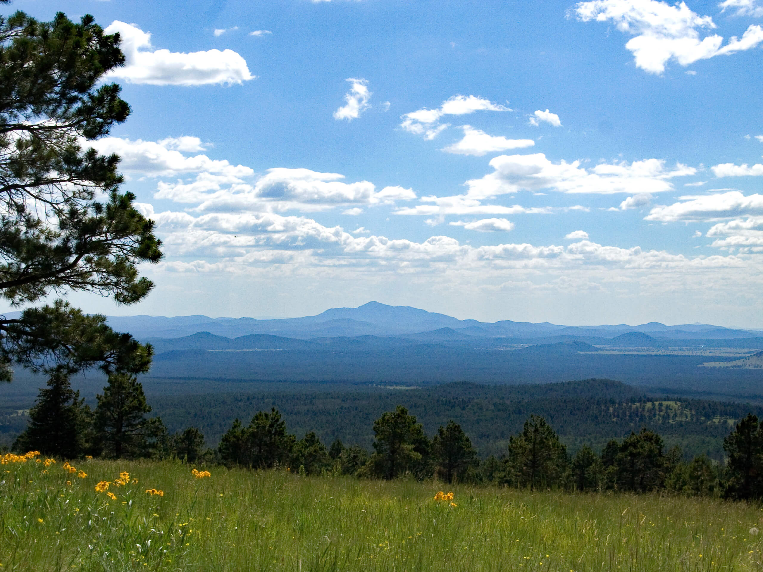
Kachina Trail #150
Difficulty Rating:
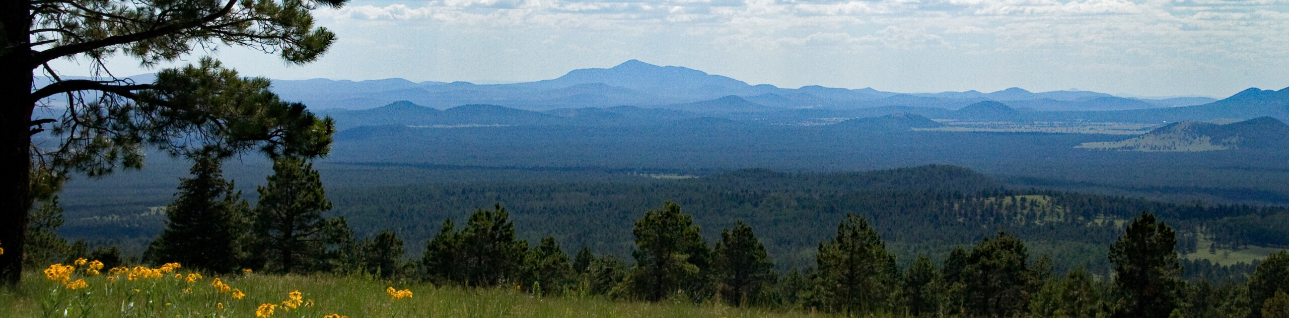
In the Kachina Peaks Wilderness, the Kachina Trail #150 links Humphreys Peak Trail and Weatherford Trail #102. This is a popular route all on its own though, featuring beautiful mountain views and an approachable difficulty level. This route hugs the southwestern flanks of Agassiz Peak and Fremont Peak with a view of Schultz Peak. It’s a great trek if you want to be close to the mountains without needing to work all that hard. This is an especially enjoyable hike in the fall when the aspens turn color.
The Kachina Trail #150 is a longer hike, but the elevation gain is very gradual and spread out, so there aren’t many intense climbs. For this reason, we consider this route beginner and kid-friendly, although families may need to turn back if the entire distance is too much. With peekaboo views the whole way, this won’t prevent a hike on this route from being an enjoyable outing.
Getting there
The trailhead for the Kachina Trail #150 is off Snow Bowl Road.

About
| Backcountry Campground | No |
| When to do | March-November |
| Pets allowed | Yes - On Leash |
| Family friendly | Yes |
| Route Signage | Average |
| Crowd Levels | High |
| Route Type | Out and back |
Kachina Trail #150
Elevation Graph
Weather
Kachina Trail #150 Description
The Kachina Trail is one of Flagstaff’s most popular hiking trails. It can be used as a standalone adventure or it can be used as a connector between the Humphreys Peak Trail and Weatherford Trail #102. On its own, it’s a beautiful meandering trail that hugs the southwestern flanks of some of Arizona’s tallest mountains, Agassiz Peak and Fremont Peak.
Kachina Trail is a nice adventure any time of year, but if you can, try to plan a visit for fall (mid-September to the end of October). This route travels through aspen forests, and when the trees put on their fall color, it’s about as good as the hike can get!
Although this is a bit of a longer route, the elevation gain is fairly gradual and spread-out, so it’s still rated as moderate. Should you have small children with you, you could always turn back a little early and still enjoy the forest and the peekaboo views.
This route is accessible year-round. While fall and summer are our favorite times to hike, winter trips are possible. Just watch for icy spots on the trail and dress warmer since there’s lots of shade on this route.
As you hike, enjoy the scenic views of the high forest, open meadows, and occasional sightline across the city. You’ll cross through a few canyons and trek over a lava cliff. Look for a cave in the lava that hints at where looser volcanic rock eroded over the years.
The route begins from the Snow Bowl. At the end of the loop where the parking is, you’ll find the trail. Early on, the route intersects two other trails. Continue your traverse straight through both junctions.
The route rises and falls gradually. The first canyon is early on in the hike, and then you’ll be skirting around the base of Agassiz Peak. The forest is quite peaceful, and then when the meadows open up, you can take in a wider view of this scenic area.
Stay left where a route drops down to the right in between Agassiz and Fremont. From here, you’ll be hiking around the base of Fremont Peak. The trail loses elevation gradually, ending where the Kachina Access Trail intersects and the Weatherford Trail climbs uphill.
From this point, turn around and retrace your steps. You could also take a moment to wander this little plateau, which sits underneath Schultz Peak.
Hiking Route Highlights
Kachina Peaks Wilderness
The Kachina Peaks Wilderness is an 18,616-acre designated wilderness area in the Coconino National Forest north of Flagstaff, Arizona. The wilderness area includes Arizona’s highest peak, Humphreys Peak, in addition to the next-tallest mountains in the San Francisco Peaks range. The Kachina Peaks Wilderness was named for the Hopi gods, the Kachinas. According to Hopi legend, these gods lived in this area for part of the year, flying from the top of the mountains to the Hopi mesas as clouds, which was where the monsoons originated. Many of the mountains in the Kachina Peaks Wilderness are sacred to local Indigenous tribes.
Frequently Asked Questions
When are the trees good on Kachina Trail?
The fall colors peak at different times each year depending on the weather, but they tend to be their best around the middle of October.
Are dogs allowed on Kachina Trail #150?
Dogs are allowed on Kachina Trail #150 as long as they’re kept on leash.
Insider Hints
You could shorten this trip by shuttling from Freidlein Prairie Road.
While fall is spectacular, an early summer hike will show off this area’s beautiful wildflowers.
Similar hikes to the Kachina Trail #150 hike

Fay Canyon Loop
Fay Canyon is one of several main canyons in the Walnut Canyon National Monument. This loop hike explores part of…

Sandy Steps, Heart, and Upper Oldham Trail
The Sandy Steps, Heart, and Upper Oldham hike makes use of several different trails to create a hike that stretches…

Fisher Point via Fay Canyon
Fisher Point is one of the best viewpoints into the gorgeous Walnut Canyon. This route leads you to the point…
Comments