Old Caves Crater Trail
View Photos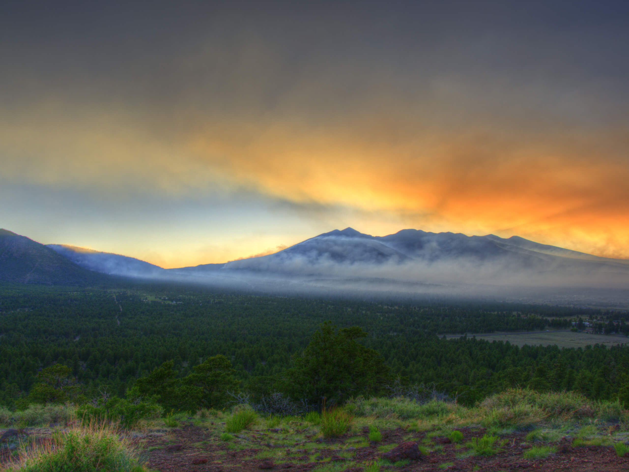
Old Caves Crater Trail
Difficulty Rating:
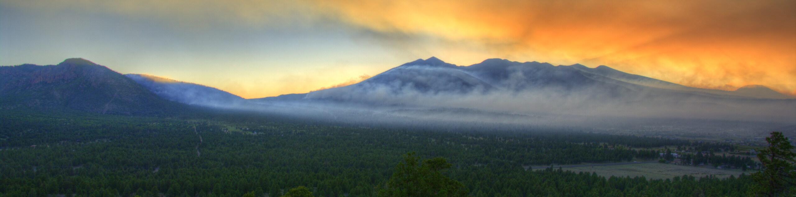
The Old Caves Crater Trail is a fascinating hike that reveals a small piece of the volcanic history of the Flagstaff area. Many years ago, a volcanic field in northern Arizona shaped the landscape through eruptions, with the crater and caves along this route remaining as two small pieces of this past. This hike leads you around the entire crater area, where you can explore the caves and hollowed-out areas where looser volcanic material has been eroded over the years.
This hike is moderately difficult. There are some switchbacks and a bit of elevation gain to complete, but it’s still suitable for strong beginners and adventurous kids. Two words of caution: the signage can be confusing, so consider bringing a downloaded GPS route. Additionally, there is a lot of wildlife on this trail (particularly deer), so remember that dogs need to be kept on leash. Expect heavy traffic on this hike.
Getting there
The trailhead for the Old Caves Crater Trail is on Silver Saddle Road.

About
| Backcountry Campground | No |
| When to do | March-November |
| Pets allowed | Yes - On Leash |
| Family friendly | Yes |
| Route Signage | Poor |
| Crowd Levels | High |
| Route Type | Lollipop |
Old Caves Crater Trail
Elevation Graph
Weather
Old Caves Crater Trail Description
The Old Caves Crater Trail hints at northern Arizona’s volcanic past. Around 700,000 years ago, a volcanic field in this region experienced multiple eruptions and lava flows that shaped the landscape. The San Francisco Peaks are remnants of this volcanic range, but smaller features, like this crater and its caves, are direct results of volcanic activity many years past.
On this route, you’ll climb up a crater (think crater like a low peak with a hollowed-out side, rather than the crater you’d picture from a meteor strike) to check out the caves carved into the volcanic rock. Caves like these can be formed by lava cooling at different stages, or they can be formed when volcanic rock of a lower density is eroded away over time.
This hike also leads you through a 100+ year old ponderosa pine stand. Watch out for deer, which frequent the area, as you go.
Keep in mind that the signage on this hike can be a bit confusing. We recommend downloading a GPS route ahead of time to avoid any confusion on the way.
The hike begins on a disused road that serves as a chill warm-up. You’ll hit a set of switchbacks where the route narrows and the grade gradually increases. Hiking through pinon pine and junipers, you’ll start an arc around the top of the crater.
Once you’ve made it to the summit ridge, there’s a T-junction. Going left takes you to the true summit and going right takes you to the south summit, where the caves are.
The caves are about 6-10 feet deep on average. There are over a dozen of them, so you could spend a while here checking them all out. There are no trees at the summit, so you will have a fairly open view, although it’s mostly just Doney Peak to look at.
Stop by the true summit if you didn’t already, then begin your descent. Keep in mind that there are a lot of crisscrossing Jeep tracks on the descent, which can make route-finding confusing. Refer to your GPS track if you think you might be getting off-course.
You’ll complete your loop around the crater before rejoining the trail to the trailhead, where you’ll retrace your steps to the starting point.
Hiking Route Highlights
Old Caves
Northern Arizona has a storied volcanic past, and as a result of lava flows and volcanic activity years past, the landscape around Flagstaff is dotted with remnants of eruptions. The Old Caves sit atop a crater, both created by volcanic eruptions. The caves are mostly formed by the erosion of lower density or looser volcanic rock over time, and today, the dozen or so caves on this crater can be explored by hikers of all ages.
Frequently Asked Questions
Is the Old Caves Crater hike hard?
No, we do not consider this to be a hard hike. Most users feel that it’s easy to moderate.
Are dogs allowed on Old Caves Crater Trail?
Dogs are allowed on Old Caves Crater Trail as long as they’re kept on leash.
Were the Old Caves created by volcanoes?
Yes, both the crater and the caves are a result of past volcanic activity.
Insider Hints
Bring a flashlight so you can see into the caves better.
The footing on this route is forgiving, so this is a fine pick if all you have are sneakers.
Similar hikes to the Old Caves Crater Trail hike

Fay Canyon Loop
Fay Canyon is one of several main canyons in the Walnut Canyon National Monument. This loop hike explores part of…

Sandy Steps, Heart, and Upper Oldham Trail
The Sandy Steps, Heart, and Upper Oldham hike makes use of several different trails to create a hike that stretches…

Fisher Point via Fay Canyon
Fisher Point is one of the best viewpoints into the gorgeous Walnut Canyon. This route leads you to the point…
Comments