Sandys Canyon Trail
View Photos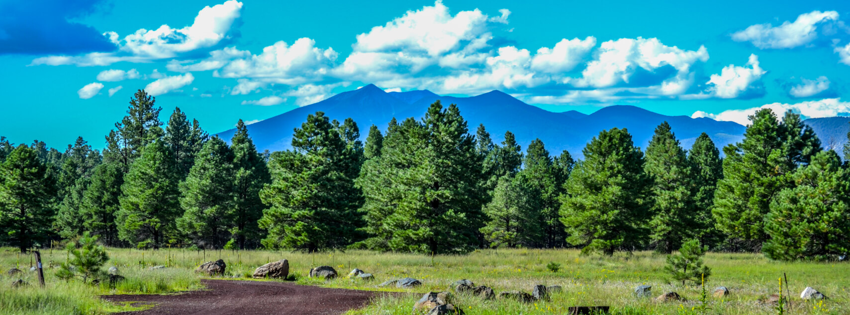
Sandys Canyon Trail
Difficulty Rating:
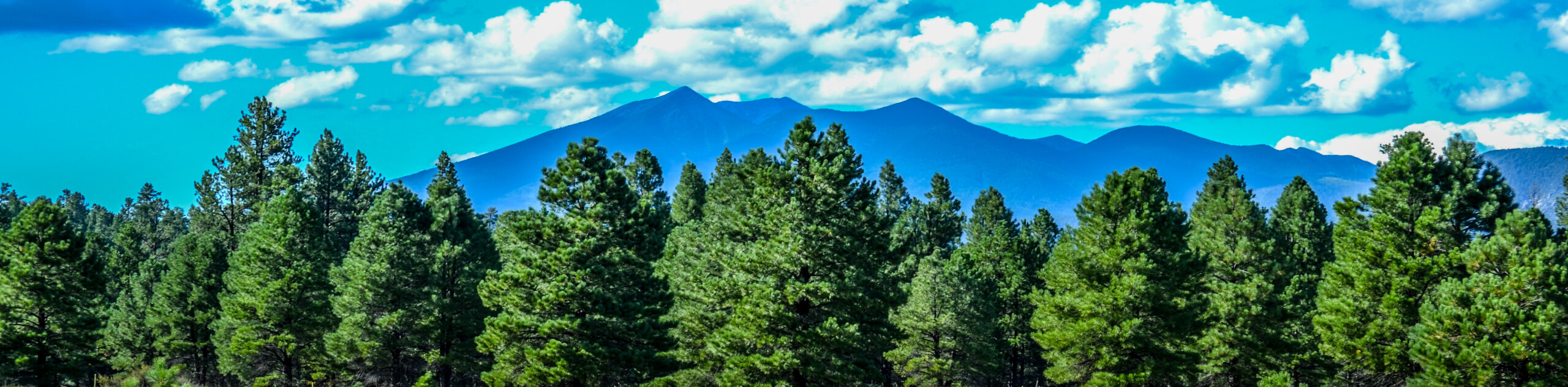
Sandys Canyon Trail is an interesting hike just outside of Flagstaff that makes for a super convenient adventure for campers at Canyon Vista Campground. This hike is 3 miles long and is rated as easy thanks to its relative lack of elevation gain. You’ll hike down into Walnut Canyon for a peek at the interesting geology of this area, and can also enjoy a good view of the San Francisco Peaks.
This hike is pleasant but not jaw-dropping on its own, so we do recommend continuing further from the end of the trail to reach Fisher Point, which is a gratifying endpoint. There are actually quite a few trails in this area that you can use to extend your adventure should you wish to. If not, you can still enjoy the beautiful canyon and the serenity of the forest.
Getting there
The trailhead for the Sandys Canyon Trail is off Lake Mary Road.

About
| Backcountry Campground | Canyon Vista Campground |
| When to do | April-October |
| Pets allowed | Yes - On Leash |
| Family friendly | Yes |
| Route Signage | Poor |
| Crowd Levels | High |
| Route Type | Out and back |
Sandys Canyon Trail
Elevation Graph
Weather
Sandys Canyon Trail Description
The Sandys Canyon Trail is an interesting hike that is located in the Coconino National Forest, not far outside of Flagstaff. This hike provides a few lovely photo spots as you make your way down into Walnut Canyon. Appreciate the layers of rock visible in the canyon, which are the same layers you’d observe in the nearby Grand Canyon.
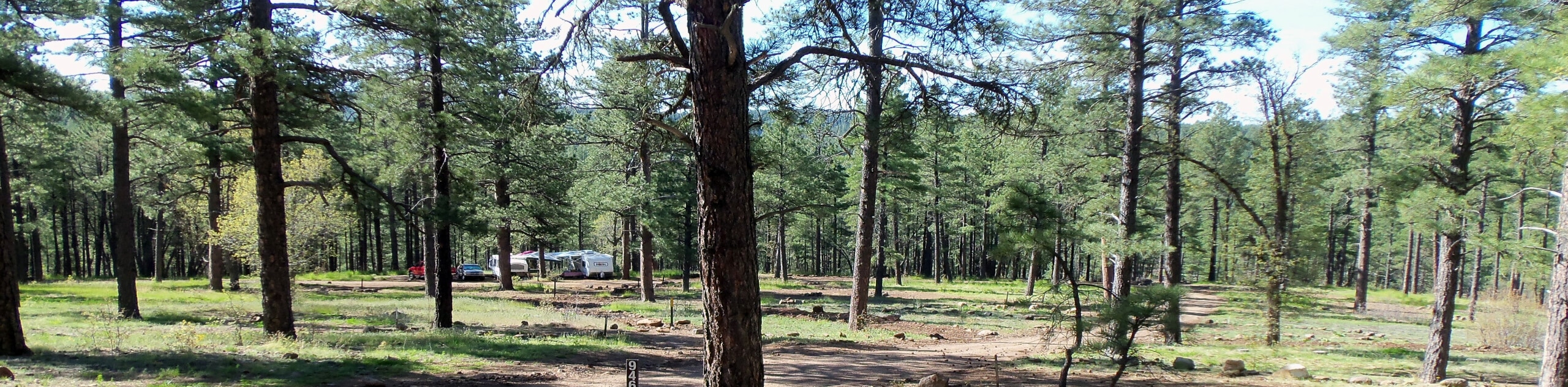
This hike is quite easy and we’d consider it suitable for all skill levels and ages. Since you’ll walk right through Canyon Vista Campground, keep this route in mind should you ever choose to camp here since it makes for such an easy adventure.
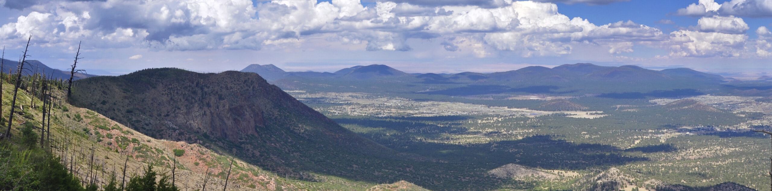
Some hikers find this trail more gratifying if they continue further past the endpoint reflected in the route. If you’re willing to go a bit further, try hiking to Fisher Point. It’s straight ahead and to the right from this route, and it gives you a beautiful vantage point over the canyon and the forest.
Sandys Canyon Trail actually connects to the Arizona Trail, a route that runs the entire length of the state from the border of Utah to the Border with Mexico. You may run into a thru-hiker on the way, and they’re normally very happy to stop and share some stories from their travels, especially if you’ve got snacks on hand!
This hike can be a touch hard to follow in some places, so downloading a GPS track is a good idea. Additionally, while this trail is accessible throughout the year, winter hikes can be quite tough due to the snow on the trail, which makes navigation even more difficult. Try to leave this one for the summertime.
From the trailhead, hike north towards Canyon Vista Campground. You’ll hike through the campground, which is a pleasant spot to spend a night next time you’ve got a weekend to fill. If you’re staying in the campground, you can start the route right from your site.
The trail crosses a creek as it turns northwest. Around a looping right turn, make sure to keep right where another trail heads off to the left. You’ll begin a short descent that takes you down to the bottom of Walnut Canyon.
As you descend the canyon, take a minute to appreciate the rock layers in the canyon walls, which are the same layers you’d observe in the nearby Grand Canyon, the best example of the geological makeup of northern Arizona.
Here, you will cross Walnut Creek and then cross back over. Trek along the canyon floor, enjoying the scenery and the flat route. The trail ends at a fork where the Walnut Canyon Trail connects to the Arizona Trail.
From this point, you can turn around and retrace your steps. There’s a tiny bit of climbing to get out of the canyon, but it’s nothing too strenuous. Should you want to keep going, bear left at the fork and then climb up the canyon next to Fisher Point, enjoy the view from this vantage point, and then descend back down the same way you came.
Hiking Route Highlights
Coconino National Forest
The Coconino National Forest is a 1,856-million acre national forest that stretches through northern Arizona near Flagstaff. “Coconino” is a Hopi word for Havasupai and Yavapai Indians. The Sandys Canyon Trail leads you through one of the many canyons in the forest and shows off the forests’ plentiful conifers and evergreens.
Frequently Asked Questions
Is Sandys Canyon Trail always open?
Yes, this route can be hiked all year.
Are dogs allowed on Sandys Canyon Trail?
Dogs are allowed on Sandys Canyon Trail as long as they’re kept on leash.
Insider Hints
If you’re out on this trail in the winter, snowshoes might be necessary to help you get through.
Book a night at the campground to stretch your adventure into an overnight affair!
Similar hikes to the Sandys Canyon Trail hike

Fay Canyon Loop
Fay Canyon is one of several main canyons in the Walnut Canyon National Monument. This loop hike explores part of…
Pumphouse Nature Trail
Pumphouse Nature Trail is a short and pleasant walk in Kachina Village, Arizona. This route is only 1.1mi…
Doney Mountain Trail
Doney Mountain Trail is a short hike in the far northeastern corner of Sunset Crater Volcano National Monument. This route…
Comments