Elden Lookout Trail
View Photos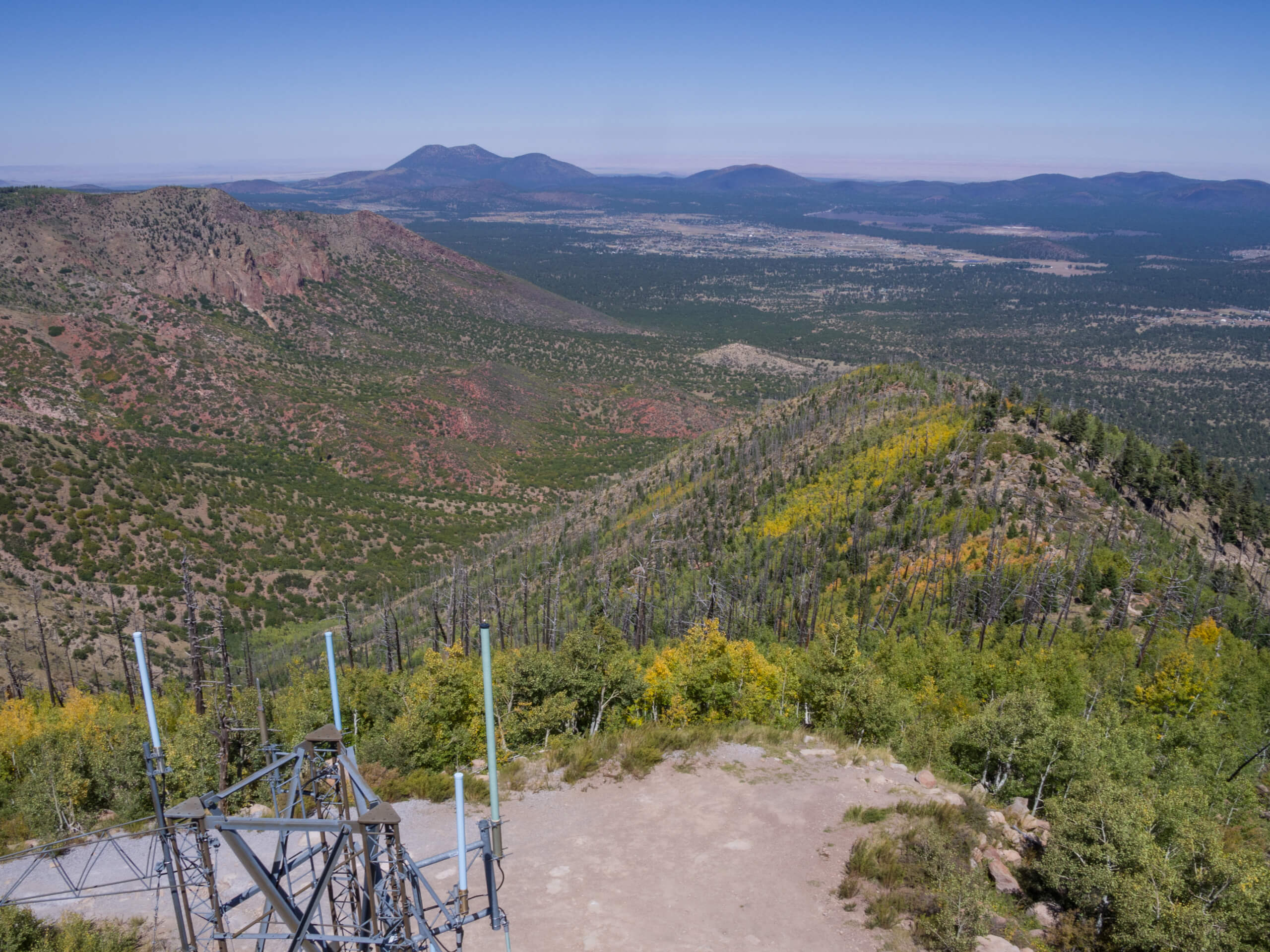
Elden Lookout Trail
Difficulty Rating:
The Elden Lookout Trail is a hard hike near Flagstaff that leads you up Elden Mountain (as the name would suggest). This mountain is one of the most obvious geographic features around Flagstaff, and getting on top of it can show you both the city and the surrounding landscape in a fresh, beautiful way. You can also use this route to quickly traverse over to T-V Hill, whose summit is just northwest of Elden’s summit.
This hike is rated as hard, and we don’t recommend it for beginners or children. While there aren’t any significant technical challenges to note, there’s a fair amount of elevation gain required and you’ll be heading up, up, up, then down, down, down. Poles might be helpful.
Getting there
The trailhead for the Elden Lookout Trail is off AZ SR 89.

About
| Backcountry Campground | No |
| When to do | April-November |
| Pets allowed | Yes - On Leash |
| Family friendly | No |
| Route Signage | Average |
| Crowd Levels | High |
| Route Type | Out and back |
Elden Lookout Trail
Elevation Graph
Weather
Elden Lookout Trail Description
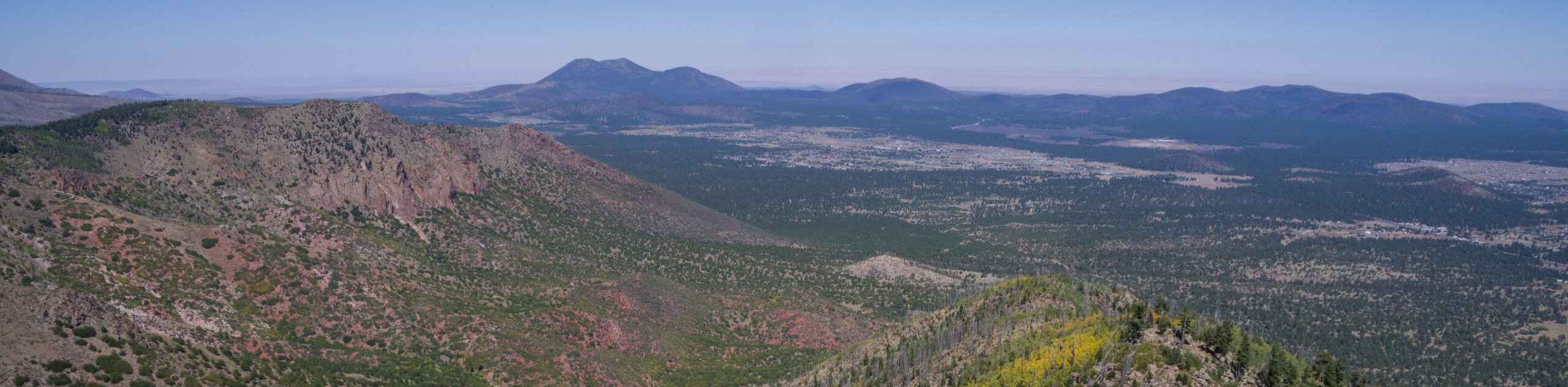
The Elden Lookout Trail is a very popular hike in Flagstaff thanks to its ease of access and unique views. This hard hike climbs up the eastern side of Elden Mountain, Flagstaff’s defining local peak. Instead of looking up at Elden as many residents do, you can stand atop the peak and admire the city and the surrounding landscapes from above.
This route can be extended by adding in the short traverse northwest to the peak of T-V Hill. The ridge between the two peaks is quite forgiving to traverse, so this is a fun option if you’ve got a little bit of gas left in the tank and want another vantage point, particularly of the peaks to the north.
The Elden Lookout Trail features some interesting geological features, including a staircase of petrified lava. Everywhere you look in Flagstaff, you can find some small (or quite obvious) hints of the area’s volcanic past, including these lava steps.
This route can be accessed from the popular Fatman’s Loop Trail, so consider that approach if you want some extra scenery en route to the summit.
From the trailhead, hike straight north towards the base of the mountain. The lower parts of the trail pass through mixed pinon and juniper forest, which gives way to ponderosa pines further up. You actually might run into some cactus, too.
You’ll take on your first set of switchbacks, then complete a northeast traverse to the other side of a canyon, before settling back into switchbacks. It mostly gets steeper as you go. You’ll hike through an area regrowing after a wildfire, so note how the plants change each year. Aspens usually crop up before pines do in the years after a fire. Someday, there will be another pine forest.
Push up to the top, where you get an expansive view of Flagstaff to the south. Turn north to check out the mountains behind you. If it’s a nice day, this is a perfect place for a picnic.
When you’re ready, turn back and retrace your steps to the trailhead, taking it easy on the steep way down.
Hiking Route Highlights
Elden Mountain
Elden Lookout Trail climbs up the eastern base of Elden Mountain. Standing at 9301ft of elevation with 1219ft of prominence, Elden Mountain was named for John Elden, one of the earliest settlers of the Flagstaff area. He established a homestead near the mountain’s base in the 19th century. The mountain, which is part of the San Francisco volcanic field, is a prominent feature from many parts of the city. You’ll be hiking where his sheep once grazed on this hike.
Frequently Asked Questions
Is Elden Mountain in Coconino National Forest?
Yes, this trail falls within the bounds of the forest.
How tall is Elden Mountain?
The mountain stands at an elevation of 9301ft with 2400ft of prominence.
Can you drive up Elden Mountain?
No, access to the summit of Elden Mountain is by foot only.
Insider Hints
This is a tough hike in the winter because of the grade of the trail. We’d wait until the ice melts.
Bring a windbreaker for the top.
Similar hikes to the Elden Lookout Trail hike

Fay Canyon Loop
Fay Canyon is one of several main canyons in the Walnut Canyon National Monument. This loop hike explores part of…

Sandy Steps, Heart, and Upper Oldham Trail
The Sandy Steps, Heart, and Upper Oldham hike makes use of several different trails to create a hike that stretches…

Fisher Point via Fay Canyon
Fisher Point is one of the best viewpoints into the gorgeous Walnut Canyon. This route leads you to the point…
Comments