Abineau-Bear Jaw Loop
View Photos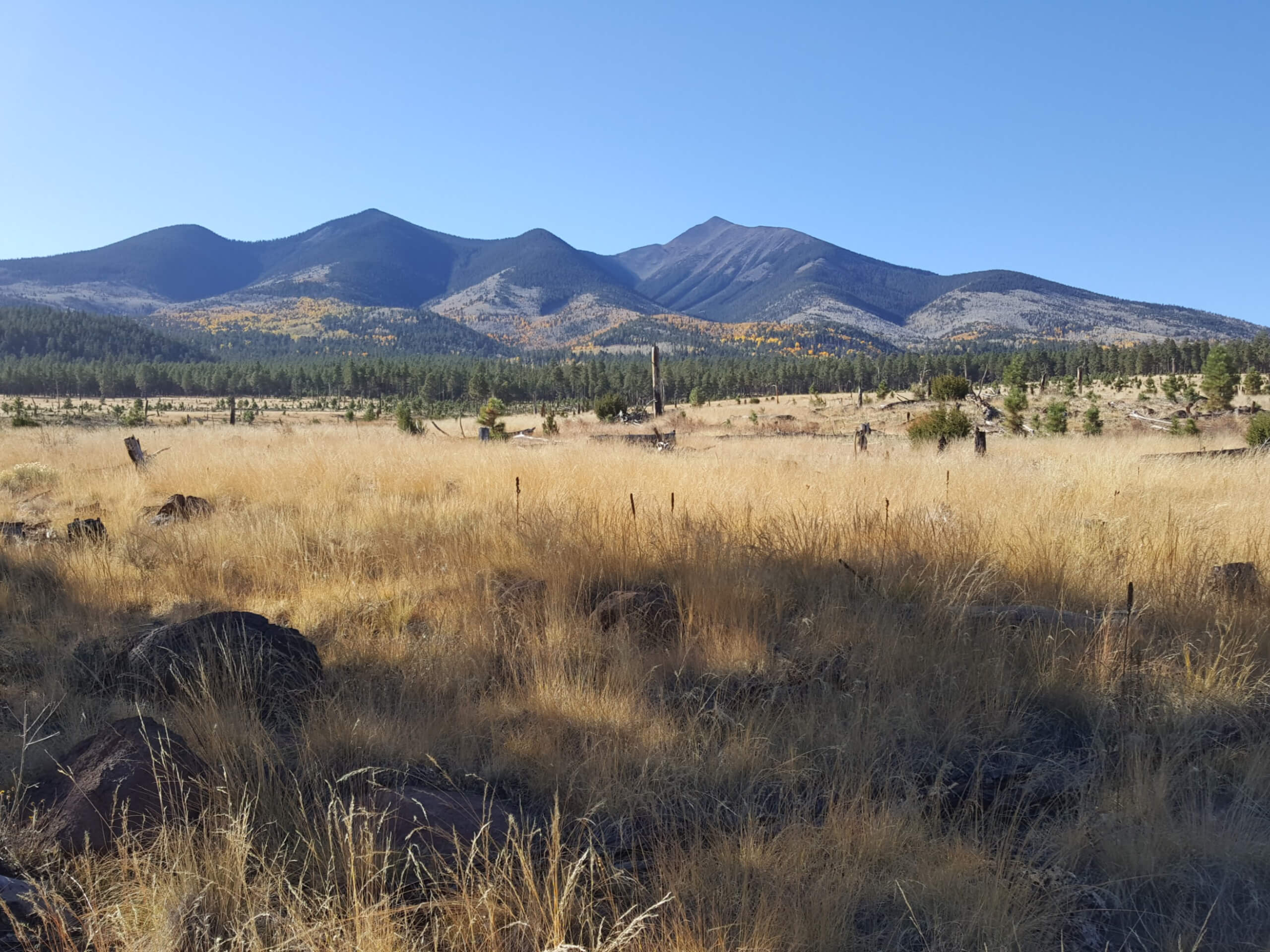
Abineau-Bear Jaw Loop
Difficulty Rating:
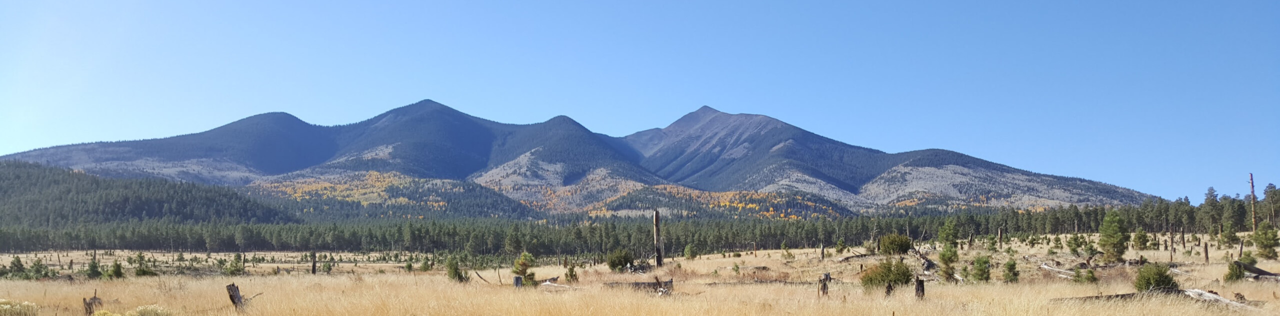
The Abineau-Bear Jaw Loop is a hard hike near Flagstaff that is popular for its views. From the top of this loop looking northwest, you can see the Grand Canyon 70.0mi away – Not bad! On other parts of the trail, you can appreciate wildflowers in the spring and the colorful aspens in autumn. You’ll also enjoy seeing a side of Humphreys Peak that most never see. It’s a varied, and pretty trail. Expect heavy traffic.
This route does make you work for your views. There are some stiff ascents required, but hopefully, the scenery can distract you enough to get through. Additionally, please be bear aware on this hike as black bears do frequent the area. You may also spot deer and elk. With all this wildlife around, remember that dogs need to be kept on a leash on this trail.
Getting there
The trailhead for the Abineau-Bear Jaw Loop is off White Horse Road.

About
| Backcountry Campground | No |
| When to do | March-November |
| Pets allowed | Yes - On Leash |
| Family friendly | No |
| Route Signage | Average |
| Crowd Levels | High |
| Route Type | Lollipop |
Abineau-Bear Jaw Loop
Elevation Graph
Weather
Abineau-Bear Jaw Loop Description
The Abineau-Bear Jaw Loop is a fabulous hike in the Coconino National Forest north of Flagstaff, Arizona. This hike climbs up and through two canyons on the northern flanks of Aubineau Peak and Humphreys Peak, the tallest mountain in Arizona.
While you won’t be working quite as hard as most other hikers on Humphrey Peak, this is still a difficult trail. There are some steep sections of climbing and those sections are consistent and unrelenting. We recommend this route for intermediate hikers or better. Thankfully, with this entire loop being comfortably mid-distance, the climbs don’t last all that long.
This route is beloved for its varied scenery. The star of the show is the Grand Canyon, which is visible from the top of the loop, 70.0mi away. For this view alone, we recommend trying to hike this route on a sunny, clear day so you can see as far as possible.
Besides the Grand Canyon, this route has lovely mountain views, interesting canyons to hike through, and gorgeous aspen forests, which go golden in the fall. Should you hike this route in the late spring and early summer, you can enjoy a carpet of wildflowers, including paintbrush, lupine, and rocky mountain iris.
Local wildlife doesn’t hesitate to make an appearance on this route. Hikers report seeing the occasional black bear. They’re normally shy, but regardless, we recommend hiking in a group, making plenty of noise, and carrying bear spray. You may also spot deer, elk, and several different bird species including Stellar’s jays, hermit thrush, and Clark’s nutcrackers. With all this wildlife around, remember that dogs are only allowed on this trail if they’re kept on a leash.
While some hikers attempt this loop in the late fall and winter, we advise against it. The Abineau side is usually the first to fill up with snow, and the routes can become nearly impassable. Additionally, parts of this trail were devastated in an avalanche in 2005, and avalanche risk can still be present on this trail in the wintertime. Save this one for the warmer months.
From the trailhead, you’ll start out on Bear Jaw Trail before hitting the trail’s split at the bottom of Aubineau Canyon. Our route goes counterclockwise, which has a harder ascent but a descent that’s easier on the knees. You’ll go right to take Abineau Trail up through the canyon.
The canyon is quite steep. Hike up through conifers and aspens, following the canyon to the point where the Waterline connector intersects on your left. From here, turn around and look out at the view; this is the highest point of the hike.
Take the Waterline Trail as it dips down and crosses two canyons to Bear Jaw Trail. Take a left on Bear Jaw Trail where it drops downhill and make your way into and across the canyon, descending through the trees back to the original trail split.
From here, retrace your steps back to the starting point.
Hiking Route Highlights
Grand Canyon
Revealing millions of years of geological history, the layered and massive Grand Canyon is a 3060 square mile canyon in Arizona. The canyon is 277.0mi long, up to 18.0mi wide and is over 6000ft at its deepest point. Carved by the Colorado River over millions of years, the canyon is now one of the world’s top natural attractions, bringing about 5 million visitors to its rim every year. Indigenous people have inhabited the canyon for many years, some considering it to be a holy site.
Frequently Asked Questions
Is the Abineau-Bear Jaw Loop good for kids?
This isn’t the most family-friendly trail, but if your kids are strong hikers, we’d say give it a shot.
When is the Abineau-Bear Jaw Loop open?
This trail doesn’t close, but we don’t recommend hiking it once the snow has started to fall.
Insider Hints
Poles can make the ascent easier.
If you prefer a steep, straight ascent in favor of a more gradual ascent, try going clockwise.
Similar hikes to the Abineau-Bear Jaw Loop hike

Fay Canyon Loop
Fay Canyon is one of several main canyons in the Walnut Canyon National Monument. This loop hike explores part of…

Sandy Steps, Heart, and Upper Oldham Trail
The Sandy Steps, Heart, and Upper Oldham hike makes use of several different trails to create a hike that stretches…

Fisher Point via Fay Canyon
Fisher Point is one of the best viewpoints into the gorgeous Walnut Canyon. This route leads you to the point…
Comments