Sunset Trail
View Photos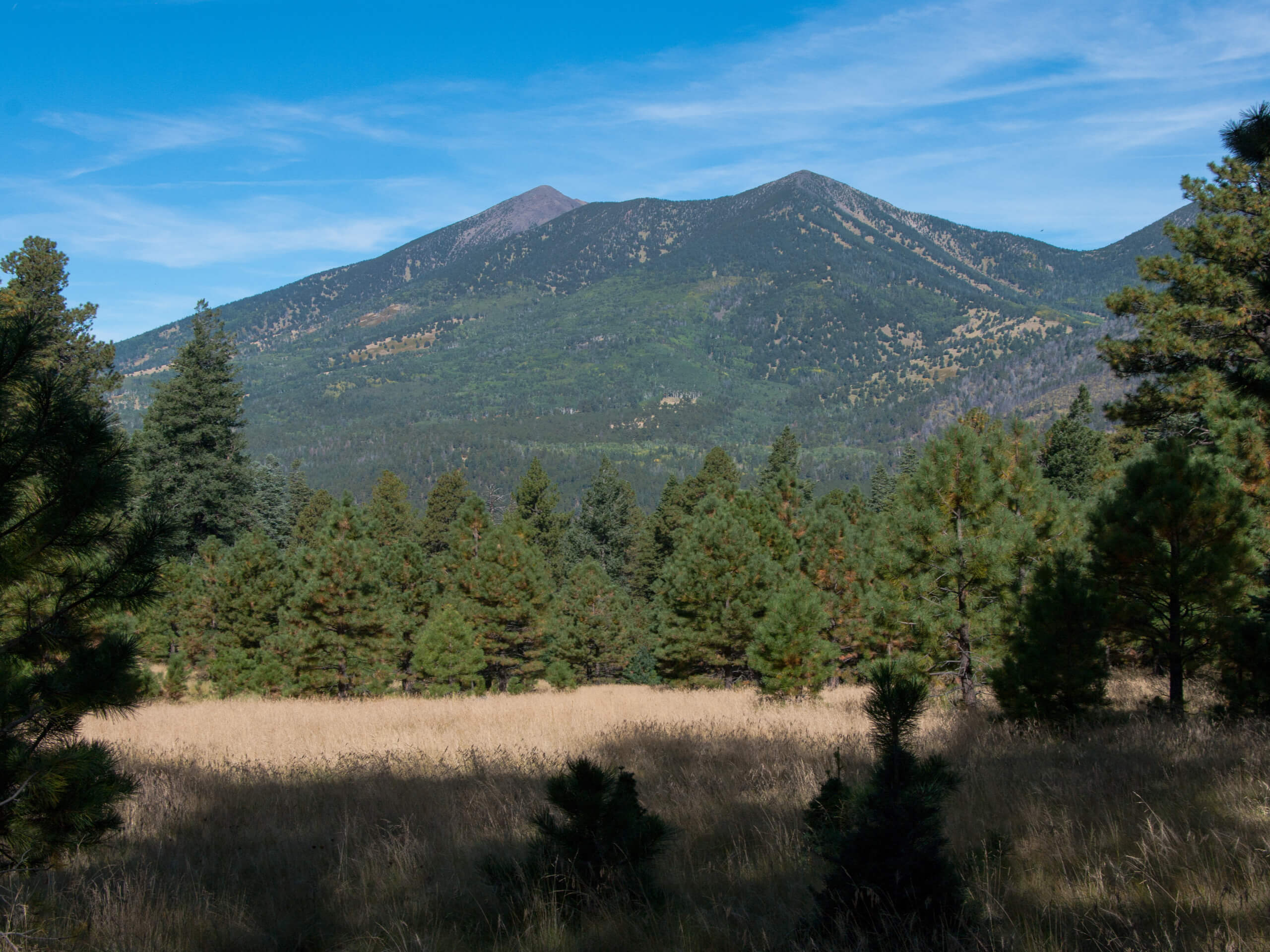
Sunset Trail
Difficulty Rating:
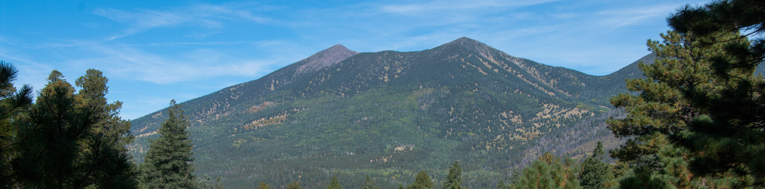
The Sunset Trail leads you up and across some of the most visible mountains in Flagstaff’s skyline, heading up Little Elden Mountain to the top of T-V Hill, next to Elden Mountain’s summit lookout. This route is used by hikers, trail runners, and mountain bikers and is enjoyed for its lovely views, especially when the fall colors start to paint the mountainsides. Expect light to moderate traffic on this route.
This route is moderately difficult, with undulating elevation gain providing lots of chances to catch your breath. You can do this route as-is or choose to go just a few steps past its end to reach the top of Elden Mountain, where you’ll have an excellent view of Flagstaff.
Getting there
The trailhead for the Sunset Trail is off Schultz Pass Road.

About
| Backcountry Campground | No |
| When to do | March-November |
| Pets allowed | Yes |
| Family friendly | Older Children only |
| Route Signage | Average |
| Crowd Levels | Low |
| Route Type | Out and back |
Sunset Trail
Elevation Graph
Weather
Sunset Trail Description
The Sunset Trail is a debatably under-appreciated multi-use trail in the Flagstaff area. This is a beautiful route with lots to see, but thankfully, it sees fewer users than many other routes in the same area – Hey, we’ll take it! The hike climbs up the north side of Little Elden Mountain, T-V Hill, and Elden Mountain for a lesser-seen view of these peaks.
This backside approach to these mountains is actually quite a bit easier than the traditional southside approaches. The trail continually climbs and then levels out, giving you lots of chances to catch your breath as you climb.
The Sunset Trail is shared by hikers, trail runners, and mountain bikers. Remember to share the trail and look out for one another. Dogs are allowed off-leash on this trail, but we recommend keeping them close as bikes whiz past.
This is a fabulous summer hike, but we also love this route in the fall when the trees on the mountains start to go golden. Since you’ll spend most of your time on this trail up in the mountains and along a treed ridge, there’s lots of forest real estate to see some fall colors on.
Part of this area is recovering from a wildfire. Hiking through areas recovering from fire is always interesting, as the foliage will change each year. Flowers tend to thrive before the trees regrow, and different species of trees can thrive as the entire forest recuperates.
The dirt road to the trailhead is a little bit rough, but it’s nothing too difficult. Very low clearance vehicles may have to take it slow. From the trailhead, take Sunset Trail (there are a few trails that leave from around this spot, so double-check the signage).
Pass the Schultz Tank, a rare water feature in the land called “sin agua,” or “without water,” by Spanish explorers, and begin to climb the slope ahead of you. You may find black bear prints on this trail. Bears aren’t overly common out here, but they do sometimes cross this path. The traffic of the trail generally keeps them away, but should you be out on off times, consider bringing a group.
Atop this slope, you’ll drop down near Little Elden Mountain, then climb back up to the ridge between that peak and T-V Hill/Elden Mountain. This ridge is quite scenic. As you climb, look down at the Sunset Crater and the Bonito Lava Flow.
This route terminates at a Y-junction, but the top of Elden Mountain is not very far away, so feel free to take a few more steps to gain the best viewpoint in this area. Look north to admire the Kachina Peaks Wilderness in all its glory; your view is nice and open.
When you’re ready, drop back down the ridge and retrace your steps to the trailhead.
Hiking Route Highlights
Kachina Peaks Wilderness
The Kachina Peaks Wilderness is an 18,616-acre designated wilderness area in the Coconino National Forest north of Flagstaff, Arizona. The wilderness area includes Arizona’s highest peak, Humphreys Peak, in addition to the next-tallest mountains in the San Francisco Peaks range. The Kachina Peaks Wilderness was named for the Hopi gods, the Kachinas. According to Hopi legend, these gods lived in this area for part of the year, flying from the top of the mountains to the Hopi mesas as clouds, which was where the monsoons originated. Many of the mountains in the Kachina Peaks Wilderness are sacred to local Indigenous tribes.
Frequently Asked Questions
Is the Sunset Trail good to watch the sunset from?
Yes, especially if you continue to the top of Elden Mountain, which is a great sunset viewpoint. Consider bringing a headlamp if you want to watch the sunset.
Is the Sunset Trail good for kids?
This hike is suitable for active families, but it might be too long for smaller children.
Insider Hints
Keep an eye out for mule deer and elk on this hike.
While this route doesn't get too busy, the top of the hike can be busier from other trails. Try to hike early in the morning or midweek for the most serene experience.
Similar hikes to the Sunset Trail hike

Fay Canyon Loop
Fay Canyon is one of several main canyons in the Walnut Canyon National Monument. This loop hike explores part of…

Sandy Steps, Heart, and Upper Oldham Trail
The Sandy Steps, Heart, and Upper Oldham hike makes use of several different trails to create a hike that stretches…

Fisher Point via Fay Canyon
Fisher Point is one of the best viewpoints into the gorgeous Walnut Canyon. This route leads you to the point…
Comments