
Soldier Loop Trail
View Photos
Soldier Loop Trail
Difficulty Rating:
Stroll underneath wildflower-dotted pine forests on the Soldier Loop Trail, a picturesque hiking, mountain biking, and running route in the Fort Tuthill area south of Flagstaff. This is a good pick for weekend warriors who want to get outside and be active in nature. The views aren’t sky-high, but the trail has a great ambiance and it’s usually not too busy. Expect moderate traffic.
Getting there
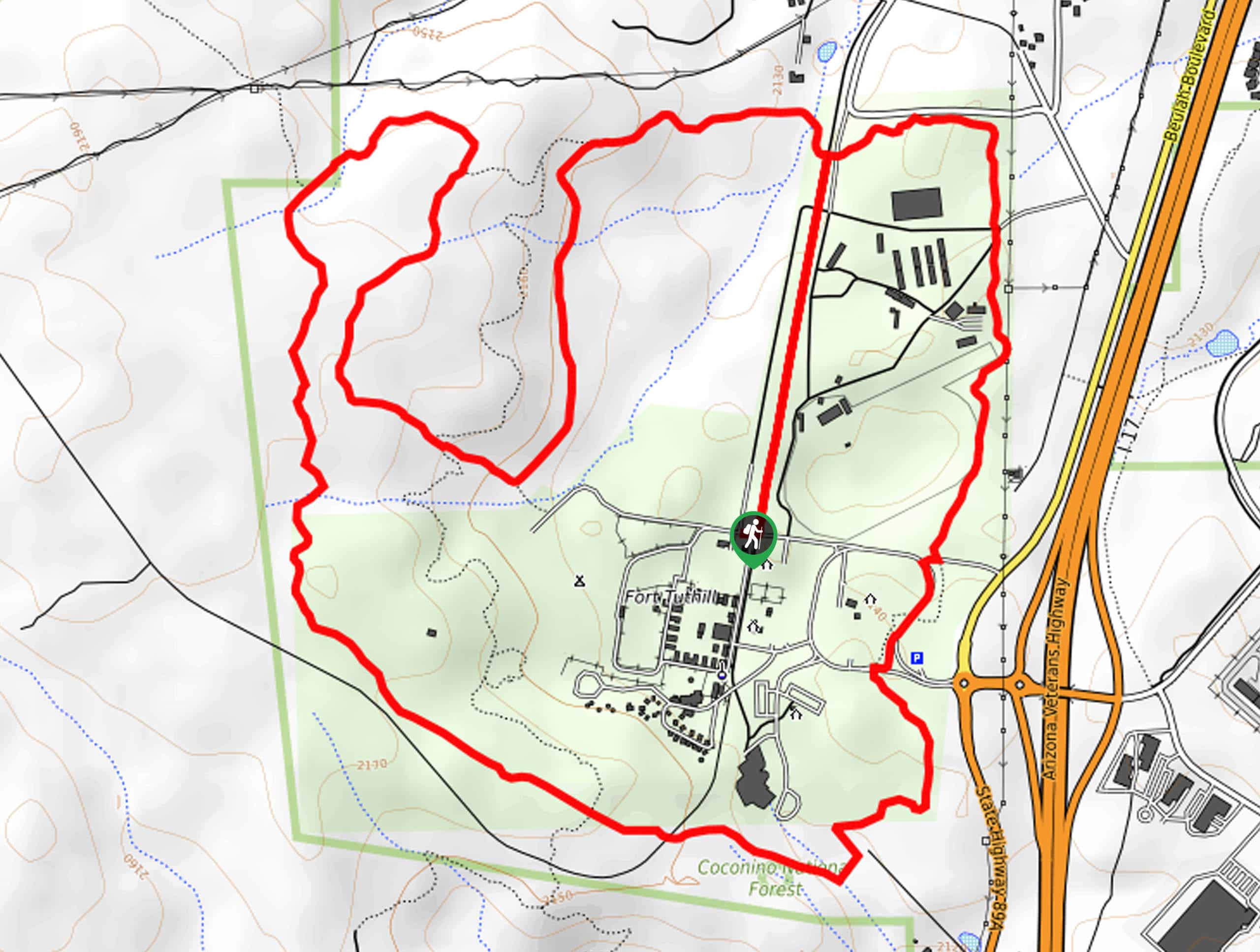
The trailhead for the Soldier Loop Trail is off Regiment Road.

About
| Backcountry Campground | Fort Tuthill Campground |
| When to do | April-October |
| Pets allowed | Yes - On Leash |
| Family friendly | Yes |
| Route Signage | Good |
| Crowd Levels | Moderate |
| Route Type | Loop |
Soldier Loop Trail
Elevation Graph
Weather
Soldier Loop Trail Description
The Soldier Loop Trail is a pleasant moderately difficult hiking, mountain biking, and running route south of Flagstaff in the Fort Tuthill area, which also offers a campground and adventure course. This route doesn’t deliver huge views, but being in the forest here is lovely and the trail doesn’t get too busy.
There’s sufficient signage on this route, so you should be able to find your way without a map or GPS track. Watch for bike traffic and remember to share the route. This trail is quite well-maintained, so you won’t need to worry about hiking in sneakers.
From the trailhead, hike up Sinclair Wash Trail to the fork and stay left onto Soldier Trail. Go left to hike south, then loop back up north, then south again in this winding section. Hike down towards the forest road on Soldier Trail, pass the amphitheater, and then hike north past the arena to return to Sinclair Wash Trail and the trailhead.
Similar hikes to the Soldier Loop Trail hike

Fay Canyon Loop
Fay Canyon is one of several main canyons in the Walnut Canyon National Monument. This loop hike explores part of…

Sandy Steps, Heart, and Upper Oldham Trail
The Sandy Steps, Heart, and Upper Oldham hike makes use of several different trails to create a hike that stretches…

Fisher Point via Fay Canyon
Fisher Point is one of the best viewpoints into the gorgeous Walnut Canyon. This route leads you to the point…
Comments