
Soldier and Highlands Loop
View Photos
Soldier and Highlands Loop
Difficulty Rating:
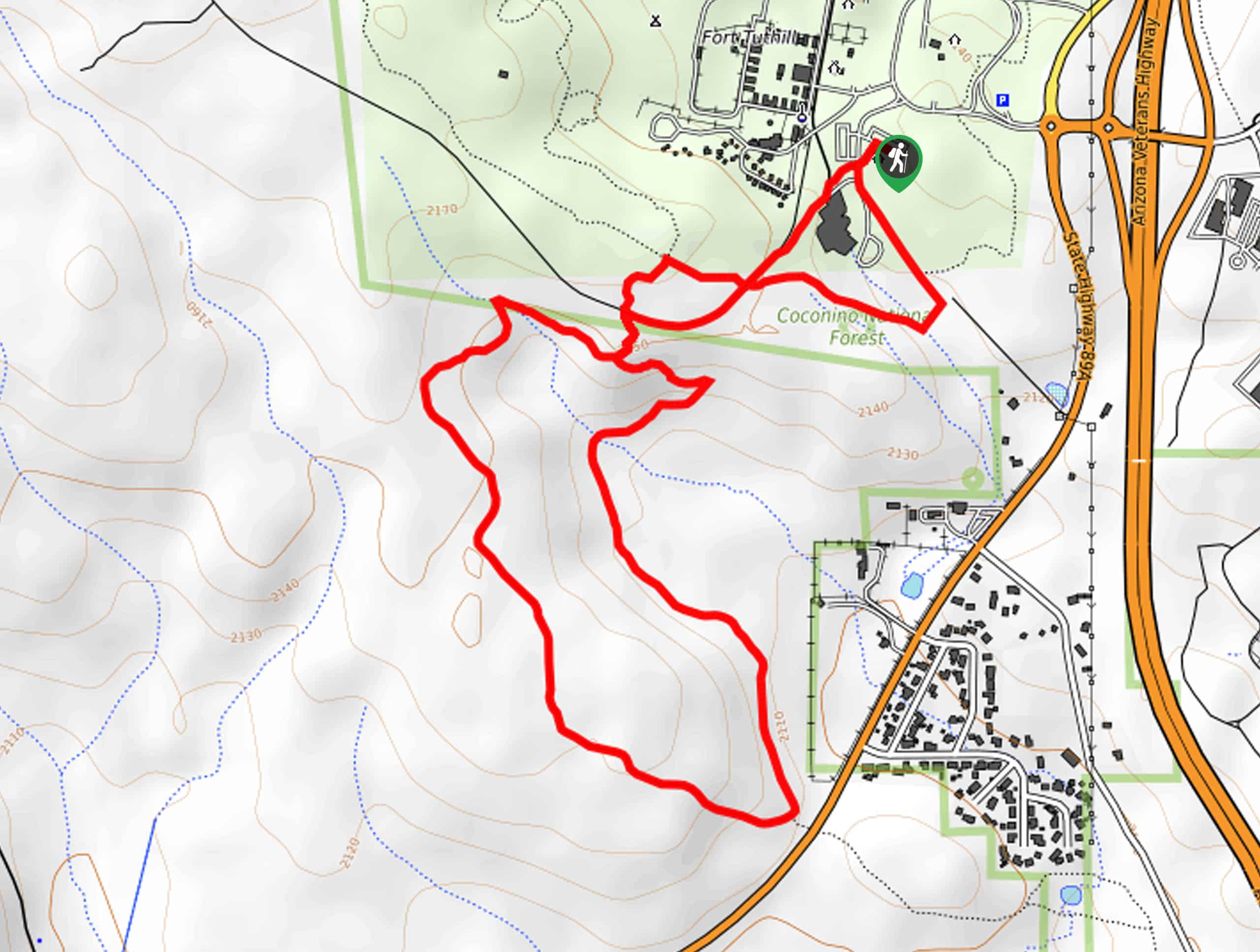
Stroll underneath oak trees and pine forests on the Soldier and Highlands Loop, a fairly relaxed hiking and running route north of Flagstaff. This is a good pick for weekend warriors who want to get outside and be active in nature. This is a great hike in the fall when the leaves have gone golden and red. The views aren’t sky-high, but the trail has a great ambiance and it’s usually not too busy. Expect moderate traffic.
Getting there
The trailhead for the Soldier and Highlands Loop is off Garrison Road.

About
| Backcountry Campground | No |
| When to do | March-November |
| Pets allowed | Yes - On Leash |
| Family friendly | Yes |
| Route Signage | Poor |
| Crowd Levels | Moderate |
| Route Type | Loop |
Soldier and Highlands Loop
Elevation Graph
Weather
Soldier and Highlands Loop Description
The Soldier and Highlands Loop is a pleasant moderately difficult hiking and running route north of Flagstaff. This route doesn’t deliver huge views, but being in the forest here is lovely and the route doesn’t get too busy. Try to time your hike for when the leaves are turning colors in the fall.
The signage on this hike leaves a bit to be desired, especially at the beginning of the hike. A downloaded GPS route can help you find the way.
From the trailhead, hike out onto Garrison Road and pass the amphitheater, taking Soldier Trail to the 4-way junction. Go left here, At the next 4-way junction, go left again. At the trail split, you’ll make your third left. You’ll follow the Highland Trail as you loop through the trees. At the trail split, you’ll start your three right turns in a row to head back past the amphitheater and to the trailhead.
Similar hikes to the Soldier and Highlands Loop hike

Fay Canyon Loop
Fay Canyon is one of several main canyons in the Walnut Canyon National Monument. This loop hike explores part of…

Sandy Steps, Heart, and Upper Oldham Trail
The Sandy Steps, Heart, and Upper Oldham hike makes use of several different trails to create a hike that stretches…

Fisher Point via Fay Canyon
Fisher Point is one of the best viewpoints into the gorgeous Walnut Canyon. This route leads you to the point…
Comments