hikes in Gifford Pinchot National Forest
Hikes in the Gifford Pinchot National Forest
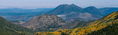
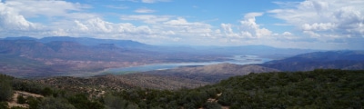
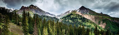
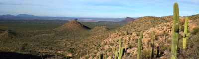
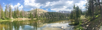
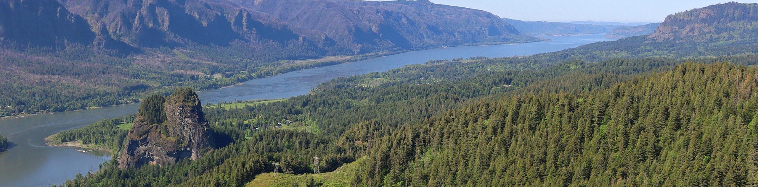
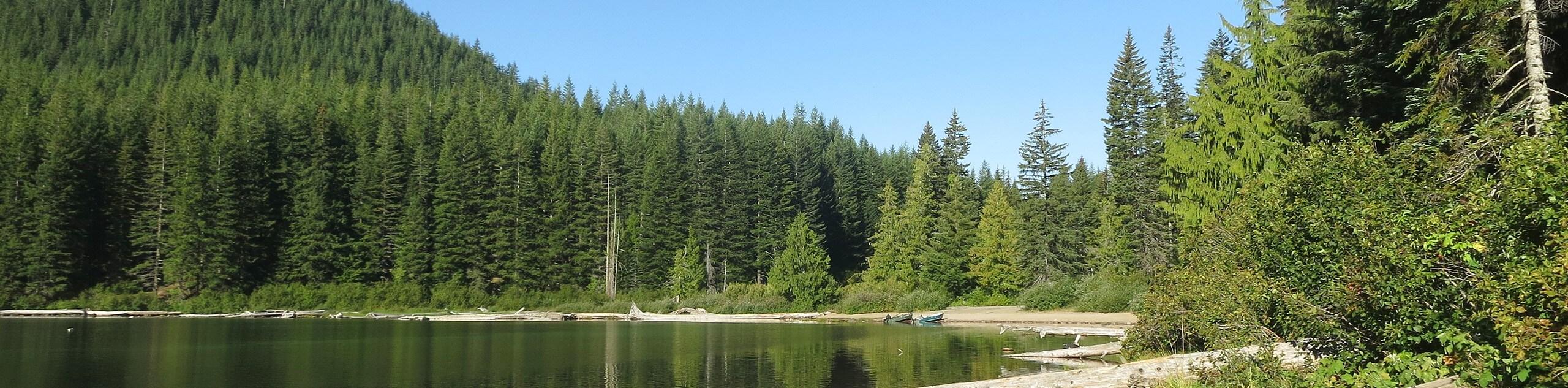
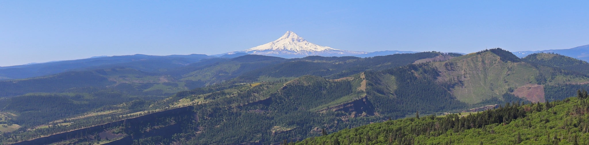
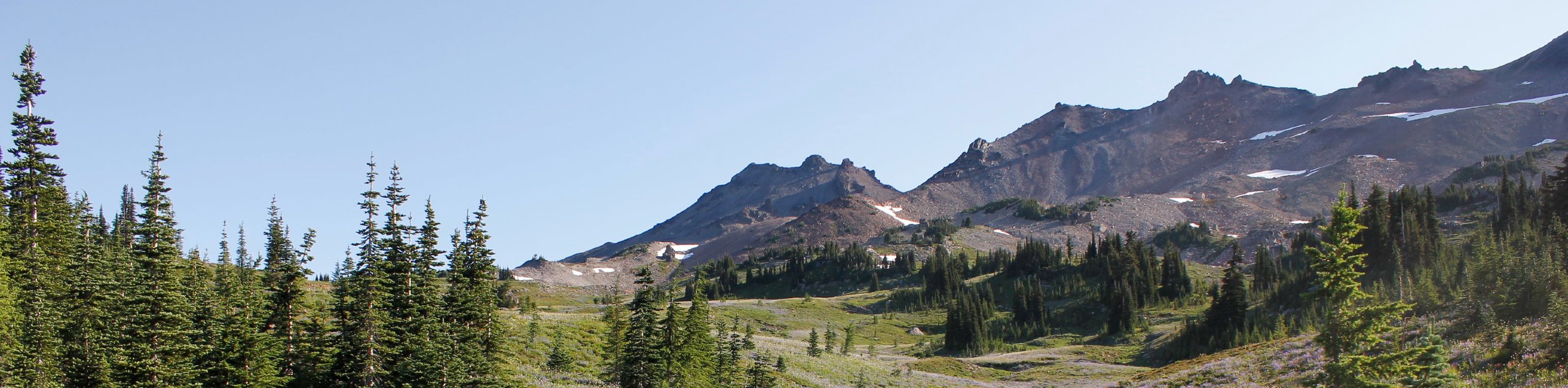
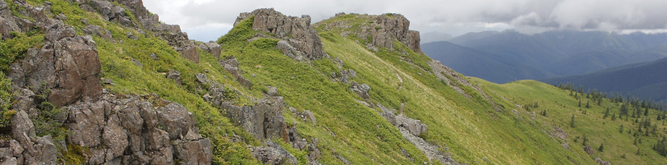
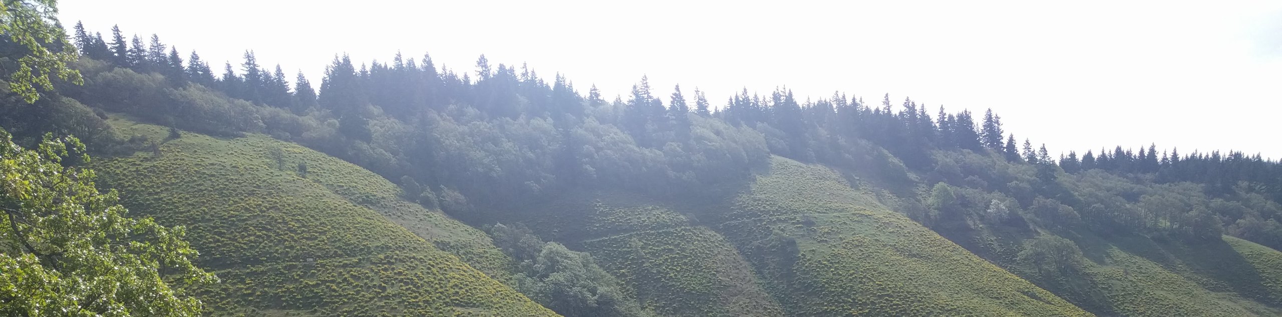
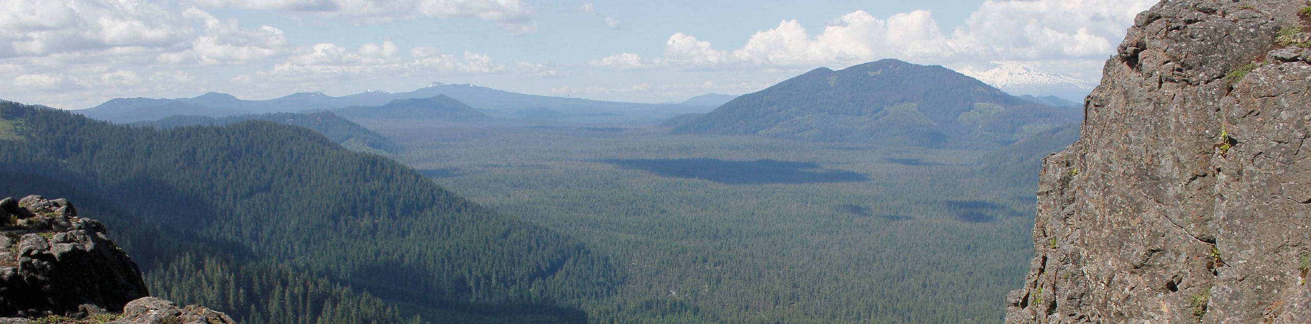
There are more miles to cover in the Gifford Pinchot National Forest than you could do in one trip, but don’t let the variety overwhelm you. Choosing the perfect adventures in this gorgeous region is easy with our extensive collection of route guides. Take easy lakeside walks, watching the reflections of the mountains quiver in the surface. Summit sky-high glaciated peaks, looking into the craters of still-active volcanoes. Hike through underground tunnels created by lava flow. Toss on your pack and lose yourself in the woods for a week, or take advantage of easy trails to introduce your kids to the outdoors. There’s something for everyone here.
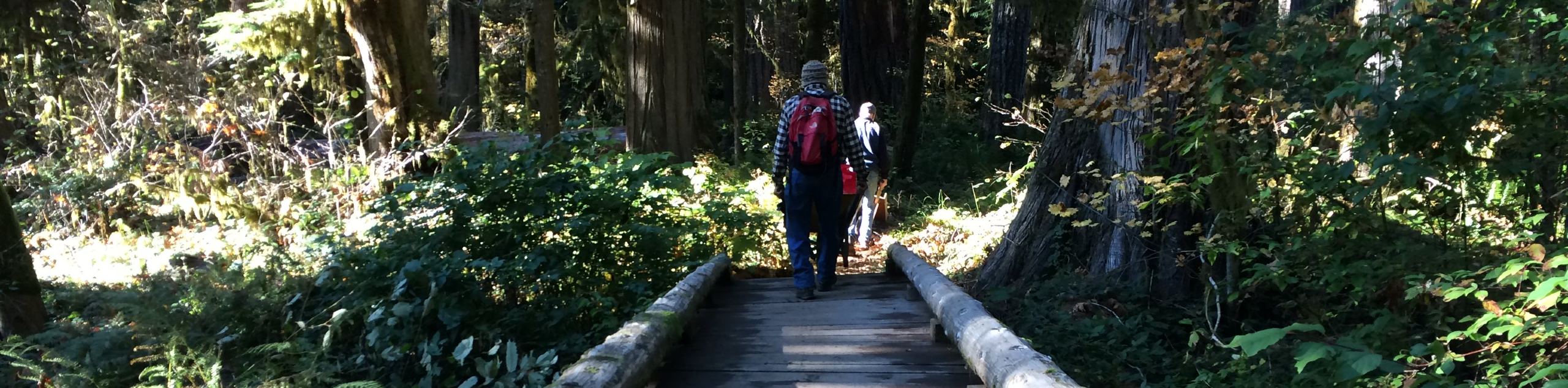
A perk of hiking in Washington is the impressive number of backcountry camping spots scattered throughout the state. Toss on your pack to make a weekend of it! Many trails are also great for mountain biking, horseback riding, fishing, or other outdoor activities. The sky’s the limit in the Gifford Pinchot National Forest.
15 Amazing Hikes in the Gifford Pinchot National Forest
Ready to start exploring? We’re making it easy to get going with 15 of our favorite hikes in the Gifford Pinchot National Forest. Our list includes short, laidback trails to intense treks and everything in between. Take a quick day hike or plan a longer backpacking adventure, getting away for the weekend or for as long as you like. What stays consistent? The natural beauty of the forest all around you, from the quiet mountaintops to the shimmering Columbia River.
Our top hikes in the Gifford Pinchot National Forest are chosen to give you an idea of what makes this region so great to explore. While starting with these 15 hikes is a great way to experience the forest, remember that we’ve got many, many more route guides in the forest and Washington in general if you want to keep going.
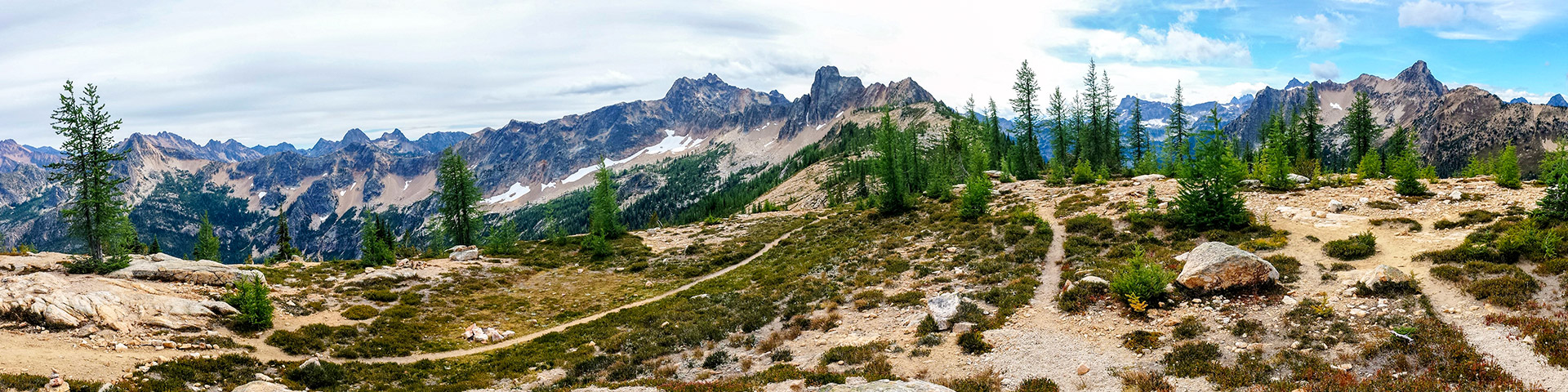
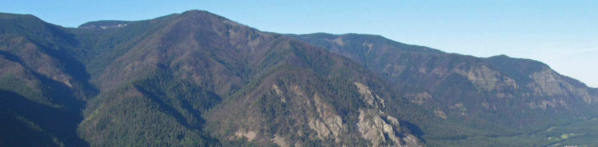
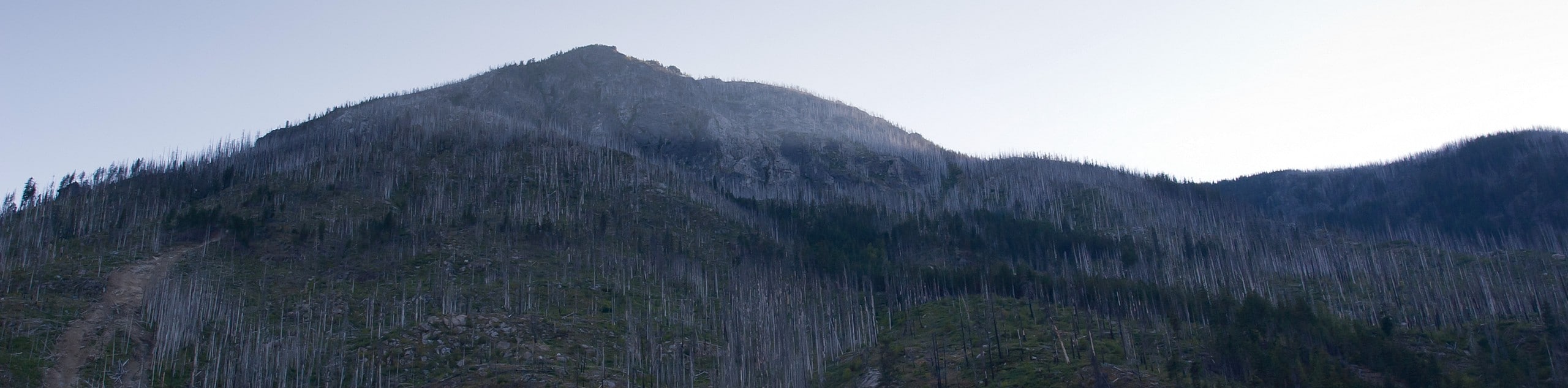
- High Rock Trail - High Rock is high, indeed. This viewpoint rises high above the surrounding South Cascades, giving you the best view you can find in the area! The views are truly panoramic and the trail to reach them isn’t that difficult. At 3.2mi in length and with moderate elevation gain, it’s a suitable trek for most skill levels and for active families.
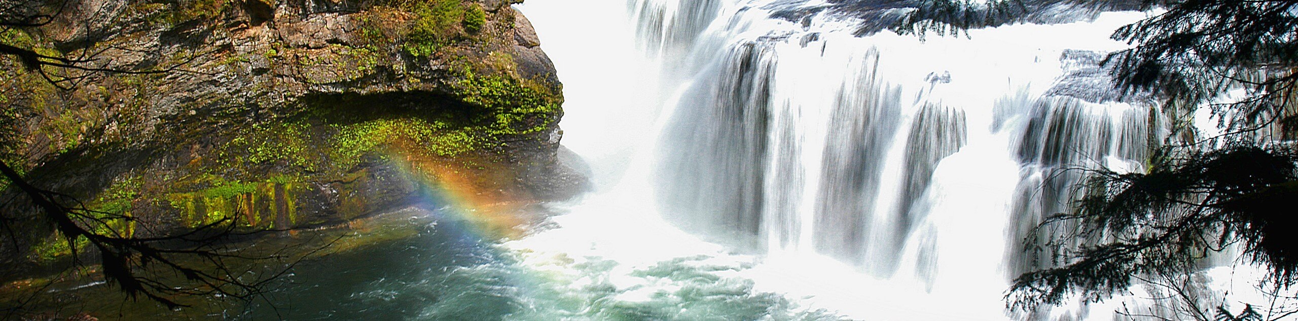
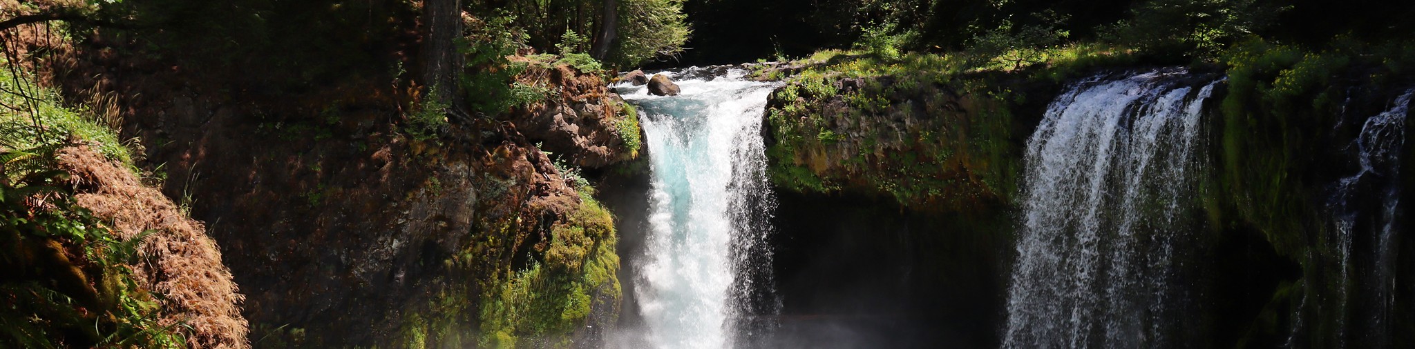
- Hidden Falls via Tarbell Trail - Hidden Falls via Tarbell Trail is a moderate hike that features beautiful waterfalls, and longer adventures on the Tarbell Trail can take you very far and through changing scenery. In this section, you’ll explore a very lush forest, check out multiple waterfalls, and stroll through clear-cut areas that open up your view.
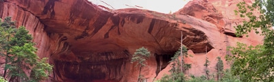
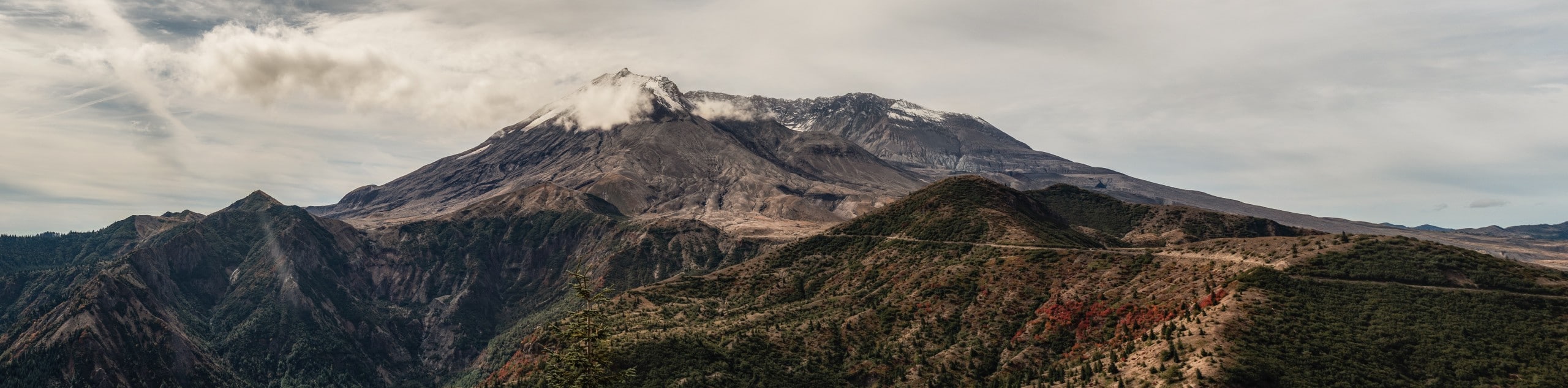
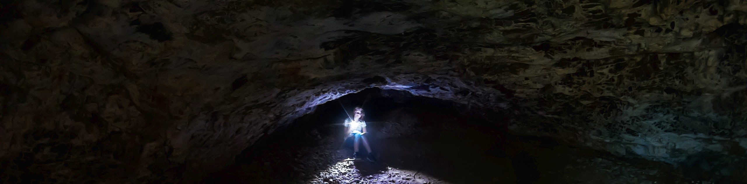
- Ape Caves Trail - The Ape Caves Trail takes you into a lava tube discovered in 1951, created by an eruption of nearby Mount St. Helens. At 2.5mi long, this trail is the longest continuous lava tube in the continental United States and the third-longest lava tube in North America. Nearly 200,000 people hike through the tube each year, making this a very popular trail.
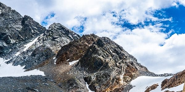
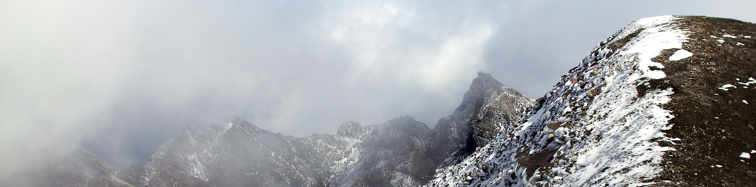
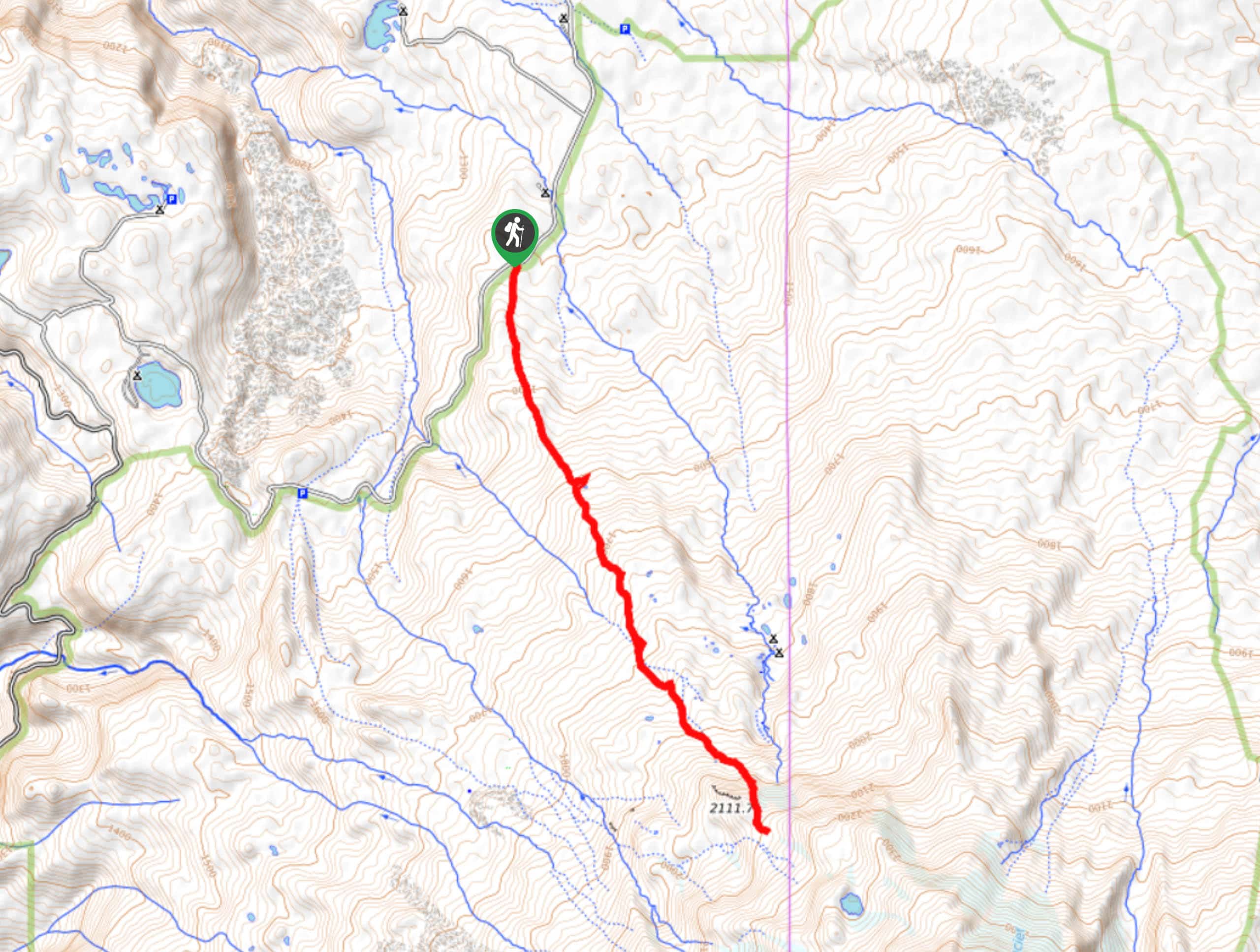
- Mount Adams South Climb - The Mount Adams South Climb is the least technical approach to Mount Adams’ summit, leading you to the top over the course of 10.9mi and over 6700ft of elevation gain. While this is the least challenging way up Mount Adams, it’s still best taken on by experienced adventurers with the proper gear and a healthy dose of gumption.
- Panther Creek Falls - Panther Creek Falls is a beautiful waterfall that cascades over a mossy slope. The hike to the viewpoint for the falls is extremely easy and quick, making it possible to enjoy for most adventurers. There’s a nice viewing deck for the falls that you can take advantage of.
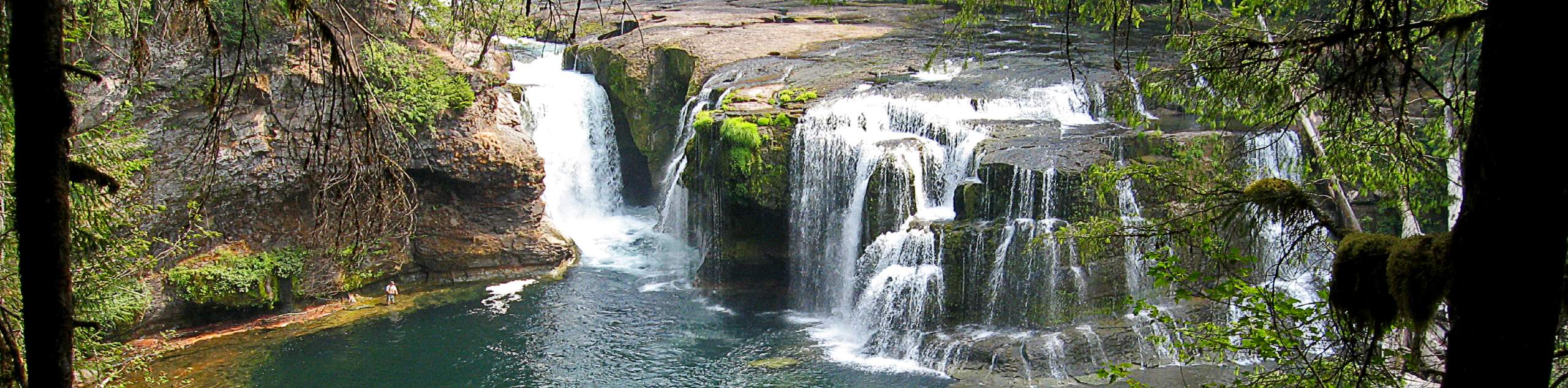
- Lewis River Falls Trail - Lewis River Falls Trail is a delightful hike in every way. The trail is in great condition, the scenery is immaculate, and despite the heavy traffic, visiting on a weekday or early morning/late afternoon can score you some solitude. There are also multiple access points for this route to shorten or lengthen it.
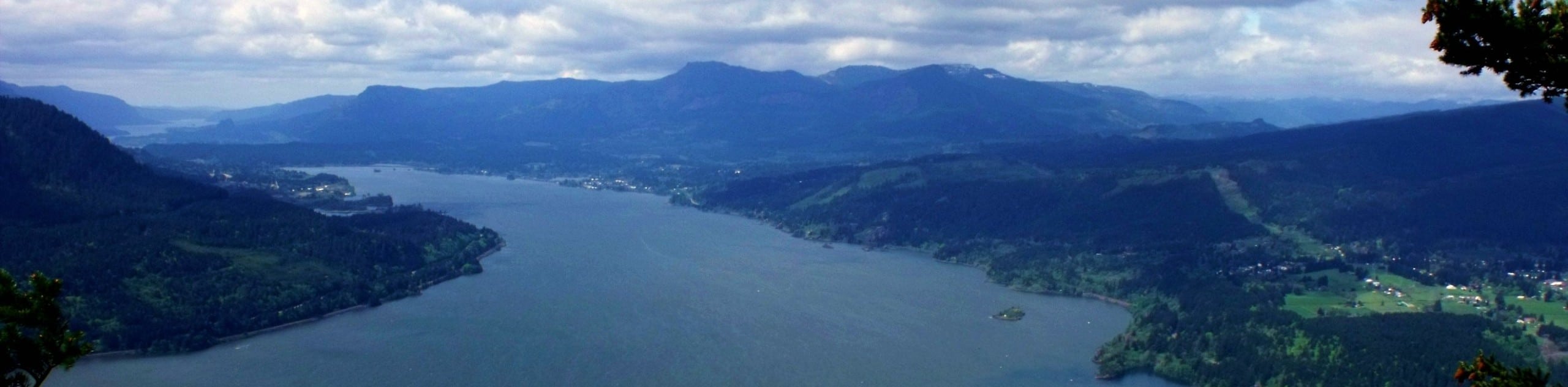
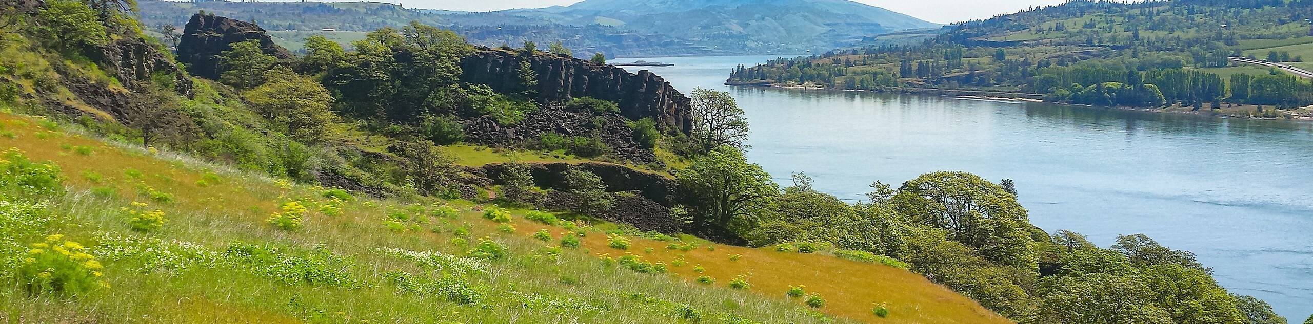
- Dog Mountain Trail - Dog Mountain Trail is one of the most sought-after hikes in the Columbia River Gorge. This 6.5mi loop trek is considered hard, with a straight-up stair stepper climb required. However, the changing scenery and plant life make for a very enjoyable trip well worth the crowds. The hike begins with temperate and high-desert flora, but it changes to a cool rainforest and then ends in flower-filled meadows with mountain views.
- Beacon Rock Trail - Beacon Rock Trail takes you through Beacon Rock State Park to a fantastic viewpoint over the Columbia River Gorge. This 1.5mi out and back route is less of a hike in the classic sense and more of a pleasant walk with a gentle, consistent incline. The route is paved or on a boardwalk, making it a nice choice for those who prefer even footing.
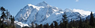
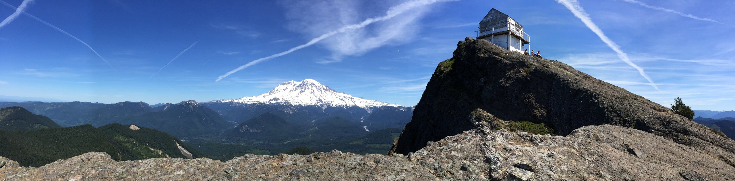
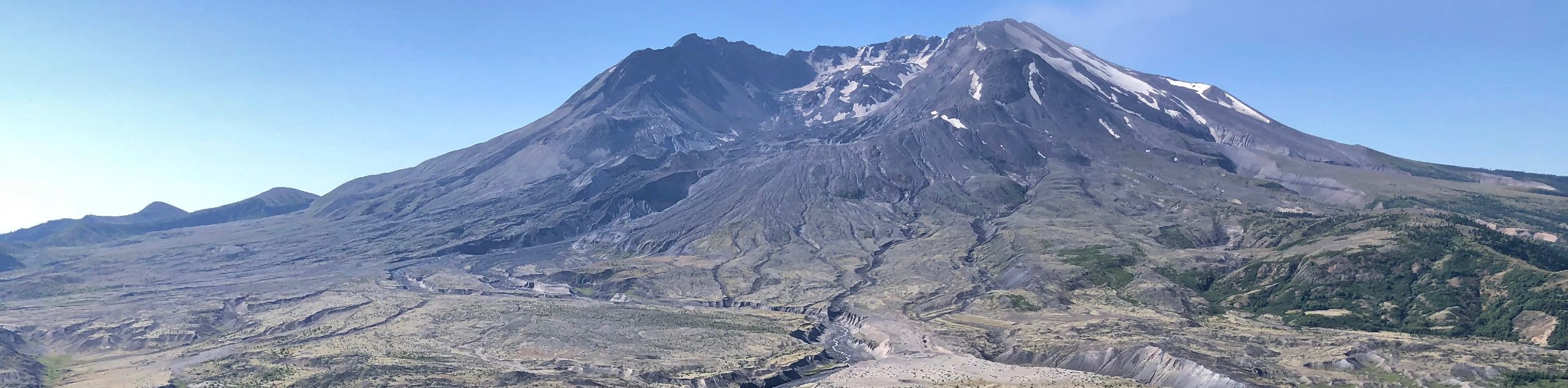
- Mount Saint Helens Summit via Monitor Ridge Trail - The view from Mount Saint Helens is very impressive, and it should be on the bucket list of every campable adventurer. The Monitor Ridge approach is challenging, but it requires no technical climbing skills. Take on a big adventure and earn the chance to gaze down into the glaciated crater of the volcano.
- Johnston Ridge Observatory Trail - Not quite ready to climb Mount Saint Helens? Admire it from the Johnston Ridge Observatory. This very quick and simple walk takes you through the observatory over a 0.5mi with almost no elevation gain. Part of the trail is wheelchair accessible and the entire path is very family-friendly.
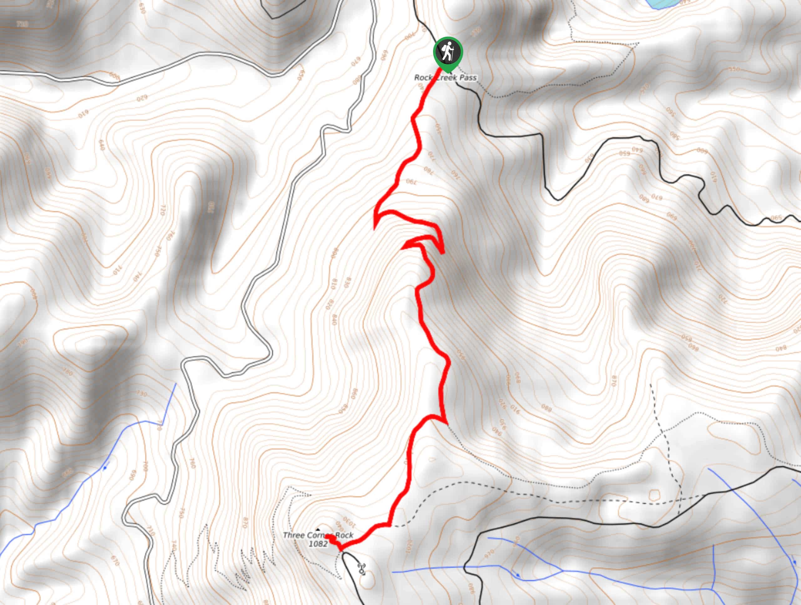
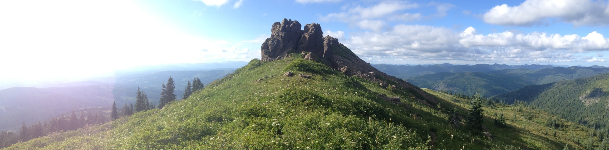
- Three Corner Rock - Three Corner Rock is a unique rock formation atop a hill that overlooks Mount Adams, Mount Rainier, and Mount Saint Helens. It’s a moderate hike, but the views are what you’d expect of a much more intensive trek. On a clear day, this is a totally camera-worthy viewpoint!
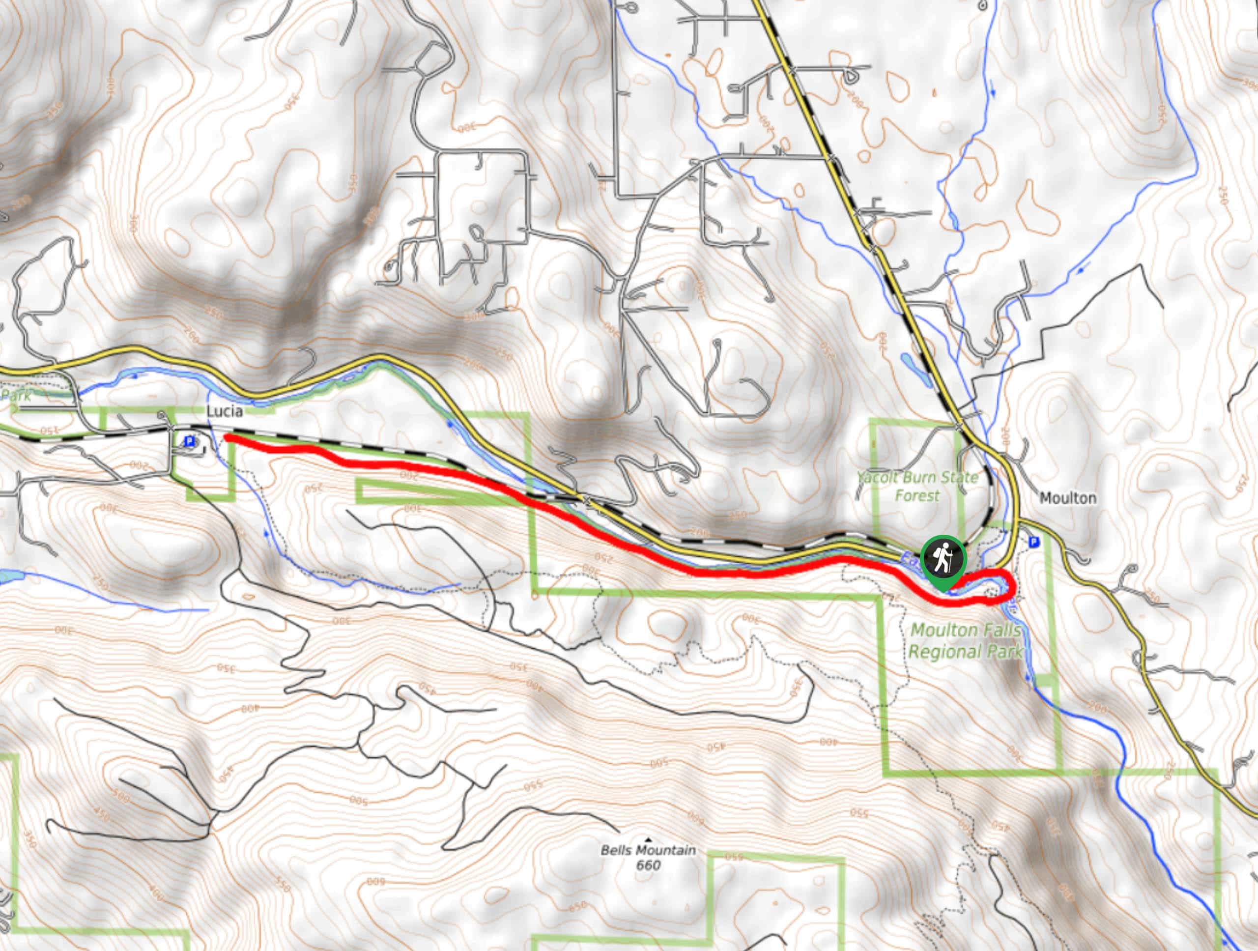
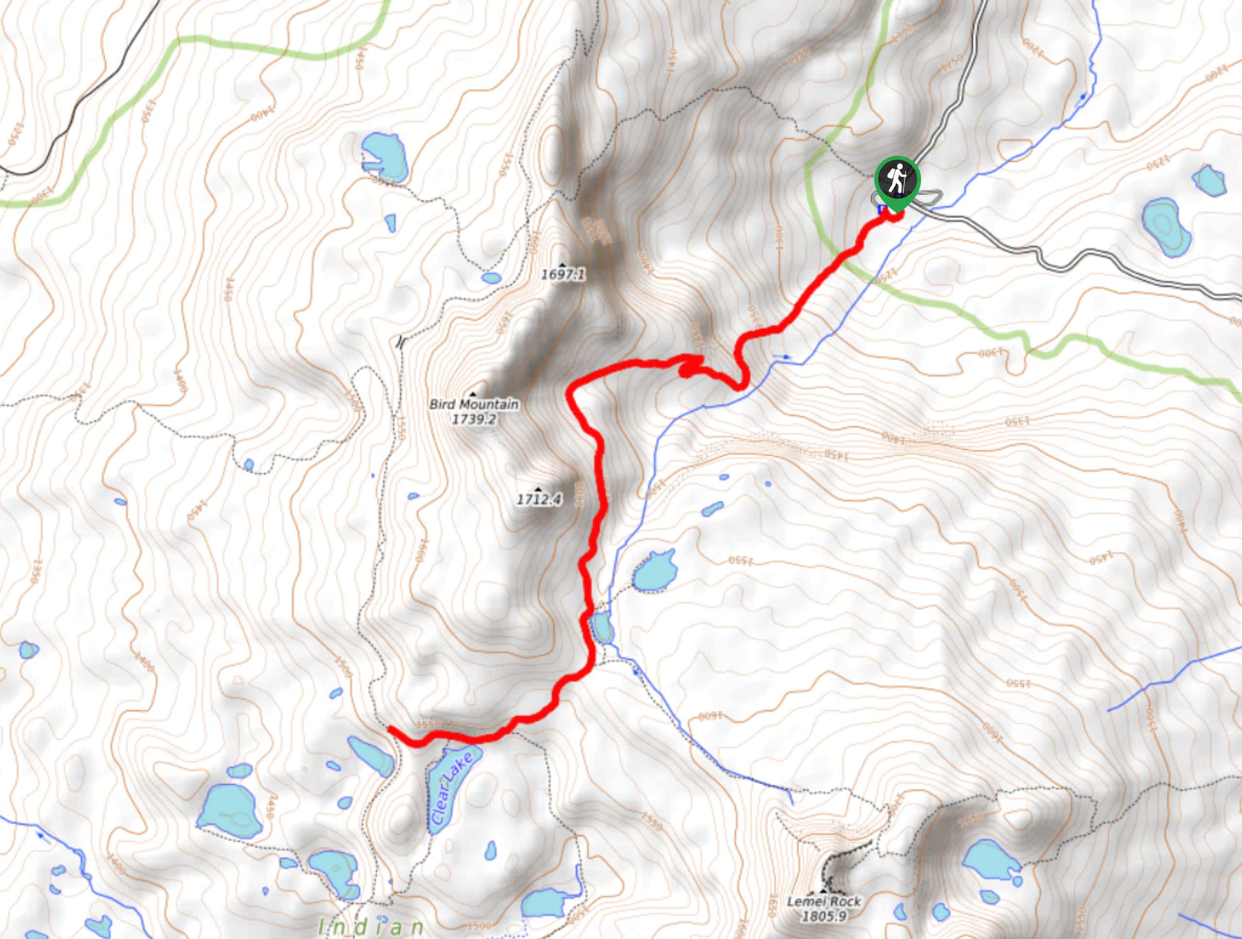
- Moulton Falls - The hike to Moulton Falls on Lewis River Trail is an easy hike suitable for all skill levels and ages. You’ll hike along a mossy cliff with the river flowing beside you, having the chance to relax at viewpoints and benches on the way. It’s peaceful but also offers the chance to adventure a little if you take side trails to Big Tree Falls or up the Bells Mountain Trail.
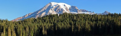
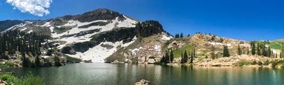
- Takhlakh Lake and Meadows Trail - The 3.3mi loop hike around Takhlakh Lake and the Takh Takh Meadows is a unique hike in the best ways. The highlight of the trek is a climb up an old lava flow for views of Mount Rainier, a uniquely southwestern Washington experience. The hike doesn’t tend to be very busy despite its fantastic views.
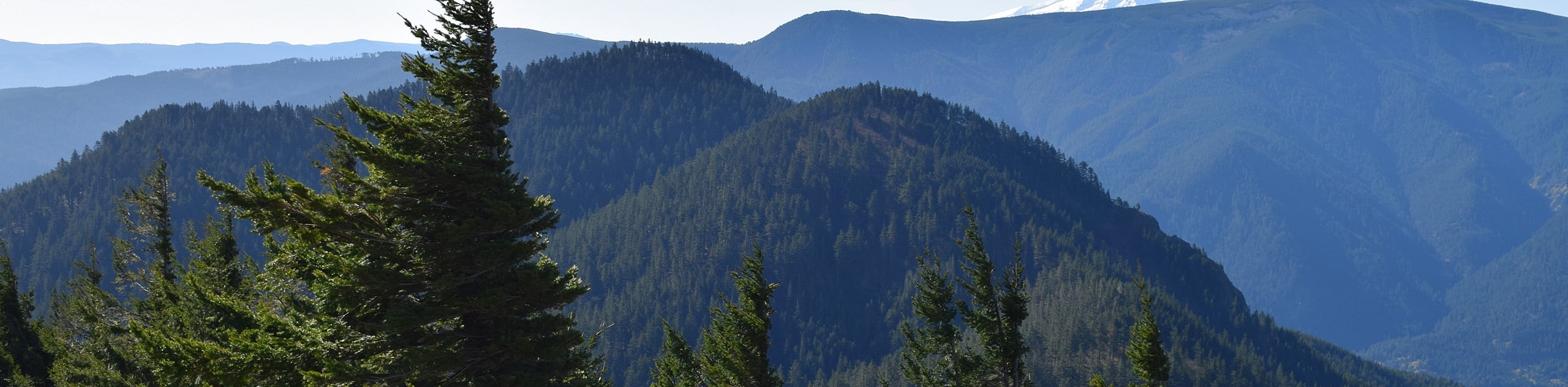
- Ape Canyon Trail - Ape Canyon Trail is well worth the effort it might require! This hike takes you through a wonderful section of old-growth forest (one of the few remaining stands near Mount Saint Helens) atop a butte with great views of Mount Rainier and Mount Adams.
- Spirit Falls Trail - Spirit Falls is a stunning spot. The falls are tucked into the forest off the beaten path, hidden in the moss of the trees until you’re right in front of them. The falls are stellar in the warmer months, but they’re especially impressive when they’re surrounded by crystalline white in the winter.
Scroll down to see the full list of hiking trails in the Gifford Pinchot National Forest.
When is the Best Time to Hike in the Gifford Pinchot National Forest
Gifford Pinchot National Forest generally experiences warm, mild summers and cool winters with lots of precipitation. While you should be prepared for rain any time of the year, visiting in the summer months of July and August tend to give the warmest, driest weather. Shoulder season (spring and fall) can bring heavier rain and snow, and winter tends to be snowy and cold.
While the summer months offer the best weather, they do also bring the heaviest crowds. If you’re okay with occasionally cooler or wetter conditions, visiting in June or mid-September can give you more privacy on the trails while still offering suitable hiking weather. If you’re hiking to enjoy golden larches, visits in late September and early October are usually best.
Other Outdoor Activities in the Gifford Pinchot National Forest
While the trails are excellent, hiking is not the only way to explore the Gifford Pinchot National Forest! This region boasts plenty of space for other outdoor activities.
Adventurers on two wheels can take advantage of the many mountain bike and dirt bike paths. Those with four-legged friends can explore horse and dog-friendly trails. Fishers will find lakes stocked with trout, and campers will be able to choose from many sites. Many hiking paths can be extended for backpacking trips thanks to the ease of backcountry camping in the forest. In the winter, skiers, snowshoers, mushers, sledders, and snowmobilers can make use of the region’s snowfall.
How to Plan a Trip to the Gifford Pinchot National Forest
A trip to the Gifford Pinchot National Forest is a worthwhile venture, but you’ll want to put enough time and energy into planning to make sure your trip runs the way you want it to. You’ll need a Northwest Forest Pass for many trails in the park, and some require a Discover Pass. If you plan on camping, make sure you plan out your campsites beforehand and check which ones are walk-up and which require advance booking.
Some popular trails have limited parking available, so try to plan your busiest hikes as early in the day as you can. Additionally, the forest roads that service many trailheads are subject to potholes and poor conditions. Planning to have a high-clearance 4WD vehicle for your time in the park is essential if you want to hike trails serviced by certain forest roads.
Gifford Pinchot National Forest Adventure Tours
Some of us love trip planning and some of us just… don’t. Take the stress out of your trip with an excerpt-planned adventure tour, letting you let go and focus on the fun stuff. Check out some incredible adventure tours in the Pacific Northwest.
Frequently Asked Questions About the Gifford Pinchot National Forest
Can you hike in the Gifford Pinchot National Forest?
Of course! There are lots and lots of trails worth exploring in the forest, and hopefully this guide can help you start your hiking adventures.
Are there bears in the Gifford Pinchot National Forest?
Yes, there are bears in the Gifford Pinchot National Forest. Be bear aware and practice bear safety while you visit.
What kinds of animals are in the Gifford Pinchot National Forest?
Some of the animals that live in the forest are deer, elk, mountain lions, black bears, coyotes, birds of prey, salmon, and many more.
Where is Gifford Pinchot National Forest?
Gifford Pinchot National Forest is located in Southwestern Washington State, USA.
Explore other great hiking regions in Washington State:
Or check out other amazing hiking regions in the United States.
Read MoreThe best hikes in Gifford Pinchot National Forest
01. High Rock Lookout Trail
Difficulty
High Rock is high, indeed. This viewpoint soars above the surrounding region of the South… Read More
02. Hidden Falls via Tarbell Trail
Difficulty
Hidden Falls via Tarbell Trail is a moderate 10.9mi hike in Yacolt Burn… Read More
03. Ape Caves Trail
Difficulty
The Ape Caves Trail takes you into a lava tube discovered in 1951. The tubes… Read More
04. Mount Adams South Climb
Difficulty
The Mount Adams South Climb is the least technical approach, leading you to the summit… Read More
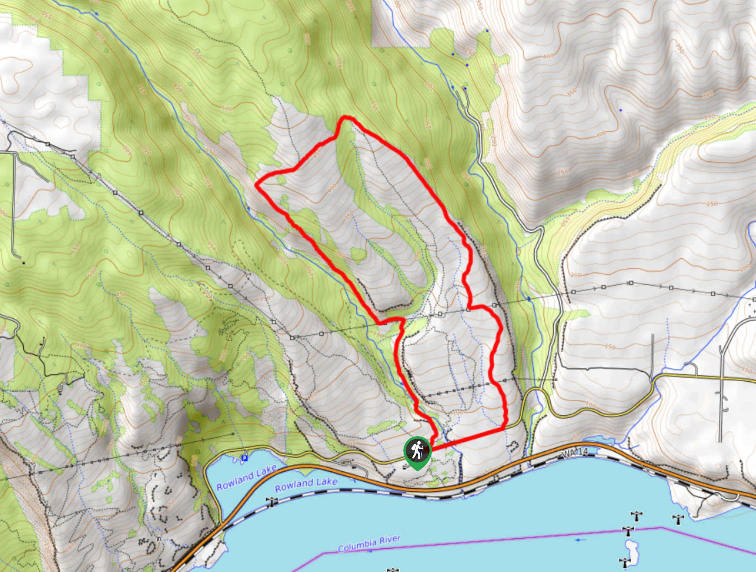
05. Panther Creek Falls Hike
Difficulty
Panther Creek Falls is a beautiful waterfall that cascades over a mossy slope in the… Read More
06. Lewis River Falls Trail
Difficulty
Lewis River Falls Trail is a delightful hike in every way. The trail is in… Read More
07. Dog Mountain Trail
Difficulty
Dog Mountain Trail is one of the most sought-after hikes in the Columbia River Gorge.… Read More
08. Beacon Rock Trail
Difficulty
Beacon Rock Trail takes you through Beacon Rock State Park to an awesome viewpoint over… Read More
09. Mount Saint Helens Summit via Monitor Ridge Trail
Difficulty
The view from Mount Saint Helens is a stunning sight, and it should be on… Read More
10. Johnston Ridge Observatory Trail
Difficulty
The Johnston Ridge Observatory has one of the best views of Mount Saint Helens you… Read More
Yes, there are more than 10
Gifford Pinchot National Forest is so beautiful that we can not give you only 10 hikes. So here is a list of bonus hikes in Gifford Pinchot National Forest that you should take a look at as well
11. Three Corner Rock Hike
Difficulty
Three Corner Rock is a unique formation atop a hill that overlooks all the big… Read More
12. Moulton Falls Hike
Difficulty
The hike to Moulton Falls on Lewis River Trail is an easy hike suitable for… Read More
13. Takhlakh Lake and Meadows Trail
Difficulty
The 3.3mi loop hike around Takhlakh Lake and the Takh Takh Meadows is… Read More
14. Ape Canyon Trail
Difficulty
Ape Canyon Trail is well worth the effort from anyone in the area. This hike… Read More
15. Spirit Falls Trail
Difficulty
Spirit Falls is a stunning sight. The falls are tucked into the forest off the… Read More
16. Hamilton Mountain and Rodney Falls Hike
Difficulty
The hike to Hamilton Mountain is a spectacular trip that captures the best of the… Read More
17. Coldwater Lake via Lakes Trail
Difficulty
The Lakes Trail is a popular pick for backpackers destined for the Mount Margaret Backcountry,… Read More
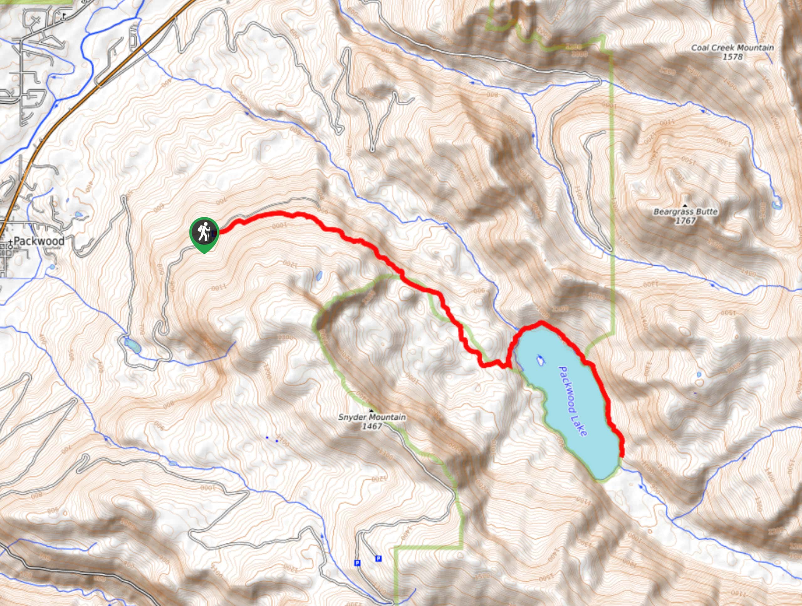
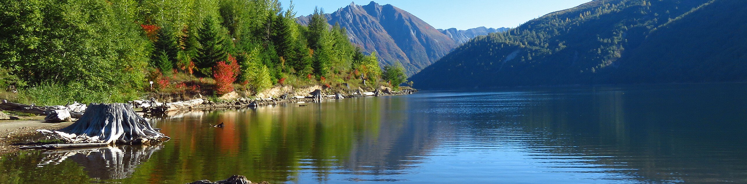
18. Packwood Lake Trail
Difficulty
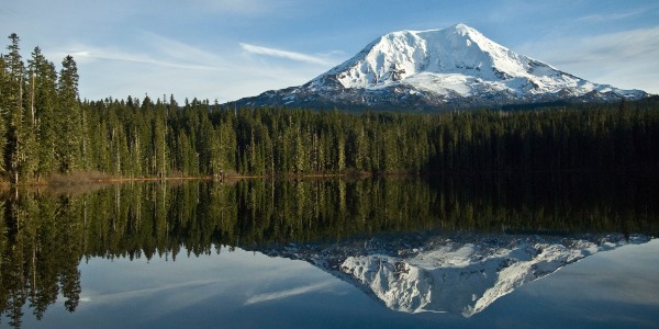
Packwood Lake’s glassy reflection is one we could stare into for an entire afternoon. With… Read More
19. Hamilton Mountain Trail
Difficulty
The hike to Hamilton Mountain is a gorgeous trip that captures the best of the… Read More
20. Windy Ridge Trail
Difficulty
Windy Ridge Trail is true to its name, but it could also be called Windy… Read More
21. Wind Mountain Trail
Difficulty
Wind Mountain Trail is a 24.0mi moderate hike that gives you a great… Read More
22. Cape Horn Loop Trail
Difficulty
The Cape Horn Loop Trail is a stellar hike, and it’s bound to become busier… Read More
23. Lower Falls Creek Trail
Difficulty
The Falls Creek Falls are a beautiful set of waterfalls in a bright green corner… Read More
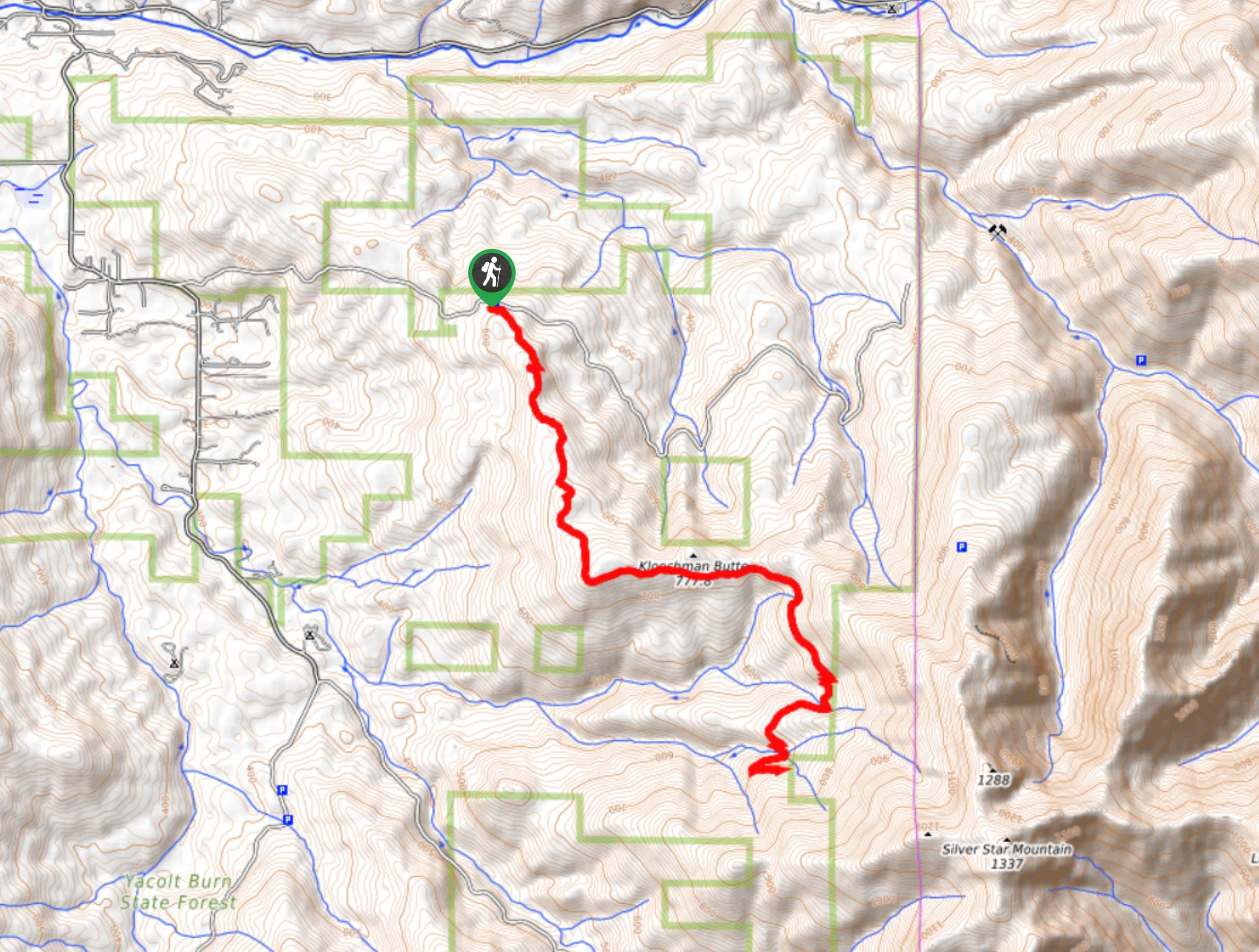
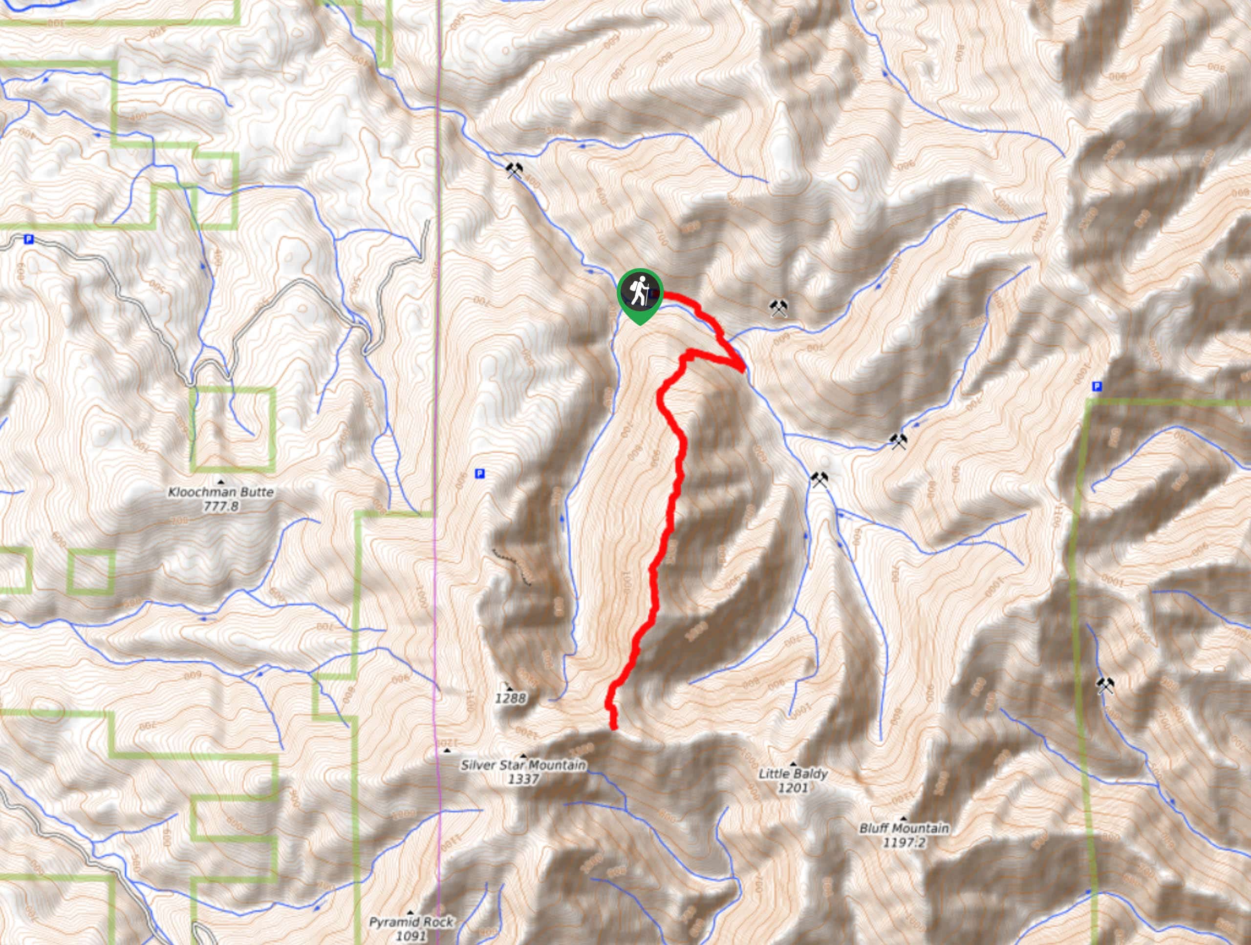
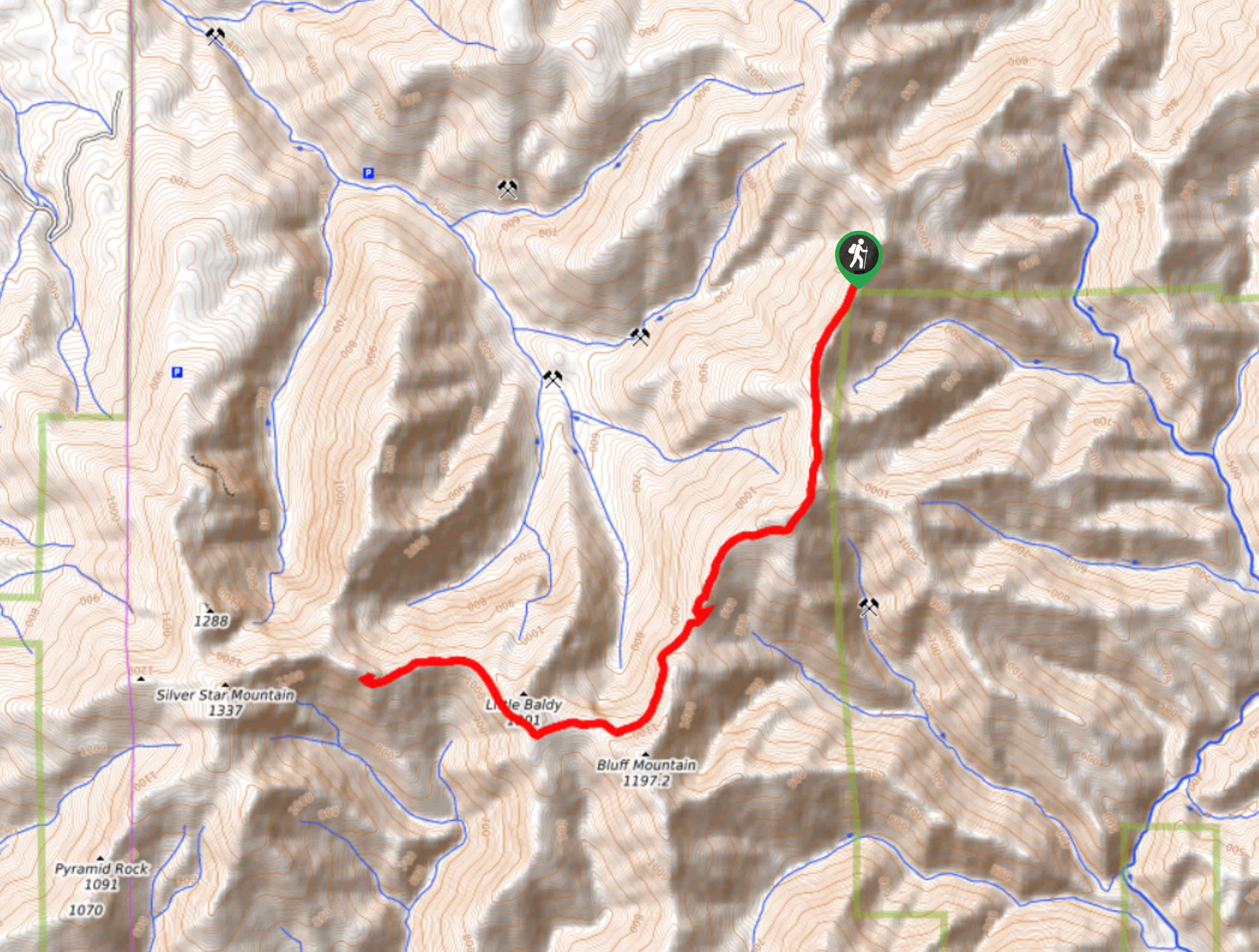
24. Silver Star Mountain via Grouse Vista Trail
Difficulty
The view from the top of Silver Star Mountain is definitely one of the better… Read More
25. Chinook Falls via Siouxon Trail
Difficulty
Siouxon Trail is a very popular backpacking route through a truly splendid forest. This area… Read More
26. Wildcat Falls via Siouxon Trail
Difficulty
Siouxon Trail is a popular backpacking trail through an awesome forest. This area is close… Read More
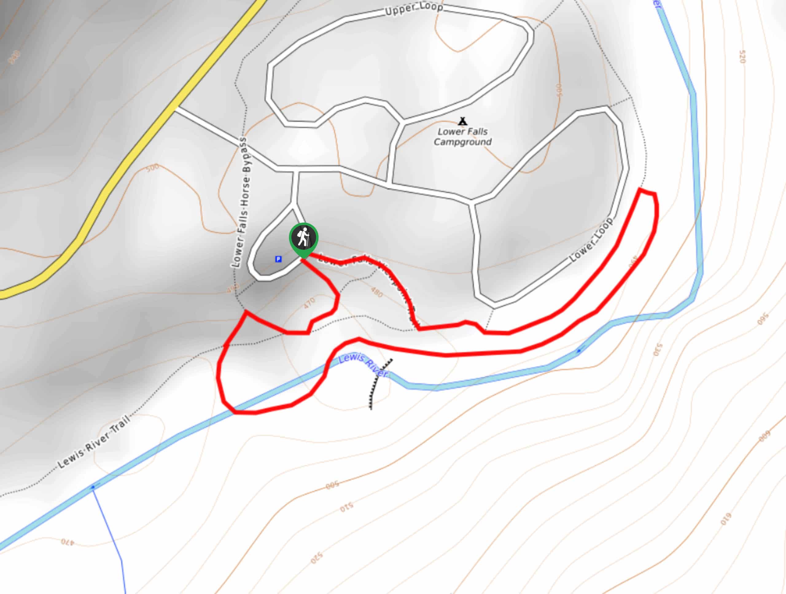
27. Lower Falls Campground Loop
Difficulty
The Lower Falls Campground Loop is a great way to stretch your legs and explore… Read More
28. Cathedral Falls Hike
Difficulty
Cathedral Falls is a fun destination for a weekend family hike. The trail to reach… Read More
29. Falls Creek Loop
Difficulty
The Falls Creek Falls are a gorgeous set of waterfalls in a lush green corner… Read More
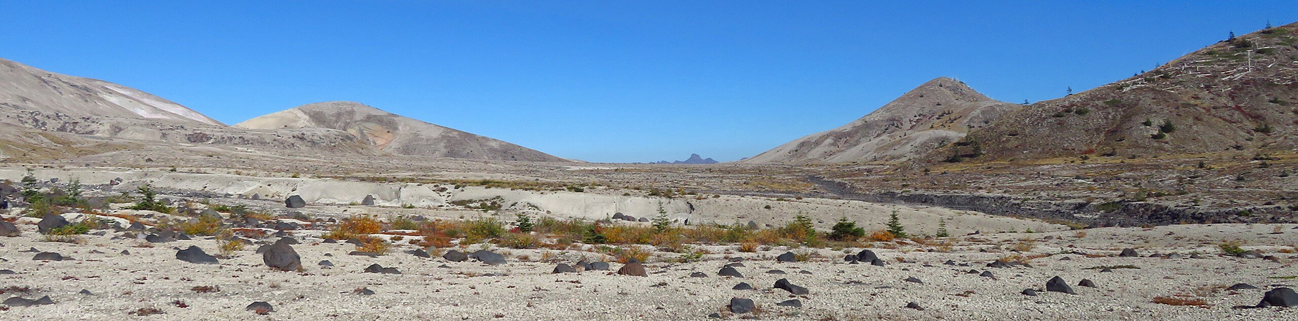
30. Lava Canyon Trail
Difficulty
The Lava Canyon is just across from the Ape Canyon Trailhead, offering similar unique scenery… Read More
31. Walupt Creek Falls Hike
Difficulty
Really looking for an adventure? The Walupt Creek Falls is just that. There is no… Read More
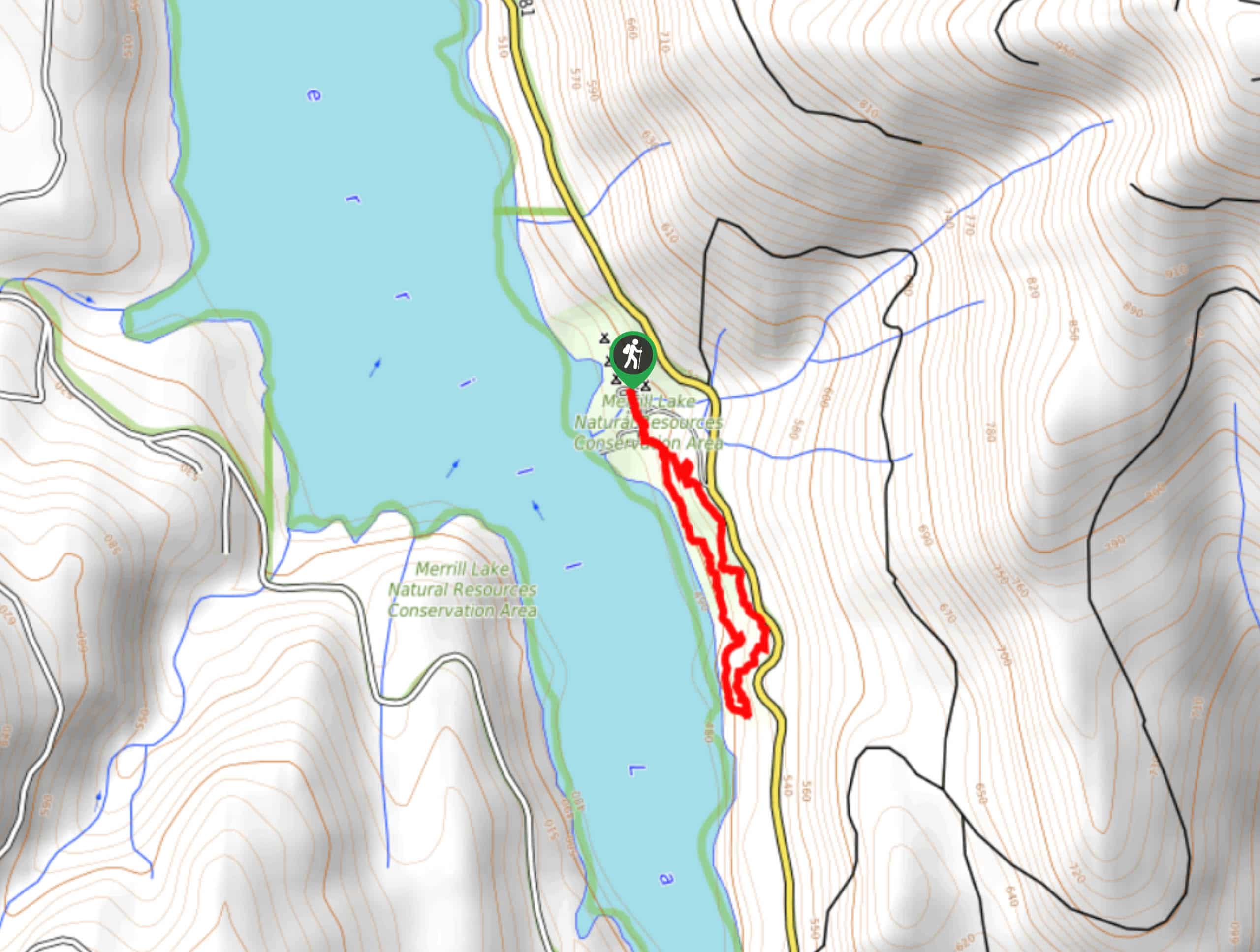
32. Merrill Lake Campground Loop
Difficulty
Staying at Merrill Lake Campground? Set out on the casual Merrill Lake Campground Loop, a… Read More
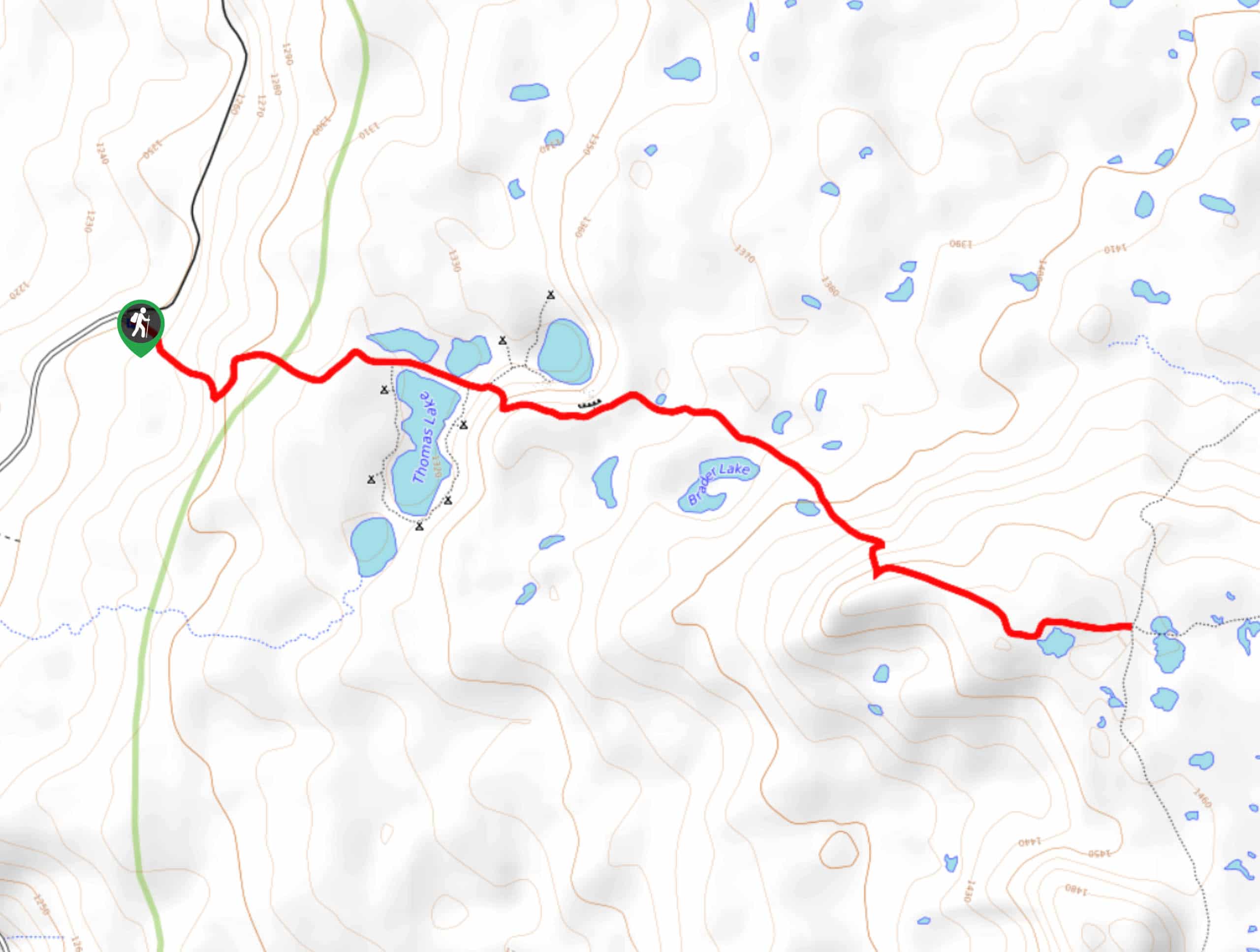
33. Thomas Lake Trail
Difficulty
Thomas Lake is a fantastic spot for a weekend getaway, offering nice backcountry camping spots… Read More
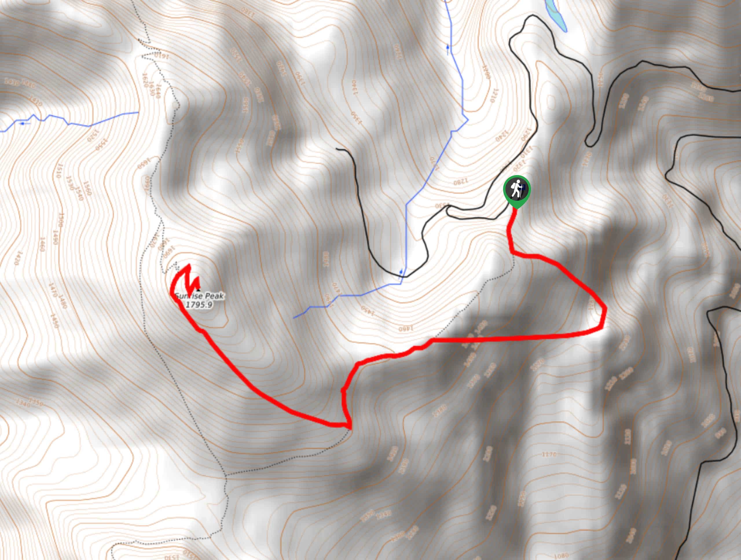
34. Sunrise Peak Trail
Difficulty
Sunrise Peak Trail is a spectacular hike with panoramic views that start before you’ve even… Read More
35. Coyote Wall Loop Trail
Difficulty
The Coyote Wall Loop Trail is a fun, customizable hike in the Columbia River Gorge.… Read More
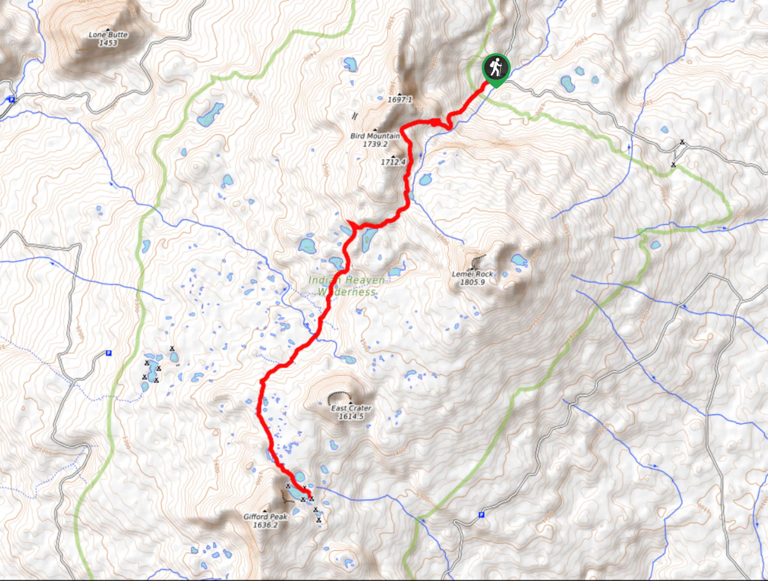
36. Indian Heaven Trail #33
Difficulty
Indian Heaven is a gorgeous region for a hike, with carpets of wildflowers, plenty of… Read More
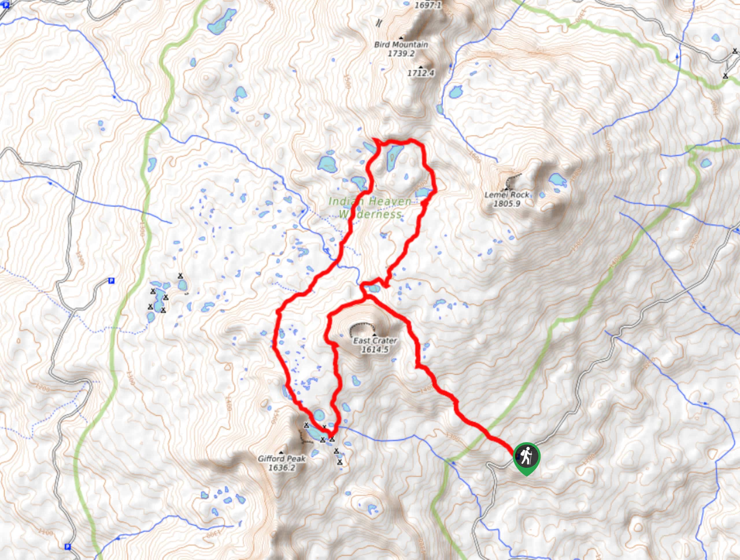
37. Indian Heaven Lakes Loop
Difficulty
Indian Heaven is a beautiful region for a hike, with expansive fields of wildflowers, too… Read More
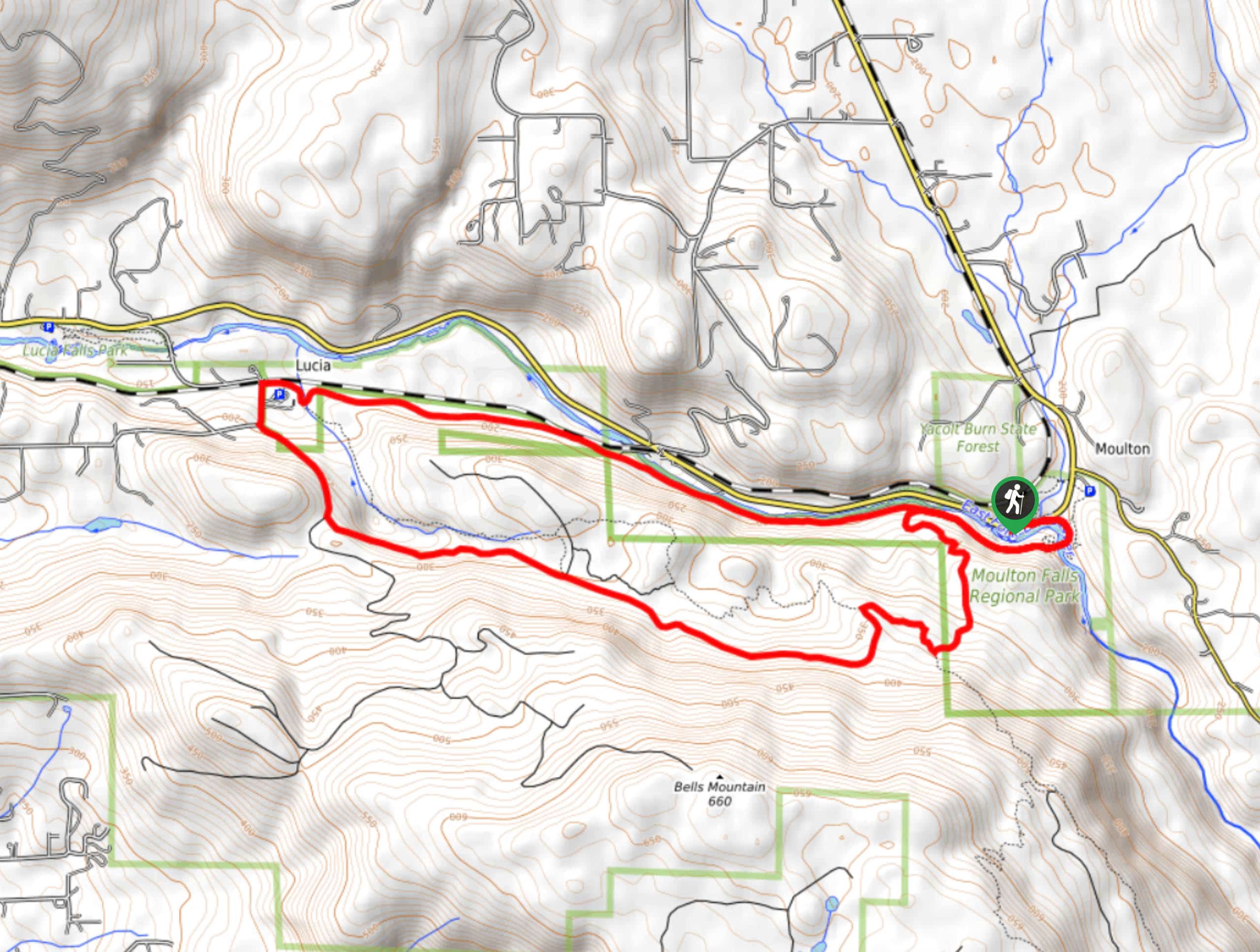
38. Moulton Falls and Mount Bell Loop
Difficulty
The hike to Moulton Falls on Lewis River Trail is an easy hike suitable for… Read More
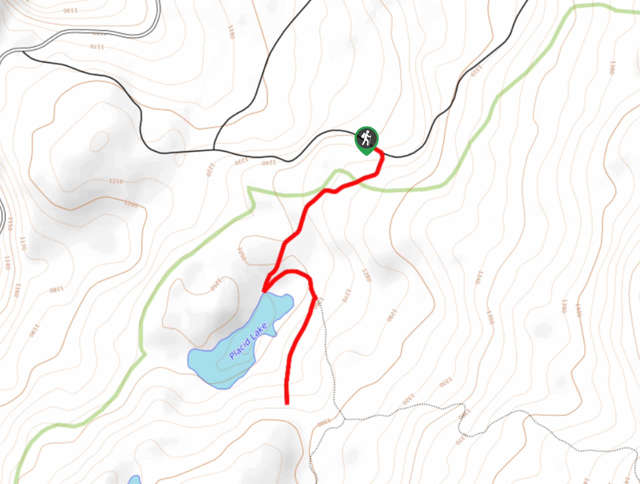
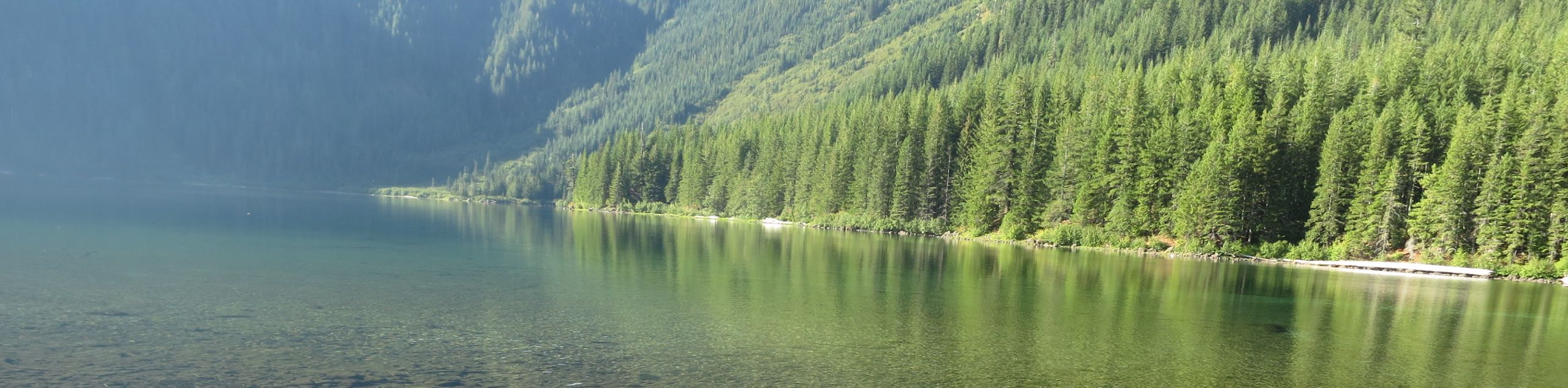
39. Placid Lake Trail
Difficulty
Placid Lake Trail is a short, easy trail that leads you to the shores of… Read More
40. Walupt Lake Trail
Difficulty
Walupt Lake Trail is a 78.0mi out and back trail in Gifford Pinchot… Read More
41. Blue Lake Hike Indian Heaven Wilderness
Difficulty
Indian Heaven Wilderness is an excellent hiking destination, with countless wildflowers, mountain views, and more… Read More
42. Hummocks Trail
Difficulty
Hummocks Trail is a 24.0mi easy trail in the Mount Saint Helens National… Read More
43. Trail of Two Forests
Difficulty
Trail of Two Forests is a very short, easy hike in Gifford Pinchot National Forest.… Read More
44. June Lake Trail
Difficulty
June Lake Trail is a 25.0mi easy hike in Gifford Pinchot National Forest… Read More
45. Glacier Lake Trail
Difficulty
Glacier Lake Trail is a 46.0mi out and back hike in Gifford Pinchot… Read More
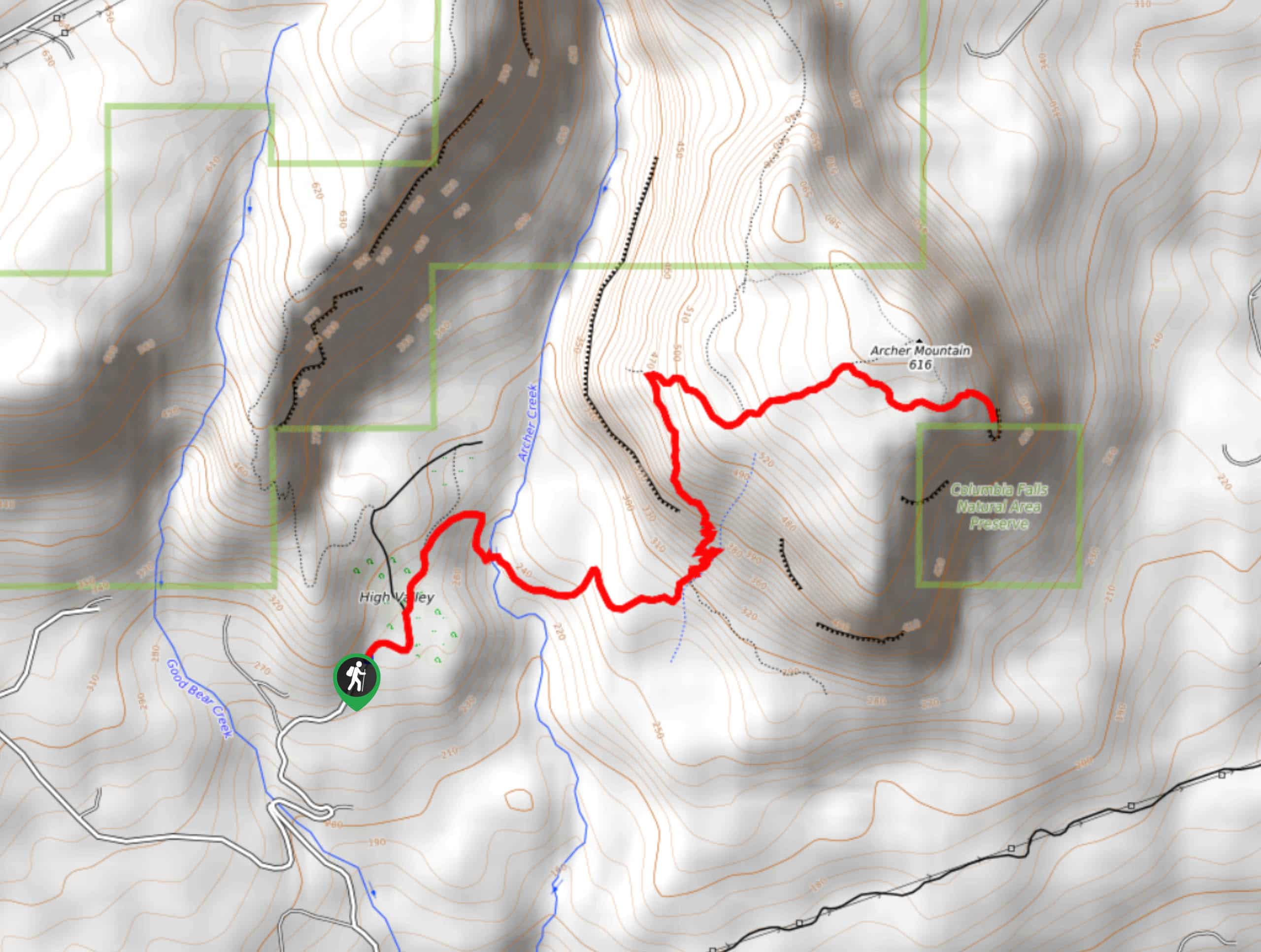
46. Archer Mountain Trail
Difficulty
Archer Mountain Trail is a hard 41.0mi hike that sees light-moderate traffic. This… Read More
47. Snowgrass Flats and Goat Lake Loop
Difficulty
The Snowgrass Flats and Goat Lake Loop is a 121.0mi hard hike in… Read More
48. Silver Star and Ed’s Trail Loop
Difficulty
The Silver Star and Ed’s Trail Loop is a varied, interesting hike with great views.… Read More
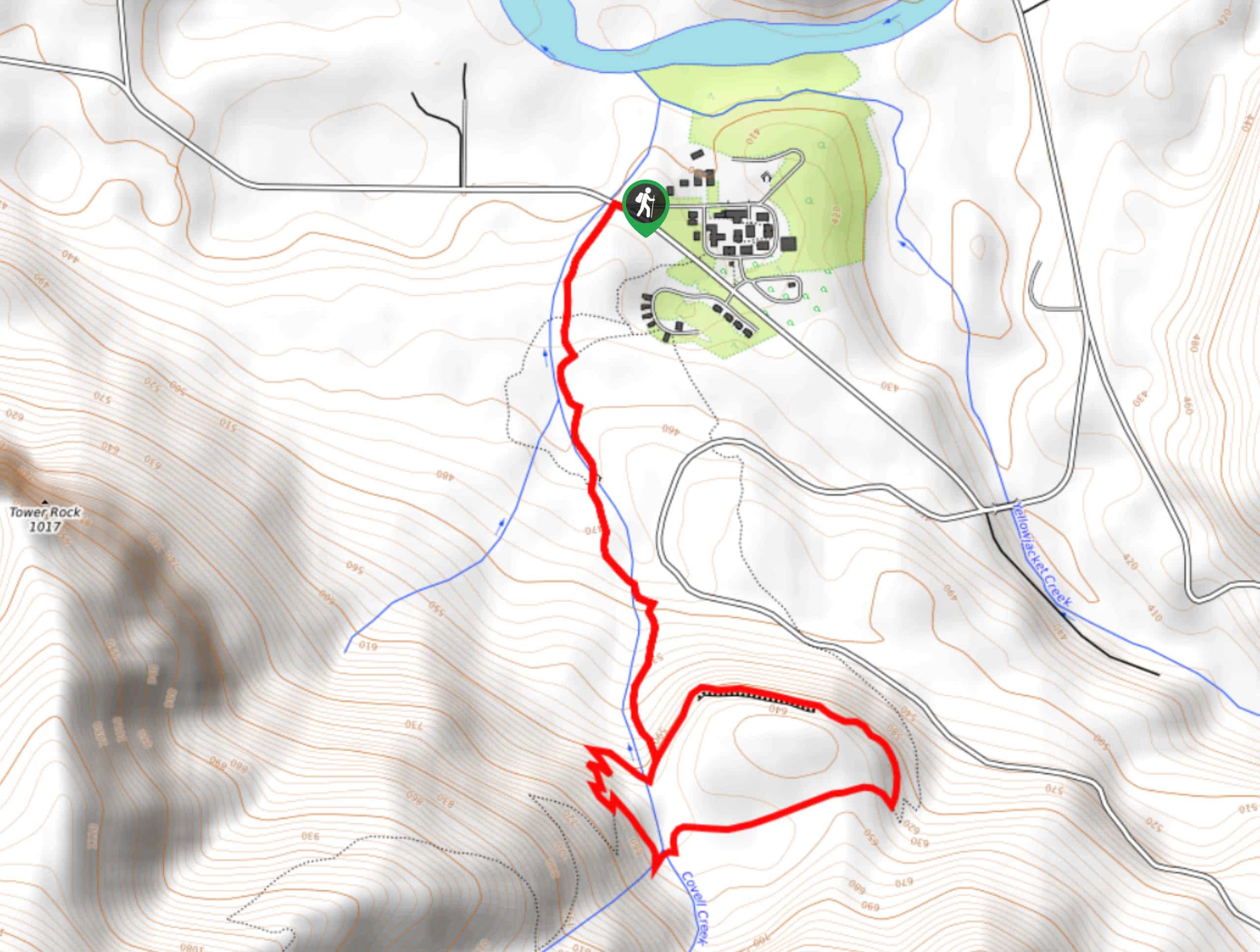
49. Covel Creek Falls and Angel Falls Trail
Difficulty
Covel Creek Falls and Angel Falls Trail is a moderate 36.0mi hike in… Read More
50. Weldon Wagon Road Trail
Difficulty
Weldon Wagon Road Trail is a straightforward hike with nice views. This 4.4mi… Read More
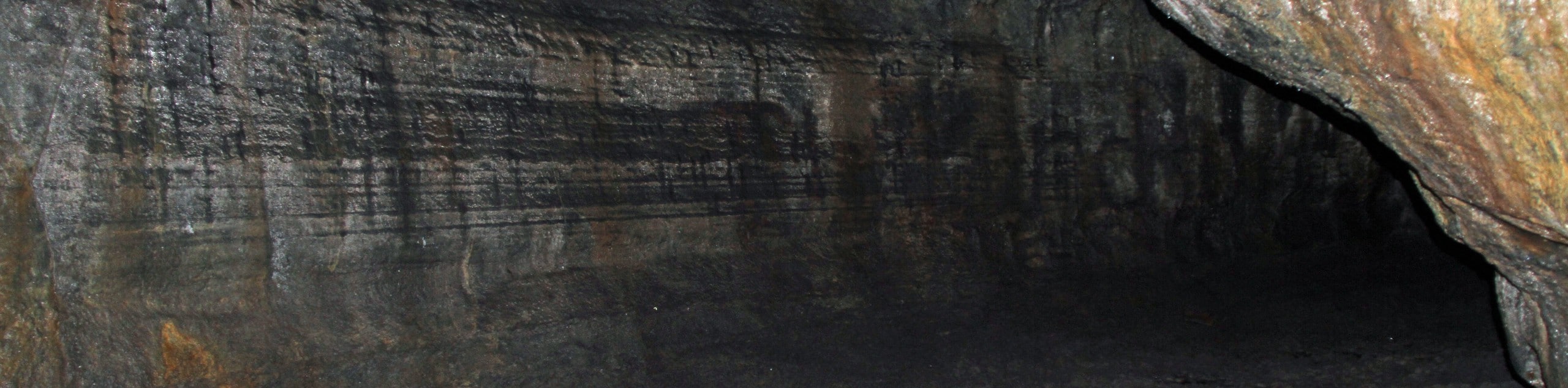
51. Layser Cave Trail
Difficulty
Layser Cave Trail is a quick jaunt to a cave in Gifford Pinchot National Forest.… Read More
52. Goat Creek Trail
Difficulty
Goat Creek Trail is an interesting, varied hike in Gifford Pinchot National Forest. This 9.9mi Read More
53. Cispus Pass Loop
Difficulty
The Cispus Pass Loop is a 12.4mi trail beginning near Walupt Lake that… Read More
54. Mount Saint Helens Summit via Worm Flows Trail
Difficulty
The view from Mount Saint Helens is a stunning sight, and it should be on… Read More
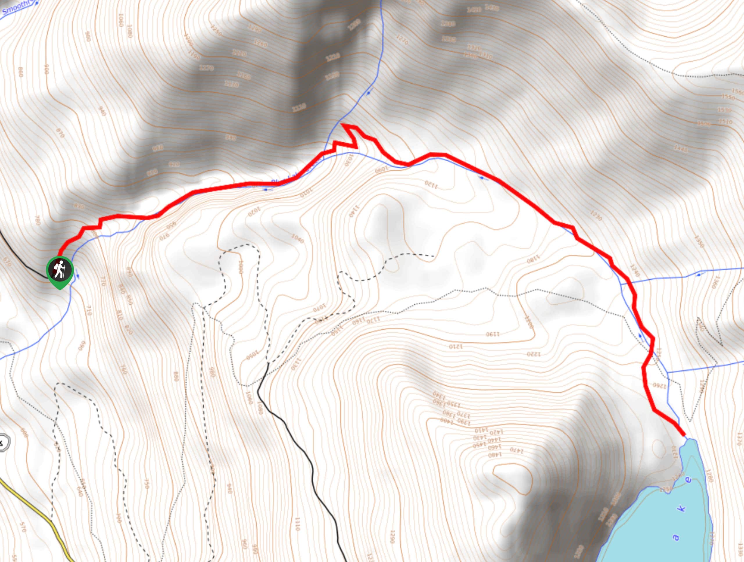
55. Blue Lake Trail
Difficulty
Blue Lake Trail leads you 4.8mi through a deep canyon to Blue Lake.… Read More

56. Iron Creek Falls Trail
Difficulty
Iron Creek Falls Trail is a 0.2mi easy trail that leads you to… Read More
57. Windy Ridge and Plains of Abraham Loop
Difficulty
The Windy Ridge and Plains of Abraham Loop is an 8.4mi lightly trafficked… Read More
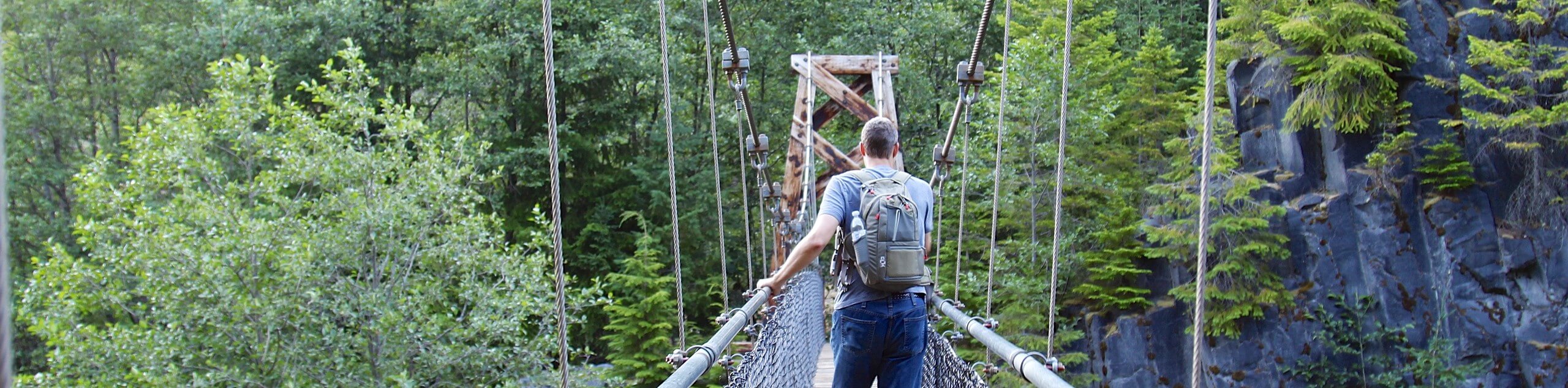
58. Lava Canyon Suspension Bridge Hike
Difficulty
The Lava Canyon Suspension Bridge is just across from the Ape Canyon Trailhead, offering similar… Read More
59. Augspurger Mountain Trail
Difficulty
Augspurger Mountain Trail is a hard 13.3mi hike in the Columbia River Gorge… Read More
60. Big Huckleberry Mountain via PCT
Difficulty
Big Huckleberry Mountain offers great views of Mount Saint Helens and Mount Hood. This route… Read More
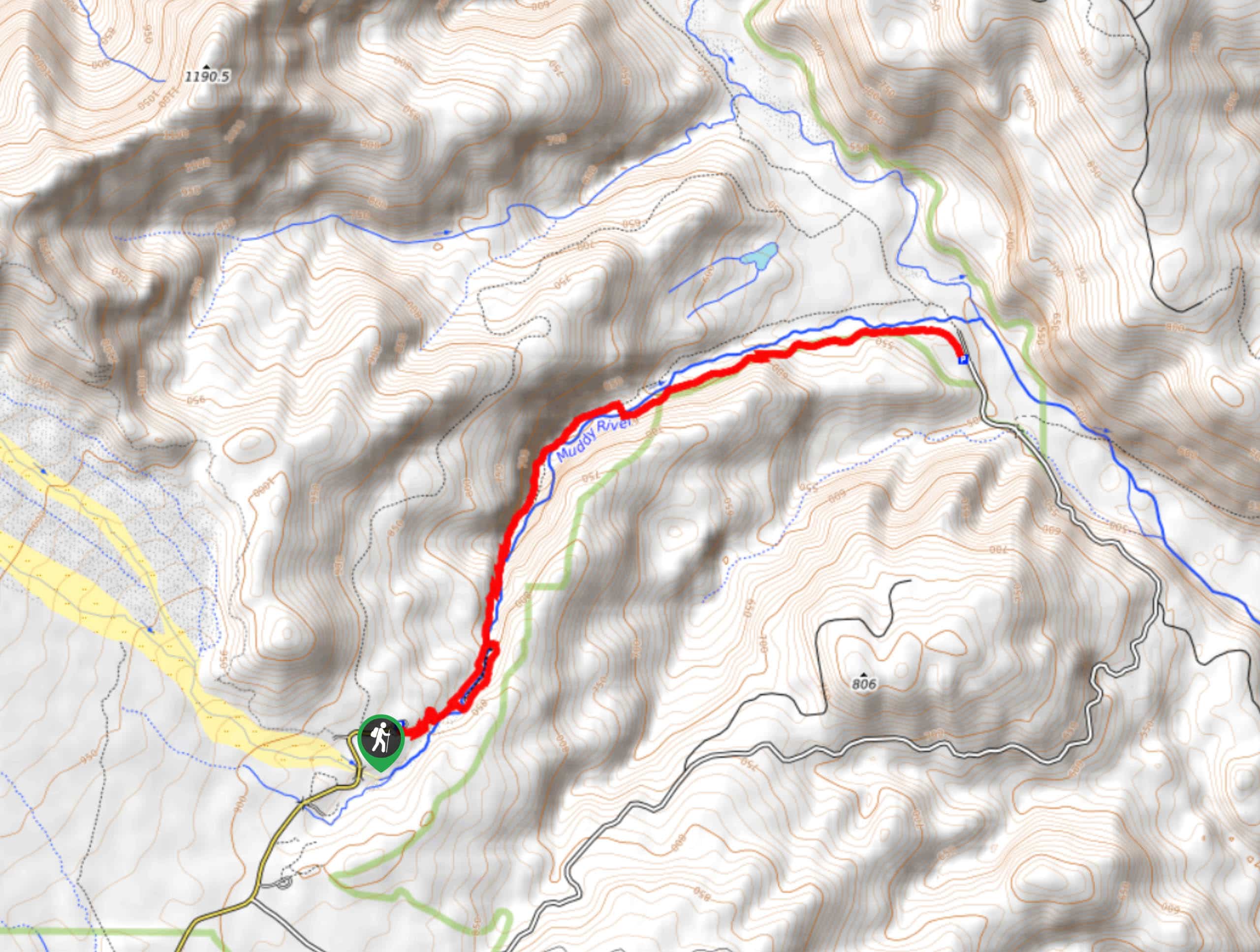
61. Curly Creek Falls via Lewis River Trail
Difficulty
Curly Creek Falls can be reached on an easy 0.8mi section of the… Read More
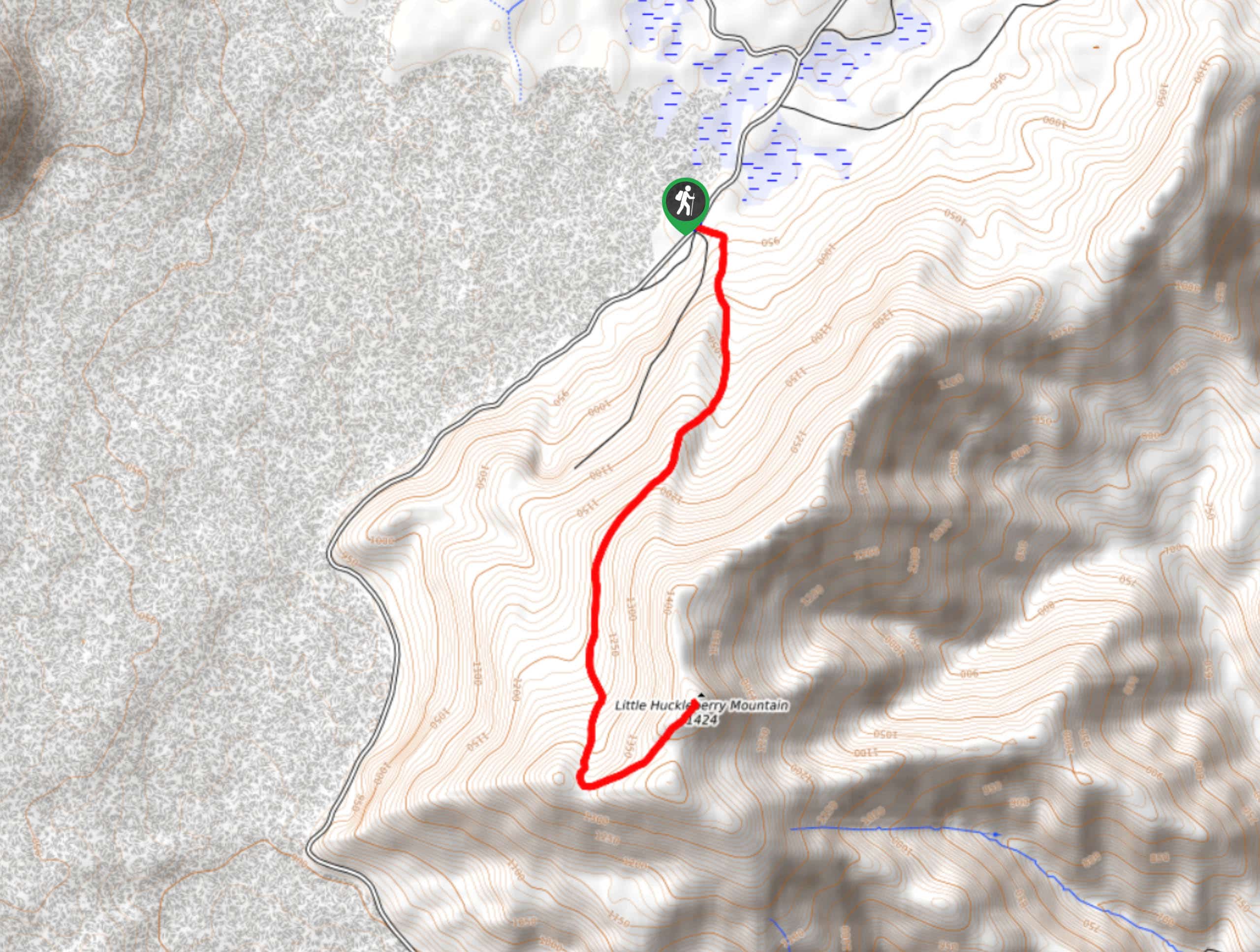
62. Little Huckleberry Trail
Difficulty
Little Huckleberry Trail takes you 4.7mi to the summit of Little Huckleberry Mountain.… Read More
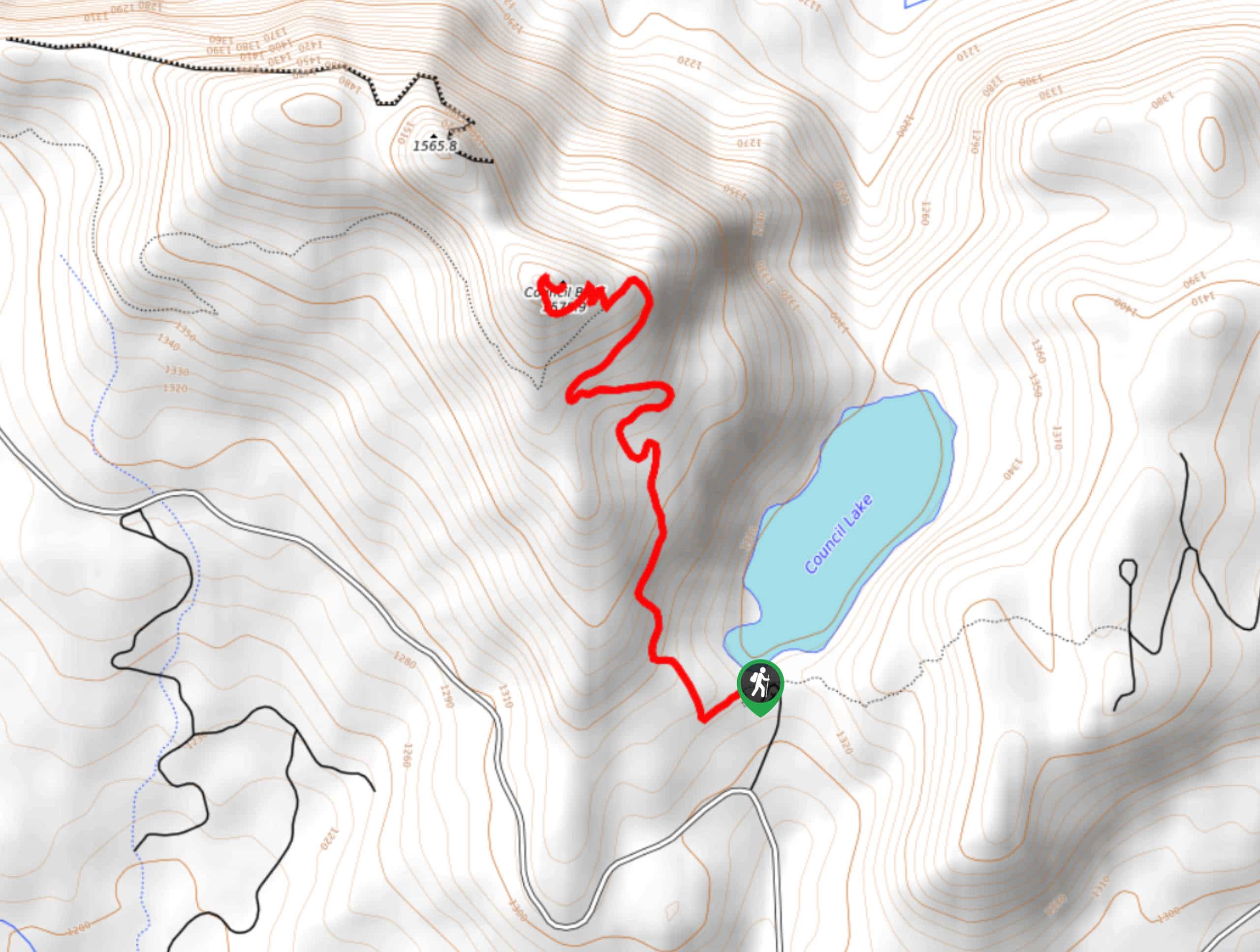
63. Council Bluff Trail
Difficulty
Council Bluff Trail is a 2.9mi out and back hike that starts from… Read More
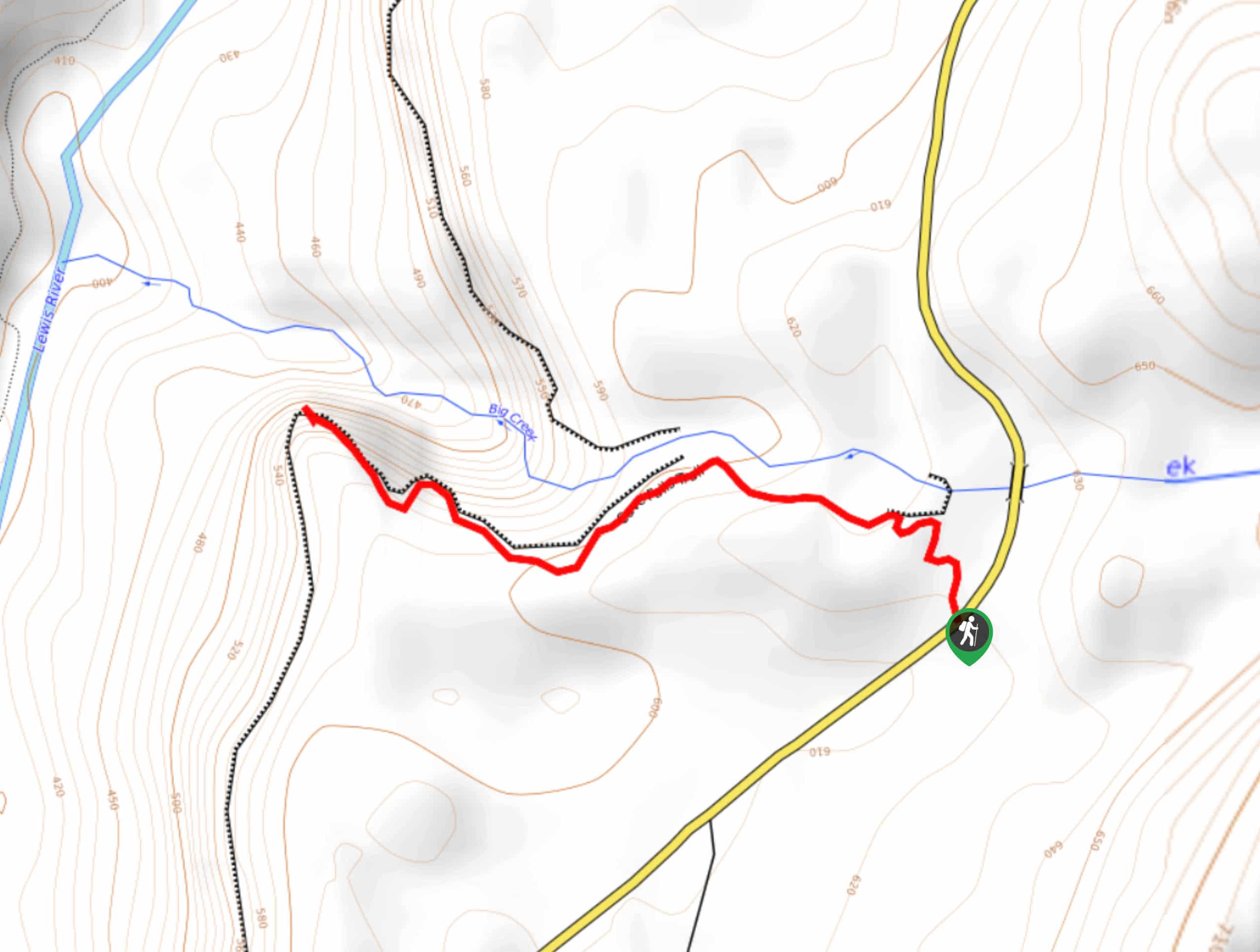
64. Big Creek Falls Trail
Difficulty
Big Creek Falls Trail takes you through a beautiful forest to three waterfalls, one of… Read More
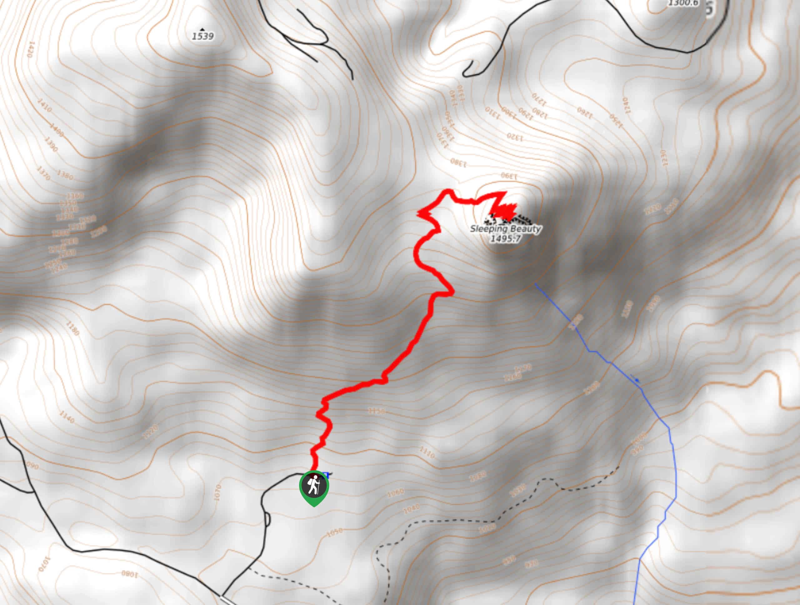
65. Sleeping Beauty Trail
Difficulty
Head up Sleeping Beauty Trail for a peek of the beauty of this corner of… Read More
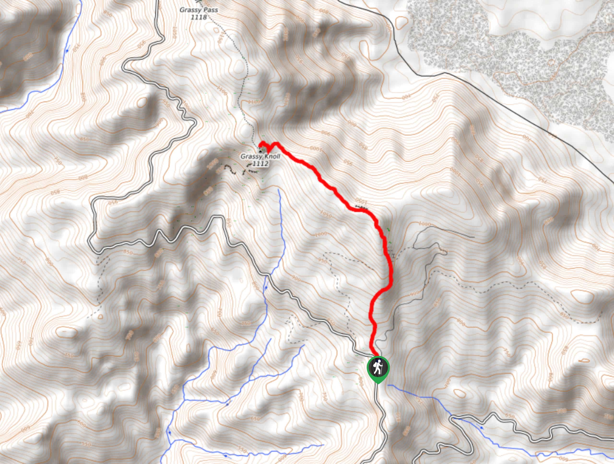
66. Grassy Knoll Trail
Difficulty
The Grassy Knoll hike is a fun 4.3mi with tiring elevation gain. This… Read More
67. Coyote Wall Labyrinth Loop
Difficulty
The Coyote Wall Loop is a fun, customizable hike in the Columbia River Gorge area.… Read More
68. Old Ranch Road and Little Maui Loop
Difficulty
If you’re exploring the Coyote Wall but want to skip some of the more difficult… Read More
69. Harmony Trail
Difficulty
Harmony Trail is a wonderful easy hike in the Gifford Pinchot National Forest that takes… Read More
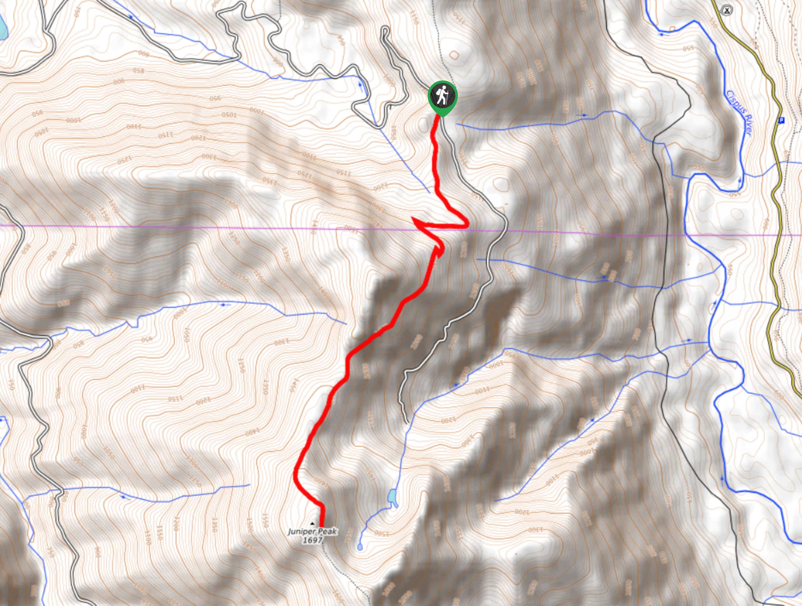
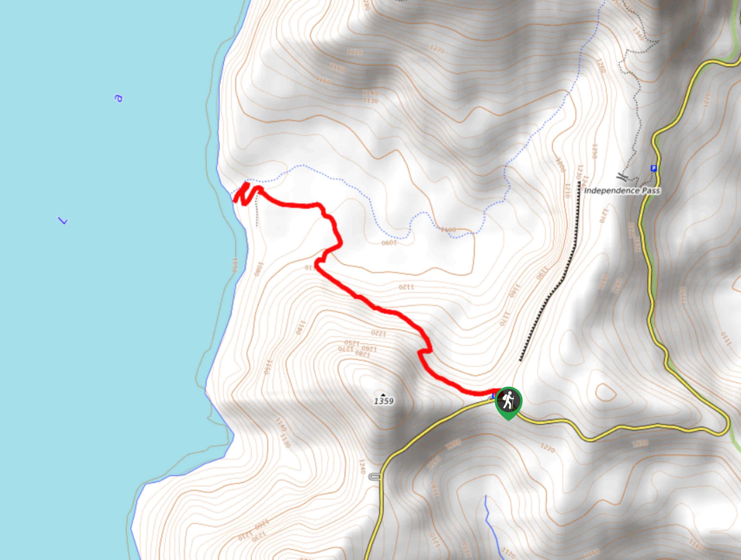
70. Juniper Peak Summit Trail
Difficulty
Juniper Peak Summit Trail is a 5.6mi moderate trail in Gifford Pinchot National… Read More
71. Starway Trail
Difficulty
The Starway Trail can either be used as a thoroughfare to other nearby trails, like… Read More
72. Bertha May Lake via Teeley Trail
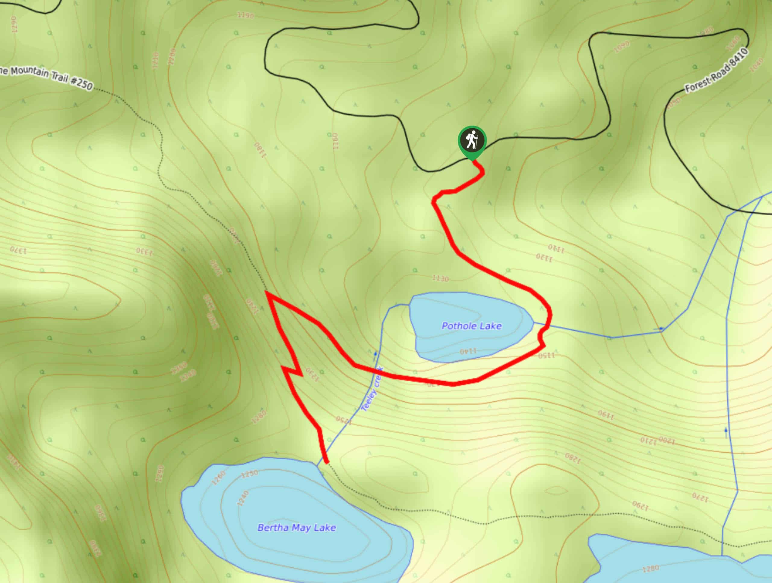
Difficulty
The hike to Bertha May Lake on Teeley Trail is a fun little adventure that… Read More
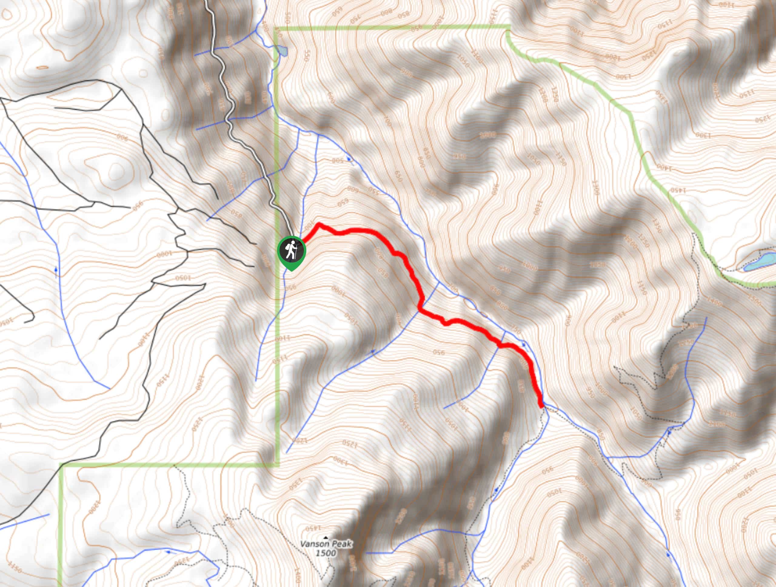
73. Killen Creek Trail
Difficulty
Killen Creek Trail is a 5.8mi out and back trail in Gifford Pinchot… Read More
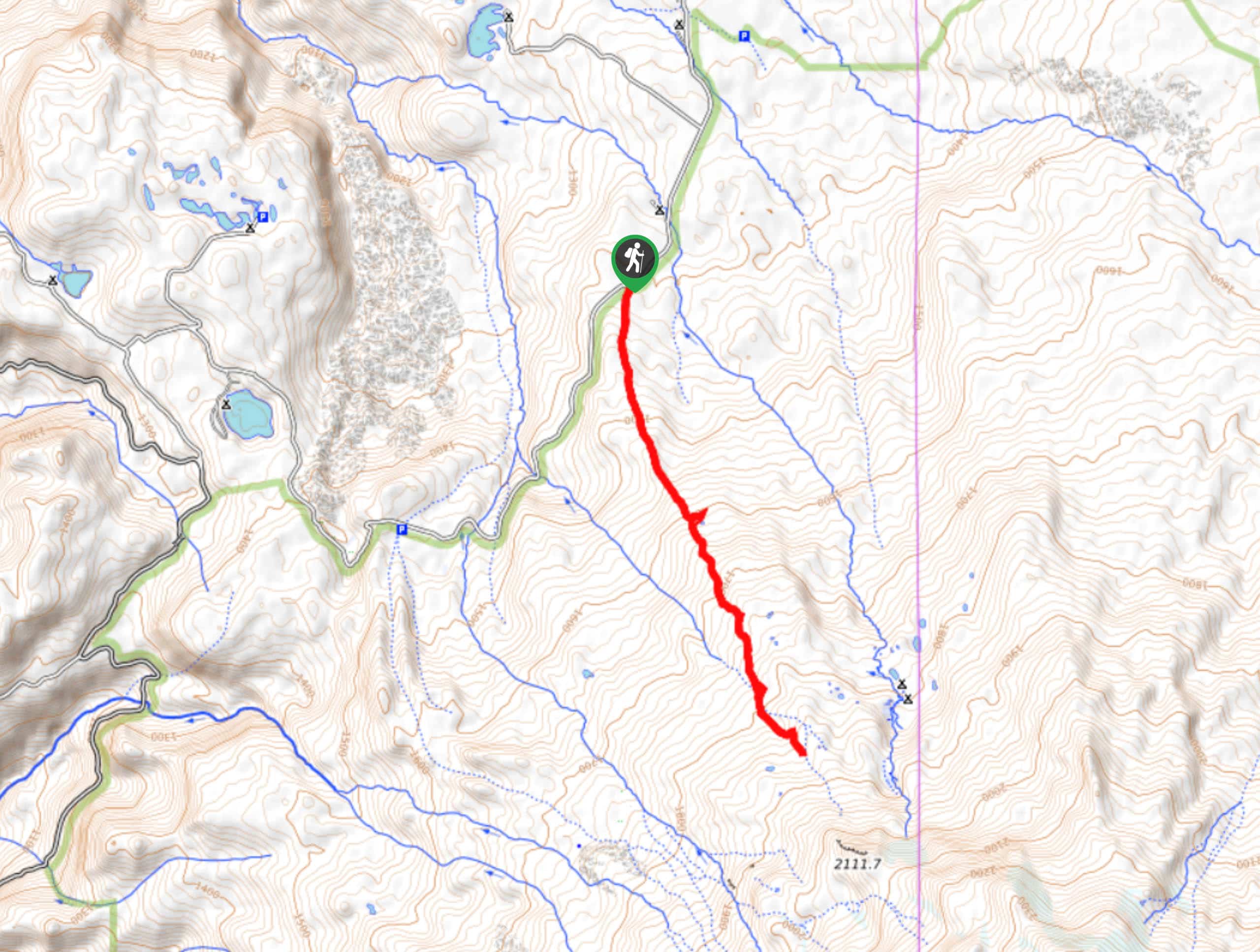
74. Red Mountain Lookout via Indian Racetrack
Difficulty
Red Mountain Lookout via Indian Racetrack is a 6.5mi hike in Gifford Pinchot… Read More
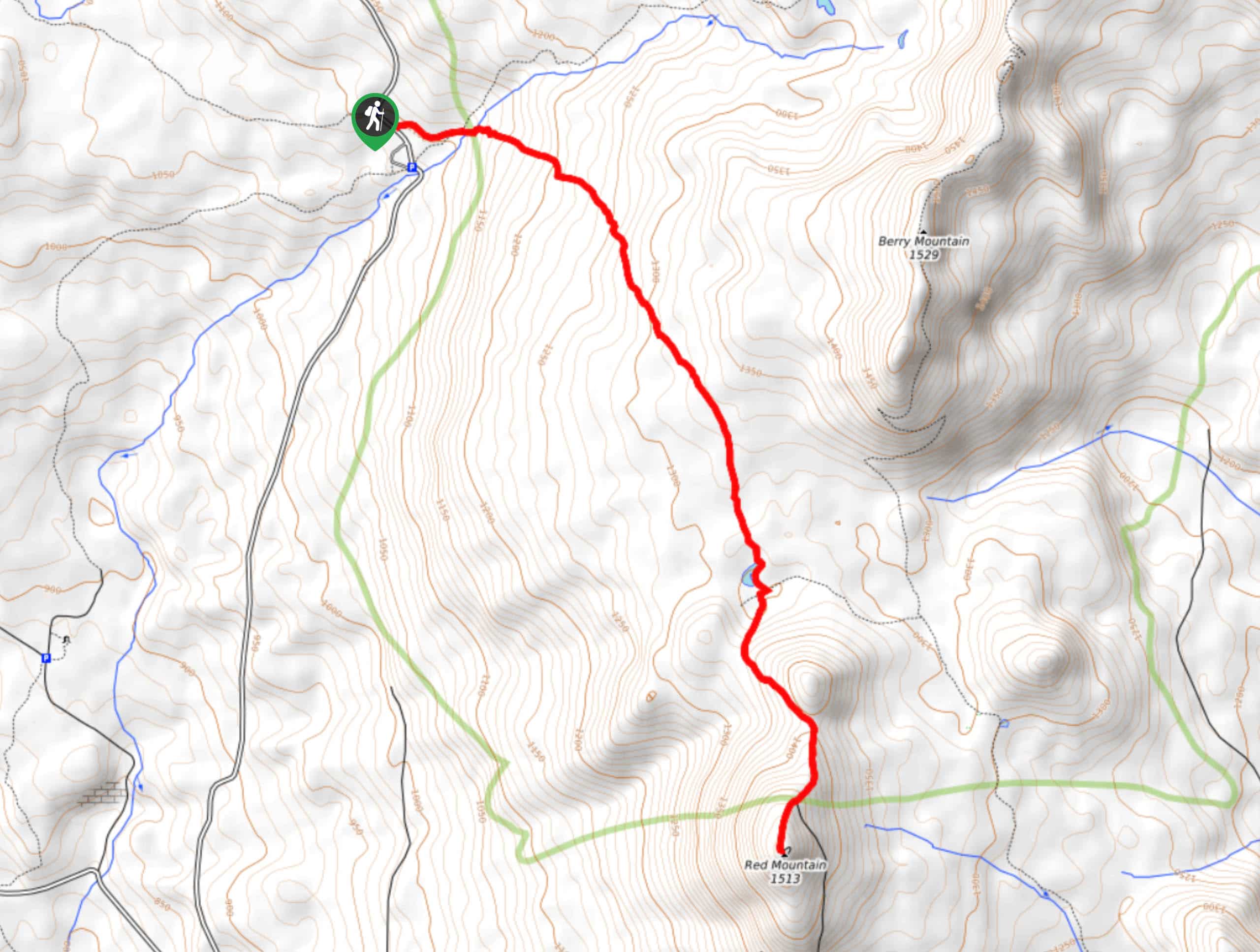
75. Bluff Mountain Trail
Difficulty
Bluff Mountain Trail is a hard 10.2mi hike that gives you access to… Read More
76. Tracy Hill Loop
Difficulty
The Tracy Hill Loop is a 4.8mi hike in the Columbia River Gorge… Read More
77. High Camp Trail
Difficulty
High Camp Trail is a 7.8mi hike that takes you to a camp… Read More
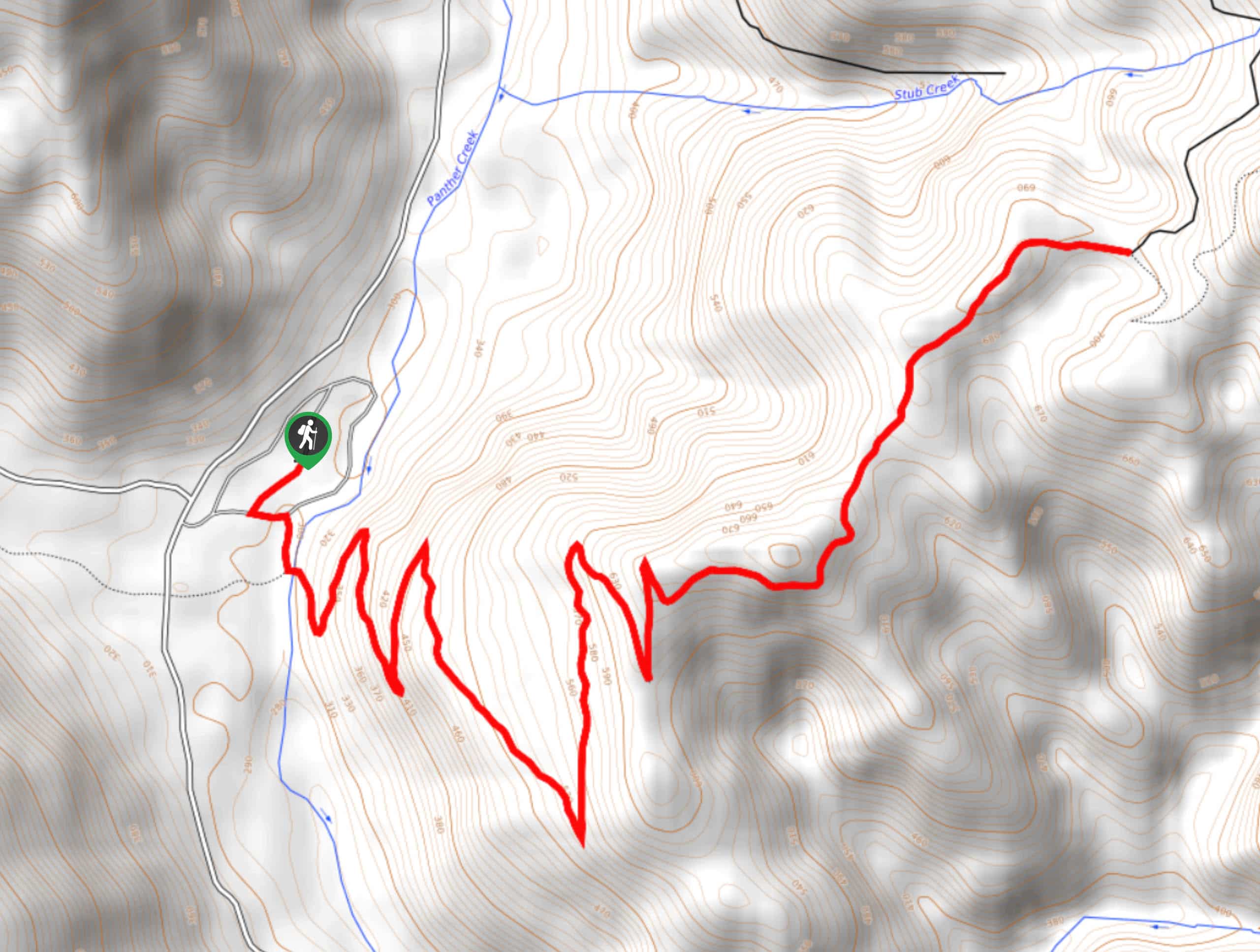
78. Pacific Crest Trail from Panther Creek
Difficulty
This route guide takes you from Panther Creek Campground to the Pacific Crest Trail, offering… Read More

79. Silver Creek Trail
Difficulty
Silver Creek Trail is a moderate hike in the Gifford Pinchot National Forest that is… Read More

80. Boundary West Trail
Difficulty
Boundary West Trail is a hike near Mount Saint Helens that doesn’t see much traffic,… Read More

81. Lakes Trail #211 Loop
Difficulty
The Lakes Trail #211 Loop is used as both a full-day hike and for backpacking… Read More

82. Ptarmigan Trail
Difficulty
Ptarmigan Trail is a 4.2mi moderate trail near the base of Mount Saint… Read More
Are we missing your favourite hike?
Tell us! If you've got photos, a GPS track and know the hike, we'd love to share your favourite hike with the rest of the 10Adventures community.