Mount Saint Helens Summit via Monitor Ridge Trail
View Photos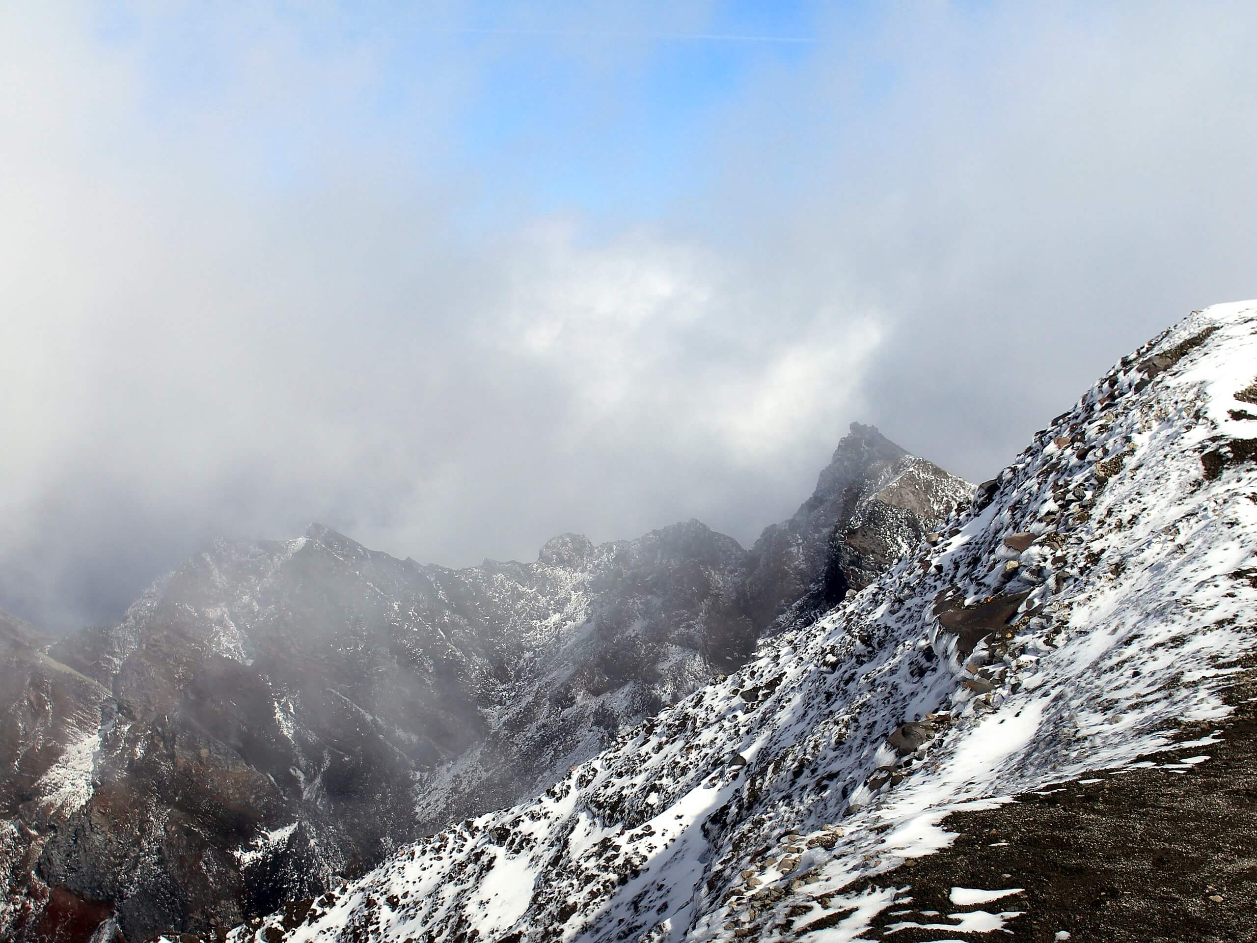
Mount Saint Helens Summit via Monitor Ridge Trail
Difficulty Rating:
The view from Mount Saint Helens is a stunning sight, and it should be on the hiking list of every campable adventurer. The Monitor Ridge approach is challenging, but it requires no technical climbing skills. This approach is just over 8.0mi long and requires 4583ft of vertical gain. It’s important to plan your hike in the summertime on a day that’s as clear as possible. Weather can make this route decidedly less friendly, so you won’t want to be hiking it in snow, rain, or the relentless wind that can howl at the summit. On the flip side, the trail can be a bit loose when it’s very dry, so just watch your footing.
Bring microspikes and poles and certainly wear good boots. Prepare for the summit wind- goggles and a buff will be lifesavers.
Getting there
The trailhead for the Monitor Ridge approach to Mount Saint Helens is at the end of Climbers Bivouac Road.

About
| Backcountry Campground | Climbers Bivouac |
| When to do | June-September |
| Pets allowed | Yes - On Leash |
| Family friendly | No |
| Route Signage | Average |
| Crowd Levels | High |
| Route Type | Out and back |
Mount Saint Helens Summit via Monitor Ridge Trail
Elevation Graph
Weather
Mount Saint Helens Summit via Monitor Ridge Trail Description
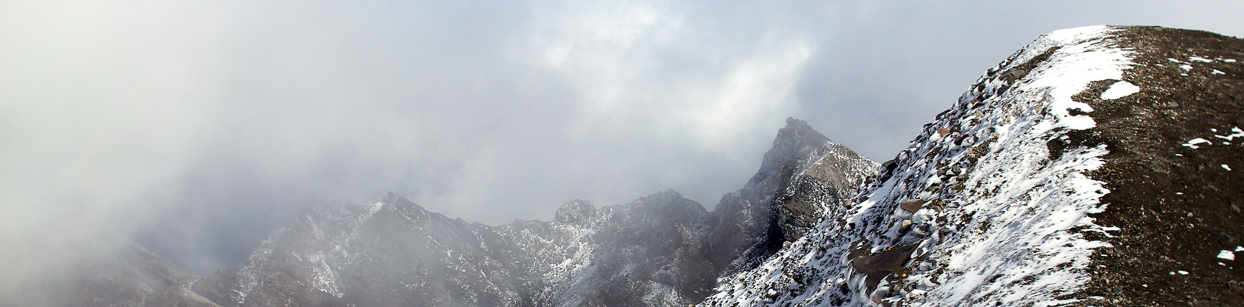
Mount Saint Helens is a simply gorgeous trek and should be on the bucket list of any hiker fit enough to do it. Keep in mind, this hike is more accessible than you might think! The Monitor Ridge approach requires no technical climbing. It does require a solid physical effort, preparation for the conditions, and attention to the weather. All that being done, you can enjoy the stellar views from this active volcano.
The best time to complete this hike is in the summer when there is minimal snow on the trail. Still, bring microspikes, poles, and good boots. The footing can be loose and rocky. You’ll also want to do your best to plan for a day with minimal wind and clear weather in the forecast. The summit is almost always windy, but it can get brutal. Goggles aren’t a bad idea if you want to actually be able to enjoy your views in the gusts.
This route begins from the Climber’s Bivouac Trailhead. You’ll take the first 2.1mi on Ptarmigan Trail, which rises 1000ft through the woods and into alpine meadows. Cross through the junction with Loowit Trail. You’ll need your climber’s permit to ascend past this point to Monitor Ridge Trail, so make sure you get one prior to the hike.
Entering the clearing past the creek, you’ll see the Green Knoll in front of you. Now on Monitor Ridge Trail, you’ll soon encounter a selection that requires scrambling over boulders as the trail peters out. This isn’t exceedingly difficult and is a bit easier on the way up than it is on the way down.
Note: This boulder field is covered in ash pumice. Ash pumice can shred your skin in a fall, so we highly recommend packing a pair of gloves and hiking carefully.
The last portion of the trail takes you up 1000ft vertical through the rocks and ash to the crater rim. It’s a real grind, but make sure you take a moment to appreciate the views as you go.
Atop the summit, you’ll stand in awe at the massive crater with the glacier forming a horseshoe around the expanding dome. Look out towards Mount Hoof, Mount Adams, and Mount Rainier.
Once you’re ready, the descent begins. Poles will be essential on the way down, as will a slow pace through the boulder field.
Hiking Route Highlights
Mount Saint Helens
The highlight of this hike is the mountain you’re climbing itself. Mount Saint Helens is an active volcano, last erupting in May of 1980, taking 57 lives and destroying 200 homes. The volcano is 8363ft high. Previously the summit was at 9677ft, but it was shortened in a lateral eruption triggered by an earthquake. Hikers flock to the summit throughout the year to take in the spectacular views of the Pacific Northwest. Mount Saint Helens was originally named Lawetlat’la by the Cowlitz people.
Frequently Asked Questions
Can you climb Mount Saint Helens year-round?
Yes, Mount Saint Helens can be climbed year-round. That being said, we recommend those without mountaineering experience stick to summer ascents.
Is Mount Saint Helens going to erupt again?
Yes, Mount Saint Helens is likely to erupt again. Scientists forecast eruptions equal or greater in intensity and impact to the 1980 eruption occurring sometime in the not too distant future.
Did lava flow out of Mount Saint Helens?
Yes, there was lava flow in the May 1980 eruption of Mount Saint Helens.
Insider Hints
If you have your climber’s permit and parking permit, you don’t need a Northwest Forest Pass to camp at Climber’s Bivouac. If you are using other trails, you’ll need a Northwest Forest Pass.
The rim is a cornice and is considered unstable. Don’t stand too close to the edge at any point or it could very well break underneath your feet.
Similar hikes to the Mount Saint Helens Summit via Monitor Ridge Trail hike

Ptarmigan Trail
Ptarmigan Trail is a 4.2mi moderate trail near the base of Mount Saint Helens. This trail is suitable…

Lakes Trail #211 Loop
The Lakes Trail #211 Loop is used as both a full-day hike and for backpacking trips. This trail isn’t for…

Boundary West Trail
Boundary West Trail is a hike near Mount Saint Helens that doesn’t see much traffic, making it a nice pick…
Comments