

Lakes Trail #211 Loop
View Photos
Lakes Trail #211 Loop
Difficulty Rating:
The Lakes Trail #211 Loop is used as both a full-day hike and for backpacking trips. This trail isn’t for the faint of heart and we recommend travelling in pairs for it. There are some daunting hands-on sections that can be tough on tired legs. You’ll also deal with overgrowth. If you can complete it, you’ll be rewarded with incredible views and varied terrain! This hike sees moderate traffic.
Getting there
The trailhead for the Lakes Trail #211 Loop is off Ryan Lake Road.

About
| Backcountry Campground | Various backcountry |
| When to do | March-November |
| Pets allowed | No |
| Family friendly | No |
| Route Signage | Average |
| Crowd Levels | Moderate |
| Route Type | Loop |
Lakes Trail #211 Loop
Elevation Graph
Weather
Lakes Trail #211 Loop Description
The Lakes Trail #211 Loop is an epic adventure that can either fill your day or be split up over a few nights. This trail is best suited for experienced hikers and we don’t recommend doing it solo. Download your GPS and bring plenty of water. Avoid this trail when it’s wet out.
This hike has lots of beautiful varied terrain, plenty of lakes to cool off in, and sections that will get your heart pumping. Be prepared for an intense, hands-on section on Whittier Ridge. This isn’t well suited to novices or those who are afraid of heights. Avoid it if it’s rained and don’t try it with a heavy overnight pack and tired legs.
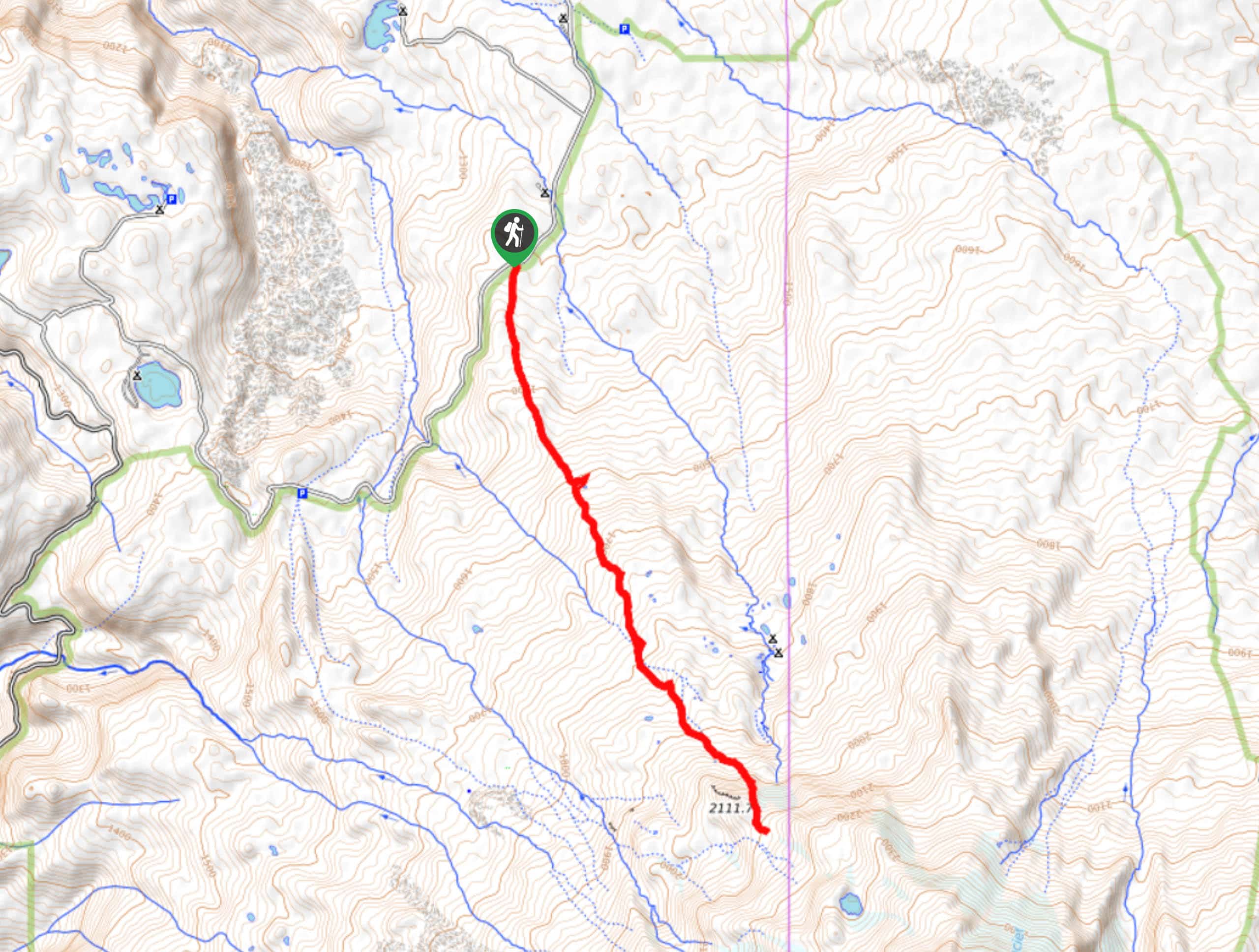
Beginning from the parking area, cross the creek and hike to the first junction, where you’ll stay right. Hike underneath a ridge and then stay right again. Turn right onto Lakes Trail where the loop starts, heading past Grizzly Lake, Obscurity Lake, Boot Lake, and Panhandle Lake. Climb the ridge behind Shovel Lake and then stay right (unless camping at Shovel Lake). Stay left at the junction for Snow Lake and then tackle Whittier Ridge, the most intense portion of the hike. Turn left after the ridge and traverse back to where the loop splits. Retrace your steps from this point back to the trailhead.
Similar hikes to the Lakes Trail #211 Loop hike

Boundary West Trail
Boundary West Trail is a hike near Mount Saint Helens that doesn’t see much traffic, making it a nice pick…
High Camp Trail
High Camp Trail is a 7.8mi hike that takes you to a camp on the base of Mount…
Bluff Mountain Trail
Bluff Mountain Trail is a hard 10.2mi hike that gives you access to several points of interest. You…
Comments