
High Camp Trail
View Photos
High Camp Trail
Difficulty Rating:
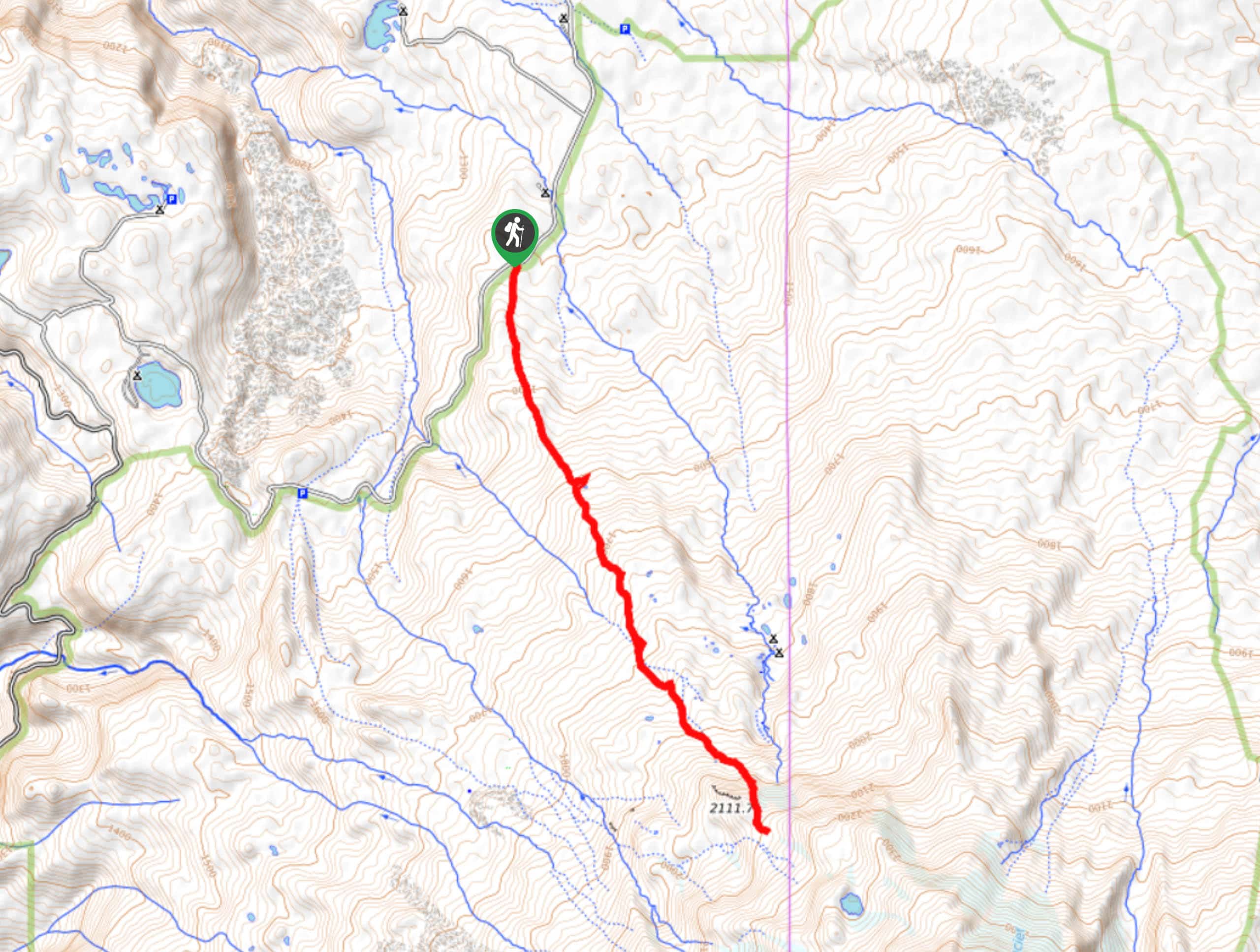
High Camp Trail is a 7.8mi hike that takes you to a camp on the base of Mount Adams. This hike requires no mountaineering skills, but going any further than High Camp requires both the skills and the permits. Do this as a backpacking trip or as a fun day hike, or use this as part of a larger expedition on Mount Adams. This trail sees heavy traffic.
Getting there
The trailhead for High Camp Trail is on Midway Loop Road.

About
| Backcountry Campground | High Camp |
| When to do | July-October |
| Pets allowed | Yes - On Leash |
| Family friendly | No |
| Route Signage | Average |
| Crowd Levels | High |
| Route Type | Out and back |
High Camp Trail
Elevation Graph
Weather
High Camp Trail Description
High Camp is an exciting hike that takes you to a camp on the base of Mount Adams. You can use this as a stepping stone to a more intense adventure on Mount Adams or do it as a day trip and say you hiked part of the mountain, which is true!
You can hike to High Camp without a climber’s permit, but you’ll need one to go any further. Also, take note that the lake above the camp, while scenic, is quite difficult to reach. The footing is very loose and mountaineering gear makes it easier. We don’t recommend going any further than the camp if you’re a casual hiker without a permit. Water isn’t easy to source at High Camp so fill up ahead of time.
The trail begins in the parking area off the main road. The climb is gradual and steady to begin with. You’ll cross the creek and then go straight through a 4-way junction. The last half mile to High Camp is very steep and challenging, so push through to make it there. From the camp, you’ll retrace your steps, saying goodbye to Mount Adams for now.
Similar hikes to the High Camp Trail hike

Ptarmigan Trail
Ptarmigan Trail is a 4.2mi moderate trail near the base of Mount Saint Helens. This trail is suitable…

Lakes Trail #211 Loop
The Lakes Trail #211 Loop is used as both a full-day hike and for backpacking trips. This trail isn’t for…

Boundary West Trail
Boundary West Trail is a hike near Mount Saint Helens that doesn’t see much traffic, making it a nice pick…
Comments