
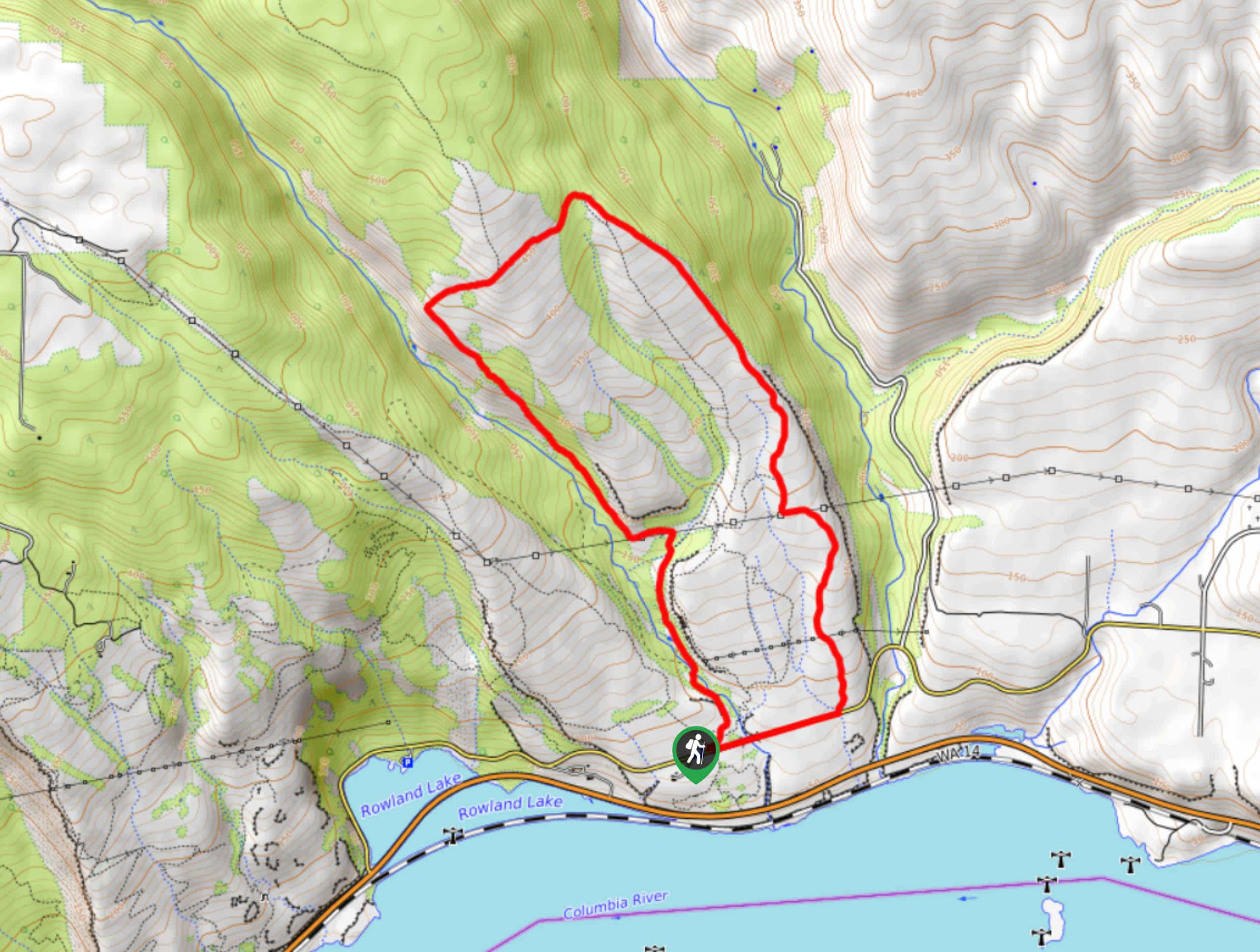
Tracy Hill Loop
View Photos
Tracy Hill Loop
Difficulty Rating:
The Tracy Hill Loop is a 4.8mi hike in the Columbia River Gorge that sees moderate traffic. The trail is pleasant and the views feature the river and the mountains beyond. This hike is best when the wildflowers are blooming, but take care to avoid the poison oak and spray for ticks before you hike.
Getting there
The trailhead for the Tracy Hill Loop is on Old Highway 8.

About
| Backcountry Campground | No |
| When to do | March-October |
| Pets allowed | Yes - On Leash |
| Family friendly | Yes |
| Route Signage | Average |
| Crowd Levels | Moderate |
| Route Type | Loop |
Tracy Hill Loop
Elevation Graph
Weather
Tracy Hill Loop Description
Tracy Hill is a wonderful spot to explore in the wildflower season when endless flowers stretch across the landscape. This hike is easy enough for most skill levels and usually not too busy. Since there are quite a few spur trails and offshoots, we recommend downloading your GPS track ahead of time.
This area has poison oak, so we strongly recommend staying on the trail and out of the foliage. In addition, users report having issues with ticks on this hike, so spray yourself down and make sure to check yourself and your dogs after the hike.
Beginning from the trailhead, go left to tackle the western ascent, staying right where Atwood Road splits off. Cross a stream and then take a right where the trail breaks away from Catherine Creek. Traverse across the top of the hill and then turn downhill (make sure you take the trail furthest to the east). Descend next to the creek and then turn right on Old Highway 8 to return to the trailhead.
Similar hikes to the Tracy Hill Loop hike

Ptarmigan Trail
Ptarmigan Trail is a 4.2mi moderate trail near the base of Mount Saint Helens. This trail is suitable…

Boundary West Trail
Boundary West Trail is a hike near Mount Saint Helens that doesn’t see much traffic, making it a nice pick…

Silver Creek Trail
Silver Creek Trail is a moderate hike in the Gifford Pinchot National Forest that is suitable for most skill levels.…
Comments