

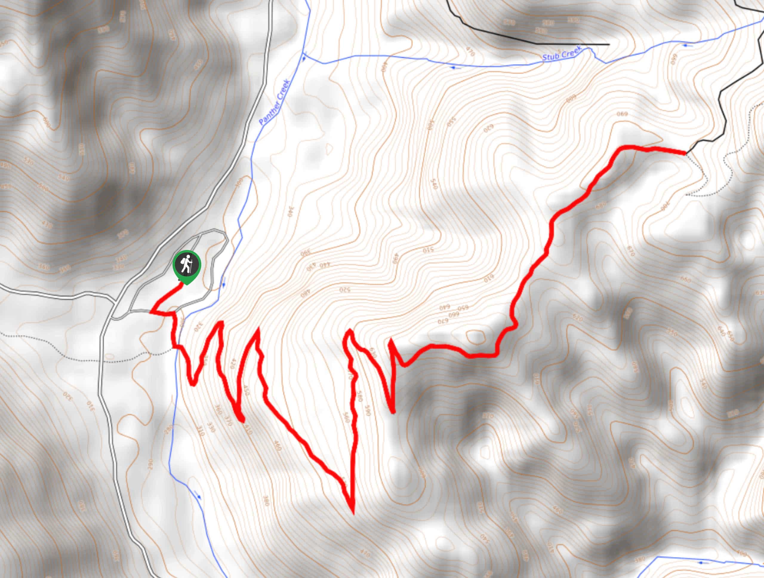
Silver Creek Trail
View Photos
Silver Creek Trail
Difficulty Rating:
Silver Creek Trail is a moderate hike in the Gifford Pinchot National Forest that is suitable for most skill levels. This 7.8mi trail passes charming creeks and gives you a nice mountain view. We especially like this hike when it’s rained recently, as it makes the creeks more impressive. This trail tends to be very quiet with light traffic.
Getting there
The trailhead for the Silver Creek Trail is on Forest Road 5240.

About
| Backcountry Campground | No |
| When to do | March-October |
| Pets allowed | Yes - On Leash |
| Family friendly | Yes |
| Route Signage | Average |
| Crowd Levels | Low |
| Route Type | Out and back |
Silver Creek Trail
Elevation Graph
Weather
Silver Creek Trail Description
Silver Creek Trail is a fun little hike that’s perfect if you’re wanting a trail with very light traffic. There don’t tend to be too many hikers here, despite numerous charming creeks and mountain views through the last third of the hike. This is a good trail for dogs and families.
Bring bug spray for this hike and try to come when there’s more water in the streams. We like this hike in the spring and early summer best.
From the trailhead, the route heads away from the forest road and follows a gully in the trees. Enjoy the calm atmosphere and the fairly gentle grade. There aren’t any major junctions to contend with, so it should be easy to follow the path. Turn around about half a mile in and look for the view of Mount Rainier. This trail terminates at the junction with Forest Road 84. From here, turn back and retrace your steps.
Similar hikes to the Silver Creek Trail hike

Ptarmigan Trail
Ptarmigan Trail is a 4.2mi moderate trail near the base of Mount Saint Helens. This trail is suitable…

Boundary West Trail
Boundary West Trail is a hike near Mount Saint Helens that doesn’t see much traffic, making it a nice pick…
Pacific Crest Trail from Panther Creek
This route guide takes you from Panther Creek Campground to the Pacific Crest Trail, offering an easy connector for those…
Comments