
Pacific Crest Trail from Panther Creek
View Photos
Pacific Crest Trail from Panther Creek
Difficulty Rating:
This route guide takes you from Panther Creek Campground to the Pacific Crest Trail, offering an easy connector for those venturing further on the PCT. It can make for a decent day hike too, with a moss-covered forest serving as your setting. This trail is moderately difficult and not very well marked, so a downloaded GPS track is recommended.
Getting there
The trailhead for the PCT connector from Panther Creek is in Panther Creek Campground.

About
| Backcountry Campground | Panther Creek Campground |
| When to do | May-November |
| Pets allowed | Yes |
| Family friendly | Yes |
| Route Signage | Poor |
| Crowd Levels | Low |
| Route Type | Out and back |
Pacific Crest Trail from Panther Creek
Elevation Graph
Weather
Pacific Crest Trail from Panther Creek Description
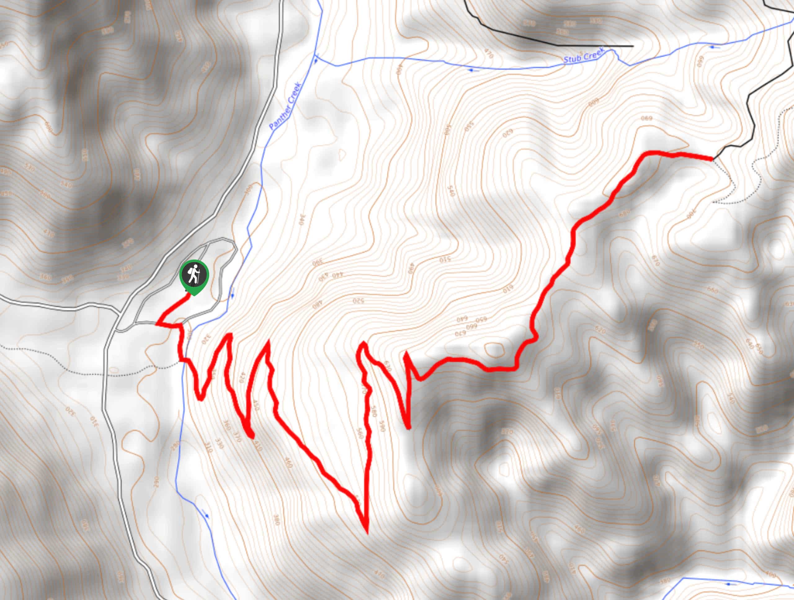
This trail connects Panther Creek Campground and the Pacific Crest Trail, making it mostly used by day hikers at the campground and thru-hikers reconnecting with the PCT. The trail features a scenic mossy forest and a solid set of switchback turns.
The trailhead for this connector isn’t very obvious and it’s not marked, so we recommend downloading your GPS track ahead of time to mitigate any challenges with navigation.
The trail begins from the west side of the campground. Head across Panther Creek and hop right into the nine wide switchback turns that take you through the bull of the elevation gain. Enjoy the mossy forest as you climb, eventually traversing a ridge to a three-way junction. This is where the trail ends, so either retrace your steps or keep going to wherever you’re headed.
Similar hikes to the Pacific Crest Trail from Panther Creek hike

Ptarmigan Trail
Ptarmigan Trail is a 4.2mi moderate trail near the base of Mount Saint Helens. This trail is suitable…

Boundary West Trail
Boundary West Trail is a hike near Mount Saint Helens that doesn’t see much traffic, making it a nice pick…

Silver Creek Trail
Silver Creek Trail is a moderate hike in the Gifford Pinchot National Forest that is suitable for most skill levels.…
Comments