

Ptarmigan Trail
View Photos
Ptarmigan Trail
Difficulty Rating:
Ptarmigan Trail is a 4.2mi moderate trail near the base of Mount Saint Helens. This trail is suitable for beginners and families and doesn’t get very busy. There are nice views along the switchbacks, but there are also often mosquitoes- bring spray!
Getting there
The trailhead for the Ptarmigan Trail is at Climber’s Bivouac at the end of Climber’s Bivouac Road.

About
| Backcountry Campground | Climber’s Bivouac |
| When to do | March-November |
| Pets allowed | Yes - On Leash |
| Family friendly | Yes |
| Route Signage | Average |
| Crowd Levels | Low |
| Route Type | Out and back |
Ptarmigan Trail
Elevation Graph
Weather
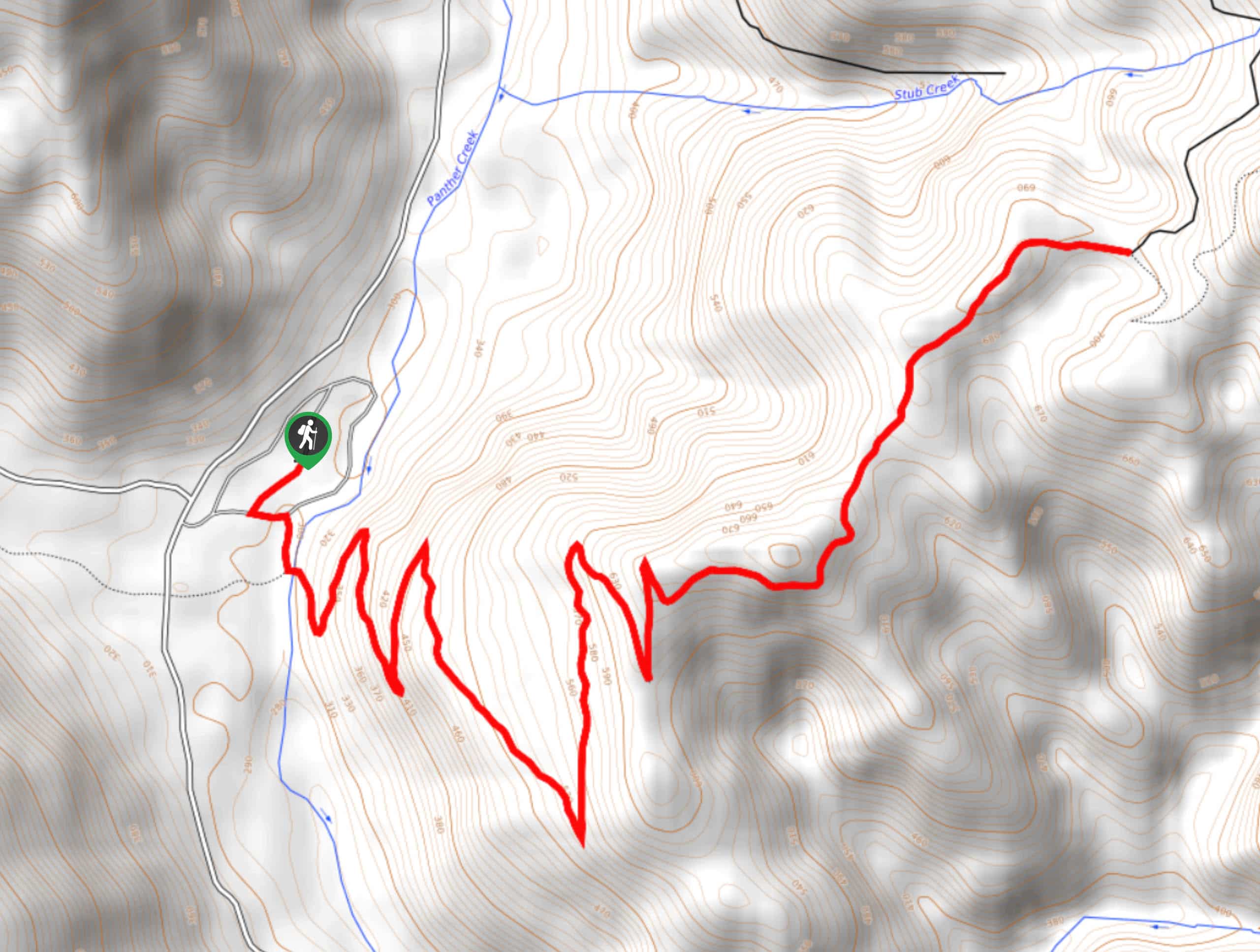
Ptarmigan Trail Description
Ptarmigan Trail is a fairly easy and straightforward hike near Mount Saint Helens. This route is used by both half-day hikers and by those heading up Mount Saint Helens via Monitor Ridge. It’s not too challenging and has nice views from the switchbacks.
This route begins from the Climber’s Bivouac Trailhead. The trail rises 1000ft through the woods and into alpine meadows, giving you varied scenery. The first half of the hike is mostly flat, then the grade increases for the second half. Look back as you ascend the switchbacks since this is where most of the view can be seen.
The trail ends just after you cross Swift Creek at the junction with Loowit Trail. Turn back and retrace your steps to the trailhead.
Similar hikes to the Ptarmigan Trail hike

Boundary West Trail
Boundary West Trail is a hike near Mount Saint Helens that doesn’t see much traffic, making it a nice pick…

Silver Creek Trail
Silver Creek Trail is a moderate hike in the Gifford Pinchot National Forest that is suitable for most skill levels.…
Pacific Crest Trail from Panther Creek
This route guide takes you from Panther Creek Campground to the Pacific Crest Trail, offering an easy connector for those…
Comments