
Bluff Mountain Trail
View Photos
Bluff Mountain Trail
Difficulty Rating:
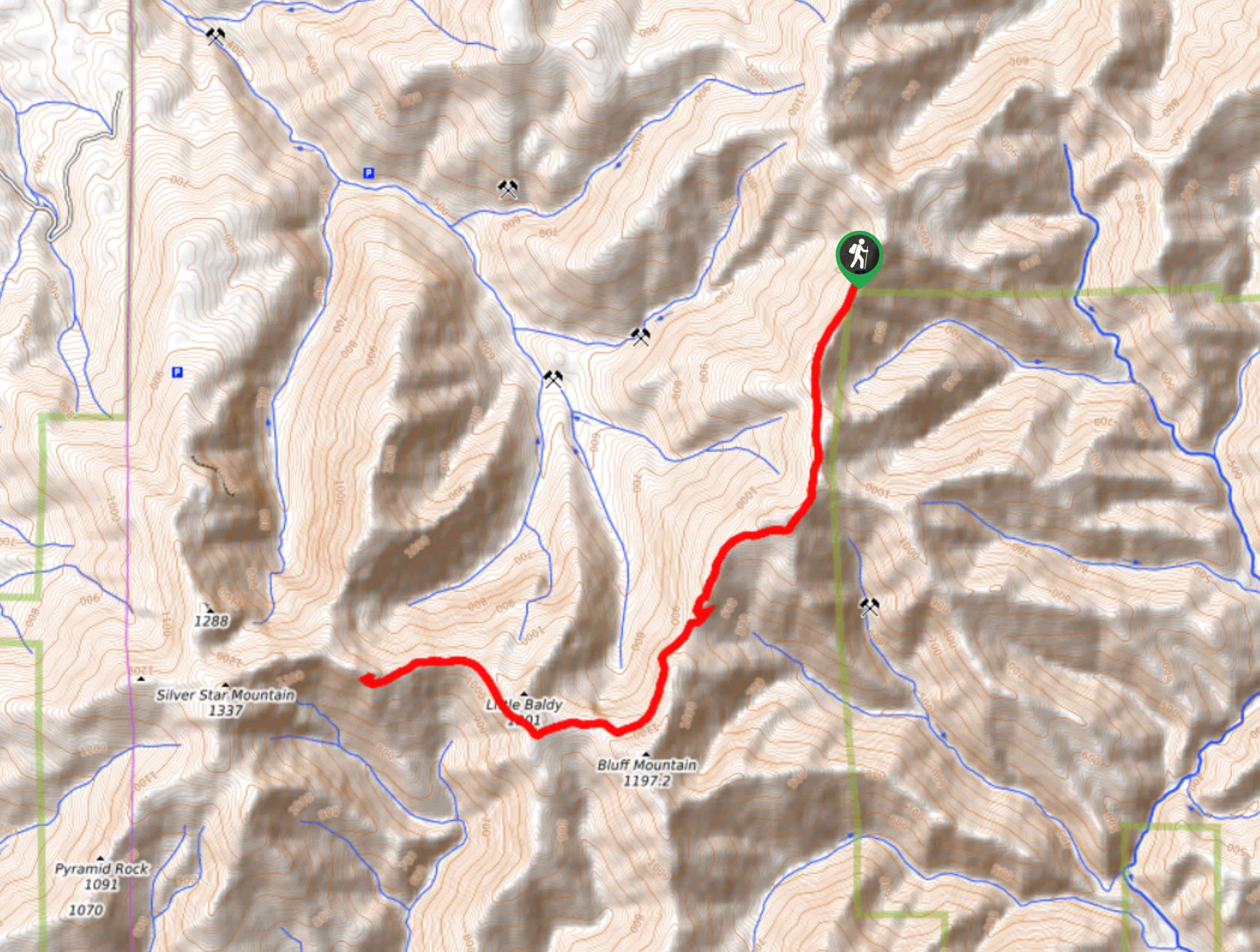
Bluff Mountain Trail is a hard 10.2mi hike that gives you access to several points of interest. You can hike to Bluff Mountain, Little Baldy, Silver Star Mountain, and Sturgeon Rock on this trail. Our guide ends after Little Baldy. This hike sees light traffic. You’ll need a capable, high-clearance vehicle to reach the trailhead.
Getting there
The trailhead for Bluff Mountain Trail is on Forest Road 41.

About
| Backcountry Campground | No |
| When to do | May-October |
| Pets allowed | Yes - On Leash |
| Family friendly | No |
| Route Signage | Average |
| Crowd Levels | Low |
| Route Type | Out and back |
Bluff Mountain Trail
Elevation Graph
Weather
Bluff Mountain Trail Description
Bluff Mountain Trail is used by hikers destined for Bluff Mountain, Little Baldy, Silver Star Mountain, and Sturgeon Rock. Our guide covers a 10.2mi out and back trek that ends after Little Baldy, but you can shorten or lengthen your trip as you please.
The road to this trailhead is rough even by Washington Forest Road standards. We don’t recommend trying to make the drive in anything but a capable 4WD high-clearance vehicle.
Beginning from the road, head southwest on Bluff mountain Trail, keeping left at the first junction. The trail is relatively easygoing as you traverse the ridge, gaining elevation consistently and gradually. You’ll hike underneath the peak of Bluff Mountain and then underneath Little Baldy on a path that is quite exposed and narrow. This section might be challenging if you’re afraid of heights.
Follow the ridge as far as you like before turning back and retracing your steps.
Similar hikes to the Bluff Mountain Trail hike

Ptarmigan Trail
Ptarmigan Trail is a 4.2mi moderate trail near the base of Mount Saint Helens. This trail is suitable…

Lakes Trail #211 Loop
The Lakes Trail #211 Loop is used as both a full-day hike and for backpacking trips. This trail isn’t for…

Boundary West Trail
Boundary West Trail is a hike near Mount Saint Helens that doesn’t see much traffic, making it a nice pick…
Comments