
Harmony Trail
View Photos
Harmony Trail
Difficulty Rating:
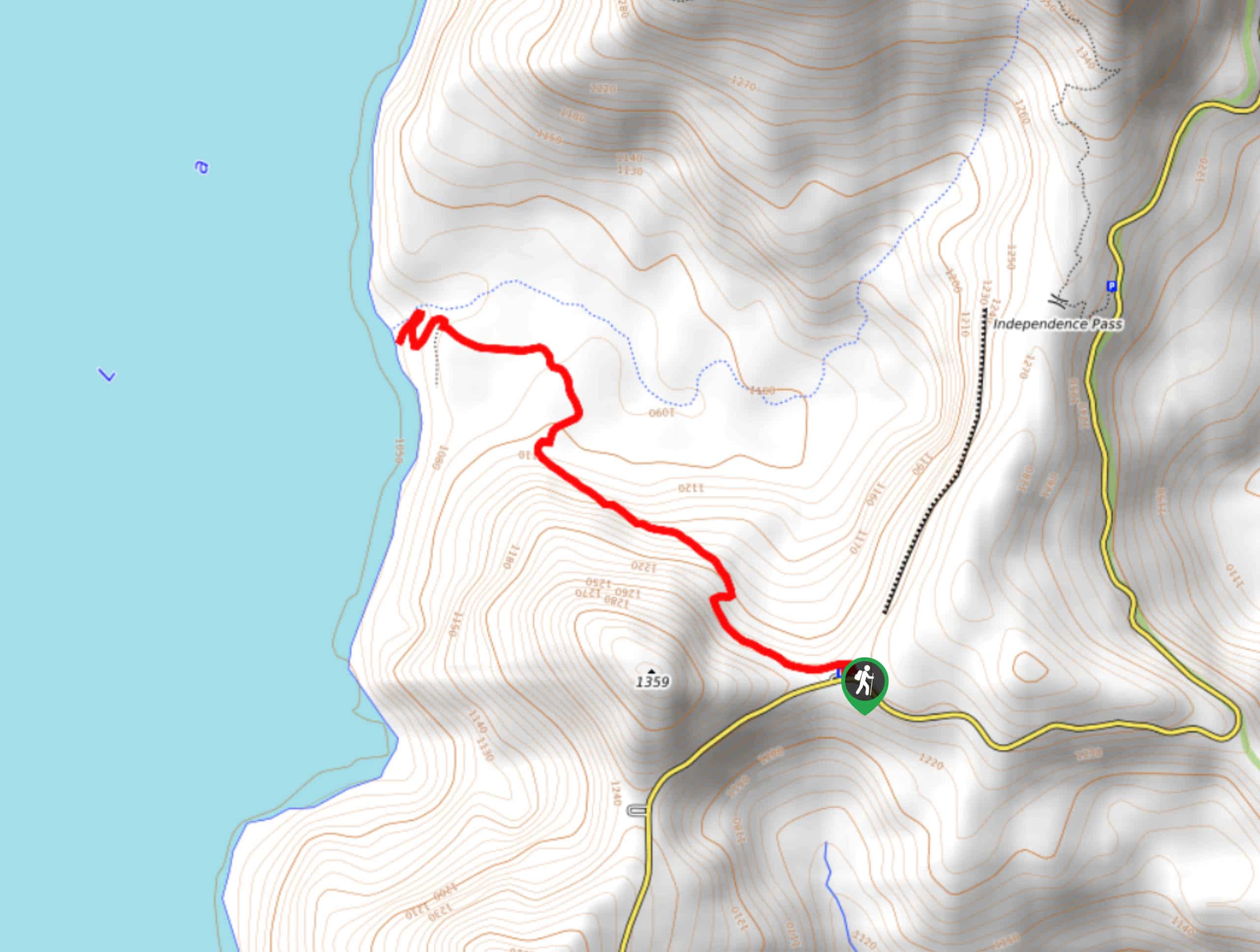
Harmony Trail is a wonderful easy hike in the Gifford Pinchot National Forest that takes you to the shore of Spirit Lake. While this side of Mount Saint Helens isn’t as well marked as the other, it’s rewarding to explore. The lake is blissful and it’s normally not too busy. This hike is 2.5mi long and sees moderate traffic.
Getting there
The trailhead for the Harmony Trail is at the Harmony Viewpoint off Spirit Lake-Iron Creek Road.

About
| Backcountry Campground | No |
| When to do | June-September |
| Pets allowed | No |
| Family friendly | Yes |
| Route Signage | Poor |
| Crowd Levels | Moderate |
| Route Type | Out and back |
Harmony Trail
Elevation Graph
Weather
Harmony Trail Description
Harmony Trail is a wonderful little hike. This trail is peaceful and pretty and the shore of Spirit Lake is a welcome midpoint. You’ll be heading downhill on the way to the lake and uphill back to the car. Stop at the viewpoint before you head out to learn about the interesting history of this unique geographical area.
The flies can be bothersome at the lakeshore. Spray is recommended. Additionally, there are no facilities at the trailhead or the lake, so make sure you make a pit stop before arriving.
The hike begins from the viewpoint, heading downhill through the forest. Enjoy the trees and the solitude (hopefully) as you trek to the river valley, where the grade decreases. Head to Harmony Falls, a nice stop before exploring the lakeshore. Head down to the water and spend as much time hanging out as you please before heading back to the trailhead the same way you came down.
Similar hikes to the Harmony Trail hike

Ptarmigan Trail
Ptarmigan Trail is a 4.2mi moderate trail near the base of Mount Saint Helens. This trail is suitable…

Silver Creek Trail
Silver Creek Trail is a moderate hike in the Gifford Pinchot National Forest that is suitable for most skill levels.…
Pacific Crest Trail from Panther Creek
This route guide takes you from Panther Creek Campground to the Pacific Crest Trail, offering an easy connector for those…
Comments