
Juniper Peak Summit Trail
View Photos
Juniper Peak Summit Trail
Difficulty Rating:
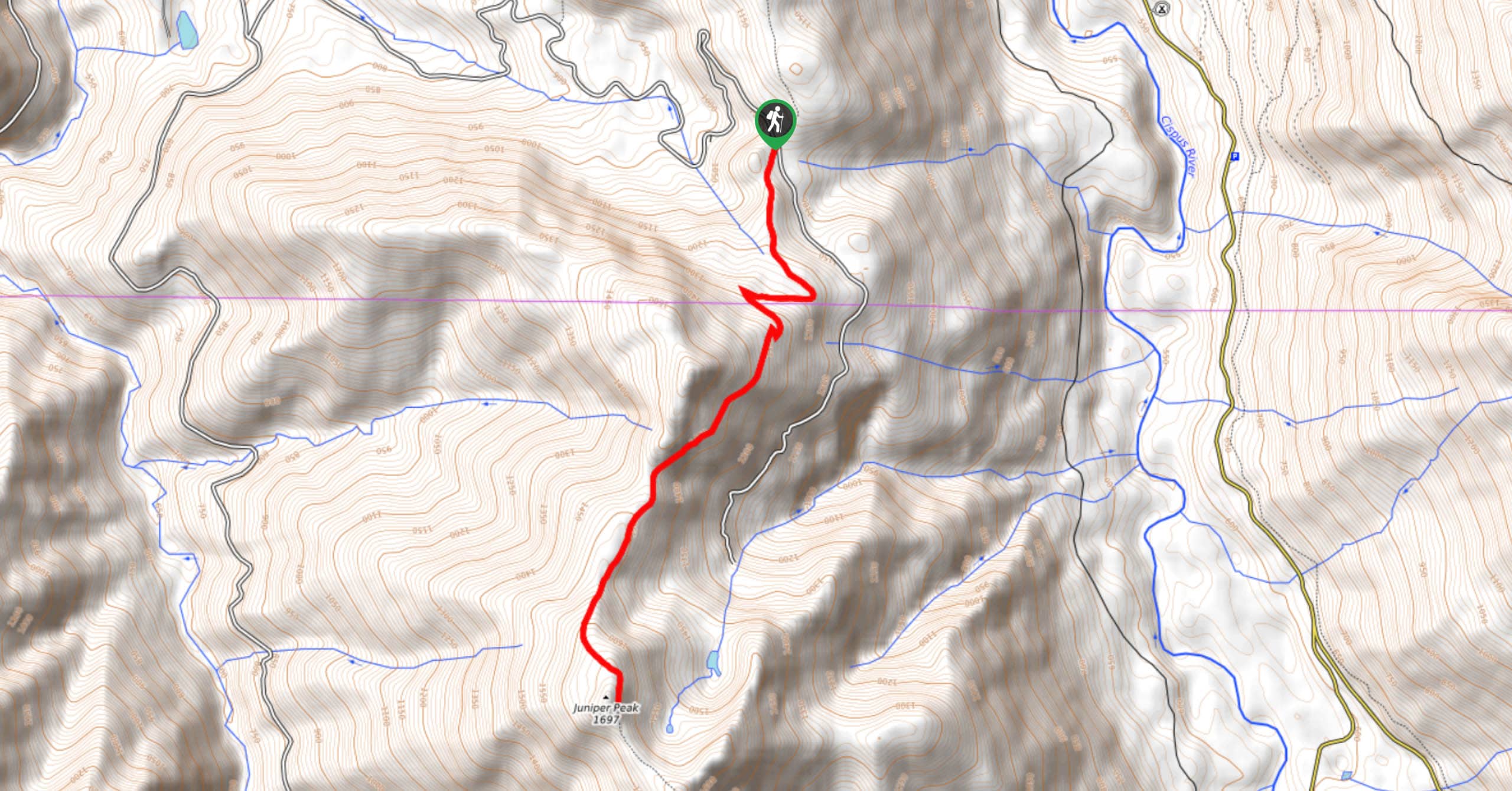
Juniper Peak Summit Trail is a 5.6mi moderate trail in Gifford Pinchot National Forest that is rated as moderate. This is a multi-use trail, allowing for hiking, horseback riding, ATV, mountain biking, and dirt biking. Sharing the trail is important, but there tends to be only moderate traffic. The trail has great views of Mount Rainier, Mount Saint Helens, and Mount Adams.
Getting there
The trailhead for the Juniper Peak Summit Trail is on Forest Road 2904.

About
| Backcountry Campground | No |
| When to do | July-September |
| Pets allowed | Yes - On Leash |
| Family friendly | Yes |
| Route Signage | Average |
| Crowd Levels | Moderate |
| Route Type | Out and back |
Juniper Peak Summit Trail
Elevation Graph
Weather
Juniper Peak Summit Trail Description
The Juniper Peak Summit Trail is open for all kinds of traffic, making it a fun, varied trail. The views of Mount Rainier, Mount Hood, Mount Adams, and Mount Saint Helens are worth the sharing you might have to do. You can also continue down the ridge further for even more views.
This hike has ATV traffic, so it’s rutted. You’ll need to hike either on top of a rut or in it. Of course, remember to share the trail and stay alert to passing bikes, ATVs, or horses.
Beginning from the trailhead, head south (another trail heads north) for a short flat warm-up before you begin climbing. A couple of switchbacks help you gain elevation before the route straightens out to gradually climb the ridge. It’s a straight shot up the ridge to Juniper Peak, where the fantastic views await. From here, retrace your steps to the trailhead.
Similar hikes to the Juniper Peak Summit Trail hike

Ptarmigan Trail
Ptarmigan Trail is a 4.2mi moderate trail near the base of Mount Saint Helens. This trail is suitable…

Boundary West Trail
Boundary West Trail is a hike near Mount Saint Helens that doesn’t see much traffic, making it a nice pick…

Silver Creek Trail
Silver Creek Trail is a moderate hike in the Gifford Pinchot National Forest that is suitable for most skill levels.…
Comments