
Starway Trail
View Photos
Starway Trail
Difficulty Rating:
The Starway Trail can either be used as a thoroughfare to other nearby trails, like Silver Star or Bluff Mountain, or it can be used as an adventure in its own right. This trail is hard, and the workout you’ll get is real. While the views aren’t the best you’ll find in the region, you can enjoy a peek of major summits and a good vantage point over your surroundings. Expect light traffic on this trail.
Getting there
The trailhead for the Starway Trail is on Forest Road 41.

About
| Backcountry Campground | No |
| When to do | May-October |
| Pets allowed | No |
| Family friendly | No |
| Route Signage | Average |
| Crowd Levels | Low |
| Route Type | Out and back |
Starway Trail
Elevation Graph
Weather
Starway Trail Description
Starway Trail is used by hikers as an alternate access to hikes like Silver Star and Bluff Mountain or as a workout on its own. If you’re only hiking this trail and not continuing on elsewhere, we recommend stopping at the high point of the hike and turning around from there. The rest of the trail doesn’t offer as much in terms of views and increases the work you’ll have to do to return.
This hike is subject to bear and cougar activity, possibly more so than others in the region. Hike with bear spray and try to travel in a group if you can.
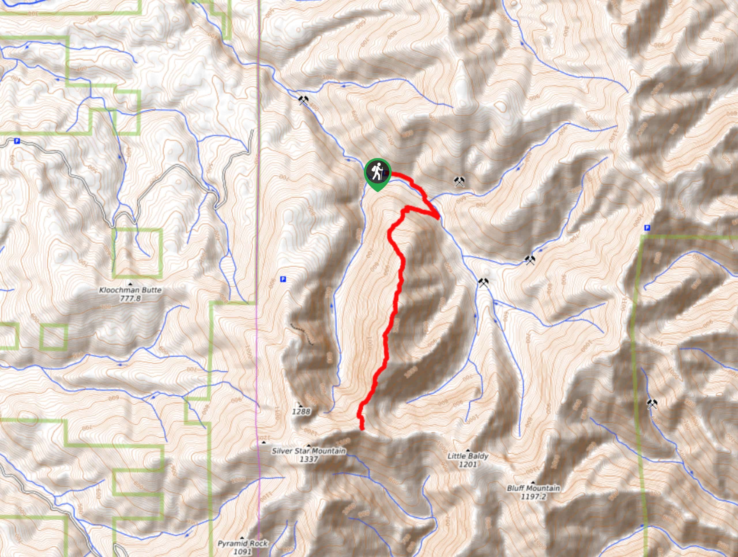
Beginning from the forest road, hike along Copper Creek. Cross the creek and take a sharp right at the second junction. The ascent up to the ridge is no joke, and poles will be helpful for this section. Climb steeply up, cresting the ridge and enjoying a more relaxed trail. Look for Mount Saint Helens, Mount Adams, and Mount Hood as you traverse the ridgeline.
If you’re here for the views and don’t want to punish your knees as much, turn back and retrace your steps from the high point of the ridge. If you want to complete the ensure trail, drop down the south end of the ridge and then turn back where the trail intersects with Bluff Mountain Trail.
Similar hikes to the Starway Trail hike

Ptarmigan Trail
Ptarmigan Trail is a 4.2mi moderate trail near the base of Mount Saint Helens. This trail is suitable…

Lakes Trail #211 Loop
The Lakes Trail #211 Loop is used as both a full-day hike and for backpacking trips. This trail isn’t for…

Boundary West Trail
Boundary West Trail is a hike near Mount Saint Helens that doesn’t see much traffic, making it a nice pick…
Comments