
Grassy Knoll Trail
View Photos
Grassy Knoll Trail
Difficulty Rating:
The Grassy Knoll hike is a fun 4.3mi with tiring elevation gain. This hard hike delivers panoramic views of Mount Rainer, Mount Hood, and the surrounding landscapes. There are two small campsites up here, so see if you can snag one to spend a night on the knoll. This trail experiences heavy traffic.
Getting there
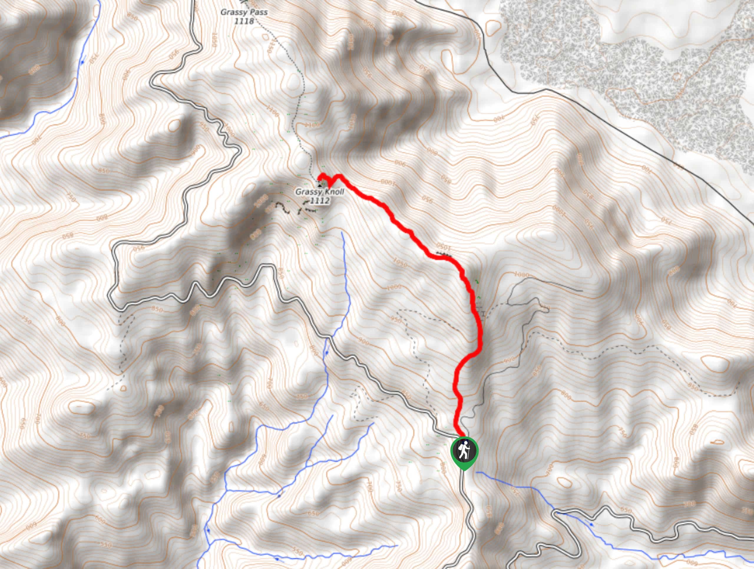
The trailhead for Grassy Knoll Trail is on Forest Road 68.

About
| Backcountry Campground | No |
| When to do | March-October |
| Pets allowed | Yes - On Leash |
| Family friendly | Older Children only |
| Route Signage | Average |
| Crowd Levels | High |
| Route Type | Out and back |
Grassy Knoll Trail
Elevation Graph
Weather
Grassy Knoll Trail Description
The Grassy Knoll is a fine knoll to spend some time on, looking out over Mount Rainier, Mount Adams, Mount Hood, and the surrounding forest. It’s a short hike up, but it’s steep enough to leave you feeling accomplished. This hike is especially nice when the wildflowers are blooming.
Beginning from the trailhead, take Grassy Knoll Trail (not the forest road to the right of it) roughly north. The climbing starts pretty much right away, and the grade increases as you approach the top of the ridge. Once you crest the ridge, you’ll enjoy a bit of a flatter stretch before the final push to the top, where the footing can be a bit loose on the rocks.
Take in the views and then retrace your steps. Intrepid adventurers can continue to Big Huckleberry on the trail that continues northwest from the Grassy Knoll.
Similar hikes to the Grassy Knoll Trail hike

Ptarmigan Trail
Ptarmigan Trail is a 4.2mi moderate trail near the base of Mount Saint Helens. This trail is suitable…

Lakes Trail #211 Loop
The Lakes Trail #211 Loop is used as both a full-day hike and for backpacking trips. This trail isn’t for…

Boundary West Trail
Boundary West Trail is a hike near Mount Saint Helens that doesn’t see much traffic, making it a nice pick…
Comments