Coyote Wall Labyrinth Loop
View Photos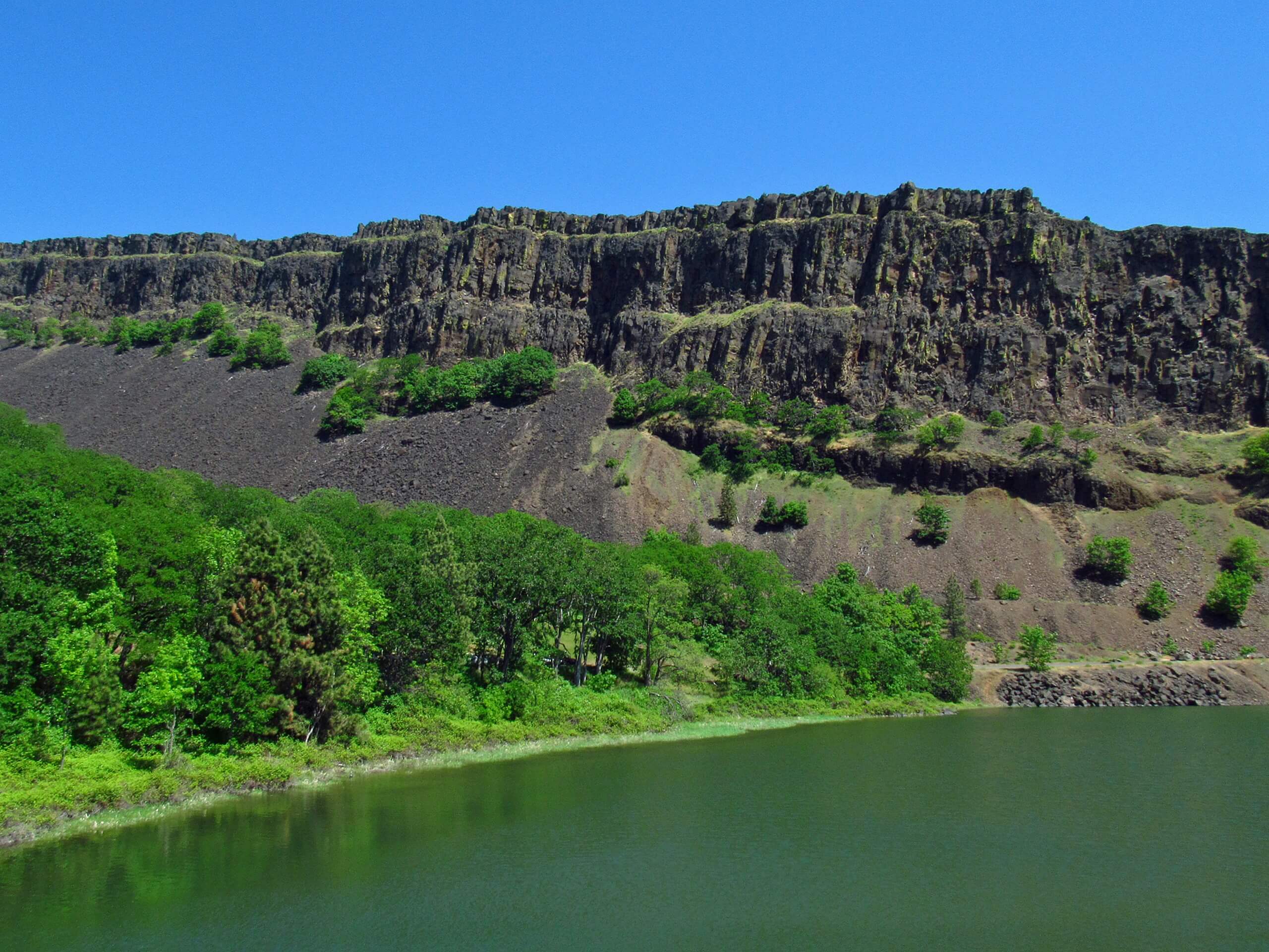
Coyote Wall Labyrinth Loop
Difficulty Rating:
The Coyote Wall Loop is a fun, customizable hike in the Columbia River Gorge area. The trail followed by this route guide is 6.7mi long and rated as moderately difficult, but you can use the labyrinth (pun intended) of interconnecting trails on the wall to make your loop shorter, longer, easier, or more challenging. If you want a similar hike with slightly more forgiving terrain, try the Coyote Wall Loop.
Getting there
The trailhead for the Coyote Wall Labyrinth Loop is on Old Highway 8.

About
| Backcountry Campground | No |
| When to do | March-November |
| Pets allowed | Yes - On Leash |
| Family friendly | Older Children only |
| Route Signage | Average |
| Crowd Levels | High |
| Route Type | Loop |
Coyote Wall Labyrinth Loop
Elevation Graph
Weather
Coyote Wall Labyrinth Loop Description
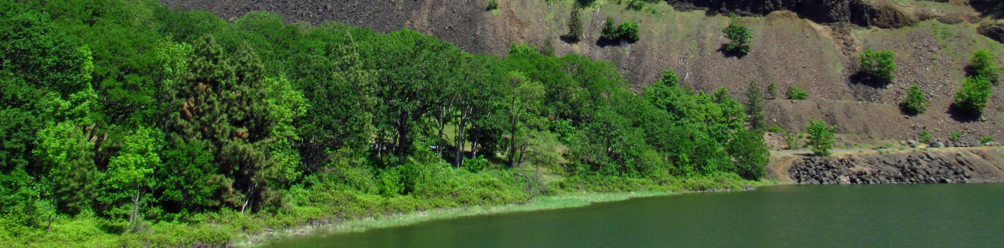
The Coyote Wall offers beautiful views of the Columbia River Gorge, including the blue river just below you across to the mountains beyond. You’ll be able to see Mount Hood in all its glory! This hike offers the opportunity to lengthen or shorten your hike. Although this isn’t an easy trail, it can be made a bit easier by taking a shorter loop or made more difficult by making a longer loop. Download a GPS track and a map to help you plan your adventure.
Parts of this hike are quite steep, so we recommend poles and sturdy boots. Also, there is poison oak along Labyrinth Trail. Beginning from the parking area, hike alongside Locke Lake on Old Highway 8 towards the wall. The trail splits off from Old Highway 8 to your left, leading you up to the base of the loop. We recommend tackling the tougher west side first. Go left, taking Old Ranch Road #4426. Stay left to switchback up the wall. It’s quite steep on your left side, so take care on loose, rocky sections.
At Traverse Trail #4427, go right. Stay right until the switchbacks by the stream and then take Old Ranch Road #4426 to Atwood Road. Stay right at the next three junctions, pass Labyrinth Falls, and then turn right near the road to head back to the trailhead.
Similar hikes to the Coyote Wall Labyrinth Loop hike

Ptarmigan Trail
Ptarmigan Trail is a 4.2mi moderate trail near the base of Mount Saint Helens. This trail is suitable…

Boundary West Trail
Boundary West Trail is a hike near Mount Saint Helens that doesn’t see much traffic, making it a nice pick…

Silver Creek Trail
Silver Creek Trail is a moderate hike in the Gifford Pinchot National Forest that is suitable for most skill levels.…
Comments